
Dirt Bike Trails
Near Rainbow Lakes Estates, Florida
Explore All Dirt Bike Trails Near Rainbow Lakes Estates, Florida
Dirt Bike Trails Near Rainbow Lakes Estates, Florida
Discover the best dirt bike trails near you. Browse trail maps, check difficulty ratings, and find your next adventure — whether you're looking for a quick ride or an all-day expedition.
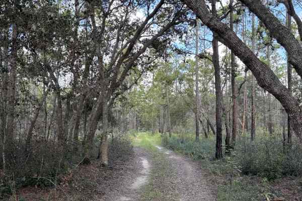
Trail 4 - Citrus WMA
Trail 4 takes you from Trail 11a at the east end to Trail 19 at the west end of the trail in the north part of the Citrus Wildlife Management Area. The road conditions are a mixture of packed sand, loose sand, and some deep holes that can turn into 2-foot deep mud holes after rainy days. The road is...
Learn more about Trail 4 - Citrus WMA
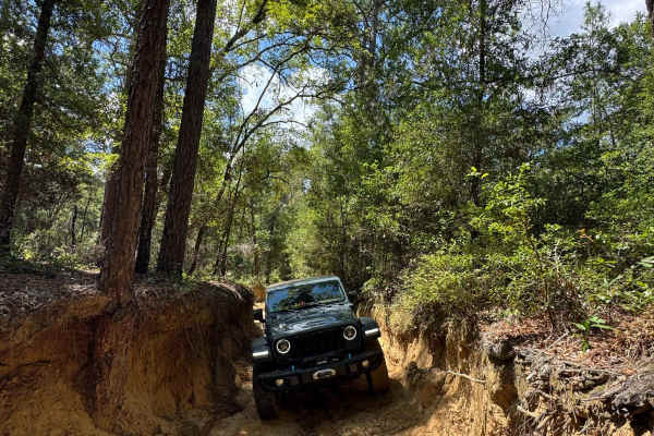
Trail 19 - Citrus WMA
Trail 19 connects Trails 2, 4, and 6 in the northwest part of the Citrus Wildlife Management Area. The trail is only 1 mile long, but one of the most technically challenging trails in Florida. Ruts, obstacles, and switchbacks are up to 4 feet high. You might need a winch to prevent flipping the vehi...
Learn more about Trail 19 - Citrus WMA
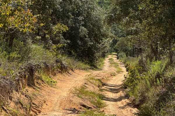
Trail 6 - Citrus WMA
Trail 6 takes you from East Haven Street at the east end to Trail 19 at the west end of the trail in the north part of the Citrus Wildlife Management Area. The road conditions are a mixture of packed sand, loose sand, and some deep holes that can turn into 2-foot deep mud holes after rainy days. The...
Learn more about Trail 6 - Citrus WMA
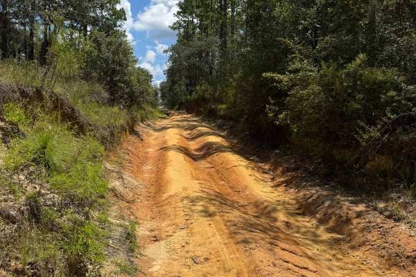
Trail 10 - Citrus WMA
Trail 10 takes you from Trail 9 at the east end to Trail 17 at the west end of the trail in the central part of the Citrus WMA. The road conditions are a mixture of packed sand, loose sand, and some deep holes that can turn into 2-foot deep mud holes after rainy days. The road is not always wide eno...
Learn more about Trail 10 - Citrus WMA
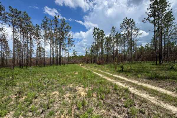
Trail 10A - Citrus WMA
Trail 10a takes you from Trail 9 at the east end to Trail 19 at the west end of the trail in the central part of the Citrus Wildlife Management Area. The road conditions are a mixture of packed sand, loose sand, and some deep holes that can turn into 2-foot deep mud holes after rainy days. The road ...
Learn more about Trail 10A - Citrus WMA
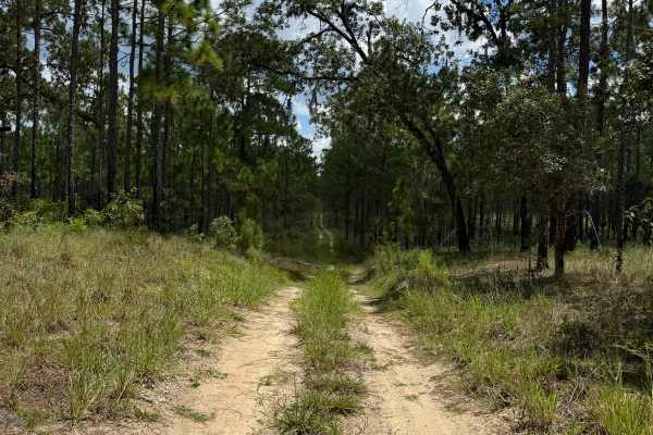
Trail 12 - Citrus WMA
Trail 12 takes you from County Road 581 at the east end to Trail 15 at the west end of the trail in the central part of the Citrus Wildlife Management Area. The road conditions are a mixture of packed sand, loose sand, and some deep holes that can turn into 2-foot deep mud holes after rainy days. Th...
Learn more about Trail 12 - Citrus WMA
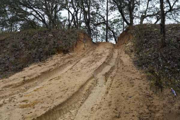
Trail 14 East
Trail 14 East is an engaging 1.9-mile off-road route through the Citrus Wildlife Management Area, offering a mix of soft sand play areas and light technical challenges perfect for stock four-wheel-drive vehicles and SxSs. Running straight west to east, this trail provides an enjoyable trek with mini...
Learn more about Trail 14 East
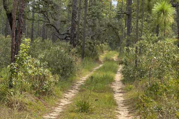
Trail 18a - Citrus WMA
Trail 18a takes you from Trail 16 at the east end to Trail 15 at the west end of the trail in the southern part of the Citrus Wildlife Management Area. The road conditions are a mixture of packed sand, loose sand, and some deep holes that can turn into 2-foot deep mud holes after rainy days. The roa...
Learn more about Trail 18a - Citrus WMA
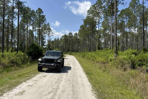
Lochloosa WMA South Trail
Lochloosa WMA South Trail connects CR-325 and the Burnt Island Trail. It allows you access to the Lochloosa Water Management Area with plenty of trails that are only accessible during hunting season. The Lochloosa WMA South Trail is open year-round. The road is mostly packed sand and wide enough for...
Learn more about Lochloosa WMA South Trail
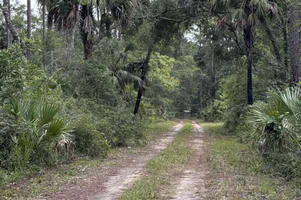
Gate 10 Road
The Gate 10 road gives you access to several hiking trails in the southern part of the Lower Suwannee National Wildlife Refuge. The road conditions are a mixture of packed sand, loose sand, and some deep holes that can turn into 2-foot deep mud holes after rainy days. The road is not always wide eno...
Learn more about Gate 10 Road
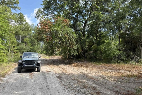
Jeep Trail - Grove Park South WMA
The Jeep Trail is part of the Grove Park Water Management Area. This trail is only accessible during hunting season or with a recreation permit that's available over the phone. The road conditions are a mixture of packed sand, loose sand, and some deep holes that can turn into 2-foot-deep mud holes ...
Learn more about Jeep Trail - Grove Park South WMA
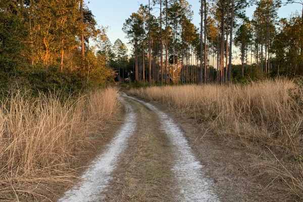
Lochloosa WCA North
This route is an easier alternative to the main Lochloosa WCA Trail. Note that this trail is only accessible to street-legal licensed vehicles. This trail is mainly hard-packed gravel with some sections of sand, but no deep sand. There is one shallow water crossing in this route that is under 6 inch...
Learn more about Lochloosa WCA North
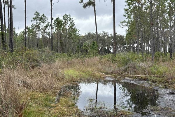
Burnt Island Loop
The Burnt Island Loop starts at Burnt Island Park in the Lochloosa Water Management Area. The trail is only open during hunting season. It's a very wet area, parts of the trail are always flooded from the lake and the creeks that are going through. The mud holes and water crossings are up to 3ft dee...
Learn more about Burnt Island Loop
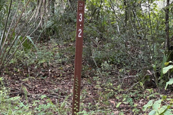
Ocklawaha Trail - ONF SE24ST
The Ocklawaha Trail, also known as Ocala National Forest Road SE24ST, connects SE 1st Road at the west end and Highway 314A at the east end in the southwest of the Ocala National Forest. The trail gives you access to some dirt roads that will take you to the Ocklawaha River. The road conditions are ...
Learn more about Ocklawaha Trail - ONF SE24ST
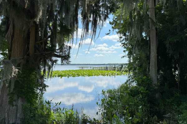
Burnt Island Trail
The Burnt Island Trail gives you access to the Lochloosa Water Management Area with plenty of trails that are only accessible during hunting season. The Burnt Island Trail, the Burnt Island Park, the fishing pier, and the boat ramp are open year-round. The road is mostly packed sand and wide enough ...
Learn more about Burnt Island Trail
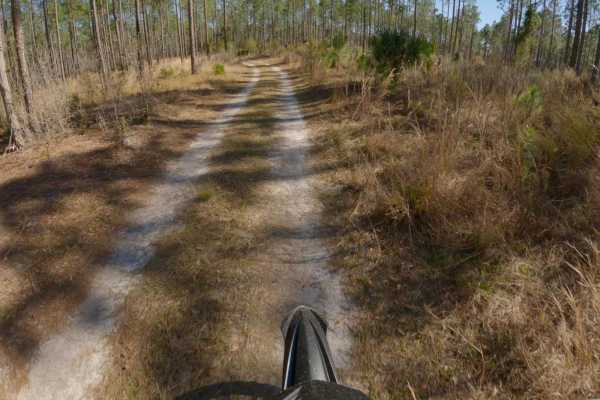
Lochloosa WCA Connector
This is an easier alternative to the main Lochloosa WCA trail and is typically drier with fewer mud holes and water crossings than the main trail. Note that this trail is only open to street-legal licensed vehicles. This trail is single-car width throughout, with little chance of vehicle-scratching ...
Learn more about Lochloosa WCA Connector
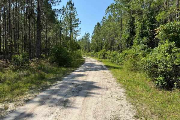
Fish Camp Road - CR2082 Connector
This route connects CR 2082 with Fish Camp Road. It runs from north to south through the Lochloosa WCA. The road conditions are a mixture of packed sand, loose sand, and some deep holes that can turn into 2-foot-deep mud holes after rainy days. Some sections require 4WD and high clearance is recomme...
Learn more about Fish Camp Road - CR2082 Connector
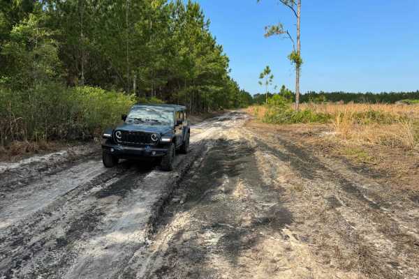
Fish Camp Road North
Fish Camp Road North takes you through the Lochloosa Wildlife Conservation Area. The trail connects CR325 and the Lochloosa WMA West Loop. The road conditions are a mixture of packed sand, loose sand, and some deep holes that can turn into 2-foot-deep mud holes after rainy days. Some sections requir...
Learn more about Fish Camp Road North
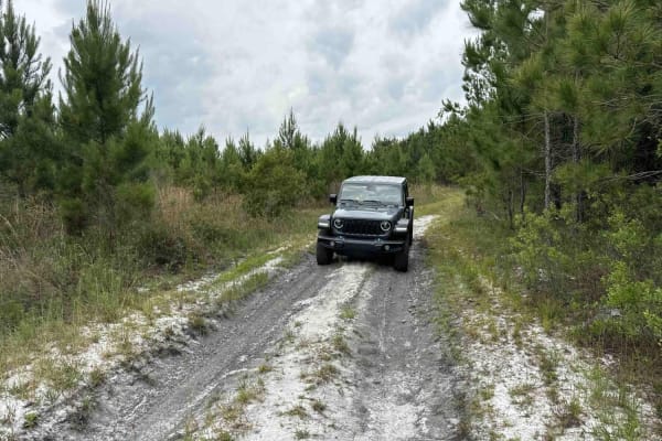
Mosquito Bay North
Mosquito Bay North Trail takes you through the Lochloosa Water Management Area. The trail connects Fish Camp Road North with Fish Camp Road Connector and allows access to the Mosquito Bay Pond. The road conditions are a mixture of packed sand, loose sand, and some deep holes that can turn into 2-foo...
Learn more about Mosquito Bay North
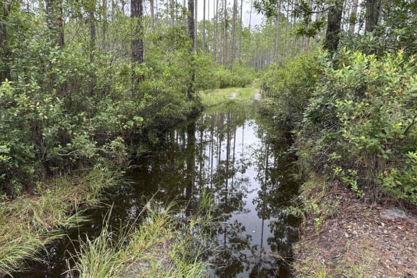
Ocala National Forest 24ST 3.2A2
The Ocala National Forest Road 24 ST 3.2A2 connects the ONF 24ST3.2A at the west end and ONF 40-5.61 which leads to Highway 40 at the east end in the southwest part of the Ocala National Forest. The road conditions are a mixture of packed sand, loose sand, and some very deep (2-3 feet), wide, and lo...
Learn more about Ocala National Forest 24ST 3.2A2
ATV trails near Rainbow Lakes Estates, Florida
Explore ATV-friendly trails near you. These trails are accessible for vehicles up to 50 inches wide, perfect for ATVs and smaller off-road machines.
Trail 19 - Citrus WMA
Trail 19 connects Trails 2, 4, and 6 in the northwest part of the Citrus Wildlife Management Area. The trail is only 1 mile long, but one of the most technically challenging trails in Florida. Ruts, obstacles, and switchbacks are up to 4 feet high. You might need a winch to prevent flipping the vehi...
Learn more about Trail 19 - Citrus WMA
Trail 6 - Citrus WMA
Trail 6 takes you from East Haven Street at the east end to Trail 19 at the west end of the trail in the north part of the Citrus Wildlife Management Area. The road conditions are a mixture of packed sand, loose sand, and some deep holes that can turn into 2-foot deep mud holes after rainy days. The...
Learn more about Trail 6 - Citrus WMA
Trail 14 East
Trail 14 East is an engaging 1.9-mile off-road route through the Citrus Wildlife Management Area, offering a mix of soft sand play areas and light technical challenges perfect for stock four-wheel-drive vehicles and SxSs. Running straight west to east, this trail provides an enjoyable trek with mini...
Learn more about Trail 14 East
Ocklawaha Trail - ONF SE24ST
The Ocklawaha Trail, also known as Ocala National Forest Road SE24ST, connects SE 1st Road at the west end and Highway 314A at the east end in the southwest of the Ocala National Forest. The trail gives you access to some dirt roads that will take you to the Ocklawaha River. The road conditions are ...
Learn more about Ocklawaha Trail - ONF SE24ST
UTV/side-by-side trails near Rainbow Lakes Estates, Florida
Find UTV and side-by-side trails near you. These trails accommodate vehicles up to 60 inches wide, ideal for UTVs, side-by-sides, and wider off-road rigs.
Trail 4 - Citrus WMA
Trail 4 takes you from Trail 11a at the east end to Trail 19 at the west end of the trail in the north part of the Citrus Wildlife Management Area. The road conditions are a mixture of packed sand, loose sand, and some deep holes that can turn into 2-foot deep mud holes after rainy days. The road is...
Learn more about Trail 4 - Citrus WMA
Trail 10 - Citrus WMA
Trail 10 takes you from Trail 9 at the east end to Trail 17 at the west end of the trail in the central part of the Citrus WMA. The road conditions are a mixture of packed sand, loose sand, and some deep holes that can turn into 2-foot deep mud holes after rainy days. The road is not always wide eno...
Learn more about Trail 10 - Citrus WMA
Trail 10A - Citrus WMA
Trail 10a takes you from Trail 9 at the east end to Trail 19 at the west end of the trail in the central part of the Citrus Wildlife Management Area. The road conditions are a mixture of packed sand, loose sand, and some deep holes that can turn into 2-foot deep mud holes after rainy days. The road ...
Learn more about Trail 10A - Citrus WMA
Trail 12 - Citrus WMA
Trail 12 takes you from County Road 581 at the east end to Trail 15 at the west end of the trail in the central part of the Citrus Wildlife Management Area. The road conditions are a mixture of packed sand, loose sand, and some deep holes that can turn into 2-foot deep mud holes after rainy days. Th...
Learn more about Trail 12 - Citrus WMA
The onX Offroad Difference
onX Offroad combines trail photos, descriptions, difficulty ratings, width restrictions, seasonality, and more in a user-friendly interface. Available on all devices, with offline access and full compatibility with CarPlay and Android Auto. Discover what you're missing today!
Open Trail Map