
Dirt Bike Trails
Near Neahkahnie, Oregon
Explore All Dirt Bike Trails Near Neahkahnie, Oregon
Dirt Bike Trails Near Neahkahnie, Oregon
Discover the best dirt bike trails near you. Browse trail maps, check difficulty ratings, and find your next adventure — whether you're looking for a quick ride or an all-day expedition.
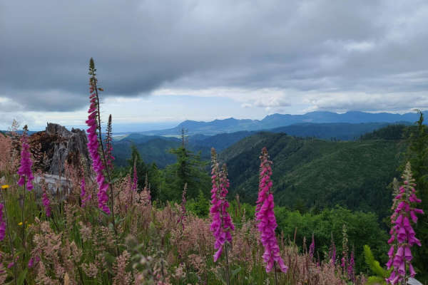
Platt Canyon Road
Platt Canyon Road offers a scenic and mildly challenging route through the dense forests of the Oregon Coast Range, making it an excellent option for beginners looking to test their hill-climbing abilities or experienced riders seeking a scenic connector. Branching off from Cook Creek Road in the Ti...
Learn more about Platt Canyon Road
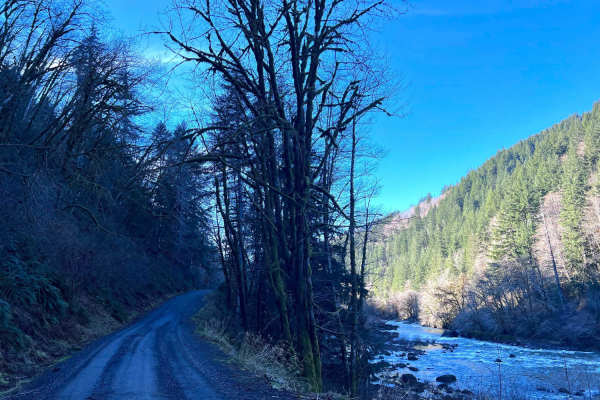
Lower Nehalem Road Beach Route
This route is a nice backcountry route that leads from HWY 26 towards Nehalem Bay. The first section of this road is paved and then turns into 11 miles of gravel. There are a couple of state-run campgrounds along the route, as well as many dispersed camping spots right along the river. It's a very s...
Learn more about Lower Nehalem Road Beach Route
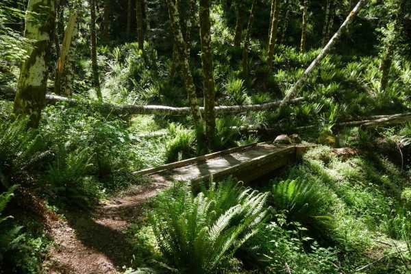
#130
Trail 130 is a directional downhill single track descending north to south, beginning with multiple downed logs and steep technical drop-offs featuring large root and rock stair-step features. The trail surface varies from dryer loose dirt to loamy dirt with better traction, with steep troughs and e...
Learn more about #130
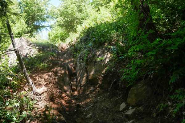
Alpina
Alpina is a directional, double black diamond descent from south to north, dropping nearly 600 feet over 0.8 miles. The trail begins with a steep ride down a forested spine, followed by narrow side-hilling with log hazards and constant exposure. The main obstacle is a large off-camber rock face with...
Learn more about Alpina
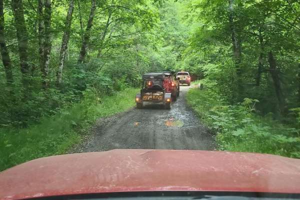
Cook Creek Road
Cook Creek Road is a scenic, beginner-friendly gravel route through Oregon's Tillamook State Forest, perfect for stock SUVs, overland rigs, and scenic drivers looking to explore the coastal mountains. Spanning approximately 11.3 miles, this easy-going logging road features a primarily dirt and grave...
Learn more about Cook Creek Road

Wolf Point
A steep, infrequently maintained gravel forest service road that climbs from the saddle intersection of Cedar Creek Road and Cedar Butte Road (also sometimes labeled as Wolf Creek Road) up to Triangulation Point, a popular summit in the Tillamook Range. This road has numerous water bars that shed wa...
Learn more about Wolf Point

Kilchis Falls Spur
This two-mile portion of Kilchis River Forest Road is used as a spur to access a nearby waterfall while exploring the area. Kilchis Falls is a tall, misty waterfall, found on the winding back roads of the Tillamook State Forest. While it stands at an impressive 100 feet tall, it's not a particularly...
Learn more about Kilchis Falls Spur
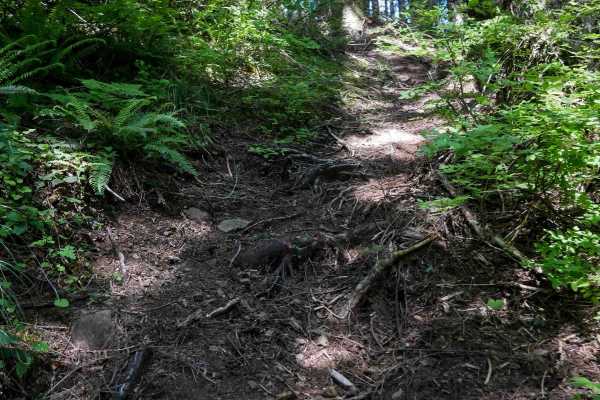
Cramlets Cliff #67
Trail #67 is a directional double black diamond descent from north to south, losing 1,700 feet of elevation over 2.2 miles. It begins with an almost vertical descent - get your weight back and feather both brakes. Even the most advanced riders may be walking their bikes down some of it. The route co...
Learn more about Cramlets Cliff #67
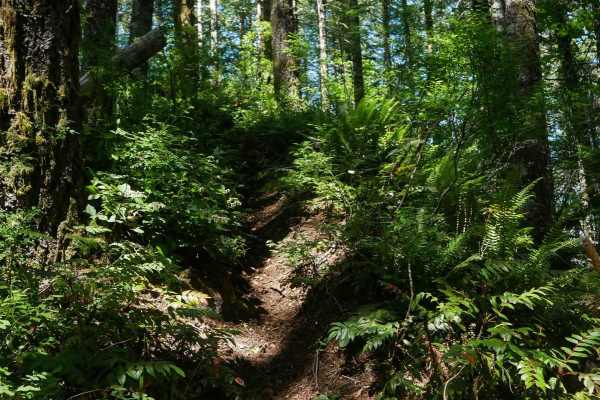
#106
Trail 106 is a directional black diamond trail dropping nearly 900 feet over just 0.7 miles from north to south. Starting with a big climb onto a spine with technical roots and rocks, the trail then descends steeply with loose dirt, ruts, and root drop-offs. Tight turns and extreme side-hilling with...
Learn more about #106
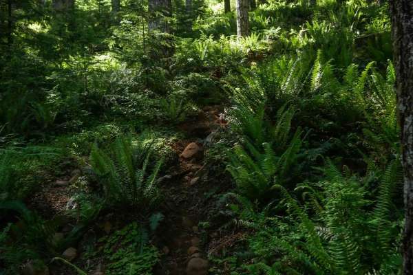
#117
Trail 117 is a short, directional spur off of Tri Loop #111, descending rapidly over just 0.2 miles and dropping 350 feet. The route begins with several large root bands that must be dropped off, followed by steep, narrow single track filled with deep troughs. The tight switchbacks are difficult to ...
Learn more about #117
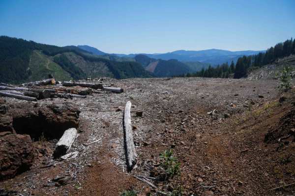
#69
Trail 69 is a two-way single track, though most riders will find the steep 1,000-foot climb from the south entrance very challenging, and it's best ridden downhill. It begins as a forest shelf road before turning into primitive single track along a narrow hillside shelf, gradual for the first half m...
Learn more about #69
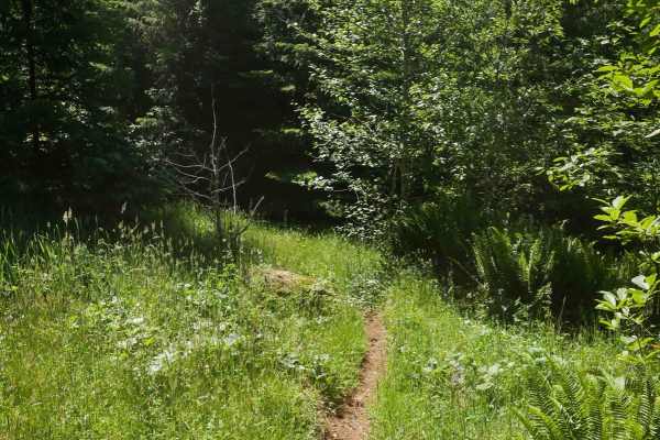
#60
Trail 60 continues directly from the bottom of Trail 67, transitioning into a scenic single track that travels through a grassy, forested valley. The trail includes numerous small logs you'll have to pop over. The terrain is much more gradual compared to its 67, but it remains narrow. The ride concl...
Learn more about #60
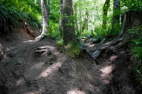
Outback #99
Outback #99 is a flowy, moderately challenging single track running through dense forest. The trail is wider than most black diamond trails in the system, but still features deep troughs, big roots, and minor ruts. Compared to nearby technical trails, this one offers more relaxed riding with gentler...
Learn more about Outback #99
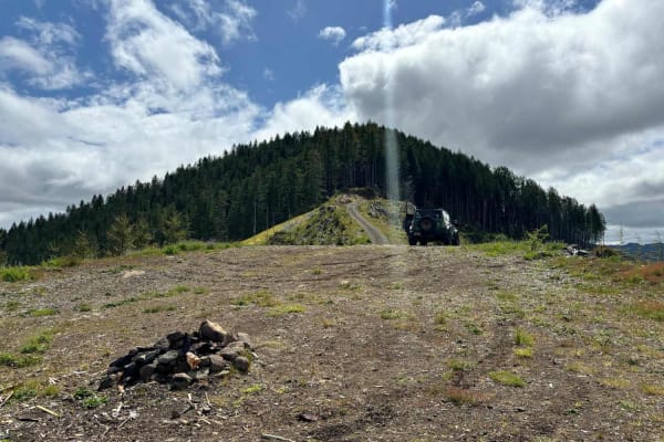
Wolf Point to Jones Creek
This trail connects Cedar Butte Road with Jones Creek Road with an optional stop at Wolf Point. An open area just below Wolf Point offers great views to the north of Triangulation Point along with views of the Cedar Creek Valley below. The top of Wolf Point is accessible via a single track trail, al...
Learn more about Wolf Point to Jones Creek
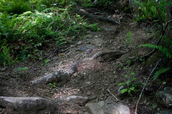
Tommy
Tommy is a short but steep directional single track running north to south, descending over 750 feet in just 0.6 miles. The trail is extremely narrow, threading through dense forest and frequently obscured by ferns. The descent is lined with ruts, roots, and tight switchbacks, with several sections ...
Learn more about Tommy
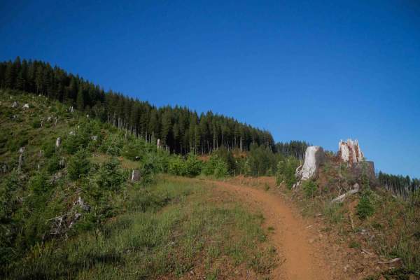
#91
Trail 91 is a very difficult directional descent (northeast to southwest) - riders likely wouldn't make it in the uphill direction due to the near-vertical grade. It begins in a logged area with wide-open epic views of the surrounding mountains, before dropping steeply down a narrow spine. Riders fa...
Learn more about #91
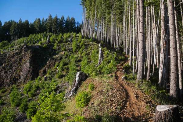
#78 (Extreme)
This extreme segment of Trail 78 is a directional descent from north to south. It begins along a logged ridgeline before entering an overgrown forest near the bottom of the route. Riders navigate root drop-offs, deep troughs, tight tree pinches, and awkwardly angled logs. Near-vertical sections and ...
Learn more about #78 (Extreme)
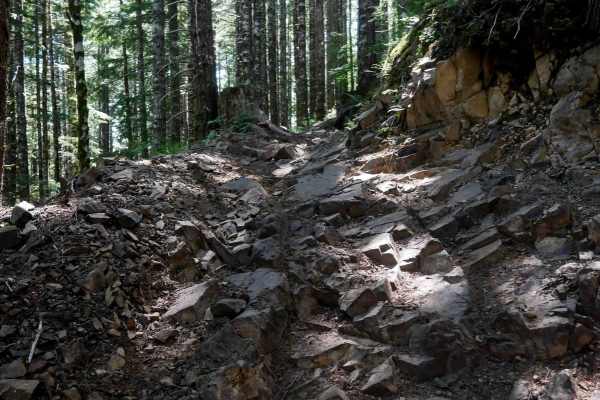
Tri Loop #111
Tri Loop #111 is a 3-mile intermediate ATV trail that traverses varied terrain, including narrow fern-lined corridors and wider ridgeline sections. Riders will encounter small embedded and loose rocks throughout, along with straight shelfy side-hilling stretches that introduce moderate exposure. The...
Learn more about Tri Loop #111
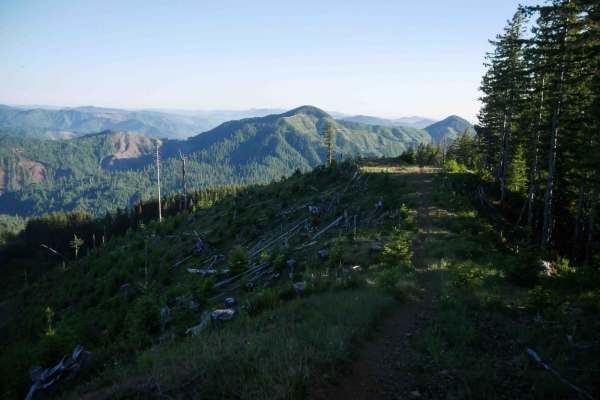
#78 (Moderate)
This segment of 78 begins on the north end with a short but steep climb featuring embedded rock at the crest. There's a bypass around the rock obstacle to enter the trail from another way, though. Once on the ridge, riders enjoy a scenic, fast, and flowy single track across a logged hillside, with r...
Learn more about #78 (Moderate)
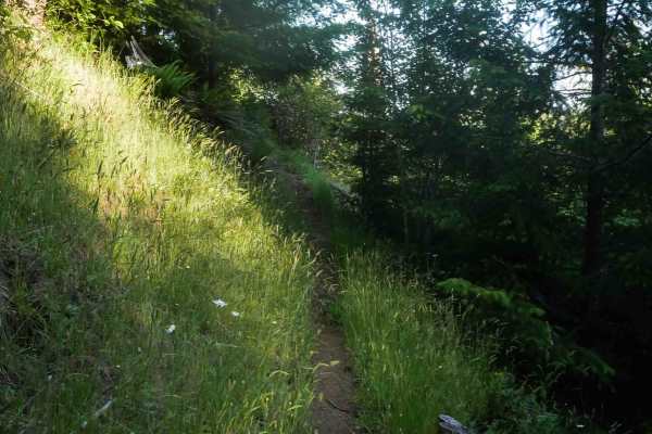
#70
Trail 70 mostly descends from north to south, traveling through dense forest and grassy meadows. The dirt surface includes roots, sticks, and deep troughs dug out below the forest floor. Riders will encounter semi-steep grades and sharp turns. After .8 miles, at the south end, it drops down to Cedar...
Learn more about #70
ATV trails near Neahkahnie, Oregon
Explore ATV-friendly trails near you. These trails are accessible for vehicles up to 50 inches wide, perfect for ATVs and smaller off-road machines.
Platt Canyon Road
Platt Canyon Road offers a scenic and mildly challenging route through the dense forests of the Oregon Coast Range, making it an excellent option for beginners looking to test their hill-climbing abilities or experienced riders seeking a scenic connector. Branching off from Cook Creek Road in the Ti...
Learn more about Platt Canyon Road
Lower Nehalem Road Beach Route
This route is a nice backcountry route that leads from HWY 26 towards Nehalem Bay. The first section of this road is paved and then turns into 11 miles of gravel. There are a couple of state-run campgrounds along the route, as well as many dispersed camping spots right along the river. It's a very s...
Learn more about Lower Nehalem Road Beach Route
Cook Creek Road
Cook Creek Road is a scenic, beginner-friendly gravel route through Oregon's Tillamook State Forest, perfect for stock SUVs, overland rigs, and scenic drivers looking to explore the coastal mountains. Spanning approximately 11.3 miles, this easy-going logging road features a primarily dirt and grave...
Learn more about Cook Creek Road
Wolf Point
A steep, infrequently maintained gravel forest service road that climbs from the saddle intersection of Cedar Creek Road and Cedar Butte Road (also sometimes labeled as Wolf Creek Road) up to Triangulation Point, a popular summit in the Tillamook Range. This road has numerous water bars that shed wa...
Learn more about Wolf Point
UTV/side-by-side trails near Neahkahnie, Oregon
Find UTV and side-by-side trails near you. These trails accommodate vehicles up to 60 inches wide, ideal for UTVs, side-by-sides, and wider off-road rigs.
Platt Canyon Road
Platt Canyon Road offers a scenic and mildly challenging route through the dense forests of the Oregon Coast Range, making it an excellent option for beginners looking to test their hill-climbing abilities or experienced riders seeking a scenic connector. Branching off from Cook Creek Road in the Ti...
Learn more about Platt Canyon Road
Lower Nehalem Road Beach Route
This route is a nice backcountry route that leads from HWY 26 towards Nehalem Bay. The first section of this road is paved and then turns into 11 miles of gravel. There are a couple of state-run campgrounds along the route, as well as many dispersed camping spots right along the river. It's a very s...
Learn more about Lower Nehalem Road Beach Route
Cook Creek Road
Cook Creek Road is a scenic, beginner-friendly gravel route through Oregon's Tillamook State Forest, perfect for stock SUVs, overland rigs, and scenic drivers looking to explore the coastal mountains. Spanning approximately 11.3 miles, this easy-going logging road features a primarily dirt and grave...
Learn more about Cook Creek Road
Wolf Point
A steep, infrequently maintained gravel forest service road that climbs from the saddle intersection of Cedar Creek Road and Cedar Butte Road (also sometimes labeled as Wolf Creek Road) up to Triangulation Point, a popular summit in the Tillamook Range. This road has numerous water bars that shed wa...
Learn more about Wolf Point
The onX Offroad Difference
onX Offroad combines trail photos, descriptions, difficulty ratings, width restrictions, seasonality, and more in a user-friendly interface. Available on all devices, with offline access and full compatibility with CarPlay and Android Auto. Discover what you're missing today!
Open Trail Map