
Dirt Bike Trails
Near Lonetree, Wyoming
Explore All Dirt Bike Trails Near Lonetree, Wyoming
Dirt Bike Trails Near Lonetree, Wyoming
Discover the best dirt bike trails near you. Browse trail maps, check difficulty ratings, and find your next adventure — whether you're looking for a quick ride or an all-day expedition.
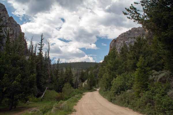
Hoop Lake - FS 80078
This trail runs from the Wyoming state line to Hoop Lake, passing by Hole in the Rock, which is easily viewed from the road as you approach from the North. This trail is well-maintained and stays 2 vehicles wide throughout the trail, with only some shallow ruts and small rocks in the trail. This tra...
Learn more about Hoop Lake - FS 80078
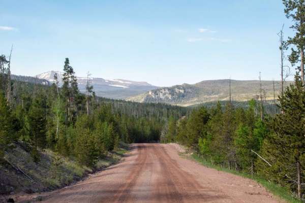
Henrys Fork - FS 80077
This trail runs from just across the Wyoming border, following Henry's Fork River down to where it ends at Henry's Fork trailhead. This trail is a well-maintained gravel road with room to pass other vehicles through most of the trail. Once you pass by the turn heading to Hole in the Rock, the trail ...
Learn more about Henrys Fork - FS 80077
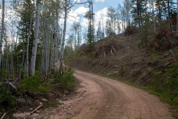
Upper Middle Beaver - FS 80164
This trail is a short out-and-back spur trail off of Hole in the Rock to Henrys Fork that heads South to where it dead-ends at the Middle Beaver hiking trailhead. This trail is a smooth and well-maintained road with only a few rocks and ruts to watch out for. Along the trail, there are a couple of o...
Learn more about Upper Middle Beaver - FS 80164
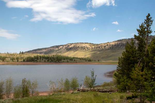
Hoop Lake Trailhead - FS 80412
This trail is a short out-and-back trail that splits off from Beaver Meadows and Heads Southwest towards Hoop Lake, where it dead-ends at a small loop parking area with lake access at the hiking trailhead. This trail is a well-maintained trail with no obstacles that is only one vehicle wide, with so...
Learn more about Hoop Lake Trailhead - FS 80412
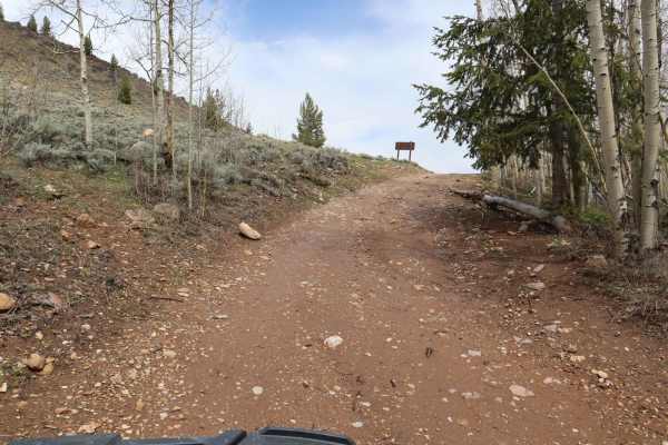
Poison Mountain
A good mix of valley vistas and alpine mountain travels, this road arcs along the Northern perimeter of Poison Mountain.The most unique characteristic of this road is the incredible diversity of scenery depending on what time of year you travel. In the Spring, the valley floors spreading out below t...
Learn more about Poison Mountain
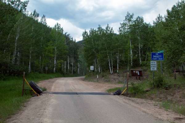
Hickerson Park-Birch Creek - FS 10221
This trail runs from the end of Dagget County Road 1 Southeast to the Sheep Creek Geologic Loop near Flaming Gorge. This trail is a well-maintained gravel road that remains wide enough for vehicles to pass each other comfortably throughout. The only obstacle on the trail is a one-lane bridge at the ...
Learn more about Hickerson Park-Birch Creek - FS 10221
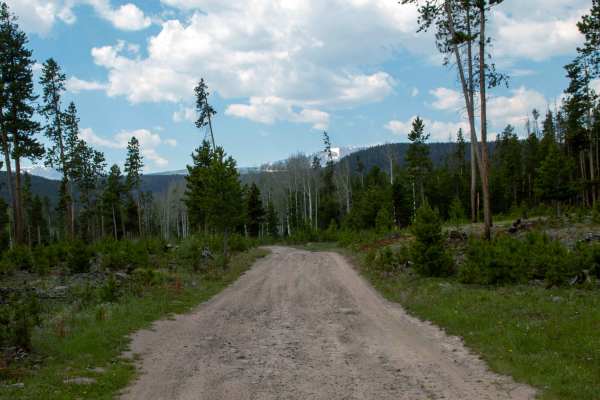
Beaver Meadows - FS 80086
This trail runs from Hoop Lake to the border of Ashley National Forest, passing over the dam for Beaver Meadow Reservoir along the way. This trail is a little rough, with small rocks scattered throughout most of the trail, as well as being only one vehicle wide in many spots. This trail has some ama...
Learn more about Beaver Meadows - FS 80086
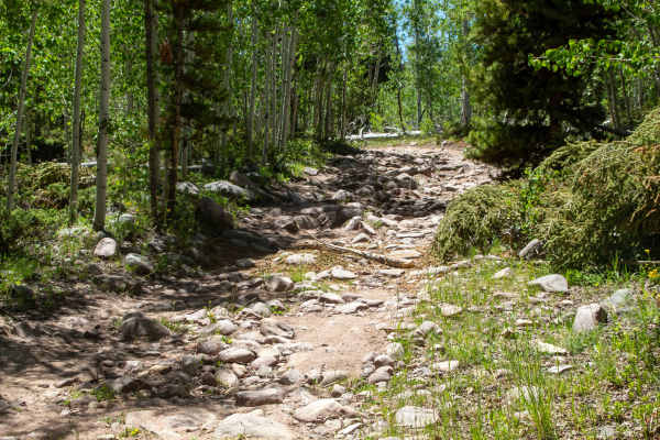
Deadhorse - FS 40005
This trail runs between China Meadows and Gilbert Creek, following the East Fork of Smiths Fork River once it drops down from China Meadows. This trail is mostly rocky with a couple of sandy sections; most of the rocky sections are not technical and will mostly just make the ride rough and slow goin...
Learn more about Deadhorse - FS 40005
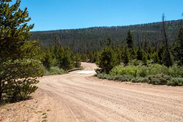
China Meadows
China Meadows (FS 80072) is a scenic, easy-rated off-road route deep in Utah’s Wasatch National Forest, ideal for overlanders, families, and beginners looking for a peaceful high-country escape. This mellow trail leads into the heart of the Evanston-Mountain View Ranger District, ending at the China...
Learn more about China Meadows
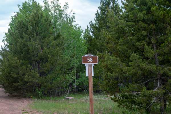
North Slope Thornburg - FS 10058
This trail runs between Beaver Meadows and Hickerson Park to Birch Creek. This trail is a smooth trail with no obstacles, but it is one vehicle wide and is super dusty when it is dry out. This trail stays in the trees across a flat and does not have any good viewpoints of the surrounding area, but i...
Learn more about North Slope Thornburg - FS 10058
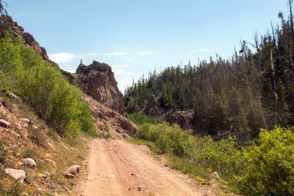
Hole in the Rock-Henry's Fork - FS 80082
This trail runs between Henrys Fork and Hoop Lake Trails, where it splits just before the trailhead on Henrys Fork and just before Hole in the Rock on Hoop Lake. This trail is mostly well-maintained, but there are sections in the middle where the trail has become a little rutted out, as well as a se...
Learn more about Hole in the Rock-Henry's Fork - FS 80082
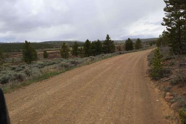
Spirit Lake
This is a very well-maintained and frequently traveled road that brings you to the beautiful and majestic Spirit Lake. Even though the road begins as a wide, 2-lane road, it begins to narrow and become increasingly more winding the closer it gets to Spirit Lake. However, it is still a flat, graded r...
Learn more about Spirit Lake
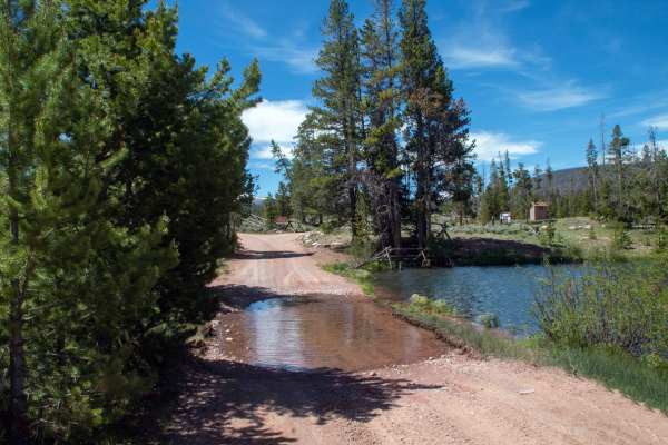
China Meadows Trailhead - FS 80125
This trail runs from the end of China Meadows and heads South past a small pond down to where the trail splits at the beginning of the trailhead campground. This trail is well maintained with only a few small potholes on the trail, with the hardest part being a shallow water crossing that can be loc...
Learn more about China Meadows Trailhead - FS 80125
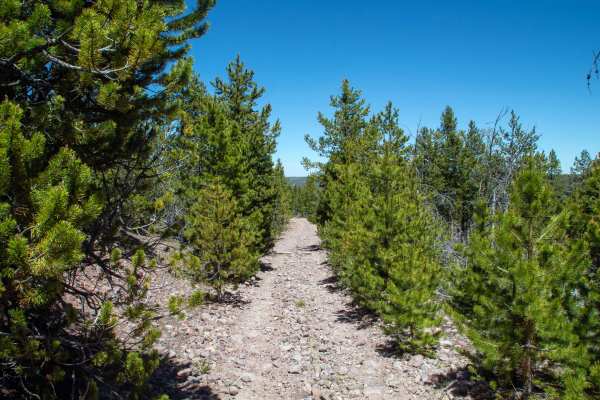
Ridge Road - FS 80076
This trail is a tight and rocky trail that follows the ridgeline running North to South. The trail start can be a little hard to spot while traveling down Blacks Fork to China Meadows Trail, so I would recommend having your map open, watching for the trailhead, which will be just after or before a c...
Learn more about Ridge Road - FS 80076
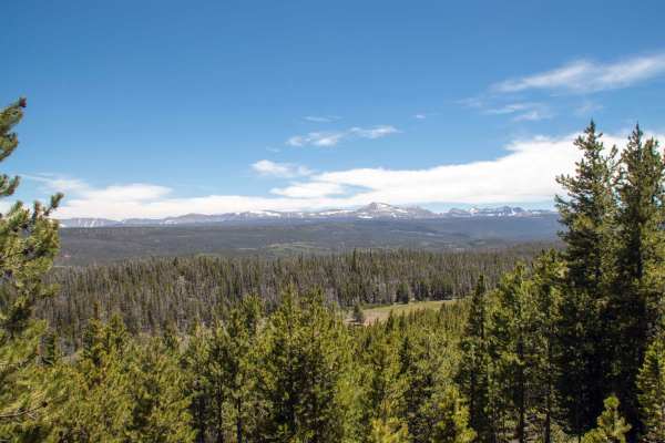
Johnson Meadow - FS 80207
This trail branches off of Gilbert Creek heading East and starts as a relatively easy trail, being a smooth one-lane road traveling through some meadows and trees, but transitions into being tighter and rockier as it turns to the North and follows the ridgeline. The trail ends after a short descent ...
Learn more about Johnson Meadow - FS 80207
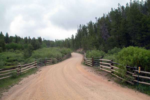
Long Park Reservoir - FS 10014
This trail branches off of Hickerson Park - Birch Creek trail and heads North to where it dead-ends at the parking lot and boat ramp for Long Park Reservoir. This trail is a well-maintained gravel road that has no major obstacles and stays two vehicles wide for most of the trail. This trail travels ...
Learn more about Long Park Reservoir - FS 10014

57 Route - Willow Creek
This is a Wyoming dirt trail that winds through BLM land and National Forest. Beginning with smooth dirt roads, the trail gradually transitions into challenging sections with deep ruts and rocky paths, making for a rough ride. The trail can become impassable when muddy and wet. Along the way, you mi...
Learn more about 57 Route - Willow Creek
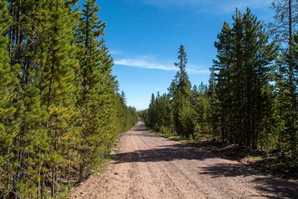
Gilbert Creek - FS 80075
This trail is a well-maintained gravel road that runs North to South following Gilbert Creek. This trail is 2 vehicles wide throughout, with the only areas of caution being the 2 bridges, where some larger potholes have formed at the ends of the bridge, as well as the many intersecting trails that c...
Learn more about Gilbert Creek - FS 80075
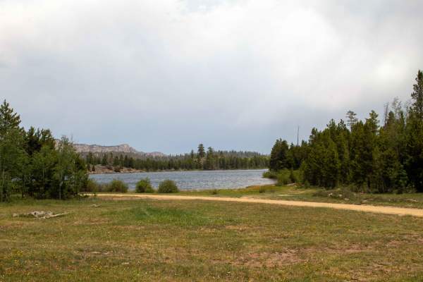
Sheep Creek Lake - FS 10009
This trail is a short spur off the Hickerson Park - Birch Creek trail that heads to Sheep Creek Lake. This trail is a smooth, well-maintained dirt road that is one vehicle wide with places to pass along the trail. The trail travels across a field following a canal to the lake, where it does a loop a...
Learn more about Sheep Creek Lake - FS 10009
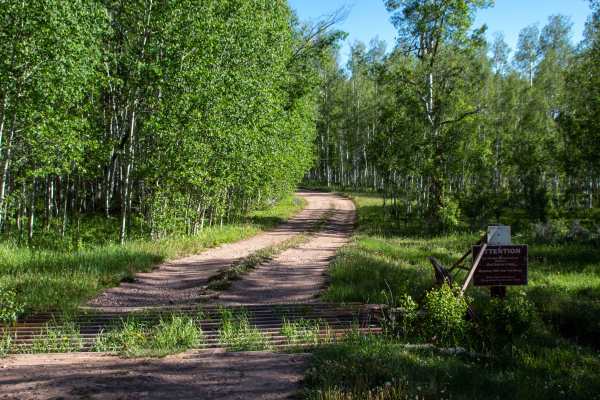
West Fork Smiths Fork - FS 80074
This trail is an easy trail as it heads North from Blacks Fork to China Meadows, running alongside the West Fork Smiths Fork River. The trail is mostly easy going with some small potholes and shallow ruts, with the hardest area being just South of Suicide Park, where the trail crosses a clearing whe...
Learn more about West Fork Smiths Fork - FS 80074
ATV trails near Lonetree, Wyoming
Explore ATV-friendly trails near you. These trails are accessible for vehicles up to 50 inches wide, perfect for ATVs and smaller off-road machines.
Hoop Lake - FS 80078
This trail runs from the Wyoming state line to Hoop Lake, passing by Hole in the Rock, which is easily viewed from the road as you approach from the North. This trail is well-maintained and stays 2 vehicles wide throughout the trail, with only some shallow ruts and small rocks in the trail. This tra...
Learn more about Hoop Lake - FS 80078
Henrys Fork - FS 80077
This trail runs from just across the Wyoming border, following Henry's Fork River down to where it ends at Henry's Fork trailhead. This trail is a well-maintained gravel road with room to pass other vehicles through most of the trail. Once you pass by the turn heading to Hole in the Rock, the trail ...
Learn more about Henrys Fork - FS 80077
Upper Middle Beaver - FS 80164
This trail is a short out-and-back spur trail off of Hole in the Rock to Henrys Fork that heads South to where it dead-ends at the Middle Beaver hiking trailhead. This trail is a smooth and well-maintained road with only a few rocks and ruts to watch out for. Along the trail, there are a couple of o...
Learn more about Upper Middle Beaver - FS 80164
Hoop Lake Trailhead - FS 80412
This trail is a short out-and-back trail that splits off from Beaver Meadows and Heads Southwest towards Hoop Lake, where it dead-ends at a small loop parking area with lake access at the hiking trailhead. This trail is a well-maintained trail with no obstacles that is only one vehicle wide, with so...
Learn more about Hoop Lake Trailhead - FS 80412
UTV/side-by-side trails near Lonetree, Wyoming
Find UTV and side-by-side trails near you. These trails accommodate vehicles up to 60 inches wide, ideal for UTVs, side-by-sides, and wider off-road rigs.
Hoop Lake - FS 80078
This trail runs from the Wyoming state line to Hoop Lake, passing by Hole in the Rock, which is easily viewed from the road as you approach from the North. This trail is well-maintained and stays 2 vehicles wide throughout the trail, with only some shallow ruts and small rocks in the trail. This tra...
Learn more about Hoop Lake - FS 80078
Henrys Fork - FS 80077
This trail runs from just across the Wyoming border, following Henry's Fork River down to where it ends at Henry's Fork trailhead. This trail is a well-maintained gravel road with room to pass other vehicles through most of the trail. Once you pass by the turn heading to Hole in the Rock, the trail ...
Learn more about Henrys Fork - FS 80077
Upper Middle Beaver - FS 80164
This trail is a short out-and-back spur trail off of Hole in the Rock to Henrys Fork that heads South to where it dead-ends at the Middle Beaver hiking trailhead. This trail is a smooth and well-maintained road with only a few rocks and ruts to watch out for. Along the trail, there are a couple of o...
Learn more about Upper Middle Beaver - FS 80164
Hoop Lake Trailhead - FS 80412
This trail is a short out-and-back trail that splits off from Beaver Meadows and Heads Southwest towards Hoop Lake, where it dead-ends at a small loop parking area with lake access at the hiking trailhead. This trail is a well-maintained trail with no obstacles that is only one vehicle wide, with so...
Learn more about Hoop Lake Trailhead - FS 80412
The onX Offroad Difference
onX Offroad combines trail photos, descriptions, difficulty ratings, width restrictions, seasonality, and more in a user-friendly interface. Available on all devices, with offline access and full compatibility with CarPlay and Android Auto. Discover what you're missing today!
Open Trail Map