
Dirt Bike Trails
Near Lakeview, Montana
Explore All Dirt Bike Trails Near Lakeview, Montana
Dirt Bike Trails Near Lakeview, Montana
Discover the best dirt bike trails near you. Browse trail maps, check difficulty ratings, and find your next adventure — whether you're looking for a quick ride or an all-day expedition.
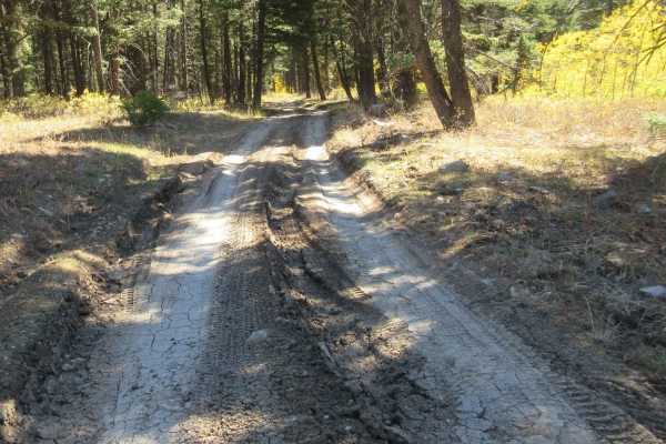
East Fork Dry Creek
This is a fun short ride up a beautiful mountain trail with some fantastic views. Depending upon the time of year, there will be flowers and deep green grasses. Later in the year, the Quaking Aspen trees are full of color. The trail originally took you to the Continental Divide but that has been blo...
Learn more about East Fork Dry Creek
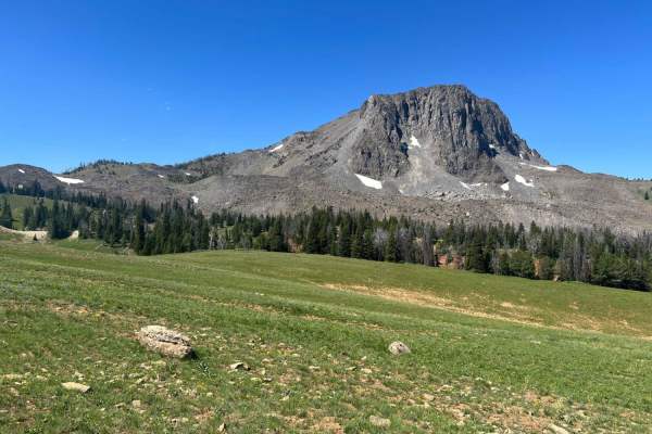
Gravelly Range South (FS290)
This is the southeastern portion of this long Forest Service Road through the upper plateau area of the Gravelly Range. On the northern end of this section, you will be mesmerized by the beauty of Black Butte. This large stone mountain stands majestically alone and is a great landmark for your trave...
Learn more about Gravelly Range South (FS290)
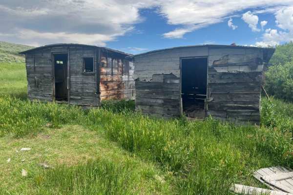
Fish Creek Lake Road (Partial)
This is an exciting adventure with some great views, trail obstacles, and two lakes that had fish rising to get the numerous bugs, due to the approaching thunderstorm when we were there. Be aware, this trail does cross numerous streams/bog obstacles that can be very challenging depending upon recent...
Learn more about Fish Creek Lake Road (Partial)

Keg Springs (Forest Service 046)
This short ride provides some beautiful views of the Teton Mountains, lakes, and local meadows. Depending upon the time of year, there will be flowers and deep green grasses. Later in the year, the Quaking Aspen trees are full of color. While the trail gets you to the Continental Divide, much of the...
Learn more about Keg Springs (Forest Service 046)
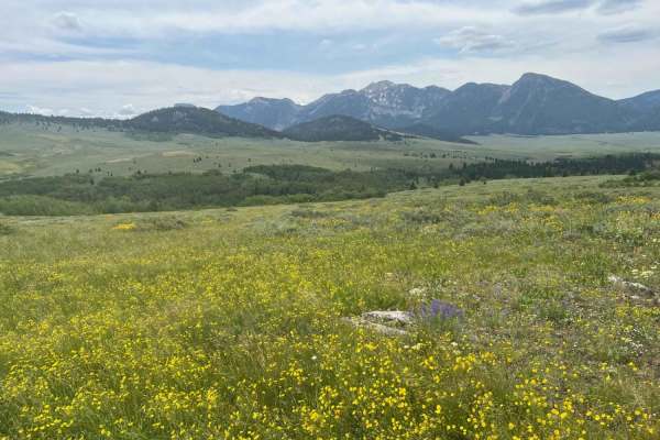
Lone Tree Pass-Deer Mountain Road
This section of trail is a fun exploration of some rocky terrain that climbs to almost 8,400 feet over a pass, giving you views of Elk Lake and the wildlife refuge area to the west. We explored this in early July, and there was still significant snow on some of the hillsides near the top of the pass...
Learn more about Lone Tree Pass-Deer Mountain Road
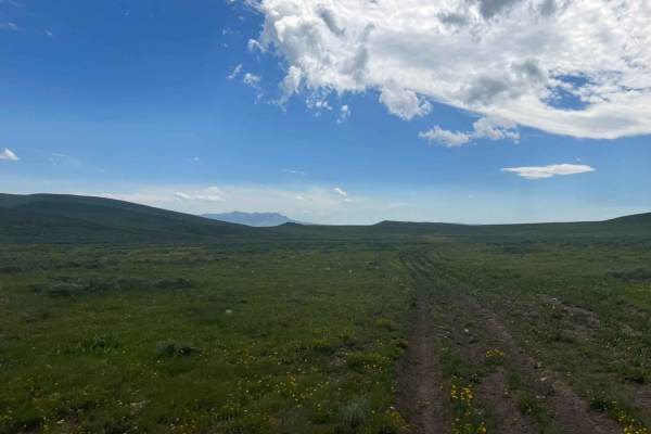
Fish Creek Ridge Road (FS 9626)
If you're not careful, you will drive past this trail from either end. The only thing marking a trail on the Eureka Basin end is a very old FS sign that informs you that this trail is restricted to specific times of the year. It opens in Jul and closes in March. The route is not used, and the only w...
Learn more about Fish Creek Ridge Road (FS 9626)
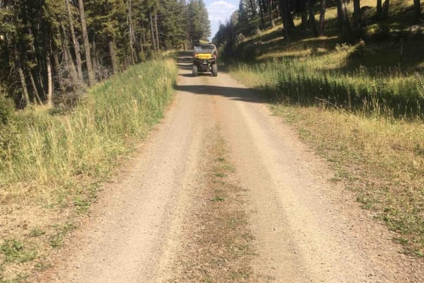
Price Peet Road
The first 7 miles of this BLM road travel through a very dense beautiful mixed conifer forest. After breaking out of the forested area, the road continues to gently descend through open hilly grasslands until it intersects with Red Rock Lakes Road. A turn to the west (left) on the Red Rocks Lake Roa...
Learn more about Price Peet Road
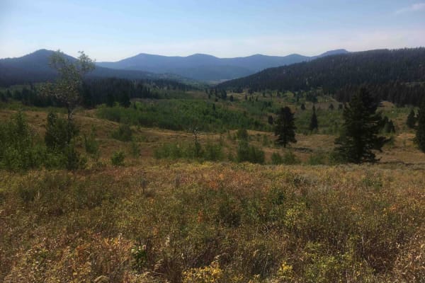
Pete Creek Trail
This short 1.3-mile trail leads from the end of the Pete Creek Road north to the Continental Divide. It goes through some dense timberland and occasionally breaks out into meadowlands at its upper end. The tread is primarily dirt and there are some washouts to be dealt with. The trail intersects wit...
Learn more about Pete Creek Trail
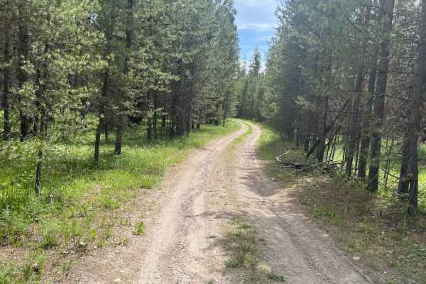
East Bench (FS 8378)
If you are looking for a short trail with mind-blowing views at the end, this is it. We almost didn't take it but decided to see where it led. This trail puts you directly above a valley where you can see Hidden Lake and Elk Lake. You also have exceptional mountain views. This area was ravaged by a ...
Learn more about East Bench (FS 8378)
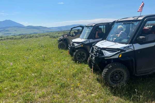
Jackknife - Cliff Lake Bench (FS 9640/41)
We were hoping to see Cliff or Wade Lake when we went down this trail, but we did not. But there were some great views as we moved along this bench. The grass was deep, and the flowers were spectacular. We were also able to see the dam formed when a mountain slide formed Quake Lake. At the end, ther...
Learn more about Jackknife - Cliff Lake Bench (FS 9640/41)
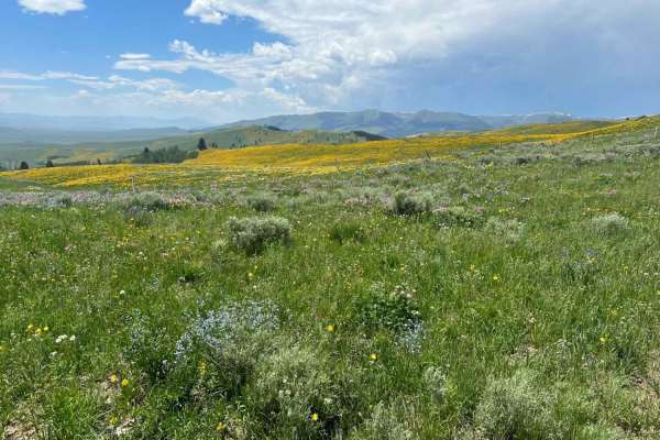
Eureka Basin Road (FS 347)
This road is actually a connector between Gravelly Range Road and Centennial Divide Road. Like Gravelly, this road has some spectacular views, and on the southern end, you will drop off the upper mesa at approximately 8,000 feet down to the valley at approximately 6,500 feet. This is an easy, mainta...
Learn more about Eureka Basin Road (FS 347)
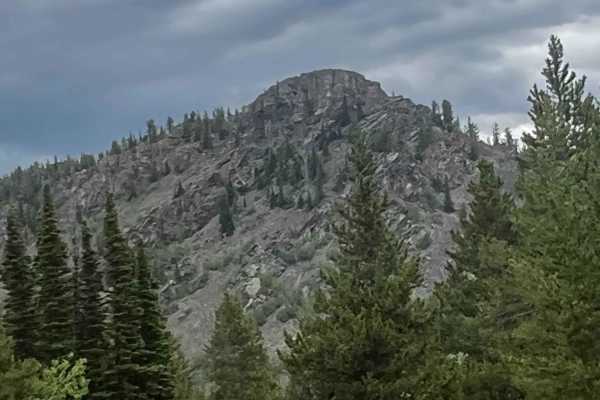
Antelope Basin (FS 230)
If toured at the correct time of the year, this is an exceptionally beautiful area with tall grasses and fields of wildflowers. In addition, there are many unique and spectacular rock formations. One that struck me was a mountain that looked like they ran out of earthen material, so a bucket of rock...
Learn more about Antelope Basin (FS 230)
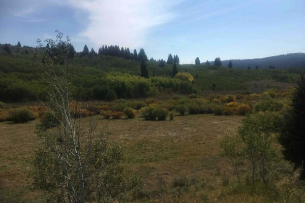
Pete Creek Road
This is a fairly typical Forest Service gravel road up the Pete Creek drainage. The mixture of vegetation types in this drainage provides a stunning visual experience. This is a really nice easy drive and would be outstanding in the fall when the aspens and willows are turning colors. This is a grea...
Learn more about Pete Creek Road
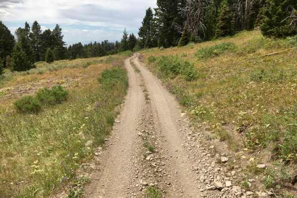
Alex Draw to McGary Canyon ATV Trail
This nearly 11-mile ATV trail is amazing!! The trail itself is designed to accommodate vehicles less than or equal to 50 inches in width, with lots of tight, narrow obstacles, climbing (and descending) rocky hairpin turns, and a few flat stretches where riders can catch their breath. The nature of ...
Learn more about Alex Draw to McGary Canyon ATV Trail
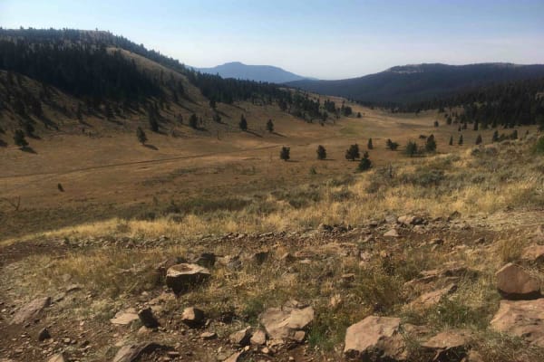
Camas Creek Trail
This trail takes off from the end of the Camas Creek Road and steadily climbs to the Continental Divide at an elevation of 8,167 feet. The lower portion of the road winds its way through dense forest; the middle portion of the road passes through thinner stands of trees alternating with subalpine me...
Learn more about Camas Creek Trail
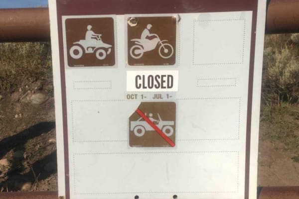
Camas Creek Road
This road travels up the Camas Creek drainage for about 4 miles. What is surprising is the visual impact of the foliage to be seen from the road. The mixture of conifers, aspen, and willow distributed over the landscape is truly remarkable. This road is open yearlong to 50" ATVs and motorcycles but ...
Learn more about Camas Creek Road
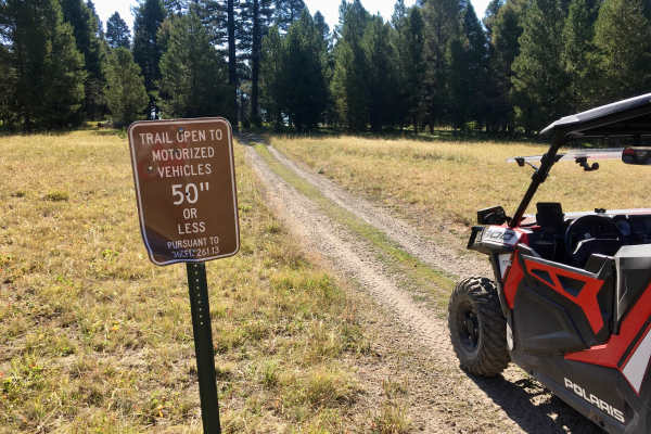
Lookout Point South ATV Trail
This ATV trail is virtually one long ascent (or descent, depending on which way you are travelling) up a broad rocky ridgeline. There are several very steep and very rocky grades. It’s a short, fun trail, but it may not be appropriate for novice riders. This trail is signed as TR 1180.
Learn more about Lookout Point South ATV Trail
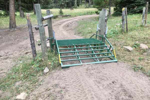
Lone Pine Pass ATV Trail
In addition to being a really fun trail, this trail, signed as ATV TR 175 on the ground, indirectly connects TR 005 to Spencer Kilgore Road. This is a pretty rough trail with lots of ruts and rocks. In several places, the tread width is narrowed by encroaching vegetation. There are several water cro...
Learn more about Lone Pine Pass ATV Trail
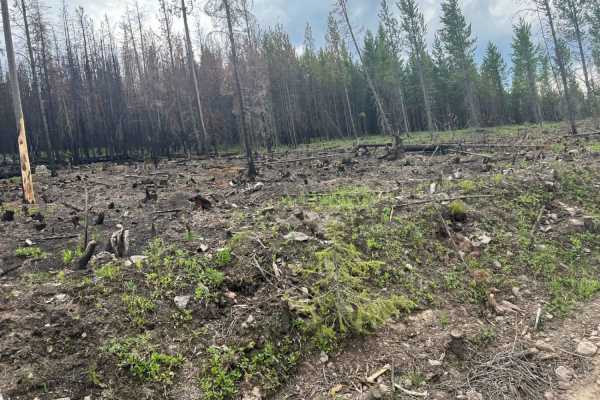
Jackpine Gulch (FS 1209)
This area shows the ravages of the fire that went through this region two years ago. It is sad to see the damage but, encouraging to see the logging operations that are going on to remove the dead trees. Hopefully, the area will be replanted once those operations are complete. We rode this trail to ...
Learn more about Jackpine Gulch (FS 1209)
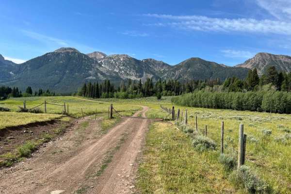
Continental Divide Trail (FS 20056)
This trail is the portal to several wonderful adventures in this area. There are trailheads with parking areas for a limited number of vehicles with trailers on either end. Red Rock Road has more parking space. There are great views and opportunities to see wildlife. Included with this track are two...
Learn more about Continental Divide Trail (FS 20056)
ATV trails near Lakeview, Montana
Explore ATV-friendly trails near you. These trails are accessible for vehicles up to 50 inches wide, perfect for ATVs and smaller off-road machines.
East Fork Dry Creek
This is a fun short ride up a beautiful mountain trail with some fantastic views. Depending upon the time of year, there will be flowers and deep green grasses. Later in the year, the Quaking Aspen trees are full of color. The trail originally took you to the Continental Divide but that has been blo...
Learn more about East Fork Dry Creek
Gravelly Range South (FS290)
This is the southeastern portion of this long Forest Service Road through the upper plateau area of the Gravelly Range. On the northern end of this section, you will be mesmerized by the beauty of Black Butte. This large stone mountain stands majestically alone and is a great landmark for your trave...
Learn more about Gravelly Range South (FS290)
Fish Creek Lake Road (Partial)
This is an exciting adventure with some great views, trail obstacles, and two lakes that had fish rising to get the numerous bugs, due to the approaching thunderstorm when we were there. Be aware, this trail does cross numerous streams/bog obstacles that can be very challenging depending upon recent...
Learn more about Fish Creek Lake Road (Partial)
Keg Springs (Forest Service 046)
This short ride provides some beautiful views of the Teton Mountains, lakes, and local meadows. Depending upon the time of year, there will be flowers and deep green grasses. Later in the year, the Quaking Aspen trees are full of color. While the trail gets you to the Continental Divide, much of the...
Learn more about Keg Springs (Forest Service 046)
UTV/side-by-side trails near Lakeview, Montana
Find UTV and side-by-side trails near you. These trails accommodate vehicles up to 60 inches wide, ideal for UTVs, side-by-sides, and wider off-road rigs.
East Fork Dry Creek
This is a fun short ride up a beautiful mountain trail with some fantastic views. Depending upon the time of year, there will be flowers and deep green grasses. Later in the year, the Quaking Aspen trees are full of color. The trail originally took you to the Continental Divide but that has been blo...
Learn more about East Fork Dry Creek
Gravelly Range South (FS290)
This is the southeastern portion of this long Forest Service Road through the upper plateau area of the Gravelly Range. On the northern end of this section, you will be mesmerized by the beauty of Black Butte. This large stone mountain stands majestically alone and is a great landmark for your trave...
Learn more about Gravelly Range South (FS290)
Fish Creek Lake Road (Partial)
This is an exciting adventure with some great views, trail obstacles, and two lakes that had fish rising to get the numerous bugs, due to the approaching thunderstorm when we were there. Be aware, this trail does cross numerous streams/bog obstacles that can be very challenging depending upon recent...
Learn more about Fish Creek Lake Road (Partial)
Keg Springs (Forest Service 046)
This short ride provides some beautiful views of the Teton Mountains, lakes, and local meadows. Depending upon the time of year, there will be flowers and deep green grasses. Later in the year, the Quaking Aspen trees are full of color. While the trail gets you to the Continental Divide, much of the...
Learn more about Keg Springs (Forest Service 046)
The onX Offroad Difference
onX Offroad combines trail photos, descriptions, difficulty ratings, width restrictions, seasonality, and more in a user-friendly interface. Available on all devices, with offline access and full compatibility with CarPlay and Android Auto. Discover what you're missing today!
Open Trail Map