
Off-road trails in undefined

Dirt Bike TrailsUnited States of AmericaLake Carmel, New York

Dirt Bike Trails
Near Lake Carmel, New York

Explore All Dirt Bike Trails Near Lake Carmel, New York

Trail Length
Technical Rating
Best Time of Year
Sort By

Dirt Bike Trails Near Lake Carmel, New York

Discover the best dirt bike trails near you. Browse trail maps, check difficulty ratings, and find your next adventure — whether you're looking for a quick ride or an all-day expedition.

Learn more about Thomaston Dam Loop
No photos available

Thomaston Dam Loop

Thomaston Dam Loop is a moderate dual-sport style ride best suited for experienced dirt bike riders looking for a mix of flowing singletrack and faster gravel segments within a controlled OHV area. Located along the Naugatuck River corridor just north of Thomaston Dam, this motorcycle-only trail sys...
Learn more about Thomaston Dam Loop
Total Miles
9.9
Tech Rating
1Easy
Best Time
Summer
Learn more about Mount Wilcox Road
Mount Wilcox Road

Mount Wilcox Road

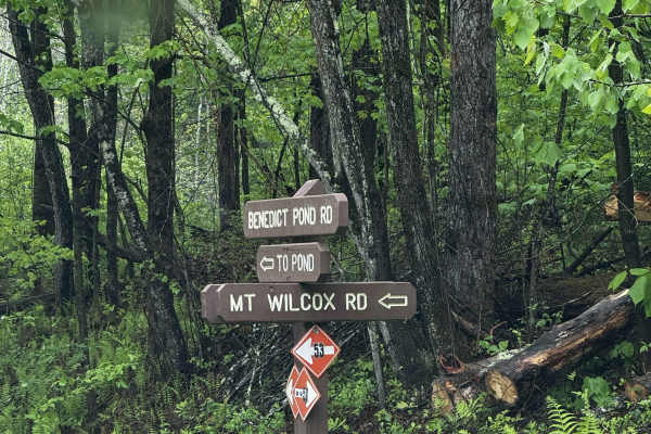
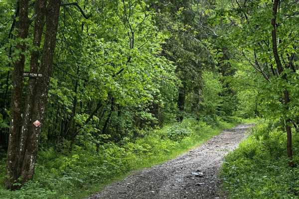
Mt Wilcox Road is the main loop that meanders through Beartown State Forest. The loop is 4.3 miles and climbs from 1,600 feet to 2,100 feet. The trail begins and ends off Benedict Pond Road. Halfway through the route from either direction is a short spur that breaks off and provides access to the su...
Learn more about Mount Wilcox Road
Total Miles
4
Tech Rating
2Easy
Best Time
Spring, Summer, Fall
Learn more about Sky Peak Road
Sky Peak Road

Sky Peak Road

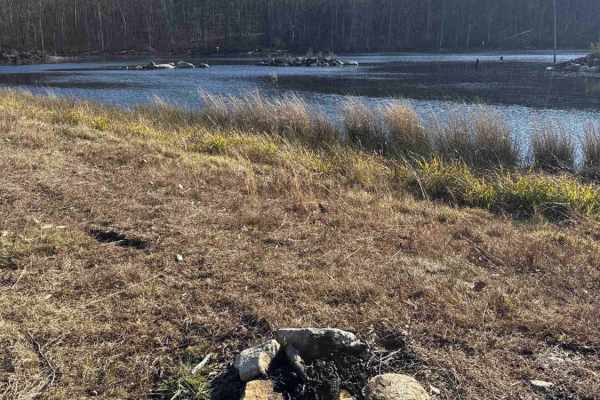
Sky Peak Road is a short connector between Beartown Mountain Road and Wilcox Mountain Road. The trail begins from Beartown and climbs from 1760 to 1900 feet in the short 0.7 miles of the trail over loose rock. The trail is well-graded in most sections, with some showing exposed rock. The trail ends...
Learn more about Sky Peak Road
Total Miles
0.7
Tech Rating
2Easy
Best Time
Spring, Summer, Fall
Learn more about Del Reeves Road
Del Reeves Road

Del Reeves Road

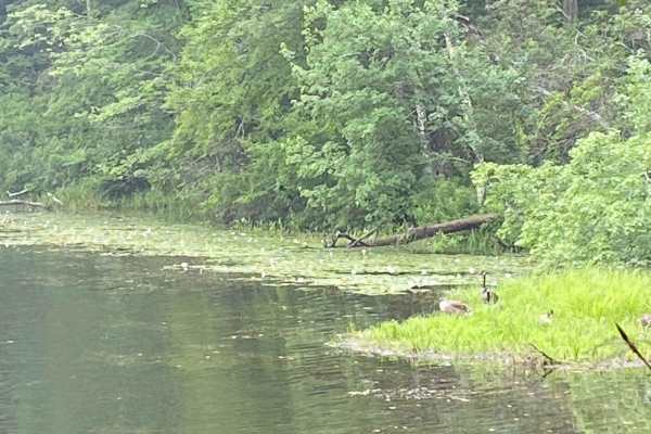
This mellow backroad route through Meshomasic State Forest follows a rough, mostly dirt track with a few gravel sections mixed in. It’s doable in nearly any vehicle, but something with off-road durability makes the ride smoother, especially when the ruts deepen, or rain turns things muddy. You’ll pa...
Learn more about Del Reeves Road
Total Miles
3.2
Tech Rating
2Easy
Best Time
Spring, Summer, Fall
Learn more about Mottlan - Jericho Road
Mottlan - Jericho Road

Mottlan - Jericho Road

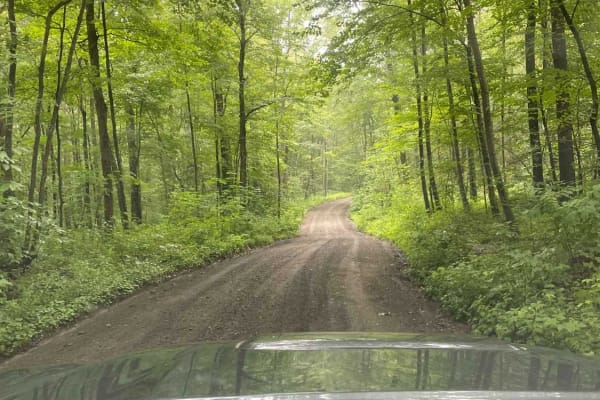
The dirt and gravel Mottland Road to Jericho Road leads directly into the Cockaponset State Forest trail network. Enjoy a leisurely drive through the forest on this road. A 4x4 /AWD is not needed to drive this road in regular conditions.
Learn more about Mottlan - Jericho Road
Total Miles
2.2
Tech Rating
1Easy
Best Time
Spring, Summer, Fall, Winter
Learn more about Filley Road
Filley Road

Filley Road

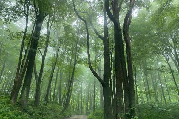
Serving as an entrance to the Cockaponset State Forest trail system, Filley Road is a very straightforward dirt and gravel path. The road allows for a smooth cruising experience through the forest and offers additional access to more trails in the state forest.
Learn more about Filley Road
Total Miles
1.8
Tech Rating
1Easy
Best Time
Spring, Summer, Fall, Winter
Learn more about Old Country Road
Old Country Road

Old Country Road

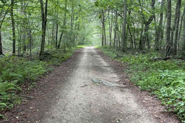
In order to access the trail system of the Cockaponset State Forest, Old Country Road is a very straightforward dirt and gravel entrance. The road allows for a smooth cruising experience through the state forest.
Learn more about Old Country Road
Total Miles
2.3
Tech Rating
1Easy
Best Time
Spring, Summer, Fall, Winter
Learn more about Tower Hill Road to Spruce Ledge Road
Tower Hill Road to Spruce Ledge Road

Tower Hill Road to Spruce Ledge Road

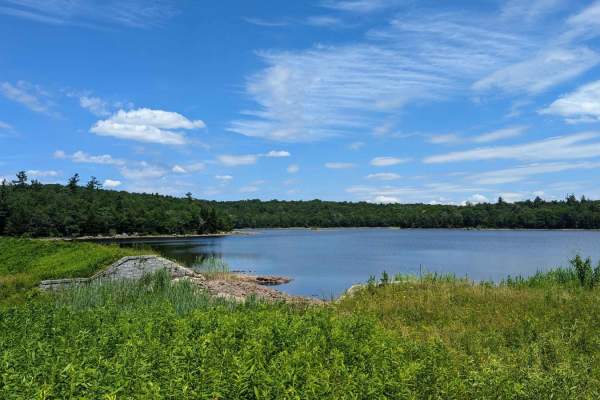
This trail is a straightforward path; however, there are sections that have puddle crossings that range from six to ten inches in size and require some ground clearance. The majority of obstacles are very straightforward and can be overcome with a stock vehicle. This road is located in the southern ...
Learn more about Tower Hill Road to Spruce Ledge Road
Total Miles
1.9
Tech Rating
2Easy
Best Time
Spring, Summer, Fall, Winter
Learn more about Ashley Lake Road
Ashley Lake Road

Ashley Lake Road

Ashley Lake Road is an old, unmaintained road through October Mountain State Forest. It rolls through hardwood forests past multiple lakes/reservoirs, including Ashley Lake, Sandwash Reservoir (this has a unique "aerator" which is a large fountain in the middle of the woods), Clapp Pond, and Mud Pon...
Learn more about Ashley Lake Road

Total Miles
2.3
Tech Rating
3Easy
Best Time
Spring, Summer, Fall
Learn more about Old Spencer Road
Old Spencer Road

Old Spencer Road

This track is very overgrown;it's super tight to start with branches all over the sides and top of your rig. The cell service is decent, but the GPS gets a little confused at times. The majority of the track is dirt;there are some decent-sized boulders you'll have to crawl over, there is a spot with...
Learn more about Old Spencer Road

Total Miles
1.2
Tech Rating
4Moderate
Best Time
Spring, Summer, Fall
Learn more about Sully's Way
Sully's Way

Sully's Way

This track is very overgrown. If you like your paint, don't go down it. It does open up after the beginning, but it's super tight to start with branches all over the sides and top of your rig. The cell service is decent, but the GPS gets a little confused at times. The majority of the track is dirt;...
Learn more about Sully's Way

Total Miles
1.4
Tech Rating
3Easy
Best Time
Summer
Learn more about Hampden Road
Hampden Road

Hampden Road

Level 1, besides one water crossing, which I'd give a 2 for a 4x4, single track wide, mostly rough gravel, overgrown slightly, will cause some scraping on the paint, it's maintained a little bit with clearing trees that fell, starts in Stafford Springs, Connecticut then ends in Hampden Massachusetts...
Learn more about Hampden Road

Total Miles
2.4
Tech Rating
3Easy
Best Time
Summer
Learn more about Burnt- Rossman Hill Road
Burnt- Rossman Hill Road

Burnt- Rossman Hill Road

This trail goes through Burnt-Rossman State Forest. It is a mostly maintained dirt road with occasional mud holes or deep ruts in sections. Deep water can accumulate in the ruts in the spring. There is a great primitive camping area Arthur Hopkins campsite on a small pond just off the road.
Learn more about Burnt- Rossman Hill Road

Total Miles
10.8
Tech Rating
2Easy
Best Time
Summer, Fall
Learn more about Torrey Mountain Road
Torrey Mountain Road

Torrey Mountain Road

This is an unmaintained road in Florida, Massachusetts. The northern end is about a mile from the eastern portal of the Hoosac Tunnel, once the world's second-largest tunnel, and climbs southward out of the beautiful Deerfield River valley. One of the more challenging trails in the Berkshires, this ...
Learn more about Torrey Mountain Road

Total Miles
1.4
Tech Rating
6Moderate
Best Time
Spring, Summer, Fall
Learn more about T-743/T-727
T-743/T-727

T-743/T-727

The trail starts off in Poyntelle as Township-727 and in Winterdale as T-743. This section of the O and W Trail is a recognized Township route open to street-licensed 4x4s. The trail follows the former route of the Ohio and Western Railroad. Multiple former stations can be observed along the route. ...
Learn more about T-743/T-727

Total Miles
13.4
Tech Rating
3Easy
Best Time
Fall, Summer, Spring
Learn more about Old Military Road/TH-35
Old Military Road/TH-35

Old Military Road/TH-35

If entering from the south, the hard part is first. The northern end of the trail is an easy dirt track. Coming up the hill from the south are many differential dingers and under carriage crunchers. The trail gets a bit narrow at times but is easily passed with a good spotter. The rougher parts skir...
Learn more about Old Military Road/TH-35

Total Miles
2.5
Tech Rating
4Moderate
Best Time
Summer, Spring, Fall
Learn more about Pachaug Enduro Trail
No photos available

Pachaug Enduro Trail

Pachaug Enduro Trail is a classic New England ride best suited for experienced dual-sport and street-legal dirt bike riders looking for a technical, mixed-terrain challenge through dense forest. Winding through Pachaug State Forest in southeastern Connecticut, this loop combines narrow singletrack w...
Learn more about Pachaug Enduro Trail

Total Miles
57.2
Tech Rating
1Easy
Best Time
Summer, Fall
Learn more about 31 Green - A
31 Green - A

31 Green - A

If you need some variety in your life, 31 Green is your trail. This uneven, dirt trail will throw some curveballs at you with various-sized rocks, up and down slopes, rocky ledges and shallow muddy obstacles. You may encounter a downed tree here and there as this trail does take you through some woo...
Learn more about 31 Green - A

Total Miles
1.9
Tech Rating
3Easy
Best Time
Spring, Summer, Winter, Fall
Learn more about 32 Blue
32 Blue

32 Blue

Ready for an adventure!? Check out 32 Blue! Just after the tunnel, this rocky uphill has some nice challenges. This includes a nice ledge to climb and some deep ruts. This is a rougher trail that can be worked through with proper line choice. The fun part is there are multiple lines to choose from.
Learn more about 32 Blue

Total Miles
0.1
Tech Rating
5Moderate
Best Time
Spring, Summer, Fall, Winter
Learn more about 31 Blue
31 Blue

31 Blue

This dirt trail presents a series of challenges with rocks of various sizes, undulating hills, and shallow muddy obstacles. Looking for a lunch spot? The 31 Blue trail leads you around the Lake, offering a scenic location to pause and appreciate the lakeside views. No swimming or driving in the lake...
Learn more about 31 Blue

Total Miles
0.7
Tech Rating
3Easy
Best Time
Spring, Summer, Fall, Winter

ATV trails near Lake Carmel, New York

Explore ATV-friendly trails near you. These trails are accessible for vehicles up to 50 inches wide, perfect for ATVs and smaller off-road machines.

Learn more about Mount Wilcox Road
Mount Wilcox Road

Mount Wilcox Road

Mt Wilcox Road is the main loop that meanders through Beartown State Forest. The loop is 4.3 miles and climbs from 1,600 feet to 2,100 feet. The trail begins and ends off Benedict Pond Road. Halfway through the route from either direction is a short spur that breaks off and provides access to the su...
Learn more about Mount Wilcox Road

Total Miles
4
Tech Rating
2Easy
Best Time
Spring, Summer, Fall
Learn more about Sky Peak Road
Sky Peak Road

Sky Peak Road

Sky Peak Road is a short connector between Beartown Mountain Road and Wilcox Mountain Road. The trail begins from Beartown and climbs from 1760 to 1900 feet in the short 0.7 miles of the trail over loose rock. The trail is well-graded in most sections, with some showing exposed rock. The trail ends...
Learn more about Sky Peak Road

Total Miles
0.7
Tech Rating
2Easy
Best Time
Spring, Summer, Fall
Learn more about Del Reeves Road
Del Reeves Road

Del Reeves Road

This mellow backroad route through Meshomasic State Forest follows a rough, mostly dirt track with a few gravel sections mixed in. It’s doable in nearly any vehicle, but something with off-road durability makes the ride smoother, especially when the ruts deepen, or rain turns things muddy. You’ll pa...
Learn more about Del Reeves Road

Total Miles
3.2
Tech Rating
2Easy
Best Time
Spring, Summer, Fall
Learn more about Mottlan - Jericho Road
Mottlan - Jericho Road

Mottlan - Jericho Road

The dirt and gravel Mottland Road to Jericho Road leads directly into the Cockaponset State Forest trail network. Enjoy a leisurely drive through the forest on this road. A 4x4 /AWD is not needed to drive this road in regular conditions.
Learn more about Mottlan - Jericho Road

Total Miles
2.2
Tech Rating
1Easy
Best Time
Spring, Summer, Fall, Winter

UTV/side-by-side trails near Lake Carmel, New York

Find UTV and side-by-side trails near you. These trails accommodate vehicles up to 60 inches wide, ideal for UTVs, side-by-sides, and wider off-road rigs.

Learn more about Mount Wilcox Road
Mount Wilcox Road

Mount Wilcox Road

Mt Wilcox Road is the main loop that meanders through Beartown State Forest. The loop is 4.3 miles and climbs from 1,600 feet to 2,100 feet. The trail begins and ends off Benedict Pond Road. Halfway through the route from either direction is a short spur that breaks off and provides access to the su...
Learn more about Mount Wilcox Road

Total Miles
4
Tech Rating
2Easy
Best Time
Spring, Summer, Fall
Learn more about Sky Peak Road
Sky Peak Road

Sky Peak Road

Sky Peak Road is a short connector between Beartown Mountain Road and Wilcox Mountain Road. The trail begins from Beartown and climbs from 1760 to 1900 feet in the short 0.7 miles of the trail over loose rock. The trail is well-graded in most sections, with some showing exposed rock. The trail ends...
Learn more about Sky Peak Road

Total Miles
0.7
Tech Rating
2Easy
Best Time
Spring, Summer, Fall
Learn more about Del Reeves Road
Del Reeves Road

Del Reeves Road

This mellow backroad route through Meshomasic State Forest follows a rough, mostly dirt track with a few gravel sections mixed in. It’s doable in nearly any vehicle, but something with off-road durability makes the ride smoother, especially when the ruts deepen, or rain turns things muddy. You’ll pa...
Learn more about Del Reeves Road

Total Miles
3.2
Tech Rating
2Easy
Best Time
Spring, Summer, Fall
Learn more about Mottlan - Jericho Road
Mottlan - Jericho Road

Mottlan - Jericho Road

The dirt and gravel Mottland Road to Jericho Road leads directly into the Cockaponset State Forest trail network. Enjoy a leisurely drive through the forest on this road. A 4x4 /AWD is not needed to drive this road in regular conditions.
Learn more about Mottlan - Jericho Road

Total Miles
2.2
Tech Rating
1Easy
Best Time
Spring, Summer, Fall, Winter

The onX Offroad Difference

onX Offroad combines trail photos, descriptions, difficulty ratings, width restrictions, seasonality, and more in a user-friendly interface. Available on all devices, with offline access and full compatibility with CarPlay and Android Auto. Discover what you're missing today!

Open Trail Map