
Dirt Bike Trails
Near Ketchum, Idaho
Explore All Dirt Bike Trails Near Ketchum, Idaho
Dirt Bike Trails Near Ketchum, Idaho
Discover the best dirt bike trails near you. Browse trail maps, check difficulty ratings, and find your next adventure — whether you're looking for a quick ride or an all-day expedition.
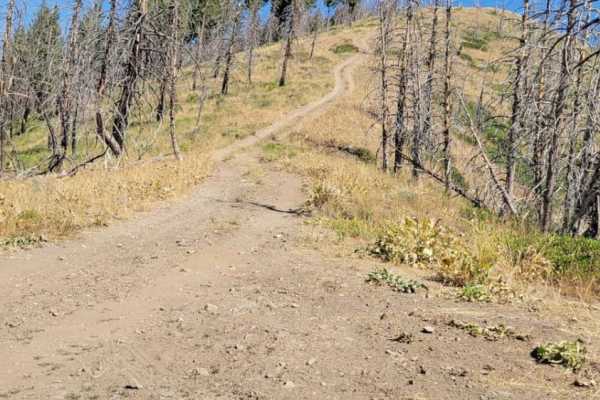
Warm Springs Creek Trail
The Warm Springs Creek Trail is an out and back trail in Sawtooth National Forest in Idaho. This trail offers incredible views of the surrounding mountains, especially as the elevation climbs. There's many campsites at the beginning and one at the top. This trail gets very narrow so pinstripes are v...
Learn more about Warm Springs Creek Trail
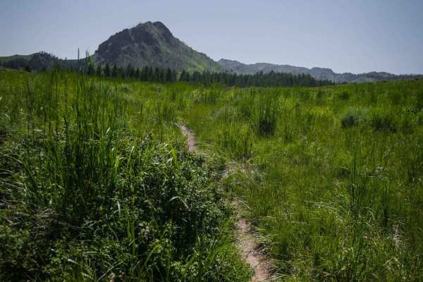
Cow Creek Shortcut
This shortcut meanders through meadows and forest on a narrow dirt trail with embedded rocks, connecting Cow Creek to Mahoney Ridge. It has a shallow creek crossing with bony rocks sticking up that is lined with a bunch of dead bushes. The trail goes in and out of aspen trees for short sections, but...
Learn more about Cow Creek Shortcut
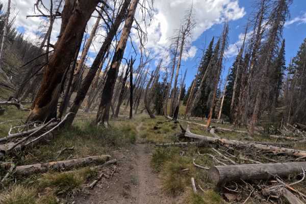
Rooks Creek - FS 7145
Rooks Creek (7145) is a decently challenging single track in the Smoky Mountains, about 20 minutes west of Ketchum, Idaho. The trail runs 4.4 miles north from Ketchum Featherville Road (FS 70227) to the Osberg Ridgeline Trail, climbing nearly 1,900 feet in a short distance. It begins as a wide singl...
Learn more about Rooks Creek - FS 7145
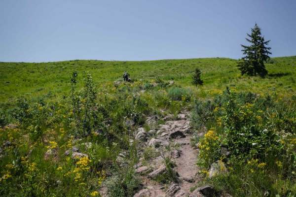
Cow Creek
Cow Creek starts directly from the Greenhorn Staging Area. The beginning is a series of wide sweeping switchbacks up a beautiful green hillside on a very rocky trail. There are big round or jagged boulders in the center of the trail and lots of two-foot wide rocks embedded in the trail that you have...
Learn more about Cow Creek
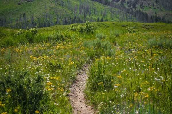
Mahoney Ridge
This is a fun trail in the Greenhorn trail system mostly made up of hard pack dirt with sections of embedded cobble. It has smooth sections and rocky sections, and a couple of wide easy switchbacks, making it a mix of fast and technical. It goes through a small burn area and has awesome views the wh...
Learn more about Mahoney Ridge
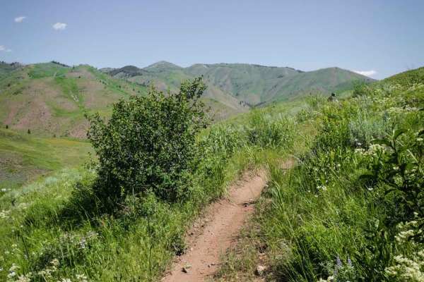
Imperial Gulch
Imperial Gulch is an epic top-tier single track for incredible views and a smooth fast and flowy trail through meadows full of wildflowers. There are only a couple of sections with some embedded small rocks and a couple roots, but it's mostly smooth dirt the whole way. It's a narrow trail with wide ...
Learn more about Imperial Gulch
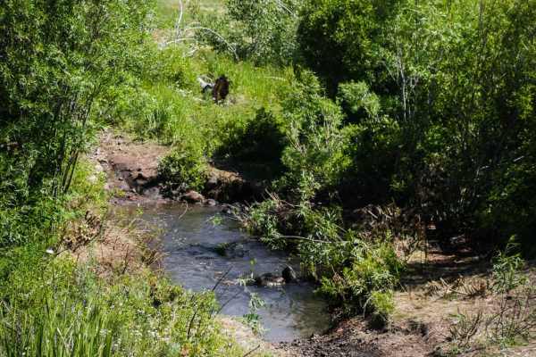
Greenhorn - Imperial Connector
The Greenhorn - Imperial Connector is likely the first trail most riders will take out of the Greenhorn staging area for this trail system. It's a short connector trail that starts directly from the trailhead and is how you access most of the trail system. The hardest and rockiest section is right i...
Learn more about Greenhorn - Imperial Connector
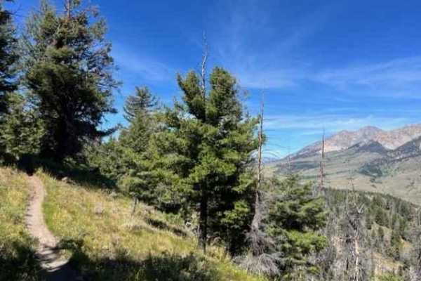
Oregon Gulch to Fox Peak
If you're looking for quick access to a great Idaho single track, this is it! Oregon Gulch begins fast and flowing, but quickly throws loose rocky climbs and roots at you. These small challenges make the trail all the better and make the short route around Fox Peak itself the icing on the cake. Whil...
Learn more about Oregon Gulch to Fox Peak
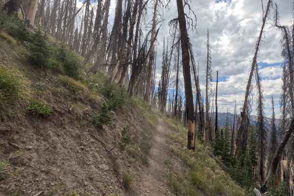
Osberg Ridgeline Trail - FS 7147
Osberg Ridgeline Trail (7147) is a scenic single track in the Smoky Mountains, located about 20 minutes west of Ketchum, Idaho. Stretching 10.9 miles, it climbs roughly 1,000 feet as it runs west from the northern end of Rooks Creek to the Baker Lake Trailhead off Forest Service Road 70162. True to ...
Learn more about Osberg Ridgeline Trail - FS 7147
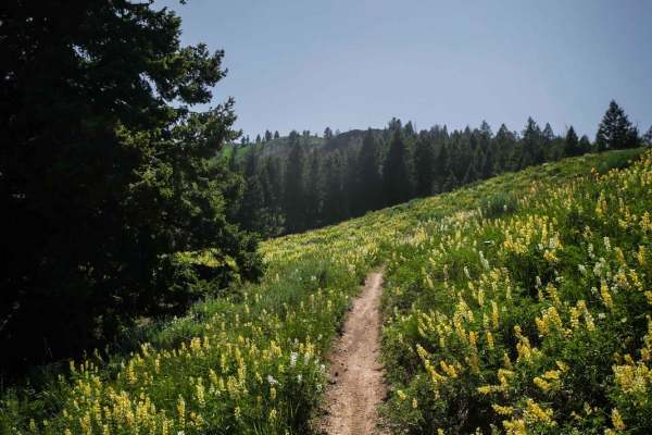
Red Warrior - Lodgepole
This is an easier single track in the Greenhorn trail system that has a nice amount of shade and less embedded rock than some of the surrounding trails. It's smooth dirt with a few easy roots across the trail, making it fast and flowy and a fun time. It meanders through a forest of pine trees on a p...
Learn more about Red Warrior - Lodgepole
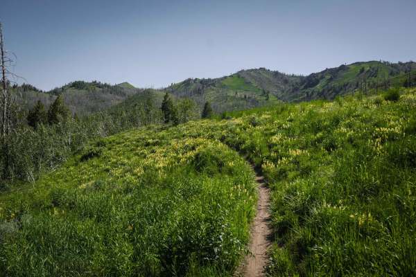
Mahoney - Lodgepole Connector
This connector trail starts from Red Warrior - Lodgepole with a loose rocky downhill into some tight switchbacks that have a lot of loose rock as well. The switchbacks get wider and more sweeping as you continue to drop down the hill to the intersection with Mahoney Butte. The trail has a view of th...
Learn more about Mahoney - Lodgepole Connector
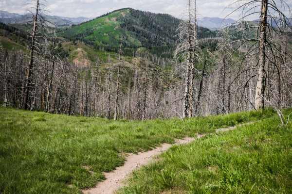
Mahoney Butte
Mahoney Butte is a 5-mile long trail that is mostly elevated above a creek, side-hilling on a narrow trail, sometimes with loose rock or embedded surface rock. The beginning and ending are the smoothest, fastest parts. There's some embedded small cobble in parts, a rocky hill, a couple of scree sect...
Learn more about Mahoney Butte
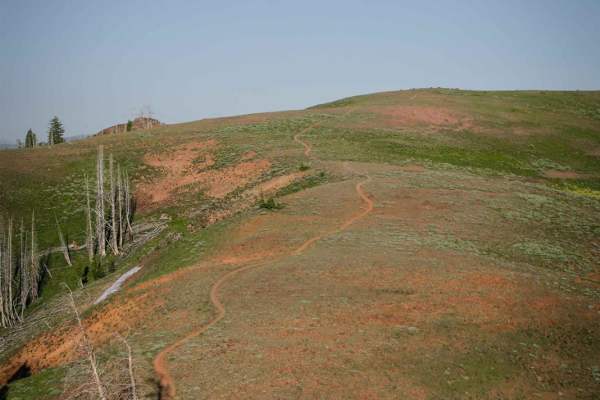
Mahoney Greenhorn
Mahoney Greenhorn is a popular trail in the Greenhorn Trail system. It starts right at the Greenhorn trailhead, so you will likely see other riders or mountain bikers. The west end of the trail starts as an epic ridge line trail, in an incredibly beautiful landscape of green rolling hills with jagge...
Learn more about Mahoney Greenhorn
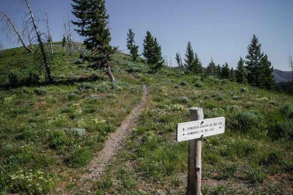
Panther Gulch - Imperial Connect
This short but moderately challenging connector trail starts on a saddle at the intersection with Howard's Trail and goes along an exposed spine with no trees on a narrow trail with lots of loose rock. It goes up and over several rolling hillsides as a ridge line trail, with several climbs and desce...
Learn more about Panther Gulch - Imperial Connect
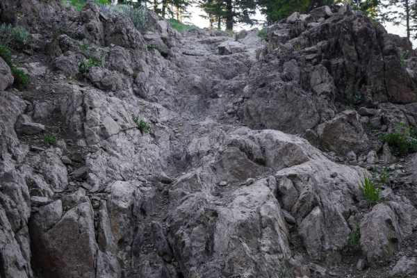
Red Warrior - Warfield Connector
This is a shortcut with a rocky challenge. Most of this short trail meanders through a forest on wide open hillsides and ridge lines with expansive views of the mountain range, but there is one major rock obstacle that makes this shortcut more challenging. There is a long rocky ledge feature with st...
Learn more about Red Warrior - Warfield Connector
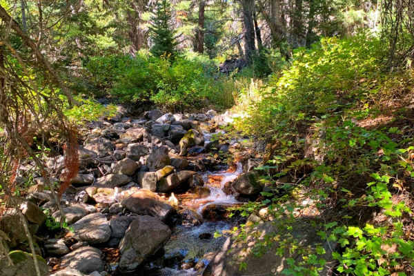
Boulder Creek Left Trail
Bumpy rocky trail with beautiful views that take you up to the base of 3 mountains. The trail is not difficult, but 4x4 high clearance and air down recommended for comfort. At the very beginning of the trail just after turning of HWY 74 are several dispersed campsites accessible to any vehicle and w...
Learn more about Boulder Creek Left Trail
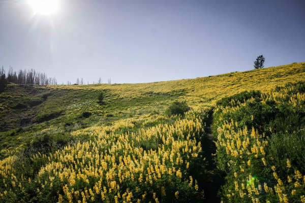
Lick Gulch
Lick Gulch in the Greenhorn Trail System is a short single track full of epic scenery including meadows of yellow lupins and wildflowers, and volcanic looking rock outcroppings. It climbs up from a gulch with a couple rocky switchbacks. One of the switchbacks is more wide and smooth, and one is ti...
Learn more about Lick Gulch
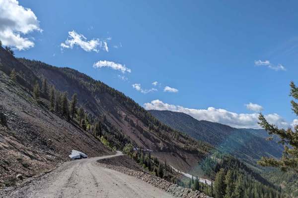
Trail Creek Pass 408/208
Trail Creek Pass is a dirt road between Chilly and Sun Valley, Idaho. We ran the pass from Sun Valley up to the summit with an elevation of 7,896 Ft. The trail, starting on the Sun Valley side, is a well-maintained gravel road. As you ascend it deteriorates with snow and mud possible. The road turns...
Learn more about Trail Creek Pass 408/208
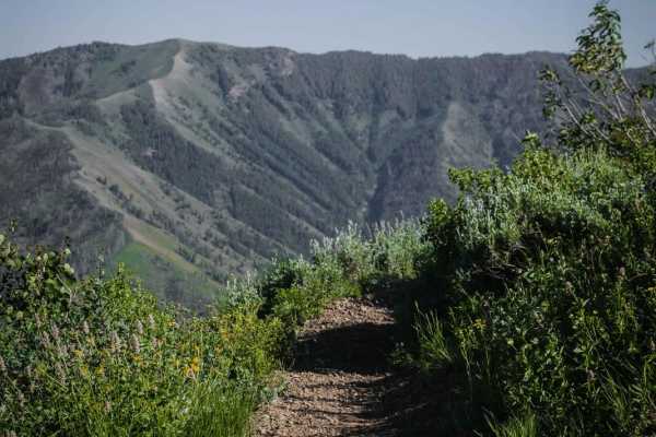
Howard's Trail
Howard's Trail is a top-tier single track in the Greenhorn Trail System near Ketchum Idaho that has incredible mountain views. Most of the route is a really narrow trail that side-hills across an exposed grassy hillside with moderate exposure. In the middle of the summer, these hillsides are full of...
Learn more about Howard's Trail
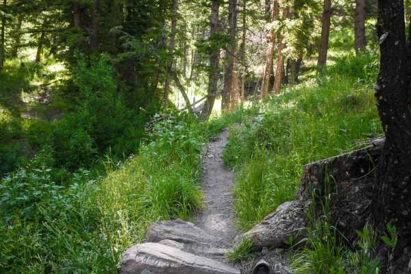
North Fork Deer Creek
The North Fork Deer Creek Trail starts in a gulch above a stream on a wide single track. It switchbacks up a hillside to get into a burn area of tall thick burnt trees. It's mostly a smooth dirt trail, but a few sections have embedded rock and boulders, including one small rock obstacle made of boul...
Learn more about North Fork Deer Creek
ATV trails near Ketchum, Idaho
Explore ATV-friendly trails near you. These trails are accessible for vehicles up to 50 inches wide, perfect for ATVs and smaller off-road machines.
Warm Springs Creek Trail
The Warm Springs Creek Trail is an out and back trail in Sawtooth National Forest in Idaho. This trail offers incredible views of the surrounding mountains, especially as the elevation climbs. There's many campsites at the beginning and one at the top. This trail gets very narrow so pinstripes are v...
Learn more about Warm Springs Creek Trail
Boulder Creek Left Trail
Bumpy rocky trail with beautiful views that take you up to the base of 3 mountains. The trail is not difficult, but 4x4 high clearance and air down recommended for comfort. At the very beginning of the trail just after turning of HWY 74 are several dispersed campsites accessible to any vehicle and w...
Learn more about Boulder Creek Left Trail
Trail Creek Pass 408/208
Trail Creek Pass is a dirt road between Chilly and Sun Valley, Idaho. We ran the pass from Sun Valley up to the summit with an elevation of 7,896 Ft. The trail, starting on the Sun Valley side, is a well-maintained gravel road. As you ascend it deteriorates with snow and mud possible. The road turns...
Learn more about Trail Creek Pass 408/208
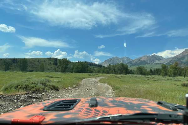
Boulder Basin
This is a route to the Boulder Basin lake following Basin Creek. Along this route, you will see many old mining cabins. This is a very mild trail until you reach a shale climb. You have one large creek crossing at about mile 1 towards the beginning of the trail. Then you wind through a slow climb tr...
Learn more about Boulder Basin
UTV/side-by-side trails near Ketchum, Idaho
Find UTV and side-by-side trails near you. These trails accommodate vehicles up to 60 inches wide, ideal for UTVs, side-by-sides, and wider off-road rigs.
Warm Springs Creek Trail
The Warm Springs Creek Trail is an out and back trail in Sawtooth National Forest in Idaho. This trail offers incredible views of the surrounding mountains, especially as the elevation climbs. There's many campsites at the beginning and one at the top. This trail gets very narrow so pinstripes are v...
Learn more about Warm Springs Creek Trail
Boulder Creek Left Trail
Bumpy rocky trail with beautiful views that take you up to the base of 3 mountains. The trail is not difficult, but 4x4 high clearance and air down recommended for comfort. At the very beginning of the trail just after turning of HWY 74 are several dispersed campsites accessible to any vehicle and w...
Learn more about Boulder Creek Left Trail
Trail Creek Pass 408/208
Trail Creek Pass is a dirt road between Chilly and Sun Valley, Idaho. We ran the pass from Sun Valley up to the summit with an elevation of 7,896 Ft. The trail, starting on the Sun Valley side, is a well-maintained gravel road. As you ascend it deteriorates with snow and mud possible. The road turns...
Learn more about Trail Creek Pass 408/208
Boulder Basin
This is a route to the Boulder Basin lake following Basin Creek. Along this route, you will see many old mining cabins. This is a very mild trail until you reach a shale climb. You have one large creek crossing at about mile 1 towards the beginning of the trail. Then you wind through a slow climb tr...
Learn more about Boulder Basin
The onX Offroad Difference
onX Offroad combines trail photos, descriptions, difficulty ratings, width restrictions, seasonality, and more in a user-friendly interface. Available on all devices, with offline access and full compatibility with CarPlay and Android Auto. Discover what you're missing today!
Open Trail Map