
Dirt Bike Trails
Near Kenilworth, Utah
Explore All Dirt Bike Trails Near Kenilworth, Utah
Dirt Bike Trails Near Kenilworth, Utah
Discover the best dirt bike trails near you. Browse trail maps, check difficulty ratings, and find your next adventure — whether you're looking for a quick ride or an all-day expedition.

Deadman Canyon Loop
This is an 8-mile-long single track that intertwines through Deadman Canyon. If you take the loop in a counter-clockwise direction, it is easier to do because of steep, loose inclines. The trail mainly twists through the cedars and crosses Deadman Creek dozens of times. The creek is generally dry an...
Learn more about Deadman Canyon Loop
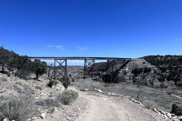
Trestle Road
Trestle Road is a 7.1-mile point-to-point trail that passes under an old trestle train bridge. The most difficult part of this trail is a steep climb after passing under the old trestle bridge, which may require 4LO for some stock 4WD vehicles. However, this trail is passable by most stock 4WD vehic...
Learn more about Trestle Road
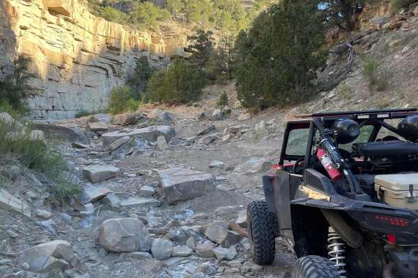
Pinnacle 1
Pinnacle 1 is a challenging but scenic trail made by the King Crawlers Club in Price. The trail takes you almost 5 miles in or next to a large dry wash before popping back out on a well-maintained gravel road to complete the loop back to the starting point. Pinnacle 1 features rock canyon walls, mud...
Learn more about Pinnacle 1
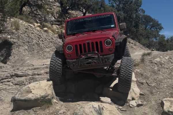
Gordon Creek Falls
Gordon Creek Falls trail is a short 2.3-mile out-and-back trail, a great side trail on Trestle Road. This trail starts you on a narrow shelf road and drops down a steep sand chute to cross the North Fork of Gordon Creek. Climbing out of the Creek, you encounter your first rock obstacle. The easier l...
Learn more about Gordon Creek Falls
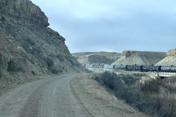
Price River/South Farnham Road
Price River/South Farnham Road is an 18.8-mile point-to-point trail in the Northern San Rafael Swell area. It follows along the railroad tracks and the Price River. Price River Road is a maintained dirt road with light washboarding. This is an open range area, so be aware and slow down for grazing l...
Learn more about Price River/South Farnham Road
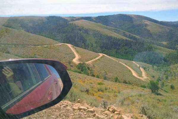
Consumers
This trail starts at Consumers Road and makes its way over Beaver Road, dropping down in between Scofield Town and Clear Creek Town. The trail starts in the cedars at about 7000 feet elevation and climbs to higher elevation pines about 9500ft. The climb is steeper with loose dirt, making it more dif...
Learn more about Consumers
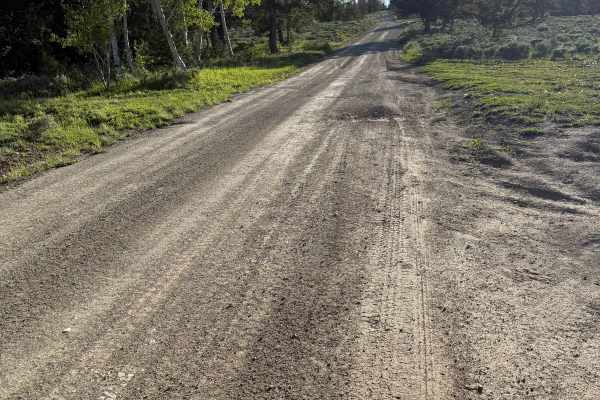
Reservation Ridge - FS 10147
Reservation Ridge is a well-maintained, well-traveled Forest Service road that runs on the borders of the Uinta and Ashley National Forests. Outside of the occasional rut, it is a smooth ride. Nothing your stock Subaru can’t handle. On the east end, there is a large paid campground, first-come, firs...
Learn more about Reservation Ridge - FS 10147
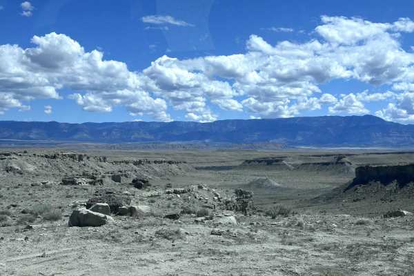
Mounds Road
Mounds Road is a 14.8-mile point-to-point trail that crosses the Mounds Reef and connects to the Price River Road. This trail is a maintained dirt road with light washboarding and no obstacles. There is a 3 track railroad crossing near the Price River Road, use caution when crossing. Mounds Road is ...
Learn more about Mounds Road
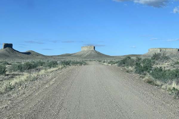
East Mounds Road
East Mounds Road is a 4.9-mile point-to-point trail that crosses the Mounds Reef and connects with the Price River road via Mounds Road. This is a well-maintained county road with no obstacles and some light washboarding. This road is passable by stock 2WD, AWD, and 4WD vehicles.
Learn more about East Mounds Road
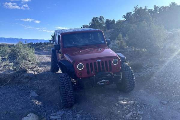
Verde Loop Trail
Verde Loop is a 6.7-mile point-to-point trail in the northern San Rafael Swell area. The trail starts and ends at the Price River trail. Verde Loop trail has erosion damage less than 12" in depth. This trail gives you access to the scenic Verde South trail. This trail is passable by most stock AWD a...
Learn more about Verde Loop Trail
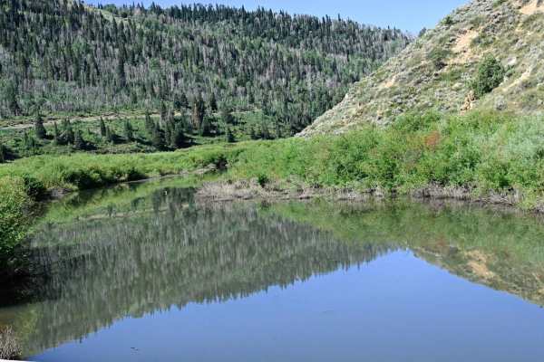
Bear Ridge - FS50008
Per its name, this route follows Bear Ridge between Skyline Drive and Scofield Lake. The trail has dual character; coming east from Skyline Drive, the trail abruptly changes from a fairly smooth dirt road to a narrower rocky trail. At about the halfway point, there's a "High Clearance 4WD recommende...
Learn more about Bear Ridge - FS50008
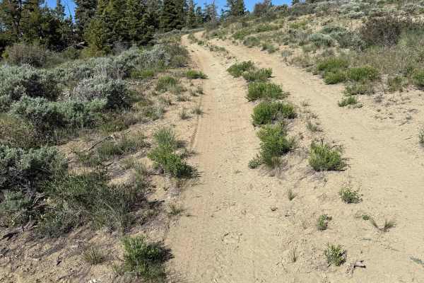
Trail Ridge - FS 10070
Trail Ridge is a very short out-and-back trail that ends at an incredible view of Ashley National Forest. There is space for maybe one tent or car camp at the end. The trail itself is hilly with a few slopes of around 20-24 degrees. There are a few drainage ruts that you straddle on your way. There ...
Learn more about Trail Ridge - FS 10070
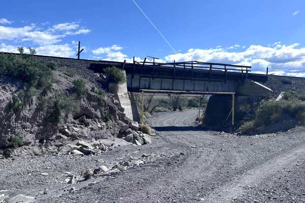
Mud Springs Road
Mud Springs Road is an easy, scenic 4.8-mile point-to-point trail departing from U.S. Route 6 that serves as an excellent gateway to the northern reaches of the San Rafael Swell. Passable by virtually any vehicle, including standard two-wheel-drive cars, four-wheel-drive rigs, and SxSs, this route i...
Learn more about Mud Springs Road
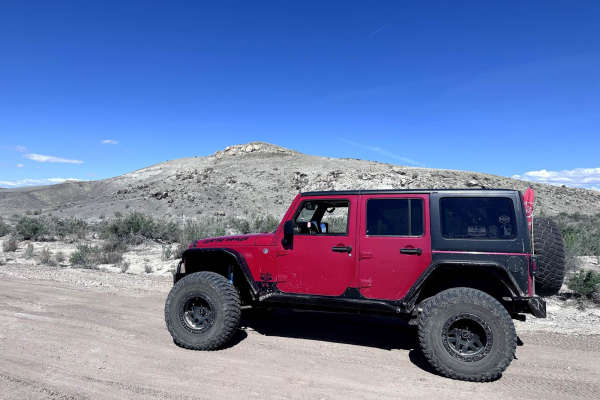
Verde Mounds Trail
Verde Mounds is a short 2.9-mile point-to-point trail in the northern San Rafael swell area. This trail goes through open range land, so be aware of grazing livestock. This is a maintained dirt road with light washboarding. Enjoy the sprawling views of the high desert as you traverse the Verde Mound...
Learn more about Verde Mounds Trail
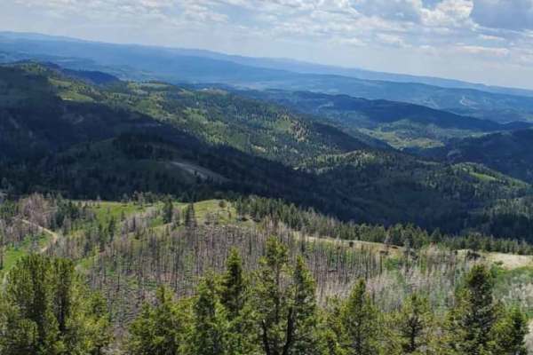
White River Loop
This trail begins just off US Highway 6 at Soldier Summit. The vegetation transitions from sagebrush and willows that follow the White River up to higher-elevation pine and aspen. These Forest Service roads are mostly graded and easy for most vehicles depending on weather. Wildlife viewing and pictu...
Learn more about White River Loop
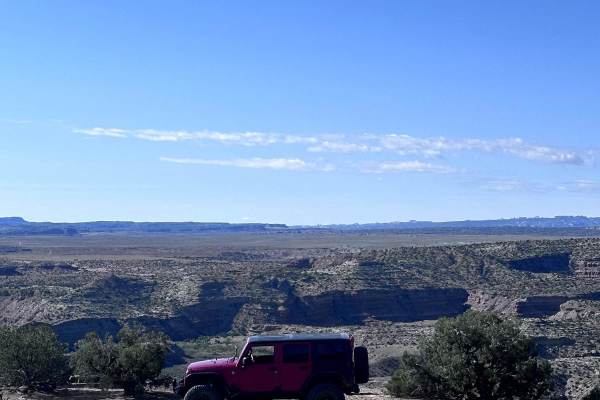
Verde South Trail
Verde South Trail is a 12.8-mile out-and-back northern San Rafael Swell trail. This is a fun trail with a beautiful view at the turnaround point. The trail has a few rocky sections with ledges up to 12" in height. There are a couple of steep grades with loose rock, which may require 4LO for some sto...
Learn more about Verde South Trail
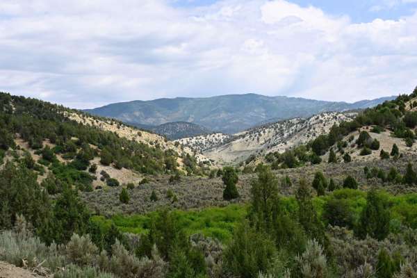
Starvation Road - FS0009
Trail travels from Utah Highway 6 at the north end, near the Skyline Drive northern terminus and trail head, and winds through Starvation Canyon to the Intersection of Bear Ridge (FS0008) at which point you can either continue to Scofield Lake/Scofield State Park, or follow Bear Ridge back to Skylin...
Learn more about Starvation Road - FS0009

Bruin Point
Bruin Point trail is a 5.5-mile point-to-point trail that climbs almost 3000 feet starting in Water Canyon to the top of Book Cliffs. This is a maintained road that has mud holes under 12 inches in depth. There are some steep climbs that are easier in 4LO. Enjoy the great views of the valley below f...
Learn more about Bruin Point
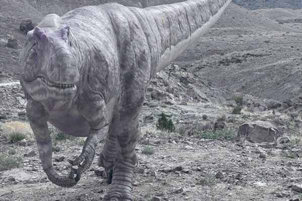
Dinosaur Quarry Road
Dinosaur Quarry Road is a 6.2-mile point-to-point trail that ends at the Jurassic National Monument. The Jurassic National Monument is a fee area and is open Thursday-Sunday from 10 AM to 5 PM, and is closed during the winter months. The road up to the Humbug Overlook trail turnoff is open every day...
Learn more about Dinosaur Quarry Road
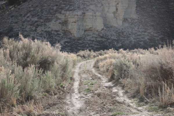
Bear Gulch - FS 10329
This trail is not well-traveled, and it shows. The trail is only one vehicle wide but not particularly difficult. There is one section where the trail has slightly washed away, but it is crossable. The trail does sort of fade away towards the end and becomes harder to follow. The huge benefit of a t...
Learn more about Bear Gulch - FS 10329
ATV trails near Kenilworth, Utah
Explore ATV-friendly trails near you. These trails are accessible for vehicles up to 50 inches wide, perfect for ATVs and smaller off-road machines.
Trestle Road
Trestle Road is a 7.1-mile point-to-point trail that passes under an old trestle train bridge. The most difficult part of this trail is a steep climb after passing under the old trestle bridge, which may require 4LO for some stock 4WD vehicles. However, this trail is passable by most stock 4WD vehic...
Learn more about Trestle Road
Pinnacle 1
Pinnacle 1 is a challenging but scenic trail made by the King Crawlers Club in Price. The trail takes you almost 5 miles in or next to a large dry wash before popping back out on a well-maintained gravel road to complete the loop back to the starting point. Pinnacle 1 features rock canyon walls, mud...
Learn more about Pinnacle 1
Gordon Creek Falls
Gordon Creek Falls trail is a short 2.3-mile out-and-back trail, a great side trail on Trestle Road. This trail starts you on a narrow shelf road and drops down a steep sand chute to cross the North Fork of Gordon Creek. Climbing out of the Creek, you encounter your first rock obstacle. The easier l...
Learn more about Gordon Creek Falls
Price River/South Farnham Road
Price River/South Farnham Road is an 18.8-mile point-to-point trail in the Northern San Rafael Swell area. It follows along the railroad tracks and the Price River. Price River Road is a maintained dirt road with light washboarding. This is an open range area, so be aware and slow down for grazing l...
Learn more about Price River/South Farnham Road
UTV/side-by-side trails near Kenilworth, Utah
Find UTV and side-by-side trails near you. These trails accommodate vehicles up to 60 inches wide, ideal for UTVs, side-by-sides, and wider off-road rigs.
Trestle Road
Trestle Road is a 7.1-mile point-to-point trail that passes under an old trestle train bridge. The most difficult part of this trail is a steep climb after passing under the old trestle bridge, which may require 4LO for some stock 4WD vehicles. However, this trail is passable by most stock 4WD vehic...
Learn more about Trestle Road
Pinnacle 1
Pinnacle 1 is a challenging but scenic trail made by the King Crawlers Club in Price. The trail takes you almost 5 miles in or next to a large dry wash before popping back out on a well-maintained gravel road to complete the loop back to the starting point. Pinnacle 1 features rock canyon walls, mud...
Learn more about Pinnacle 1
Gordon Creek Falls
Gordon Creek Falls trail is a short 2.3-mile out-and-back trail, a great side trail on Trestle Road. This trail starts you on a narrow shelf road and drops down a steep sand chute to cross the North Fork of Gordon Creek. Climbing out of the Creek, you encounter your first rock obstacle. The easier l...
Learn more about Gordon Creek Falls
Price River/South Farnham Road
Price River/South Farnham Road is an 18.8-mile point-to-point trail in the Northern San Rafael Swell area. It follows along the railroad tracks and the Price River. Price River Road is a maintained dirt road with light washboarding. This is an open range area, so be aware and slow down for grazing l...
Learn more about Price River/South Farnham Road
The onX Offroad Difference
onX Offroad combines trail photos, descriptions, difficulty ratings, width restrictions, seasonality, and more in a user-friendly interface. Available on all devices, with offline access and full compatibility with CarPlay and Android Auto. Discover what you're missing today!
Open Trail Map