
Dirt Bike Trails
Near Katherine, Arizona
Explore All Dirt Bike Trails Near Katherine, Arizona
Dirt Bike Trails Near Katherine, Arizona
Discover the best dirt bike trails near you. Browse trail maps, check difficulty ratings, and find your next adventure — whether you're looking for a quick ride or an all-day expedition.
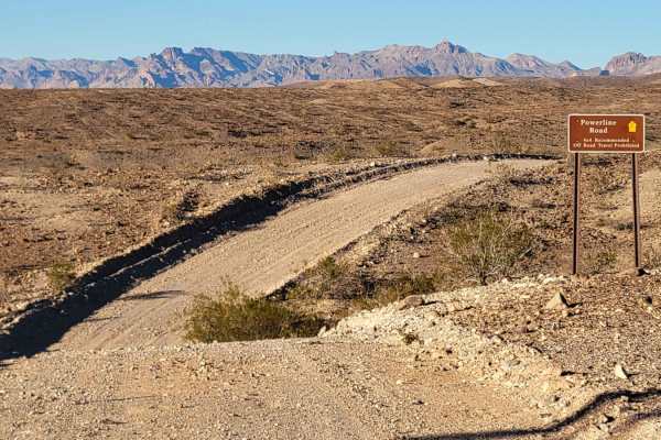
Powerline Road (South) - 2
Powerline Road (South), Route 2, is a point-to-point dirt trail that begins and ends off of Princess Cove Road. The trail follows the powerline towers and offers beautiful views of the surrounding desert and the Colorado River to the west. For the most part, it is a mild and easy-going dirt trail. H...
Learn more about Powerline Road (South) - 2
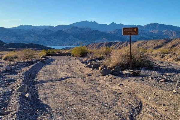
Arrowhead Cove Road - 2A
Arrowhead Cove Road, Route 2A, is an out-and-back trail from Powerline Road South to the water's edge of Arrowhead Cove. The trail follows a wash bed and is easy-going with no major obstacles or challenging sections. Due to the wash, avoid this trail in flash flooding conditions. There is vegetation...
Learn more about Arrowhead Cove Road - 2A
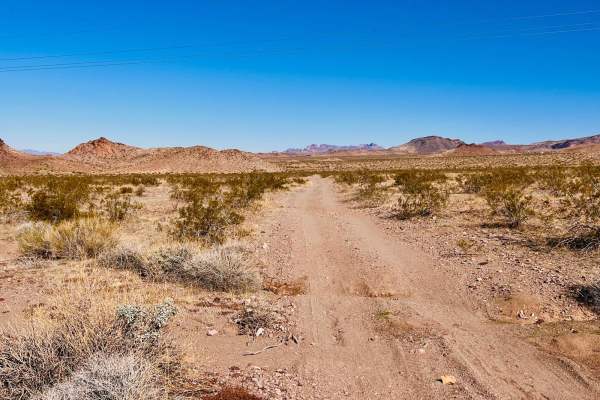
Middle Mine Fun
This is a fun trail out to a small mine on BLM land. It picks up off Katherine Mine Trail, an extensive open graded trail. Watch for ruts and small cross washes on either end of the trail. This trail heads towards some exciting rock formations around the middle of this trail. These rock formations d...
Learn more about Middle Mine Fun
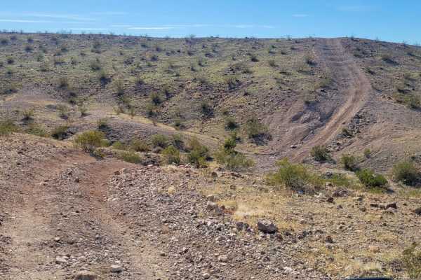
AZ Peace Trail Spur to Davis Camp (West)
Spur to Davis Camp (West), also known as Buck Wash Road, is allegedly part of the Arizona Peace Trail system. It begins just east of Bullhead City and there are a dozen trails/options to reach this particular trail. If following the AZPT highlight on OnX, it begins off of McCormick Boulevard. Right ...
Learn more about AZ Peace Trail Spur to Davis Camp (West)
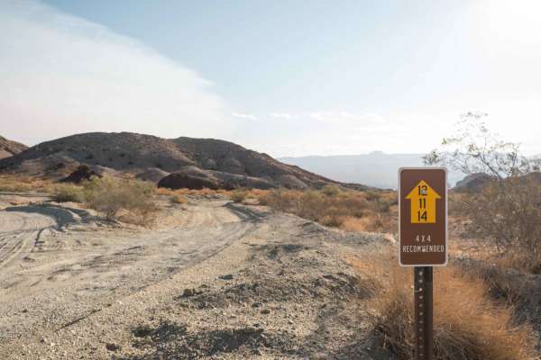
Stonehouse Trail
The Stonehouse Trail is a single-wide dirt road that winds through desert hills in the Lake Mead National Recreation Area and passes by an old stone house ruin. The road is not technical but has some pretty sandy sections and a couple of rutted areas that require a 4WD with high clearance. The road ...
Learn more about Stonehouse Trail
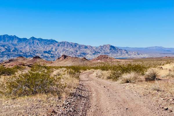
Choose An Adventure Mine to Powerlines
This is a loop trail out to a multi-tier mine. The trail enters and exits from the Katherine Mine Trail. Getting out to the mine, the trail is a sandy wash that crosses other sandy washes. Once at the mine, it is a choose-your-own-adventure to explore the mine. A couple of fingers of the trail drive...
Learn more about Choose An Adventure Mine to Powerlines
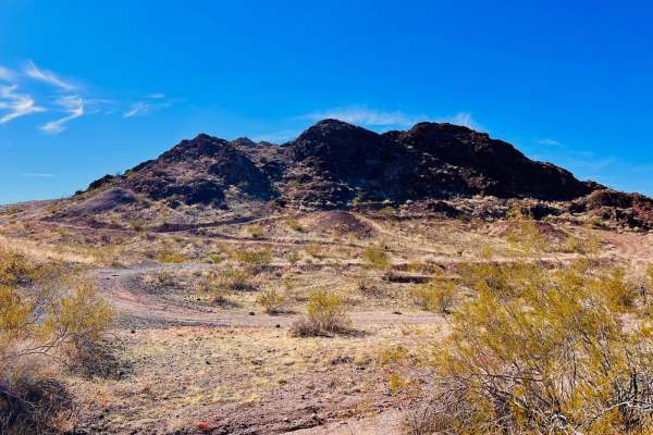
Cave Mine Mountain Site
This is another fun loop trail in a section of BLM land just outside the Lake Mead National Recreation Area. Off-highway travel is allowed outside the Rec Area. This trail can be picked up at a turn on the pavement just outside of a neighborhood. Keep an eye out for it. It looks like it's just a was...
Learn more about Cave Mine Mountain Site
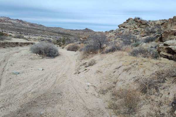
Bridge Canyon to Laughlin Single Track
This is overall a low technical difficulty route with one spot that would not be recommended for anything other than a dirt bike or skilled four-wheeler. It generally follows the large power lines west. Starting from Tropicana RV/Oversize vehicle parking lot, the route is very easy and flat terrain ...
Learn more about Bridge Canyon to Laughlin Single Track
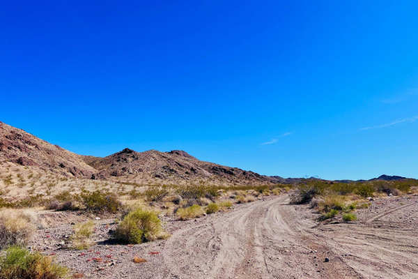
Tyro Mine
This trail can be accessed off of Katherine Mine Trail, which is a wide-open, easy, graded trail. The Tyro Mine trail narrows immediately and turns into a mild sandy wash. There is a little mini-slot canyon to the left, a quarter of a mile in. Multiple dispersed campsites at the beginning of this tr...
Learn more about Tyro Mine
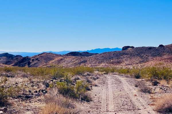
Katherine Canyon Loop
This is a loop trail from the easy main trail, Katherine Mine Trail. One end of the loop is more heavily traveled than the other. The entire trail is a loose, sandy wash trail. The trail loops around a large mountain and heads into a beautiful canyon. The canyon is relatively short, but the rock for...
Learn more about Katherine Canyon Loop
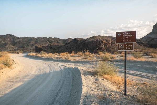
Nevada Telephone Cove Road
The Nevada Telephone Cove Road is inside the Lake Mead National Recreation Area boundary and starts just off State Route 163 a few miles outside of Laughlin, Nevada. This is a well-trafficked and reasonably maintained double-wide dirt road winding through the Mohave desert hillside leading to Teleph...
Learn more about Nevada Telephone Cove Road
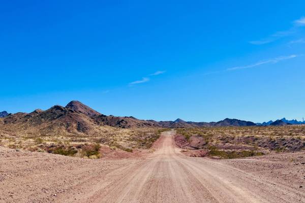
Katherine Mine Trail
This excellent point-to-point trail picks up off Highway 68 From the Katherine Heights Townhomes complex. The trail begins behind the neighborhood. The trail heads north through some mountains and then turns west towards the Colorado River. This area is heavily used and shows signs of regular gradin...
Learn more about Katherine Mine Trail

Secret Pass Slot Canyon
To the East of Bullhead City, Secret Pass Slot Canyon is an out-and-back wash trail that leads adventurers to a drivable slot canyon. The trail begins as a wide open, sandy wash basin, consisting of several trails that all lead in the same direction. Most, if not all of them, are washboarded for the...
Learn more about Secret Pass Slot Canyon
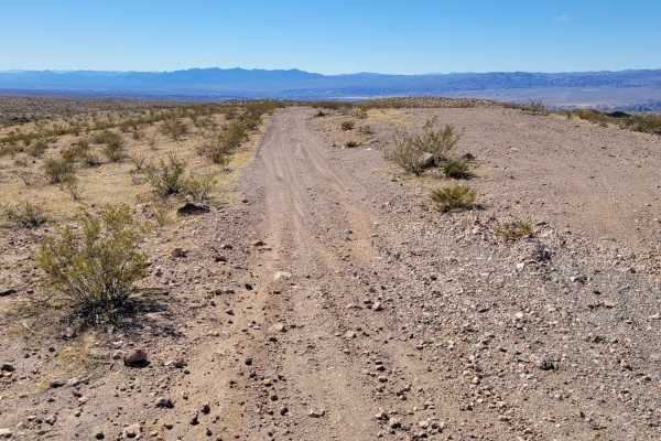
Buck Wash Road
Buck Wash Road is a 3 mile point-to-point, two-track trail that parallels Highway 68. From the Black Mountains westward, it is a beautiful hilltop track that rollercoasters its way back to civilization. For the most par,t it is a mild and easy-going dirt trail. There are a handful of brief rocky sec...
Learn more about Buck Wash Road
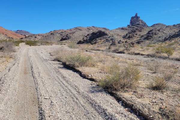
AZ Peace Trail Spur to Davis Camp (East)
The sign mentions "4x4 Recommended", which is likely as a "just in case", but isn't required to complete the route. The trail can be in a high-clearance 4x4 in 2WD. Spur to Davis Camp (East) is allegedly a part of the Arizona Peace Trail system. This point-to-point trail begins and ends at the Secre...
Learn more about AZ Peace Trail Spur to Davis Camp (East)
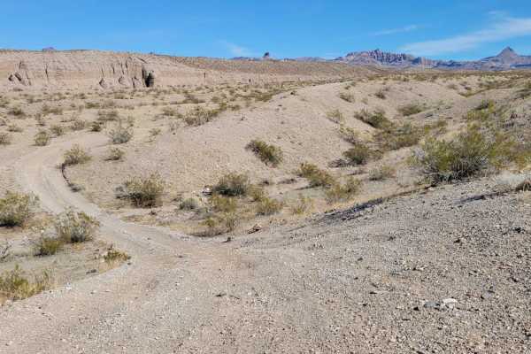
Slot Canyon Bypass
Slot Canyon Bypass is a point-to-point trail that traverses the ridgeline above Secret Pass Slot Canyon. Starting at the western end, the trail begins in the sandy, canyon wash, climbing up and back out into the desert landscape. The trail is predominantly an easy-going dirt two-track with a short h...
Learn more about Slot Canyon Bypass
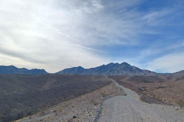
Mead Davis Power Road
Mead Davis Power Road is a rocky, dusty, sandy, rutted, washed-out road. Some sections require a short wheelbase high clearance vehicle, otherwise, its an easy road 4x4 is highly recommended. There is a chance for water crossings when in the rainy seasons and flash floods. The road runs through both...
Learn more about Mead Davis Power Road
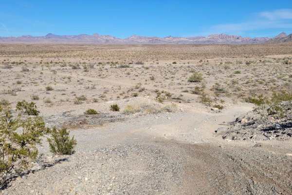
Desert Byway
Desert Byway is a point-to-point trail that ribbons its way across the desert landscape, connecting from Silver Creek Road (155) to the "Bypass Route". The trail has a little bit of everything classic to this region. There are several hill climbs/descents along the way; some are more challenging tha...
Learn more about Desert Byway
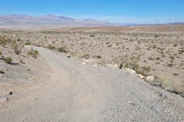
Bullhead City AZ Peace Trail
This 3-mile point-to-point stretch of the AZPT connects from Silver Creek Road (155) to Bullhead City, paralleling the Black Mountains to the east and the city to the west. The trail is like a desert rollercoaster, weaving through washes and climbing/descending several hills. The hills vary with dif...
Learn more about Bullhead City AZ Peace Trail
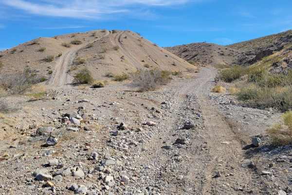
Here to There
Here to There is an alternative point-to-point trail that connects the sandy washes of the Secret Pass Slot Canyon trail to the Slot Canyon Bypass trail. From out of the wash, there are two hills to choose from. The one to the left is a steeper challenge that connects back to the main trail. The oth...
Learn more about Here to There
ATV trails near Katherine, Arizona
Explore ATV-friendly trails near you. These trails are accessible for vehicles up to 50 inches wide, perfect for ATVs and smaller off-road machines.
Powerline Road (South) - 2
Powerline Road (South), Route 2, is a point-to-point dirt trail that begins and ends off of Princess Cove Road. The trail follows the powerline towers and offers beautiful views of the surrounding desert and the Colorado River to the west. For the most part, it is a mild and easy-going dirt trail. H...
Learn more about Powerline Road (South) - 2
Arrowhead Cove Road - 2A
Arrowhead Cove Road, Route 2A, is an out-and-back trail from Powerline Road South to the water's edge of Arrowhead Cove. The trail follows a wash bed and is easy-going with no major obstacles or challenging sections. Due to the wash, avoid this trail in flash flooding conditions. There is vegetation...
Learn more about Arrowhead Cove Road - 2A
Middle Mine Fun
This is a fun trail out to a small mine on BLM land. It picks up off Katherine Mine Trail, an extensive open graded trail. Watch for ruts and small cross washes on either end of the trail. This trail heads towards some exciting rock formations around the middle of this trail. These rock formations d...
Learn more about Middle Mine Fun
AZ Peace Trail Spur to Davis Camp (West)
Spur to Davis Camp (West), also known as Buck Wash Road, is allegedly part of the Arizona Peace Trail system. It begins just east of Bullhead City and there are a dozen trails/options to reach this particular trail. If following the AZPT highlight on OnX, it begins off of McCormick Boulevard. Right ...
Learn more about AZ Peace Trail Spur to Davis Camp (West)
UTV/side-by-side trails near Katherine, Arizona
Find UTV and side-by-side trails near you. These trails accommodate vehicles up to 60 inches wide, ideal for UTVs, side-by-sides, and wider off-road rigs.
Powerline Road (South) - 2
Powerline Road (South), Route 2, is a point-to-point dirt trail that begins and ends off of Princess Cove Road. The trail follows the powerline towers and offers beautiful views of the surrounding desert and the Colorado River to the west. For the most part, it is a mild and easy-going dirt trail. H...
Learn more about Powerline Road (South) - 2
Arrowhead Cove Road - 2A
Arrowhead Cove Road, Route 2A, is an out-and-back trail from Powerline Road South to the water's edge of Arrowhead Cove. The trail follows a wash bed and is easy-going with no major obstacles or challenging sections. Due to the wash, avoid this trail in flash flooding conditions. There is vegetation...
Learn more about Arrowhead Cove Road - 2A
Middle Mine Fun
This is a fun trail out to a small mine on BLM land. It picks up off Katherine Mine Trail, an extensive open graded trail. Watch for ruts and small cross washes on either end of the trail. This trail heads towards some exciting rock formations around the middle of this trail. These rock formations d...
Learn more about Middle Mine Fun
AZ Peace Trail Spur to Davis Camp (West)
Spur to Davis Camp (West), also known as Buck Wash Road, is allegedly part of the Arizona Peace Trail system. It begins just east of Bullhead City and there are a dozen trails/options to reach this particular trail. If following the AZPT highlight on OnX, it begins off of McCormick Boulevard. Right ...
Learn more about AZ Peace Trail Spur to Davis Camp (West)
The onX Offroad Difference
onX Offroad combines trail photos, descriptions, difficulty ratings, width restrictions, seasonality, and more in a user-friendly interface. Available on all devices, with offline access and full compatibility with CarPlay and Android Auto. Discover what you're missing today!
Open Trail Map