
Dirt Bike Trails
Near Jacumba Hot Springs, California
Explore All Dirt Bike Trails Near Jacumba Hot Springs, California
Dirt Bike Trails Near Jacumba Hot Springs, California
Discover the best dirt bike trails near you. Browse trail maps, check difficulty ratings, and find your next adventure — whether you're looking for a quick ride or an all-day expedition.
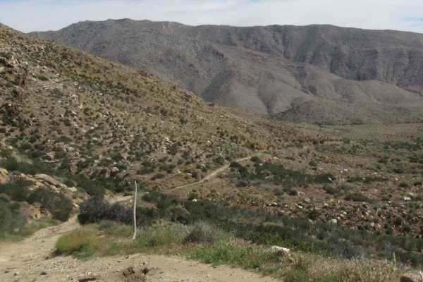
EC 19 Table Mountain Road
EC 19 Table Mountain Road is a 6.1-mile point-to-point trail rated 3 of 10 located in San Diego County. EC 19 is also known as Mica Gem Mine Road by locals after the mining group that used to tunnel and quarry this section of road. EC 19 provides the only access to the BLM Open Space area of Table M...
Learn more about EC 19 Table Mountain Road
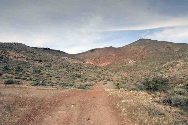
EC 39 Table Mountain
EC 39 Table Mountain is a 1.3-mile point-to-point trail rated 3 of 10 located in San Diego County. EC 39 is the westernmost trail within the Table Mountain area and provides the north/south connection between EC 19 and EC 33. This is a BLM-designated "open" trail and can be used by all vehicles. EC ...
Learn more about EC 39 Table Mountain
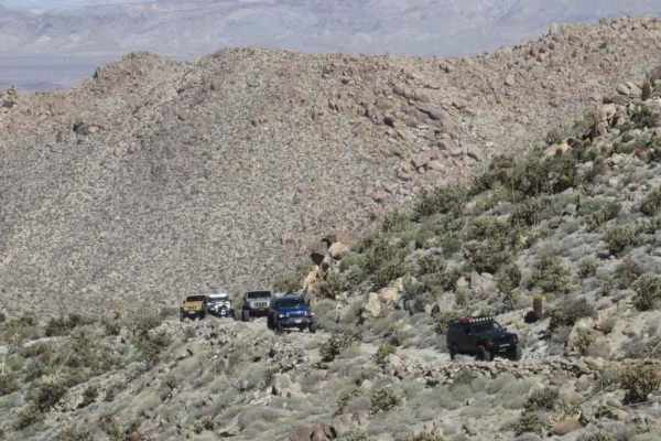
EC 33 Table Mountain
EC 33 Table Mountain is a 2-mile point-to-point trail rated 3 of 10 located in San Diego County. EC 33 provides the east/west connection between EC 19 and EC 39. This is a BLM-designated "open" trail and can be used by all vehicles. EC 33 is primarily a sand/dirt track with a few areas of sandy wash...
Learn more about EC 33 Table Mountain

Jojoba Canyon
There are massive lumpy rocks everywhere. What a beautiful trail. This easy trail cuts across to connect to a few other routes in the area, and the views do not disappoint. The trail passes by the Piedras Grandes hiking trailhead and parking area. It is approximately a mile-and-a-half hike each way ...
Learn more about Jojoba Canyon
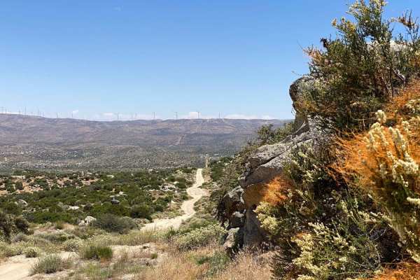
Cerro Prieto Loop
This loop begins at the Cerro Anagodo Loop on a well-graded dirt road with a few washboards. The adventure truly starts with a right turn onto the pipeline road. Here, you'll encounter rutted, off-camber, and steep sections requiring a high-clearance, 4x4 vehicle and careful wheel placement. The hig...
Learn more about Cerro Prieto Loop
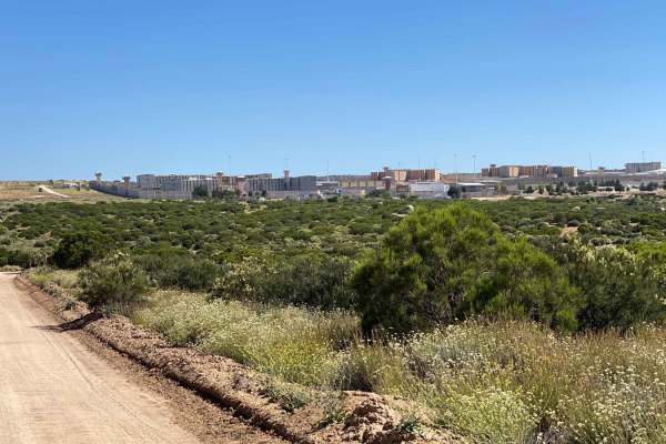
El Hongo Prison Loop
This route starts on Mexico 2 Libre, looping around the El Hongo Prison area before reconnecting with the highway. The first half mile is deteriorated pavement, mostly covered with dirt, leading to a graded dirt road navigable by any high-clearance vehicle. It's a pleasant tour through the lower par...
Learn more about El Hongo Prison Loop

San Diego and Eastern AZ Railway Run
This section of trail runs along the San Diego and Eastern Arizona Railway Tracks. It's a fun blast that parallels the tracks and shortcuts out a few of the longer loops if you are short in time heading out or back from the area. There are a few enjoyable washed-out sections with short steep hill cl...
Learn more about San Diego and Eastern AZ Railway Run

Dos Cabezos Upper Siding
This route is a great connector trail from the intersection at the abandoned rail station up and into the Anza Borrego park. The other end connects with the Jojoba Wash Trail and finishes at three large fire rings and camping spots along the abandoned tracks. There's an abundance of wildlife and pla...
Learn more about Dos Cabezos Upper Siding

La Rumorosa to Laguna Hanson Trail
Starting in the pueblo of La Rumorosa, a stop at the famous restaurant and bakery Las Altura, just 500 meters from the trailhead, is highly recommended. The trail begins at the highway, currently a mix of dirt and dark gravel, with ongoing construction suggesting that the first half mile may eventua...
Learn more about La Rumorosa to Laguna Hanson Trail
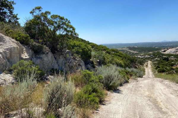
Around Cerro Anegado
This trail begins off Mexico 2 Libre near El Hongo, marked by signs for Cienego Redondo and Rancho Isabel. Initially, you'll traverse a well-maintained dirt road with occasional washboards, winding through intriguing landscapes as you move away from the highway. If you continue straight past the fir...
Learn more about Around Cerro Anegado

Hayden Springs
This trail is an excellent border trail for the area that hits close to and runs through some of the lumpy rock mountains the area is famous for. The trail's eastern section follows the abandoned rail lines for part of it. Some short, steep hill climbs, and ledges may become even more severe after a...
Learn more about Hayden Springs

BLM 109
This trail starts at Dos Cabeza BLM 150 and is a windy, sandy road cutting through a desert full of teddy bear cacti, ocotillo, and various desert bushes, creating a densely vegetated environment. The area is full of mega power windmills where massive turbines dominate the landscape. You'll encounte...
Learn more about BLM 109

La Rumorosa to Mesa Colorado
The journey begins on a well-kept dirt road that gradually transforms into a more rugged path upon reaching the gate of Rancho Club Hacienda. To continue towards Mesa Colorado, simply inform the guard of your passage, who will grant access despite the presence of a rope gate--this stretch of road re...
Learn more about La Rumorosa to Mesa Colorado
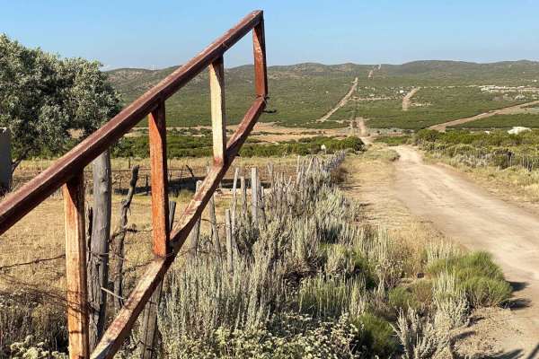
Mesa Colorado to El Hongo
The trail commences at an archway leading to the Laguna Hanson Trail, running parallel to Mexico Highway 2 in the opposite direction of traffic. Upon turning away from the highway, the ascent begins towards the initial high point. Just before reaching the antennas, the path diverges onto a less main...
Learn more about Mesa Colorado to El Hongo
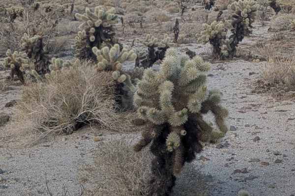
Dos Cabeza East - BLM 150
This trail runs from east to west, starting near the railroad tracks by Highway 80 and ending at BLM 137. The route runs through a field of teddy bear cacti and various desert bushes, creating a densely vegetated corridor. You're traveling through a large area of mega power windmills where massive t...
Learn more about Dos Cabeza East - BLM 150

BLM 109 North
This trail starts north of Highway 2 and features hard packed sand surface throughout. The route winds its way through a desert of ocotillo, desert brush, and other flora, creating a vegetated corridor. You'll encounter a couple of short, steep drop downhills and uphill sections that require momentu...
Learn more about BLM 109 North
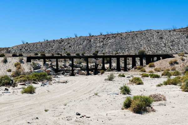
Sugarloaf Train Tracks Loop
This trail is a fun loop around the abandoned train track side of sugarloaf hill. There are many left-behind and falling-apart things to look at along the way. Old concrete pads, trash piles, abandoned bicycles, and even washed-out rail bridges with the tracks just hanging around. The route is mostl...
Learn more about Sugarloaf Train Tracks Loop
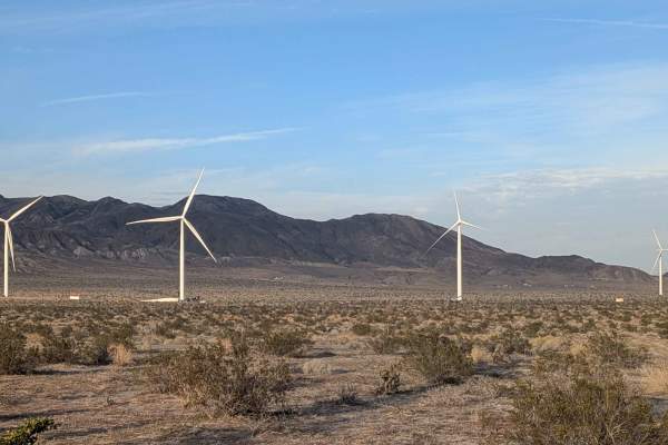
BLM 119
This one vehicle-wide trail starts at BLM 109 North and winds up and down through the desert, lined with ocotillo, sage, creosote, and other desert bushes, creating a vegetated corridor. The surface is mostly fine sand throughout, requiring constant momentum management. You'll encounter washboards, ...
Learn more about BLM 119
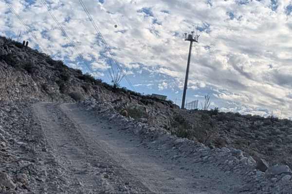
Sugarloaf Mountain - BLM 118
This trail starts at Highway 2 and is one and a half vehicles wide with a sand and gravel surface. The route cuts through the power windmill area where massive turbines create an impressive industrial landscape. The trail features fine soft sand throughout, requiring constant momentum management. La...
Learn more about Sugarloaf Mountain - BLM 118
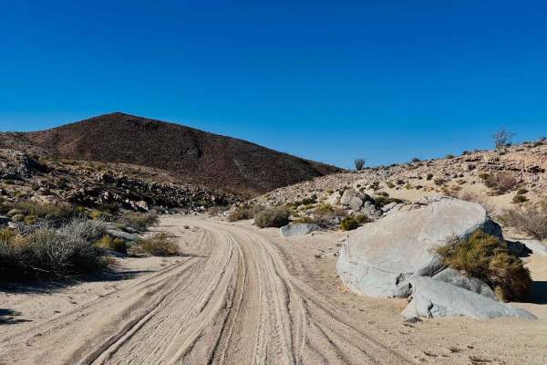
Mortero Wash
This trail leads from the main paved highway of Sweeney pass road into the network of trails in the area. It begins as rough washboard and crushed rock and quickly becomes really packed sand as it weaves its way up the wash. There are a few tight pinch points with massive boulders in the wash. There...
Learn more about Mortero Wash
ATV trails near Jacumba Hot Springs, California
Explore ATV-friendly trails near you. These trails are accessible for vehicles up to 50 inches wide, perfect for ATVs and smaller off-road machines.
EC 19 Table Mountain Road
EC 19 Table Mountain Road is a 6.1-mile point-to-point trail rated 3 of 10 located in San Diego County. EC 19 is also known as Mica Gem Mine Road by locals after the mining group that used to tunnel and quarry this section of road. EC 19 provides the only access to the BLM Open Space area of Table M...
Learn more about EC 19 Table Mountain Road
EC 39 Table Mountain
EC 39 Table Mountain is a 1.3-mile point-to-point trail rated 3 of 10 located in San Diego County. EC 39 is the westernmost trail within the Table Mountain area and provides the north/south connection between EC 19 and EC 33. This is a BLM-designated "open" trail and can be used by all vehicles. EC ...
Learn more about EC 39 Table Mountain
EC 33 Table Mountain
EC 33 Table Mountain is a 2-mile point-to-point trail rated 3 of 10 located in San Diego County. EC 33 provides the east/west connection between EC 19 and EC 39. This is a BLM-designated "open" trail and can be used by all vehicles. EC 33 is primarily a sand/dirt track with a few areas of sandy wash...
Learn more about EC 33 Table Mountain
Cerro Prieto Loop
This loop begins at the Cerro Anagodo Loop on a well-graded dirt road with a few washboards. The adventure truly starts with a right turn onto the pipeline road. Here, you'll encounter rutted, off-camber, and steep sections requiring a high-clearance, 4x4 vehicle and careful wheel placement. The hig...
Learn more about Cerro Prieto Loop
UTV/side-by-side trails near Jacumba Hot Springs, California
Find UTV and side-by-side trails near you. These trails accommodate vehicles up to 60 inches wide, ideal for UTVs, side-by-sides, and wider off-road rigs.
EC 19 Table Mountain Road
EC 19 Table Mountain Road is a 6.1-mile point-to-point trail rated 3 of 10 located in San Diego County. EC 19 is also known as Mica Gem Mine Road by locals after the mining group that used to tunnel and quarry this section of road. EC 19 provides the only access to the BLM Open Space area of Table M...
Learn more about EC 19 Table Mountain Road
EC 39 Table Mountain
EC 39 Table Mountain is a 1.3-mile point-to-point trail rated 3 of 10 located in San Diego County. EC 39 is the westernmost trail within the Table Mountain area and provides the north/south connection between EC 19 and EC 33. This is a BLM-designated "open" trail and can be used by all vehicles. EC ...
Learn more about EC 39 Table Mountain
EC 33 Table Mountain
EC 33 Table Mountain is a 2-mile point-to-point trail rated 3 of 10 located in San Diego County. EC 33 provides the east/west connection between EC 19 and EC 39. This is a BLM-designated "open" trail and can be used by all vehicles. EC 33 is primarily a sand/dirt track with a few areas of sandy wash...
Learn more about EC 33 Table Mountain
Cerro Prieto Loop
This loop begins at the Cerro Anagodo Loop on a well-graded dirt road with a few washboards. The adventure truly starts with a right turn onto the pipeline road. Here, you'll encounter rutted, off-camber, and steep sections requiring a high-clearance, 4x4 vehicle and careful wheel placement. The hig...
Learn more about Cerro Prieto Loop
The onX Offroad Difference
onX Offroad combines trail photos, descriptions, difficulty ratings, width restrictions, seasonality, and more in a user-friendly interface. Available on all devices, with offline access and full compatibility with CarPlay and Android Auto. Discover what you're missing today!
Open Trail Map