
Dirt Bike Trails
Near Huachuca City, Arizona
Explore All Dirt Bike Trails Near Huachuca City, Arizona
Dirt Bike Trails Near Huachuca City, Arizona
Discover the best dirt bike trails near you. Browse trail maps, check difficulty ratings, and find your next adventure — whether you're looking for a quick ride or an all-day expedition.
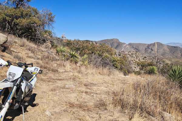
Mine Road
This trail is comprised of a bunch of different two-track roads. This trail is reasonably fun, but not too difficult. Some of these roads are well maintained, while others are old mining roads that would only be suited for off-road machines, like dirt bikes, Jeeps, or side x side. Most of the other ...
Learn more about Mine Road
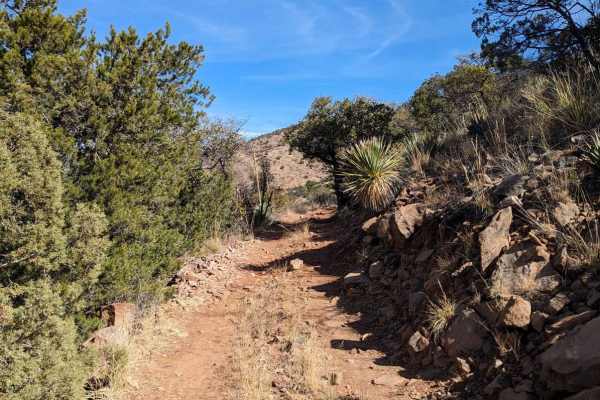
Coal Mine Road FR-4859
Enjoy incredible mountain views and scattered cacti along this road. Pronghorns, mule deer, and bobcats are also prevalent in the area, as are black-tailed prairie dogs. Most of the trail is hard-packed dirt road. Be aware of open-range cattle that line the ditches and occasionally cross the road. I...
Learn more about Coal Mine Road FR-4859
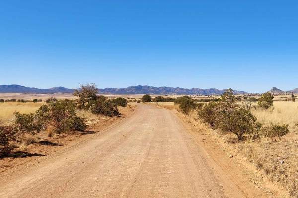
Patagonia Loop
This trail will take you through the Sonoita area's 4,970-foot elevation, featuring high-rolling grasslands surrounded by spectacular mountains and canyons. This region offers some of Arizona's most beautiful weather and landscapes. Mount Wrightson, one of the tallest peaks in Arizona, dominates the...
Learn more about Patagonia Loop
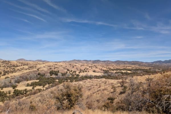
Parker Canyon
Parker Canyon is a rugged off-road trail characterized by rocky and bumpy terrain, though it remains mostly level throughout. The route follows a ridge line, offering dispersed camping opportunities along the way. The trail initially runs alongside a fence line before opening up to stunning panorami...
Learn more about Parker Canyon
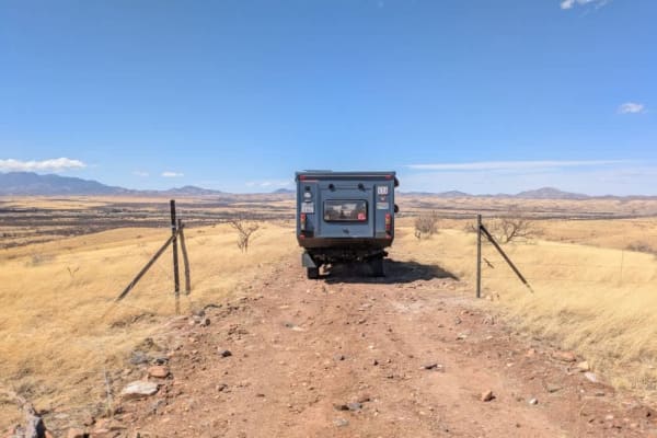
East Yucca Farm Road
East Yucca Farm Road is a well-maintained route that descends into the lower grasslands, offering a scenic drive through open landscapes. Along the way, travelers will find numerous dispersed campsites in addition to a designated camping area. The road eventually connects to the main route, making i...
Learn more about East Yucca Farm Road
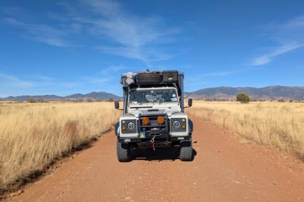
Sunnyside Canyon
Sunnyside Canyon is a narrow, single-track dirt road with numerous spurs and offshoots that invite exploration. The trail is unmaintained and rocky, stretching long and flat with certain sections that require slow, careful navigation due to rough terrain. Following the boundary of a fenced area, the...
Learn more about Sunnyside Canyon
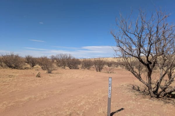
Canyon Road
Canyon Road begins as a relatively well-maintained dirt road running parallel to a wash, offering scenic views and easy driving. At the start of the trail, you'll find a handful of designated campsites nestled beneath mesquite trees--these are popular with both weekend campers and overlanders. As yo...
Learn more about Canyon Road
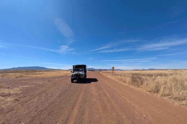
Montezuma Pass
Montezuma Pass is a heavily corrugated service road that provides access to Parker Canyon Lake. The route is a double-lane mountain pass with winding curves and rolling elevation changes, making for a scenic but bumpy drive. On Sundays, the road is a popular destination for motorcyclists looking to ...
Learn more about Montezuma Pass
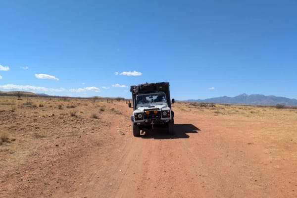
FR 6914
Trail 6914 begins as a maintained road, offering an easy start before transitioning into more challenging terrain. At the trailhead, there is a dispersed group campsite, though camping is not permitted near water sources. After passing through the second gate, the route becomes more technical, featu...
Learn more about FR 6914
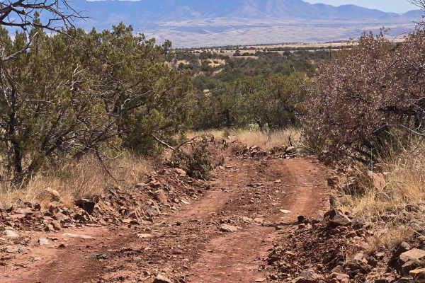
FSR 4104 to Hog Ridge
Start at State Route 83, head west on Santa Rita Road, riding past cattle ranches and wonderful western-style homes. Take the left at the fork in the road, which is FS 4104. Continue to follow this trail until you reach the intersection with FSR 785. You may see deer, antelope, and rabbits. We saw a...
Learn more about FSR 4104 to Hog Ridge
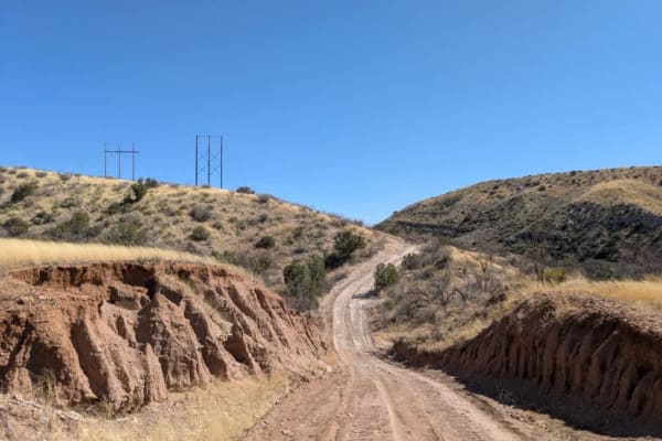
Bear Springs Canyon
Bear Springs Canyon is a scenic and enjoyable trail that was recently maintained as of 3/12/25, though conditions can change quickly, especially with rain in the forecast. The route winds through open grasslands before narrowing into a single-track path that follows the edge of a canyon. Along the w...
Learn more about Bear Springs Canyon
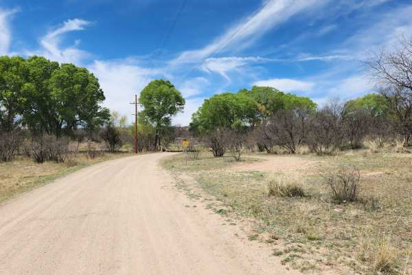
East Empire Ranch Road
This road is a simple dirt road that is typically graded with occasional washboarding and is a gateway to much of the Cienega Creek and the Las Cienegas National Conservation Areas. Along the landscape, you will see rolling grasslands, a verdant riparian area, towering cottonwood trees, and mesquite...
Learn more about East Empire Ranch Road
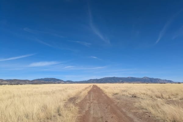
Max Tank Road
Max Tank Road branches off to the right from the Patagonia Loop, welcoming travelers with sightings of deer herds near its entrance. The trail winds through open grasslands, where signs of cattle are evident, though few are typically seen along the route. As the journey unfolds, the road splits, req...
Learn more about Max Tank Road

Oak Tree Canyon
Oak Tree Canyon is on the historic Empire Ranch, which is now known as the Las Cienegas National Conservation Area. This section features expansive mountain views, craggy peaks, and a visit to a historical site. The conservation area hosts a working ranch, so you might encounter a few cows. Thus, it...
Learn more about Oak Tree Canyon
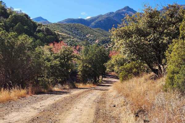
Gardner Canyon FR 92
Gardner Canyon is a rugged forest road that features creek crossings, gorgeous grasslands, and a little local history. This trail is a scenic canyon drive dotted with mesquite, scrub oak, tall grasses, and cacti. This area is popular for ATVs and has large easy-access camping areas for RVs. Most of ...
Learn more about Gardner Canyon FR 92
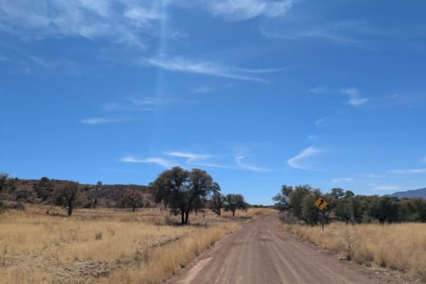
Parker Road
Parker Road is a scenic single-track trail that connects to Montezuma Pass, which then links up with the Patagonia Loop. As it winds through the landscape, the trail passes by several ranches and navigates a series of washes, featuring gentle ascents and descents along the way. In some areas, the te...
Learn more about Parker Road
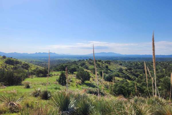
Kentucky Gulch - FR 163
Kentucky Gulch provides a gentle ascent through undulating hill terrain, with the trail meandering amidst grassy hills dotted with oak, juniper, agave, and other distinctive plant species. Be sure to check the weather conditions before heading out, as rain or snow could affect the road. Traveling on...
Learn more about Kentucky Gulch - FR 163
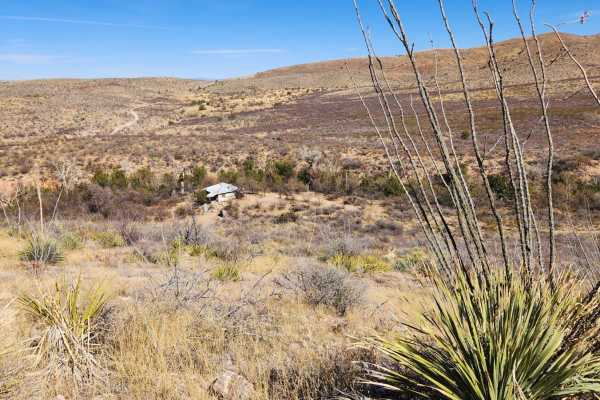
Wakefield Cabin
This trail will guide you through historic ranch land. As you descend into a small canyon near the end, you'll spot an abandoned Buddhist cabin on your left.This trail dips into a wash for about a quarter mile. Riders need to closely follow the trail maps, as there's a part where the trail exits the...
Learn more about Wakefield Cabin
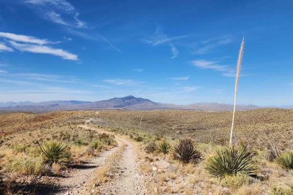
Lower Wakefield Canyon
This trail follows ridge lines, offering stunning views of the sprawling desert landscapes below. This trail's many sections are overgrown, making pinstriping nearly inevitable, particularly for larger vehicles. Just a wa ning if you plan on taking a bigger rig. Cell service in this area can be unr...
Learn more about Lower Wakefield Canyon
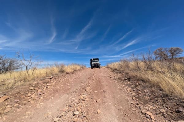
Chuparosa Road
Chuparosa is a narrow, rocky, single-track trail that winds through open grasslands, offering a rugged yet scenic off-road experience. As the route follows the ridge, drivers will encounter several gates along the way, adding to the sense of adventure. The trail eventually leads to a steep and rocky...
Learn more about Chuparosa Road
ATV trails near Huachuca City, Arizona
Explore ATV-friendly trails near you. These trails are accessible for vehicles up to 50 inches wide, perfect for ATVs and smaller off-road machines.
Mine Road
This trail is comprised of a bunch of different two-track roads. This trail is reasonably fun, but not too difficult. Some of these roads are well maintained, while others are old mining roads that would only be suited for off-road machines, like dirt bikes, Jeeps, or side x side. Most of the other ...
Learn more about Mine Road
Coal Mine Road FR-4859
Enjoy incredible mountain views and scattered cacti along this road. Pronghorns, mule deer, and bobcats are also prevalent in the area, as are black-tailed prairie dogs. Most of the trail is hard-packed dirt road. Be aware of open-range cattle that line the ditches and occasionally cross the road. I...
Learn more about Coal Mine Road FR-4859
Patagonia Loop
This trail will take you through the Sonoita area's 4,970-foot elevation, featuring high-rolling grasslands surrounded by spectacular mountains and canyons. This region offers some of Arizona's most beautiful weather and landscapes. Mount Wrightson, one of the tallest peaks in Arizona, dominates the...
Learn more about Patagonia Loop
Parker Canyon
Parker Canyon is a rugged off-road trail characterized by rocky and bumpy terrain, though it remains mostly level throughout. The route follows a ridge line, offering dispersed camping opportunities along the way. The trail initially runs alongside a fence line before opening up to stunning panorami...
Learn more about Parker Canyon
UTV/side-by-side trails near Huachuca City, Arizona
Find UTV and side-by-side trails near you. These trails accommodate vehicles up to 60 inches wide, ideal for UTVs, side-by-sides, and wider off-road rigs.
Mine Road
This trail is comprised of a bunch of different two-track roads. This trail is reasonably fun, but not too difficult. Some of these roads are well maintained, while others are old mining roads that would only be suited for off-road machines, like dirt bikes, Jeeps, or side x side. Most of the other ...
Learn more about Mine Road
Coal Mine Road FR-4859
Enjoy incredible mountain views and scattered cacti along this road. Pronghorns, mule deer, and bobcats are also prevalent in the area, as are black-tailed prairie dogs. Most of the trail is hard-packed dirt road. Be aware of open-range cattle that line the ditches and occasionally cross the road. I...
Learn more about Coal Mine Road FR-4859
Patagonia Loop
This trail will take you through the Sonoita area's 4,970-foot elevation, featuring high-rolling grasslands surrounded by spectacular mountains and canyons. This region offers some of Arizona's most beautiful weather and landscapes. Mount Wrightson, one of the tallest peaks in Arizona, dominates the...
Learn more about Patagonia Loop
Parker Canyon
Parker Canyon is a rugged off-road trail characterized by rocky and bumpy terrain, though it remains mostly level throughout. The route follows a ridge line, offering dispersed camping opportunities along the way. The trail initially runs alongside a fence line before opening up to stunning panorami...
Learn more about Parker Canyon
The onX Offroad Difference
onX Offroad combines trail photos, descriptions, difficulty ratings, width restrictions, seasonality, and more in a user-friendly interface. Available on all devices, with offline access and full compatibility with CarPlay and Android Auto. Discover what you're missing today!
Open Trail Map