
Dirt Bike Trails
Near Hendersonville, Tennessee
Explore All Dirt Bike Trails Near Hendersonville, Tennessee
Dirt Bike Trails Near Hendersonville, Tennessee
Discover the best dirt bike trails near you. Browse trail maps, check difficulty ratings, and find your next adventure — whether you're looking for a quick ride or an all-day expedition.
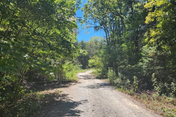
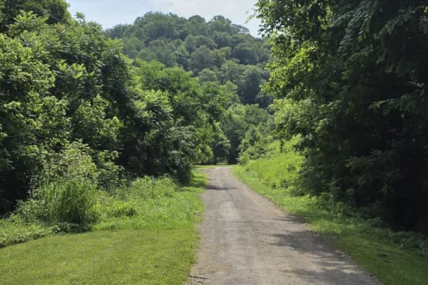
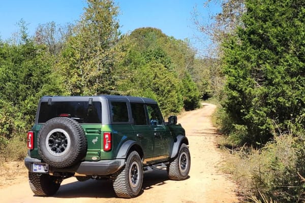
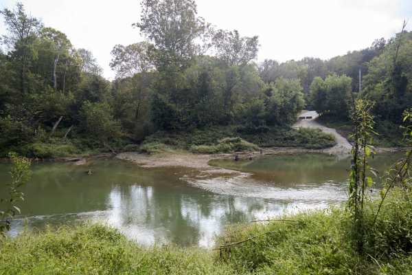
Cedar Forest Road
This trail is only open to vehicles that are registered and street legal. If your vehicle is not registered or street legal, do not attempt this trail. If you're up for some light trail riding under a canopy provided by beautiful, mature trees, Cedar Forest Road in the Cedars of Lebanon State Forest...
Learn more about Cedar Forest Road
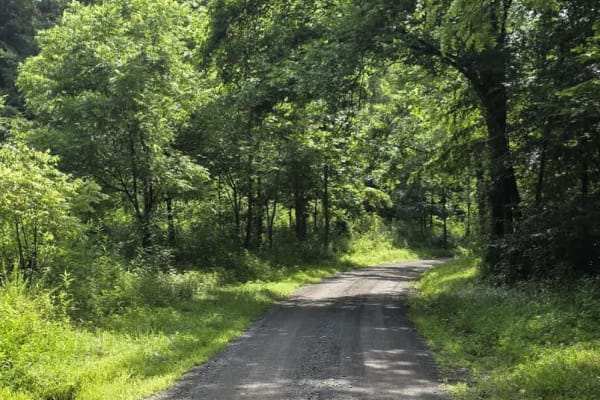
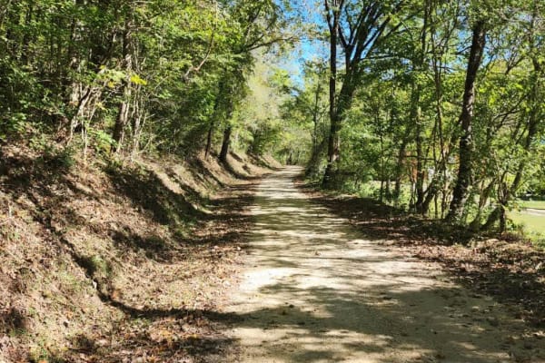
Gravley Hill Road - Macon County Tour
Winding through the gentle terrain of northern Tennessee, this graded gravel trail marks the starting point of the iconic Macon County Tour (MCT), a 100+ mile off-road journey that explores the rolling hills and hardwood forests of Tennessee and Kentucky. While generally easy and well-maintained, th...
Learn more about Gravley Hill Road - Macon County Tour
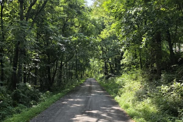
Sullivan Hollow Road - Macon County Tour
This scenic off-road trail, part of the Macon County Tour (MCT), offers an easy yet engaging drive through Tennessee's rolling backcountry. While the route follows a graded path, multiple washouts and narrow stretches without shoulders--some with steep drop-offs--add a layer of caution to the otherw...
Learn more about Sullivan Hollow Road - Macon County Tour
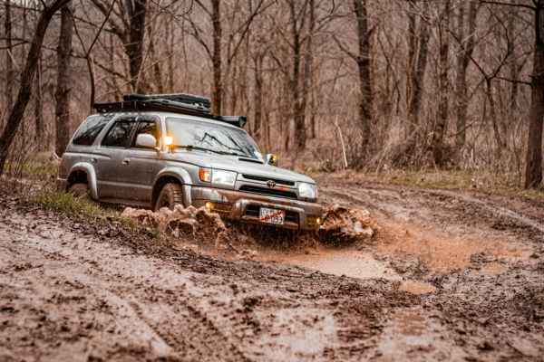
Shiloh's Playground
Shiloh's Playground consists of multiple muddy lines through some tight woods. It can be done in full-size 4x4s, SxS, or dirt bikes. If unloading on a trailer, there is a dirt lot across the paved road for parking/unloading. From this lot, you can also access the creek and drive through to get to sm...
Learn more about Shiloh's Playground
Dry Branch to Dixon Creek Road - Macon County Tour
This stretch of the iconic Macon County Tour offers a scenic drive through gently rolling hills and a patchwork of open farmland, blending rural charm with a few rugged elements. The road is primarily gravel, interrupted by a very brief paved connector that leads into a striking elevation change--co...
Learn more about Dry Branch to Dixon Creek Road - Macon County Tour
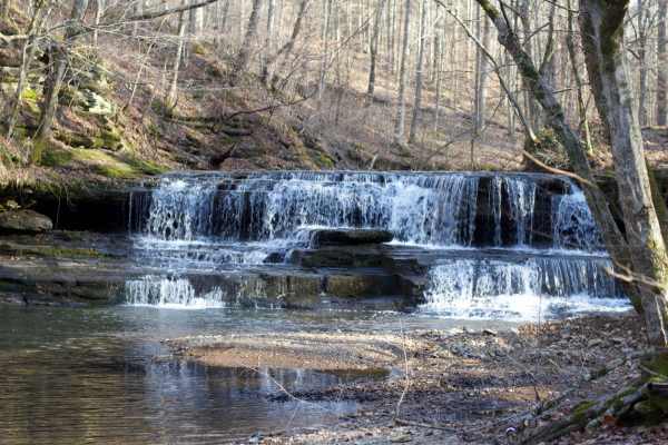
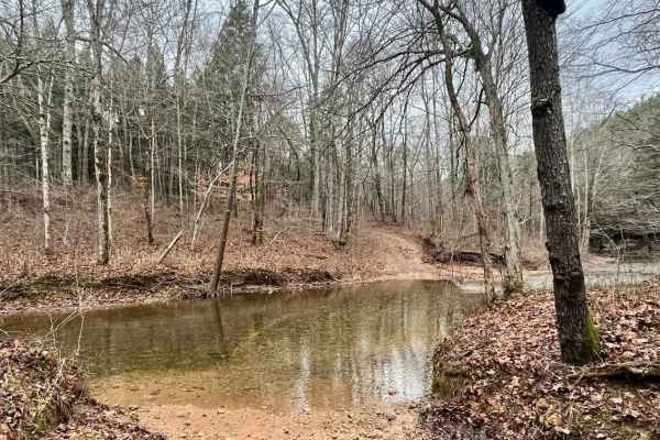
Long Fork Waterfall
Woodard Road is not a technical route;it is an easy gravel road leading down to a shallow creek crossing that includes a waterfall. The creek is shallow but the rock bottom can be slick. You can drive across it and continue further down the road or just turn around and head back out.
Learn more about Long Fork Waterfall

Porter Branch Road
This is a public access dirt road that has a few simple water crossings. It's 2WD-friendly and easy to complete. The surrounding property off the road is private property, so be sure to stay on the road and do not drive up the creek to adhere to Tread Lightly standards as well as local laws.
Learn more about Porter Branch Road
Dutch Potts Hollow Road
This is a public access dirt road that makes up a portion of the famed, Tennessee Dirt Devil. While not particularly challenging, trail riders will enjoy beautiful views graced with rockwork and a very nice waterfall. The surrounding property off the roadway is private property so be sure to stay on...
Learn more about Dutch Potts Hollow Road
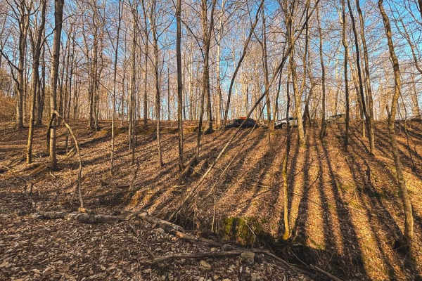
Hance Hollow Road - Macon County Tour
Hance Hollow Road is an old county road that is now rarely used. It's a steady steep descent or climb on a narrow road with tight switchbacks. It is located in a heavily wooded area in northeastern middle Tennessee on the Macon County Tour, or M.C.T. In the fall, you'll find colorful foliage in a ca...
Learn more about Hance Hollow Road - Macon County Tour
South Lick Creek Road
This is a public access dirt road that makes up a portion of the famed, Tennessee Dirt Devil. While not particularly challenging, trail riders will enjoy beautiful views of sprawling farmland and wildlife. One water crossing has a paved bridge which is eroding heavily at a corner and can be treacher...
Learn more about South Lick Creek Road
Ben Fly Road
This is a public access dirt road. The creek crossing is best completed by hugging the bank if there have been recent rains. Depending on the direction, before the creek, there will be a hill descent into the creek or a hill climb after exiting the creek if coming from the opposite way. There's priv...
Learn more about Ben Fly Road
Tyler Ridge Road
This is a public access dirt road that makes up a portion of the famed, Tennessee Dirt Devil. While not particularly challenging, trail riders will enjoy beautiful views graced with an abandoned church and old cemetery, multiple elevation changes with some washed-out areas, puddles to splash through...
Learn more about Tyler Ridge Road
Web Hollow Road
This is a public access dirt road that makes up a portion of the famed, Tennessee Dirt Devil. While not particularly challenging, trail riders will enjoy several elevation changes along a winding trail through a mixed forest. Several single-lane wooden bridges are along the route so be aware of the ...
Learn more about Web Hollow Road
Old Mill Creek Road
Old Mill Creek Road is great for someone just getting into off-roading. Most, if not all, of this route is safe and easy enough for high-clearance 2WD. However, there are one to two muddy/rocky areas that could benefit from 4WD depending on the amount of rain the area has received and how muddy it i...
Learn more about Old Mill Creek Road
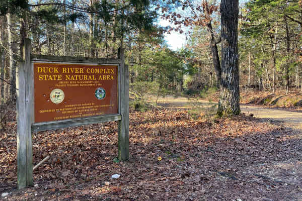
Cheek's Bend Road
Part of the Duck River Complex State Natural Area and Yanahli Wildlife Management Area trail system. No fee is required to drive Cheek’s Bend Road. Access is open year-round. Visitors hiking in the area may optionally contribute via an online donation system available by QR code at the hiking trailh...
Learn more about Cheek's Bend Road
Old Highway 50
This is a public access dirt road that makes up a portion of the famed, Tennessee Dirt Devil. While not particularly challenging, trail riders will enjoy a gorgeous winding trail through a lush forest and little to no traffic leading to a peaceful drive. Several elevation changes occur which can res...
Learn more about Old Highway 50
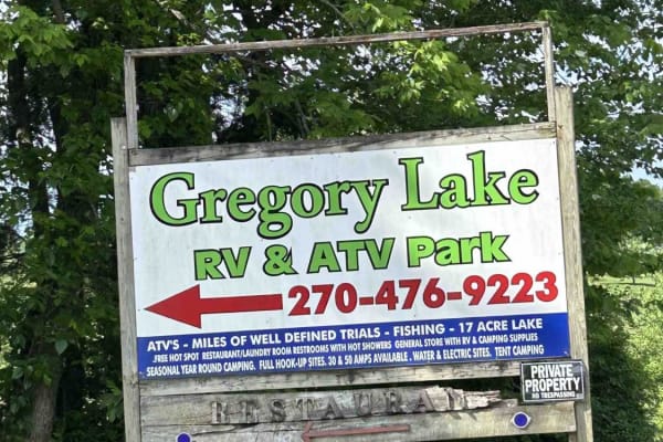
GL Powerline Trail
The Powerline Trail is Gregory Lake RV and ATV Park's southeastern boundary. The park requires riders to register at the front desk, sign a waiver, and pay a small fee. The trail is accessed from one of two primary trailheads in the park. The trail is well-defined. It is mostly dirt with some mud in...
Learn more about GL Powerline Trail
Houchin Ferry - Mammoth Cave NP
Houchin Ferry Road is a 5-mile out-and-back trail that is located within Mammoth Cave National Park. The trail begins off Ollie Road and ends along the Green River. There is no longer a possible way to cross the river at the end of the trail so you must turn back. Along the trail are a few parking a...
Learn more about Houchin Ferry - Mammoth Cave NP
GL Primary Trail
This is Gergory Lake RV and ATV Park's primary trail. This trail is accessed from the Primary Trailhead in the park. The park requires riders to register at the front desk, sign a waiver, and pay a small fee. The trail is well-defined and maintained. This trail is also the route to access the park's...
Learn more about GL Primary Trail
Gregory Lake West Boundary
This trail is Gregory Lake RV and ATV Park's western boundary. The park requires riders to register at the front desk, sign a waiver, and pay a small fee. The trail is accessed from one of the 2 primary trailheads near the park cabins and public pavilion. The trail is very well-defined, with numerou...
Learn more about Gregory Lake West Boundary
ATV trails near Hendersonville, Tennessee
Explore ATV-friendly trails near you. These trails are accessible for vehicles up to 50 inches wide, perfect for ATVs and smaller off-road machines.
Cedar Forest Road
This trail is only open to vehicles that are registered and street legal. If your vehicle is not registered or street legal, do not attempt this trail. If you're up for some light trail riding under a canopy provided by beautiful, mature trees, Cedar Forest Road in the Cedars of Lebanon State Forest...
Learn more about Cedar Forest Road
Gravley Hill Road - Macon County Tour
Winding through the gentle terrain of northern Tennessee, this graded gravel trail marks the starting point of the iconic Macon County Tour (MCT), a 100+ mile off-road journey that explores the rolling hills and hardwood forests of Tennessee and Kentucky. While generally easy and well-maintained, th...
Learn more about Gravley Hill Road - Macon County Tour
Sullivan Hollow Road - Macon County Tour
This scenic off-road trail, part of the Macon County Tour (MCT), offers an easy yet engaging drive through Tennessee's rolling backcountry. While the route follows a graded path, multiple washouts and narrow stretches without shoulders--some with steep drop-offs--add a layer of caution to the otherw...
Learn more about Sullivan Hollow Road - Macon County Tour
Shiloh's Playground
Shiloh's Playground consists of multiple muddy lines through some tight woods. It can be done in full-size 4x4s, SxS, or dirt bikes. If unloading on a trailer, there is a dirt lot across the paved road for parking/unloading. From this lot, you can also access the creek and drive through to get to sm...
Learn more about Shiloh's Playground
UTV/side-by-side trails near Hendersonville, Tennessee
Find UTV and side-by-side trails near you. These trails accommodate vehicles up to 60 inches wide, ideal for UTVs, side-by-sides, and wider off-road rigs.
Cedar Forest Road
This trail is only open to vehicles that are registered and street legal. If your vehicle is not registered or street legal, do not attempt this trail. If you're up for some light trail riding under a canopy provided by beautiful, mature trees, Cedar Forest Road in the Cedars of Lebanon State Forest...
Learn more about Cedar Forest Road
Gravley Hill Road - Macon County Tour
Winding through the gentle terrain of northern Tennessee, this graded gravel trail marks the starting point of the iconic Macon County Tour (MCT), a 100+ mile off-road journey that explores the rolling hills and hardwood forests of Tennessee and Kentucky. While generally easy and well-maintained, th...
Learn more about Gravley Hill Road - Macon County Tour
Sullivan Hollow Road - Macon County Tour
This scenic off-road trail, part of the Macon County Tour (MCT), offers an easy yet engaging drive through Tennessee's rolling backcountry. While the route follows a graded path, multiple washouts and narrow stretches without shoulders--some with steep drop-offs--add a layer of caution to the otherw...
Learn more about Sullivan Hollow Road - Macon County Tour
Shiloh's Playground
Shiloh's Playground consists of multiple muddy lines through some tight woods. It can be done in full-size 4x4s, SxS, or dirt bikes. If unloading on a trailer, there is a dirt lot across the paved road for parking/unloading. From this lot, you can also access the creek and drive through to get to sm...
Learn more about Shiloh's Playground
The onX Offroad Difference
onX Offroad combines trail photos, descriptions, difficulty ratings, width restrictions, seasonality, and more in a user-friendly interface. Available on all devices, with offline access and full compatibility with CarPlay and Android Auto. Discover what you're missing today!
Open Trail Map