
Dirt Bike Trails
Near Hanna, Wyoming
Explore All Dirt Bike Trails Near Hanna, Wyoming
Dirt Bike Trails Near Hanna, Wyoming
Discover the best dirt bike trails near you. Browse trail maps, check difficulty ratings, and find your next adventure — whether you're looking for a quick ride or an all-day expedition.
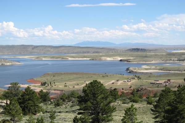
Seminoe-Alcova Backcountry Byway
One of Wyoming's designated scenic backways, this drive utilizes both paved and gravel roads to travel over the rugged Seminoe Mountains and past three reservoirs fed by the North Platte River. You'll discover the unsung mountain ranges of central Wyoming as well as some of the best fishing spots in...
Learn more about Seminoe-Alcova Backcountry Byway
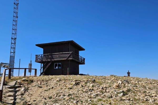
Kennaday Peak
This trail takes you to the top of Kennaday Peak, where you will find a historic fire lookout. The trail starts out as a well-maintained forest service road, a little narrow at the bottom but two-way traffic is possible. As you near the top it does become narrow and very rocky, only allowing one-way...
Learn more about Kennaday Peak
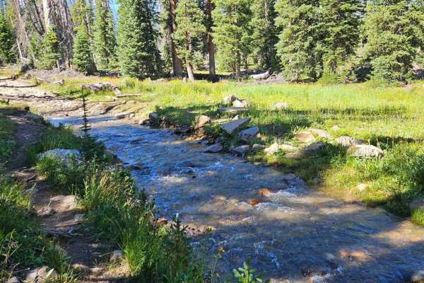
Cascade North Twin
This trail offers almost every terrain you can think of to encounter. The trail starts off by driving down a flooded creek bed, and there are many water crossings after that as you travel alongside multiple mountain lakes. The trail is quite rocky and technical but most high clearance 4x4s should be...
Learn more about Cascade North Twin
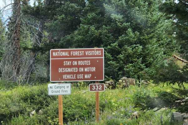
Towner Lake
Towner Lake is an easy, scenic dirt and rock route in Wyoming's Snowy Range that is ideal for beginners and those looking for a quick, visually stunning drive past alpine lakes and vibrant meadows. Spanning approximately 2.8 miles within the Medicine Bow-Routt National Forests, this trail begins jus...
Learn more about Towner Lake

Bear Lake
This popular, fun four-wheeling route leads to Bear Lake in the beautiful Snowy Range. The road begins from Libby Pass near timberline and descends into a subalpine forest where you can spot elk and marmots. The roadbed is typically found with some small puddles and a bumpy surface, but late melting...
Learn more about Bear Lake
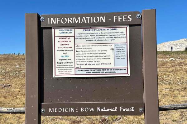
Libby Flats Road 336
Road 336 is one mile off of Road 396 to Bear Lake. A high-clearance vehicle is needed for this trail. A good portion of the trail is covered with rocks. Be prepared for strong winds and changing weather conditions. Highway 130 is only open from late May to late autumn until the snow accumulation get...
Learn more about Libby Flats Road 336
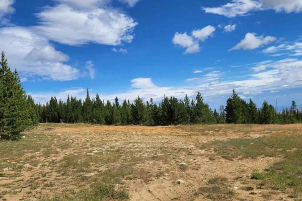
Fallen Pines
You will enjoy this road with its amazing views at the top that sneak out of the trees every now and again. There are a bunch of camping spots at the beginning of the road, enough space for a large group at some. Dirt or rocky road with gentle grades. Safe for most 4WD and high-clearance 2WD vehicle...
Learn more about Fallen Pines
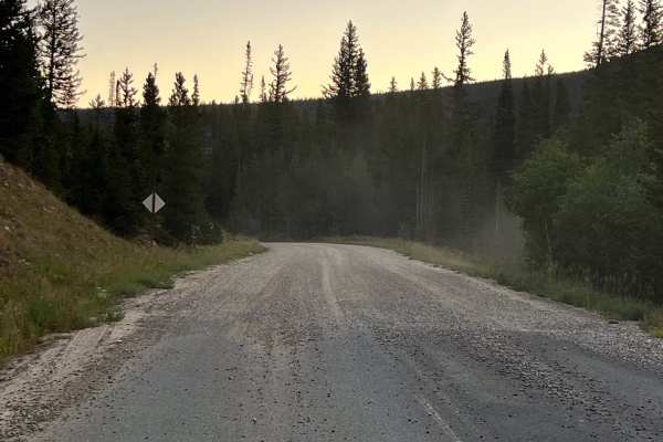
Sand Lake Road - FS 101
This route covers the portion of Forest Service Road 101(Sand Lake Road) from Highway 130 to the Deep Creek Campground. It is a scenic and easy drive through the eastern edge of Wyoming’s Medicine Bow National Forest. This gravel road is mostly two lanes wide and suitable for stock SUVs, passenger v...
Learn more about Sand Lake Road - FS 101

USFS Road 307 - Centennial Ridge
Trail winds through a heavily wooded area with fantastic views of the Centennial Ridge down to the flatlands and Sheep Mountain below. Look out for the abandoned mining equipment near the end of the trail. The trail is easy with some mud and ruts year-round but can have ice and deep snow through the...
Learn more about USFS Road 307 - Centennial Ridge
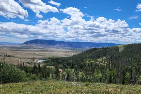
Ehlin Road
You will enjoy this road with its amazing views. There are a few spots that look like they would be good for camping. Road can be muddy when wet, with some water puddles. Dirt or rocky road with gentle grades. Safe for most 4WD and high-clearance 2WD vehicles. Roads are typically two vehicles wide.
Learn more about Ehlin Road
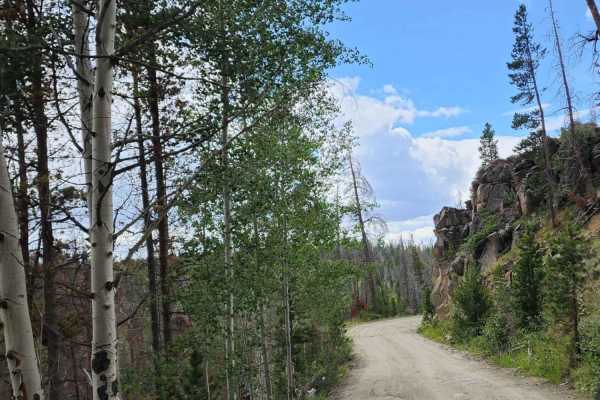
Keystone
Beautiful road with amazing views and tall trees. There isn't much for camping, maybe a spot or two, but it is a quick simple enjoyable road to take a drive on. This road takes you into the small town of Keystone; please drive slowly! Dirt or rocky road with gentle grades. Safe for most 4WD and high...
Learn more about Keystone
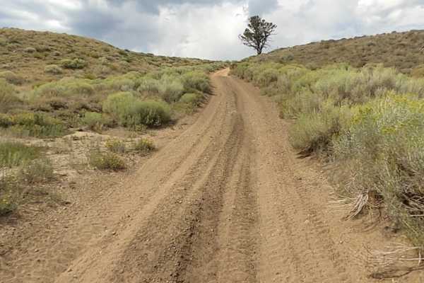
Squaw Ridge Road
Heading from Fox Road (County Road 47), you'll come to the Squaw Ridge Road Trailhead, which is also known as Forest Service Road 311.A. This trail starts off with deep sand ruts, which will get you off camber pretty quickly on the ascent to the top. Once you pass the initial loose sand, the terrain...
Learn more about Squaw Ridge Road
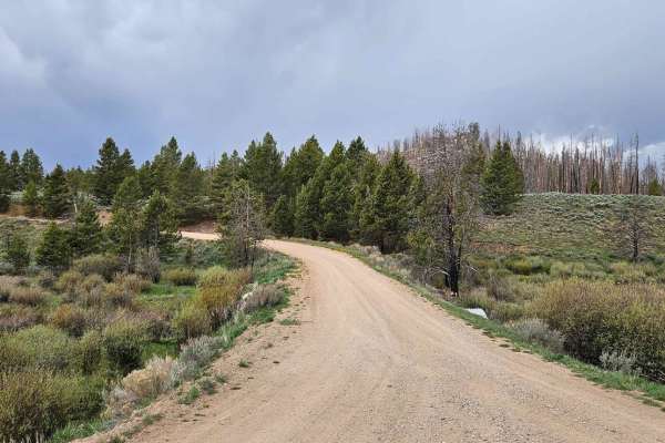
FS516 to Platte Ridge
This is a well-maintained forest service road. It has multiple sites along the way for dispersed camping. The trail winds high above Pelton Creek and gives you multiple access points to the Platte River Wilderness Area. Although empty most of the year, it does get busy come fall as many hunters use ...
Learn more about FS516 to Platte Ridge
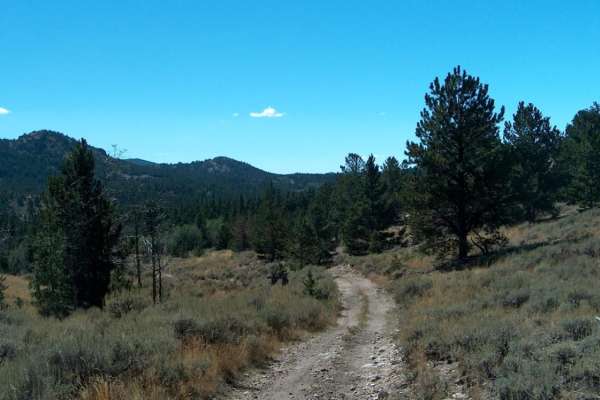
Big Bear Canyon/Devils Pass
Big Bear Canyon and its side trails around Devils Pass are among the best four-wheeling areas in the Laramie Mountains. Begin this trail system by fording LaBonte Creek on the south side of FR 658 and climb into a heavily-timbered canyon covered with ponderosa pines, quaking aspen, and massive bould...
Learn more about Big Bear Canyon/Devils Pass

Valley Trail
This is a 50-inch trail. It starts high on the mountain running through tight trees. Once at the top, you drop down into a beautiful valley that offers views of a snowy range that cannot be seen any other way. There is a large rock field to crawl over on your way down into the valley. Once at the bo...
Learn more about Valley Trail
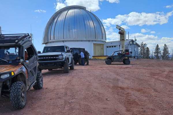
Jelm Mountain
This is a well-maintained road that climbs to a stunning 10,000 feet. The views on the way up are breathtaking. Once at the top, you will find the U.W. Infrared Telescope Observatory, as well as amazing 360-degree views of the valleys and mountains below. There are multiple dispersed camping sites a...
Learn more about Jelm Mountain
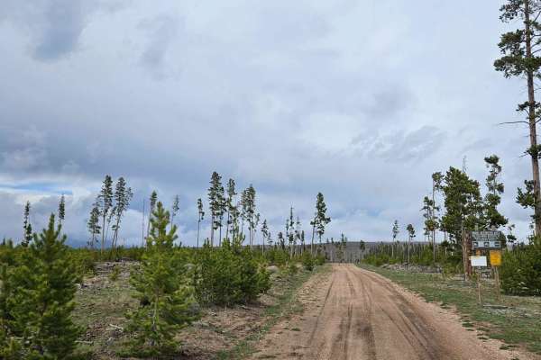
FS 501 MTN HOME
The trail starts at Mountain Home, where there is a large parking lot to unload if you are riding an ATV or SXS. The trail begins fairly easily and has multiple places for dispersed camping. Multiple large water crossings can be deep in the spring or after a good rain. Parts of the trail cross throu...
Learn more about FS 501 MTN HOME
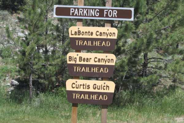
Labonte Canyon
The short trail through LaBonte Canyon is one of the most scenic motorized routes in the Laramie Mountains. This trip takes you through the riparian corridor of LaBonte Creek, bound by hills of granite and covered with apsens, shrubs, pines, and grassy meadows. The passage is rich with opportunities...
Learn more about Labonte Canyon
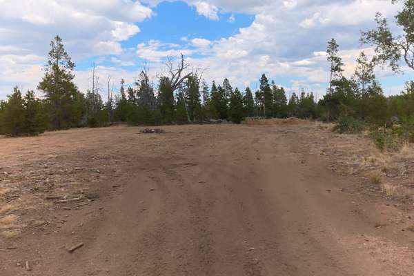
FS 516D
This short trail branches off FS 516 and travels into a forested area surrounded by trees.
The trail is mostly dirt with little to no rocks and has 5–6-inch ruts. At the end of the trail, there is a large, private campsite with extremely level ground, a fire ring, and enough space for up to 20 vehic...
Learn more about FS 516D
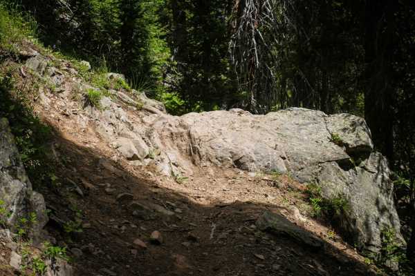
Whiskey Creek
Whiskey Creek is a 9-mile fun and challenging single track on the border of Wyoming and Colorado. Much of this narrow trail is very rocky. It has lots of rock ledges and root ledges with big boulders in the trail, and some really narrow sections of side-hilling. The trail is mostly flat and runs by ...
Learn more about Whiskey Creek
ATV trails near Hanna, Wyoming
Explore ATV-friendly trails near you. These trails are accessible for vehicles up to 50 inches wide, perfect for ATVs and smaller off-road machines.
Seminoe-Alcova Backcountry Byway
One of Wyoming's designated scenic backways, this drive utilizes both paved and gravel roads to travel over the rugged Seminoe Mountains and past three reservoirs fed by the North Platte River. You'll discover the unsung mountain ranges of central Wyoming as well as some of the best fishing spots in...
Learn more about Seminoe-Alcova Backcountry Byway
Kennaday Peak
This trail takes you to the top of Kennaday Peak, where you will find a historic fire lookout. The trail starts out as a well-maintained forest service road, a little narrow at the bottom but two-way traffic is possible. As you near the top it does become narrow and very rocky, only allowing one-way...
Learn more about Kennaday Peak
Cascade North Twin
This trail offers almost every terrain you can think of to encounter. The trail starts off by driving down a flooded creek bed, and there are many water crossings after that as you travel alongside multiple mountain lakes. The trail is quite rocky and technical but most high clearance 4x4s should be...
Learn more about Cascade North Twin
Towner Lake
Towner Lake is an easy, scenic dirt and rock route in Wyoming's Snowy Range that is ideal for beginners and those looking for a quick, visually stunning drive past alpine lakes and vibrant meadows. Spanning approximately 2.8 miles within the Medicine Bow-Routt National Forests, this trail begins jus...
Learn more about Towner Lake
UTV/side-by-side trails near Hanna, Wyoming
Find UTV and side-by-side trails near you. These trails accommodate vehicles up to 60 inches wide, ideal for UTVs, side-by-sides, and wider off-road rigs.
Seminoe-Alcova Backcountry Byway
One of Wyoming's designated scenic backways, this drive utilizes both paved and gravel roads to travel over the rugged Seminoe Mountains and past three reservoirs fed by the North Platte River. You'll discover the unsung mountain ranges of central Wyoming as well as some of the best fishing spots in...
Learn more about Seminoe-Alcova Backcountry Byway
Kennaday Peak
This trail takes you to the top of Kennaday Peak, where you will find a historic fire lookout. The trail starts out as a well-maintained forest service road, a little narrow at the bottom but two-way traffic is possible. As you near the top it does become narrow and very rocky, only allowing one-way...
Learn more about Kennaday Peak
Cascade North Twin
This trail offers almost every terrain you can think of to encounter. The trail starts off by driving down a flooded creek bed, and there are many water crossings after that as you travel alongside multiple mountain lakes. The trail is quite rocky and technical but most high clearance 4x4s should be...
Learn more about Cascade North Twin
Towner Lake
Towner Lake is an easy, scenic dirt and rock route in Wyoming's Snowy Range that is ideal for beginners and those looking for a quick, visually stunning drive past alpine lakes and vibrant meadows. Spanning approximately 2.8 miles within the Medicine Bow-Routt National Forests, this trail begins jus...
Learn more about Towner Lake
The onX Offroad Difference
onX Offroad combines trail photos, descriptions, difficulty ratings, width restrictions, seasonality, and more in a user-friendly interface. Available on all devices, with offline access and full compatibility with CarPlay and Android Auto. Discover what you're missing today!
Open Trail Map