
Dirt Bike Trails
Near Greenville, Texas
Explore All Dirt Bike Trails Near Greenville, Texas
Dirt Bike Trails Near Greenville, Texas
Discover the best dirt bike trails near you. Browse trail maps, check difficulty ratings, and find your next adventure — whether you're looking for a quick ride or an all-day expedition.
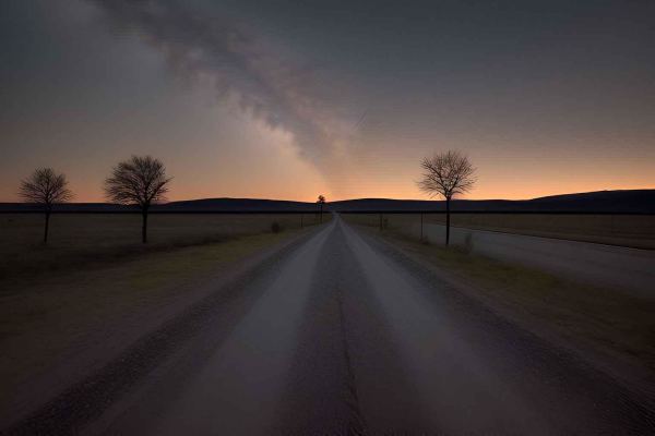
Old Tenmile Creek
The Tenmile Creek Trail offers a mix of rocky and clayey terrain with limestone banks. Watch for boulder fields, loose climbs, and water crossings. The trail runs through gently rolling prairies and wooded creek banks, with historical markers highlighting early settlements and abundant game like dee...
Learn more about Old Tenmile Creek
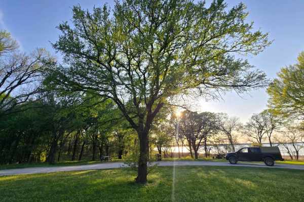
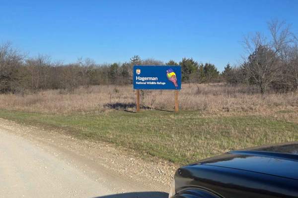
Wildlife Drive
This is a fun, easy trail with flatland views on the east side of the Hagerman National Wildlife Refuge. It also has a water crossing that is drivable when the water is shallow. At the end of this trial, on the north side, is a big, heavily treed picnic area for family and friends to hang out for th...
Learn more about Wildlife Drive
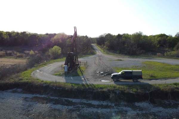
Bennet Lane Gravel Road
This trail will take you through a peaceful, scenic route and up-close views of oil rigs. A lot can be learned here regarding these oil rigs and how they work. You will also encounter lots of wildlife; if you are into birdwatching, this is a perfect place. Fishing is allowed but absolutely no campin...
Learn more about Bennet Lane Gravel Road
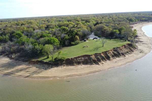
Sandy Point Road
This route is part of an AutoTour within the Wildlife Refuge. It is connected to several side entry roads that hold some of the most active working oil rigs in North Texas. The beauty of this place is not only how easy it is to drive on this loose gravel road, but how accessible it is to see this ir...
Learn more about Sandy Point Road
Oil Field Road
This trail is part of the Hagerman National Wildlife Refuge. As you drive on the loose gravel road, you will find side roads that lead to a waterfront oil rig driller. There are several that branch off towards the water or towards Sandy Point Road. Like all trails in this park, it can be accessible ...
Learn more about Oil Field Road
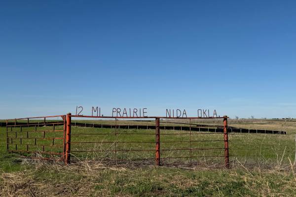
Twelve Mile Prairie Trail #1
The 12-mile Prairie Trail begins at Horse Creek Road and ends at Dunn Road or vice versa, and rolls out across open country that mixes prairie stretches, scattered timber, and gentle elevation changes. The route follows a series of old rural paths that feel untouched and authentic, giving the ride a...
Learn more about Twelve Mile Prairie Trail #1
ATV trails near Greenville, Texas
Explore ATV-friendly trails near you. These trails are accessible for vehicles up to 50 inches wide, perfect for ATVs and smaller off-road machines.
Old Tenmile Creek
The Tenmile Creek Trail offers a mix of rocky and clayey terrain with limestone banks. Watch for boulder fields, loose climbs, and water crossings. The trail runs through gently rolling prairies and wooded creek banks, with historical markers highlighting early settlements and abundant game like dee...
Learn more about Old Tenmile Creek
Twelve Mile Prairie Trail #1
The 12-mile Prairie Trail begins at Horse Creek Road and ends at Dunn Road or vice versa, and rolls out across open country that mixes prairie stretches, scattered timber, and gentle elevation changes. The route follows a series of old rural paths that feel untouched and authentic, giving the ride a...
Learn more about Twelve Mile Prairie Trail #1
UTV/side-by-side trails near Greenville, Texas
Find UTV and side-by-side trails near you. These trails accommodate vehicles up to 60 inches wide, ideal for UTVs, side-by-sides, and wider off-road rigs.
Old Tenmile Creek
The Tenmile Creek Trail offers a mix of rocky and clayey terrain with limestone banks. Watch for boulder fields, loose climbs, and water crossings. The trail runs through gently rolling prairies and wooded creek banks, with historical markers highlighting early settlements and abundant game like dee...
Learn more about Old Tenmile Creek
Twelve Mile Prairie Trail #1
The 12-mile Prairie Trail begins at Horse Creek Road and ends at Dunn Road or vice versa, and rolls out across open country that mixes prairie stretches, scattered timber, and gentle elevation changes. The route follows a series of old rural paths that feel untouched and authentic, giving the ride a...
Learn more about Twelve Mile Prairie Trail #1
The onX Offroad Difference
onX Offroad combines trail photos, descriptions, difficulty ratings, width restrictions, seasonality, and more in a user-friendly interface. Available on all devices, with offline access and full compatibility with CarPlay and Android Auto. Discover what you're missing today!
Open Trail Map