
Dirt Bike Trails
Near Geneva, Washington
Explore All Dirt Bike Trails Near Geneva, Washington
Dirt Bike Trails Near Geneva, Washington
Discover the best dirt bike trails near you. Browse trail maps, check difficulty ratings, and find your next adventure — whether you're looking for a quick ride or an all-day expedition.

Middle Fork Nooksack - FS 38
Middle Fork Nooksack is a 12.6-mile out-and-back gravel road located east of Deming and ending at Ridley Creek Trailhead. The road surface gets procedurally rougher, starting as a wide gravel road with some potholes and ending as a tight trail with some ruts and large deep potholes. The first 4.8 mi...
Learn more about Middle Fork Nooksack - FS 38
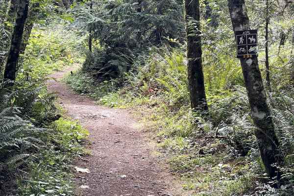
230
Trail 230 is one of several short motorcycle trails in the Whistle Lake Area. It's a wide dirt path with a few embedded rock surfaces, embedded boulders, and big roots, but it is overall a very easy trail. It goes between tall skinny red alder trees, sword ferns, and thick cedar trees in a really sc...
Learn more about 230
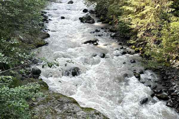
Glacier Creek Road
This 5.4 mile out and back trail once accessed several backcountry hiking trails and views of the glaciers on Mt. Baker. This road has been washed out by the creek in multiple areas and has been closed to motorized vehicles at 2.9 miles but still open for hiking. This trail is passable by 2WD, AWD, ...
Learn more about Glacier Creek Road
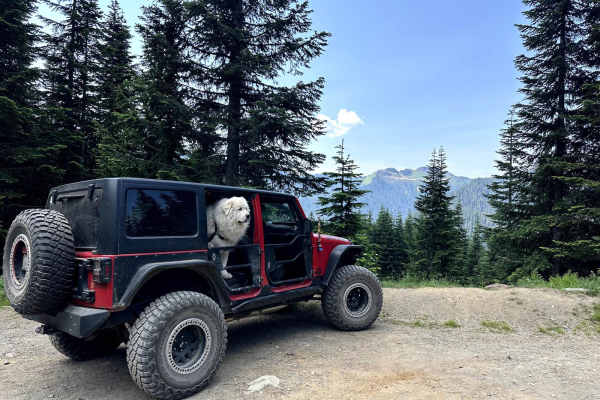
Canyon Creek Road
This 15.2 miles out and back trail heads up to the Damfino Lakes Hiking Trailhead, which becomes a multi-use trail from 1 AUG to 30 SEP for horses and motorcycles. This road gives excellent views of Church, Bearpaw, and Excelsior Mountains with Mount Baker in the background. This road is passable by...
Learn more about Canyon Creek Road
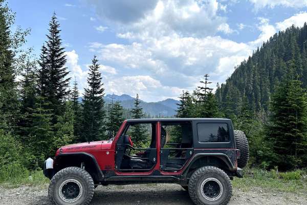
Canyon Ridge Road
This 14-mile out-and-back trail climbs up to the canyon Ridgeline and ends at the canyon ridge trailhead (motorcycle trail). This trail gives great views of Bald Mountain and the Canyon valley area. There is a dispersed camping area along this road. The trail starts paved and then is a gravel forest...
Learn more about Canyon Ridge Road
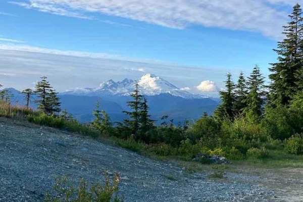
Iron Mountain Camp - FS 1775
Forest Service Road 1775 is a scenic off-road route tucked into the lush foothills of the North Cascades, offering an approachable yet rewarding drive for overland explorers and weekend adventurers. The road begins as a well-maintained gravel surface, suitable for high-clearance 2WD or AWD vehicles ...
Learn more about Iron Mountain Camp - FS 1775
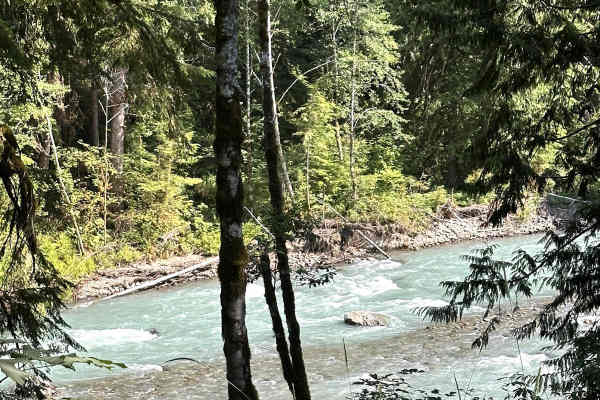
Nooksack River Trail
This 6.2 mile out and back trail used to run along the Nooksack River and then up the Wells Creek Valley, but a washout on the road around 3.4 miles in has closed the upper portion to vehicles. This area has several dispersed camping areas along the Nooksack River. This road is passable by 2WD, AWD,...
Learn more about Nooksack River Trail
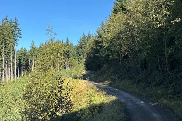
Walker Valley Mainline
Walker Valley Mainline is primarily a graded gravel and dirt road with a few sections of ungraded gravel. It is an easy ride in the summer months; however, there is no winter maintenance. During times of rain, snow, and ice, the road can become rutted and harder to travel on. Walker Valley Mainline ...
Learn more about Walker Valley Mainline
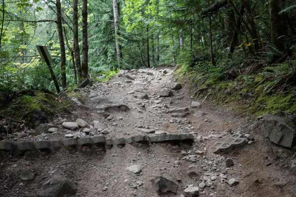
Pats
Pats is a short 48" ATV trail in the Walker Valley ORV Area that starts directly from the staging area off of Peter Burns Rd. It starts out with a small rocky climb, up a dirt surface with loose round rocks in the trail and embedded rock surfaces. It goes through a really unique terrain that is like...
Learn more about Pats
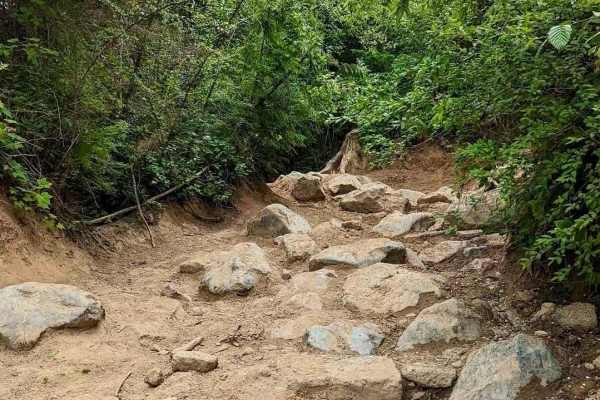
Expressway
This trail in Skagit County, Washington, takes you through dense lush forest, covered in thick mosses, sword ferns, and evergreen trees. Drivers can expect boulder-strewn pathways, deep muddy ruts, and large rock obstacles with bypasses. Due to limited parking on weekends, arriving early is recommen...
Learn more about Expressway
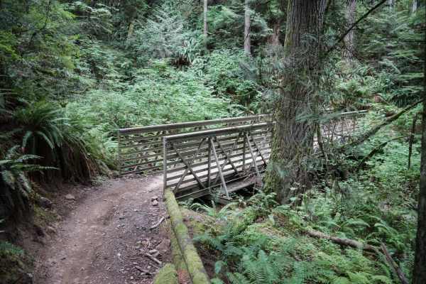
Tooler
Tooler is a 2-mile long short and fast singletrack in the Walker Valley ORV Area. It is accessed through Pats ATV Trail and is likely a more popular trail as it is close to the staging area. It's not super narrow, being a decent width that is accommodating to newer riders. It goes through tall fir t...
Learn more about Tooler
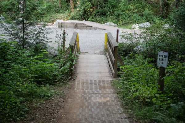
Jam
Jam is the first ATV trail that most riders will take out of the Walker Valley Staging Area. It exits the parking area on a wooden bridge to start the trail and goes one mile south to intersect with Muddled Meanderings. This trail is very wide and easy and could be a good practice trail for kids or ...
Learn more about Jam
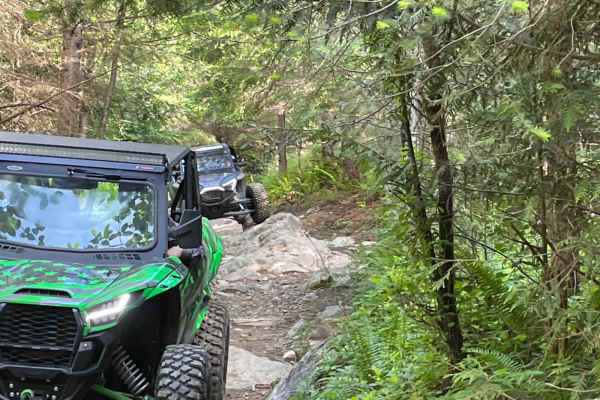
Around the Sound
This is a trail that will surprise you. It starts like it is just a simple wooded dirt trail, and then it becomes rock piles, mud holes, and tight twisty off-camber turns. The obstacles are not overly technical, but if one approaches them incorrectly, one could cause damage to your ride.
Learn more about Around the Sound
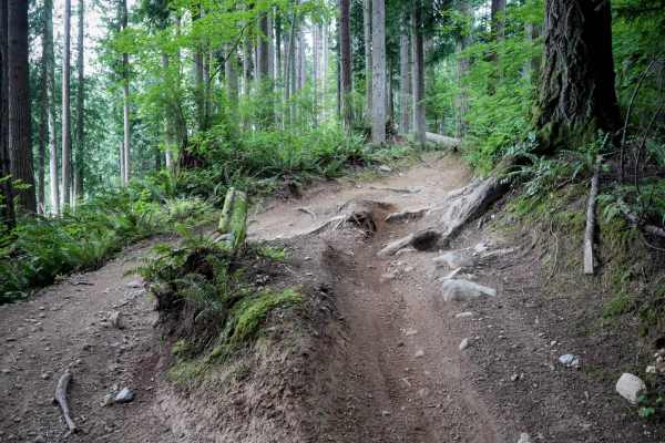
Muddled Meanderings
This is a 1.4 mile long very curvy ATV trail. The south end starts at a patch of blackberries before going across a wooden bridge. It's a wide trail that tightly winds through thick cedar trees, with small rocks and roots in the trail. The trail is lined with ferns in a dense jungle, with one sectio...
Learn more about Muddled Meanderings
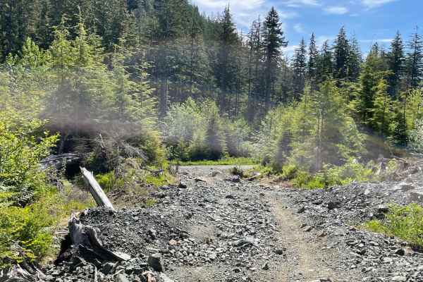
Humps and Bumps
The trail lives up to its name. It is a constant up and down on loose rock, and then there are a bunch of optional obstacles that will challenge all skill levels to some degree. The trail has lines that are easy for less experienced or lower clearance machines and lines that will test the flexibil...
Learn more about Humps and Bumps
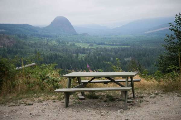
Centennial
This 2-mile long 48" ATV trail starts off from the northern entrance as a rocky and more challenging route. The first half mile is a very steep and loose descent, with small ledges, roots, and loose round rocks that could be more challenging on an ATV. There are cement pavers to help with traction, ...
Learn more about Centennial
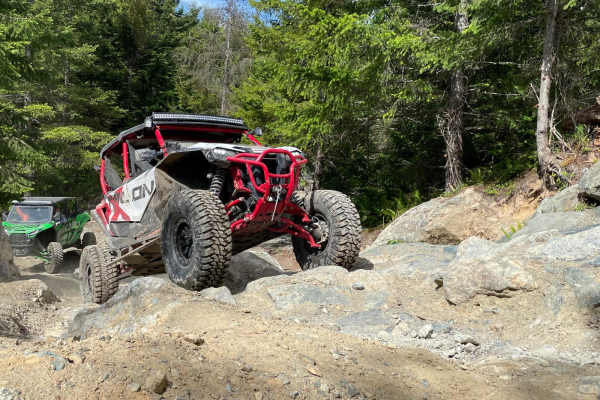
No Newbies and 4x4 Skills Area
This is a short in and out trial that connects with the Humps and Bumps trail near the end. The trail leads to an offroad practice area where riders can test their skills in multiple types of trail conditions. There are areas to test your ability to climb over large obstacles, straddle boulder crevi...
Learn more about No Newbies and 4x4 Skills Area
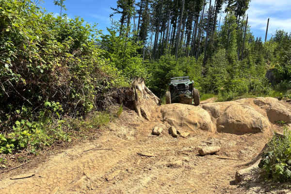
Timber Tamer
This trail tends to be muddy year-round. It travels through a low area of the system and is a very rocky and muddy mess, which makes it a lot of fun and challenging. This trail changes to some extent every time you ride it because the rock obstacles are almost all loose rock fields except the larger...
Learn more about Timber Tamer

Twisted Tree
This is a short singletrack in the Walker Valley ORV Area. It starts off with a few root/rock obstacles that could be tricky for the inexperienced rider, as they are abrupt roots on a steep turn that require some momentum and getting the front end up. There are embedded rock surfaces and overgrown b...
Learn more about Twisted Tree
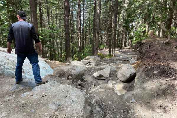
Ron's Run
This is a dirt and rock trail that travels through Douglas fir, Hemlock, and Pine tree forests. It is highly rutted with some larger rock obstacles that are very challenging and highly technical. In spots, the trail is so steep that the local off-road club that maintains the trail has installed conc...
Learn more about Ron's Run
ATV trails near Geneva, Washington
Explore ATV-friendly trails near you. These trails are accessible for vehicles up to 50 inches wide, perfect for ATVs and smaller off-road machines.
Middle Fork Nooksack - FS 38
Middle Fork Nooksack is a 12.6-mile out-and-back gravel road located east of Deming and ending at Ridley Creek Trailhead. The road surface gets procedurally rougher, starting as a wide gravel road with some potholes and ending as a tight trail with some ruts and large deep potholes. The first 4.8 mi...
Learn more about Middle Fork Nooksack - FS 38
Glacier Creek Road
This 5.4 mile out and back trail once accessed several backcountry hiking trails and views of the glaciers on Mt. Baker. This road has been washed out by the creek in multiple areas and has been closed to motorized vehicles at 2.9 miles but still open for hiking. This trail is passable by 2WD, AWD, ...
Learn more about Glacier Creek Road
Canyon Creek Road
This 15.2 miles out and back trail heads up to the Damfino Lakes Hiking Trailhead, which becomes a multi-use trail from 1 AUG to 30 SEP for horses and motorcycles. This road gives excellent views of Church, Bearpaw, and Excelsior Mountains with Mount Baker in the background. This road is passable by...
Learn more about Canyon Creek Road
Canyon Ridge Road
This 14-mile out-and-back trail climbs up to the canyon Ridgeline and ends at the canyon ridge trailhead (motorcycle trail). This trail gives great views of Bald Mountain and the Canyon valley area. There is a dispersed camping area along this road. The trail starts paved and then is a gravel forest...
Learn more about Canyon Ridge Road
UTV/side-by-side trails near Geneva, Washington
Find UTV and side-by-side trails near you. These trails accommodate vehicles up to 60 inches wide, ideal for UTVs, side-by-sides, and wider off-road rigs.
Middle Fork Nooksack - FS 38
Middle Fork Nooksack is a 12.6-mile out-and-back gravel road located east of Deming and ending at Ridley Creek Trailhead. The road surface gets procedurally rougher, starting as a wide gravel road with some potholes and ending as a tight trail with some ruts and large deep potholes. The first 4.8 mi...
Learn more about Middle Fork Nooksack - FS 38
Glacier Creek Road
This 5.4 mile out and back trail once accessed several backcountry hiking trails and views of the glaciers on Mt. Baker. This road has been washed out by the creek in multiple areas and has been closed to motorized vehicles at 2.9 miles but still open for hiking. This trail is passable by 2WD, AWD, ...
Learn more about Glacier Creek Road
Canyon Creek Road
This 15.2 miles out and back trail heads up to the Damfino Lakes Hiking Trailhead, which becomes a multi-use trail from 1 AUG to 30 SEP for horses and motorcycles. This road gives excellent views of Church, Bearpaw, and Excelsior Mountains with Mount Baker in the background. This road is passable by...
Learn more about Canyon Creek Road
Canyon Ridge Road
This 14-mile out-and-back trail climbs up to the canyon Ridgeline and ends at the canyon ridge trailhead (motorcycle trail). This trail gives great views of Bald Mountain and the Canyon valley area. There is a dispersed camping area along this road. The trail starts paved and then is a gravel forest...
Learn more about Canyon Ridge Road
The onX Offroad Difference
onX Offroad combines trail photos, descriptions, difficulty ratings, width restrictions, seasonality, and more in a user-friendly interface. Available on all devices, with offline access and full compatibility with CarPlay and Android Auto. Discover what you're missing today!
Open Trail Map