
Dirt Bike Trails
Near Etna, Wyoming
Explore All Dirt Bike Trails Near Etna, Wyoming
Dirt Bike Trails Near Etna, Wyoming
Discover the best dirt bike trails near you. Browse trail maps, check difficulty ratings, and find your next adventure — whether you're looking for a quick ride or an all-day expedition.
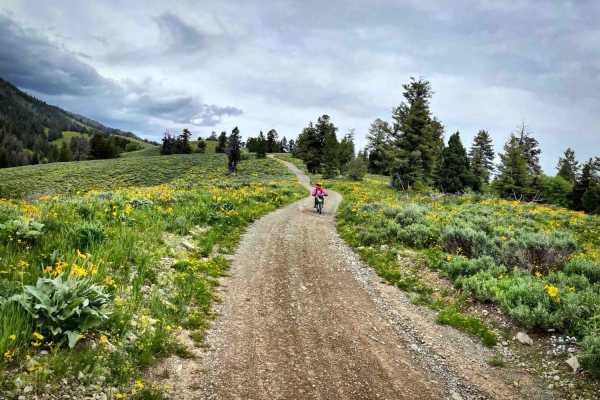
Pat Canyon - 286
Forest Service Road 286 is about 3.5-mile long with beautiful vistas of Star Valley, Wyoming, and the Palisades Reservoir. There are fire pits and a campsite along the first mile near Deer Creek. Bring bug repellant and watch for wildlife. Pack In. Pack Out. At the end of Pay Canyon road, it turn...
Learn more about Pat Canyon - 286
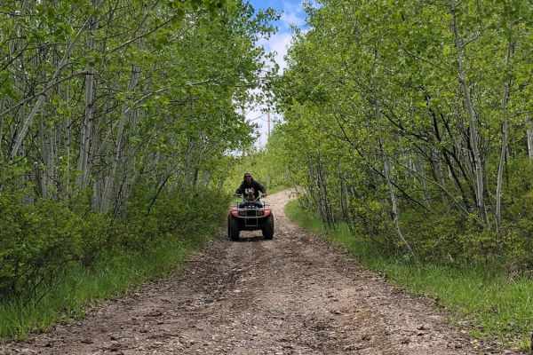
Stewart Trail
Stewart trail is a multi-use trail. Horse, hike, mountain bike, snowshoe, snowmobile, as well as hunters. Park in the cul-de-sac. Do follow trail etiquette. The trail head starts in a residential area and meanders behind property landowners and an Elk Refuge. Motorized is prohibited in the Elk Refug...
Learn more about Stewart Trail
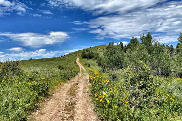
Old Man Ridge
Old Man Ridge Trail is beautiful in early summer, with a view of Star Valley, Wyoming, below. There is a closed gate; be sure to close it behind you if you intend to continue. Late Summer and Fall, it's quite dusty and rocky. The trail dead ends into private land. Do not continue.
Learn more about Old Man Ridge
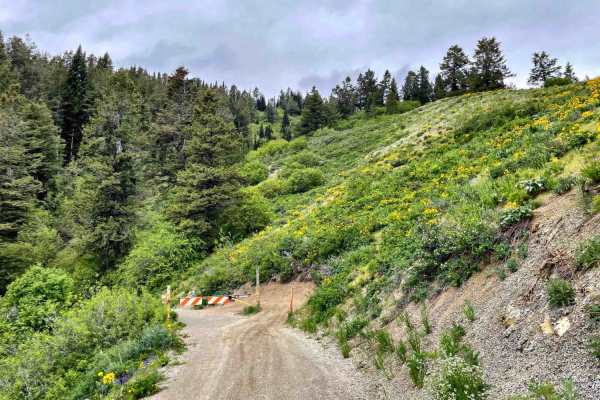
Black Mountain - 004
You just completed Pat Canyon and you will see a gate. Public access is permitted beyond the gate. The trail meanders along the west side of the Black Mountain with 3.5 miles of easy switchbacks into a very dense forest, to the Black Mountain Communication Data Site, which provides transmission ser...
Learn more about Black Mountain - 004
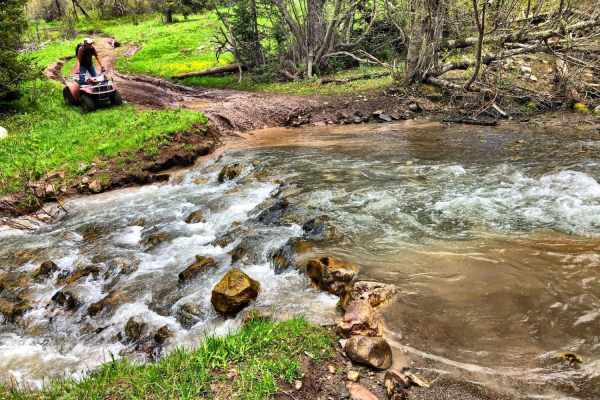
Burns Trout Creek Trail
Fun trail for all levels of riding. In the spring and early summer the trail has lots of deep run-offs, ruts, mudholes and dispersed creek water. There are two major, year around, water crossing which are not deep but can be quite fast running, and is doable on two wheels. Cows and horses also use ...
Learn more about Burns Trout Creek Trail
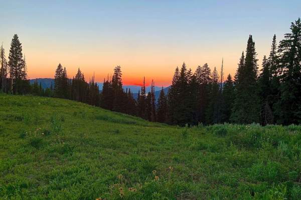
Squaw Creek
This trail has two important notes. First is that it is only open to 50" ATV's or smaller. Second is that it is seasonal : open July 1st through August 10th. This trail offers beautiful mountain landscapes with aspens, pines, fields of grassy wildflowers, and sweeping views of peaks and valleys. The...
Learn more about Squaw Creek
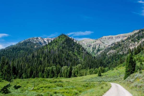
Greys River
Greys River Road is a well-graded dirt road that can be done by most vehicles. The area is amazing, and just the main road itself is worth a visit. The best way to experience this area is to camp up the road close to alpine and ride OHVs up the road and explore the side trails as you go. Be aware th...
Learn more about Greys River
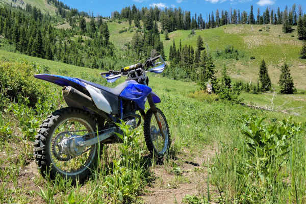
Mountain Single Track
Singletrack trail for dirt bikes only. It is not wide enough for anything with four wheels. This trail is on the advanced side with tight turns/corners, small creek crossings, brief loose sections, and occasional small obstacles. Good throttle control and bike maneuverability are a must. According t...
Learn more about Mountain Single Track
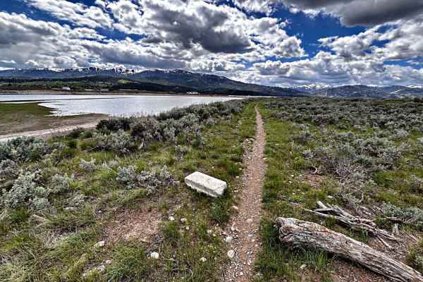
Skinny Mini
This little single track is a multi-use trail used by hikers, runners, dog walkers, and mountain bikers, along beautiful Palisades Reservoir. If you see dust, you are riding too fast. Keep it in check. Do not go off-trail and ride over the sagebrush. It's called the Skinny Mini, as the trail is no...
Learn more about Skinny Mini
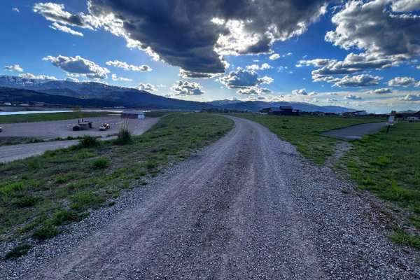
Old Palisades
Old Palisades can be taken from the Town of Alpine to the Palisades Reservoir instead of taking Old Alpine Road. Since this trail is adjacent to many homes, keep speed to 15 miles per hour or less. The trail is well traveled by dog walkers and hikers, be friendly in our small town, and stop and say ...
Learn more about Old Palisades
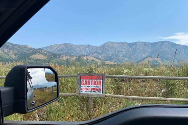
Alpine Scenic Beach Drive
NOTE THIS CAN ONLY BE DRIVEN DURING LOW RESERVOIR LEVELS! This is a gentle dirt road with two worn earth berms to cross. Closer to the reservoir along US Hwy 26, there are loose sandy areas. The low vantage point from the valley floor is breathtaking on a clear day with views of the surrounding moun...
Learn more about Alpine Scenic Beach Drive
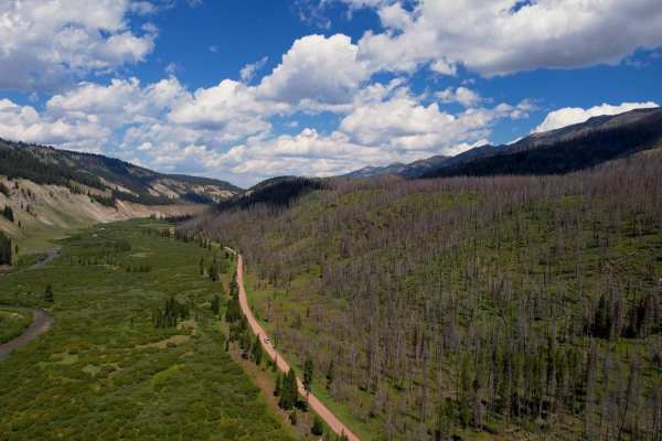
Greys River Road
This route takes you the whole length of the Wyoming Range following the Greys River. Along the way, you'll experience mountain vistas, the beautiful Greys River, wildlife, alpine lakes, and hundreds of places to camp. The trail is not aggressive at all, minus a few water crossings and the occasiona...
Learn more about Greys River Road
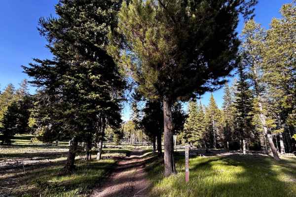
Iowa Creek - 452
This is a short little side trail to an old miner's cabin, homemade sleuth, outhouse, and root cellar off the Caribou City Trail. Be careful when entering these dwellings and leave no trace. This trail is an easy ride, with a few small rocks, and will eventually dead-end with a turnabout. You can he...
Learn more about Iowa Creek - 452
Willow Creek
The beginning of this section is a very easy 1 difficulty. You can access the north fork which is popular among hiking and horse riding. Shortly after that, the trail turns to a 2 and quickly to a 3. There are a few spurs along the way some are 50" or less. There is also the Pine Trail that will tak...
Learn more about Willow Creek
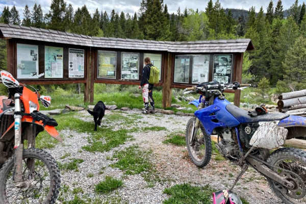
Caribou City Trail #165
This road is highly visited, and worth the trip in winter (snowmobile only) and in Spring, Summer, and Fall. At the end of this ORV trail, you will learn about 1860s Caribou City Mining Town and be able to hike, mountain bike, and horse ride additional trails beyond. Plenty of space to turn around ...
Learn more about Caribou City Trail #165
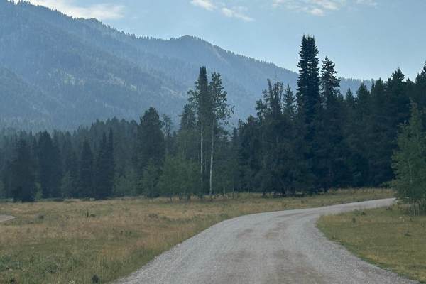
Grover Park
This road will take you from the small town of Grover to a smaller area known as Turnerville. This road is graded every year but still has lots of washboards and potholes. That being said it is traveled regularly by the locals to go back and forth. There is plenty of camping and spurs to do some rec...
Learn more about Grover Park
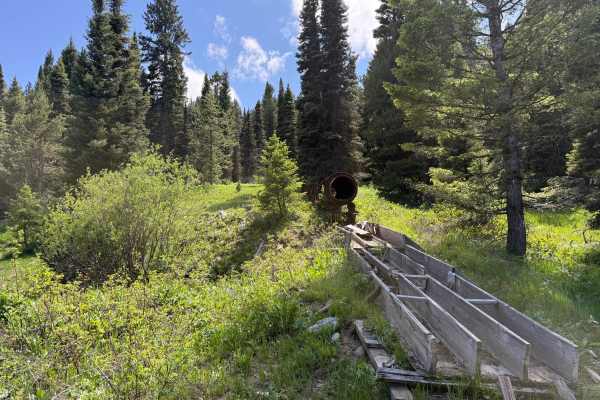
Robinson Mine
The Robinson Mine Trail is a scenic and historic backcountry route that provides access to some of the most impressive mining relics on Caribou Mountain in the Caribou National Forest. Following a remote dirt road through the heart of the mountain’s historic mining district, the trail offers a moder...
Learn more about Robinson Mine
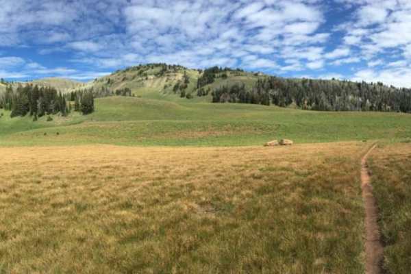
Palisades Indian Creek
This route has amazing views while you ride along two forks of a creek that enter Palisades after their confluence towards the trailhead. The route takes the rider from 5,800 to 9,400 feet while crossing and riding in the creek. On the southern side, the route is only 5 miles from the Hoback, a very...
Learn more about Palisades Indian Creek
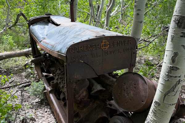
Monte Cristo Mine
The Monte Cristo Mine Trail is a scenic backcountry route for full-size off-road vehicles on the slopes of Caribou Mountain in the Caribou National Forest. Accessible from either the Robinson Mine Trail or the Willow Creek approach, the trail provides a moderate off-road adventure while leading visi...
Learn more about Monte Cristo Mine
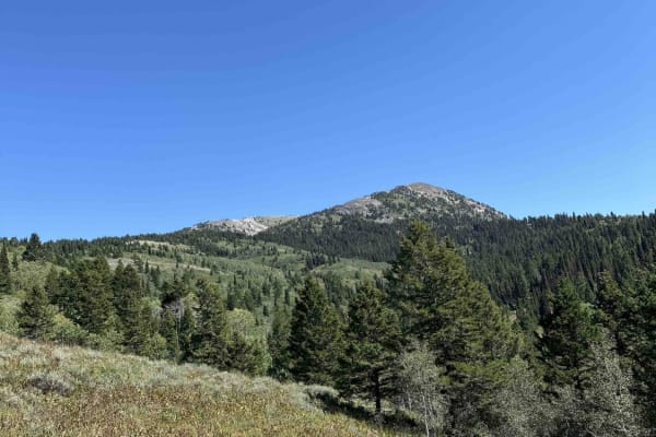
Willow Creek to Caribou Mountain FS#50018
This trail is an offshoot/access trail for the already published Caribou Loop trail. The trail is passable with high clearance 4x4, SxS, and dirt bikes. This is a steep trail through dense timber, opening up onto the northwest side of Caribou Mountain, giving access to the Caribou Mountain Trail. Th...
Learn more about Willow Creek to Caribou Mountain FS#50018
ATV trails near Etna, Wyoming
Explore ATV-friendly trails near you. These trails are accessible for vehicles up to 50 inches wide, perfect for ATVs and smaller off-road machines.
Pat Canyon - 286
Forest Service Road 286 is about 3.5-mile long with beautiful vistas of Star Valley, Wyoming, and the Palisades Reservoir. There are fire pits and a campsite along the first mile near Deer Creek. Bring bug repellant and watch for wildlife. Pack In. Pack Out. At the end of Pay Canyon road, it turn...
Learn more about Pat Canyon - 286
Stewart Trail
Stewart trail is a multi-use trail. Horse, hike, mountain bike, snowshoe, snowmobile, as well as hunters. Park in the cul-de-sac. Do follow trail etiquette. The trail head starts in a residential area and meanders behind property landowners and an Elk Refuge. Motorized is prohibited in the Elk Refug...
Learn more about Stewart Trail
Old Man Ridge
Old Man Ridge Trail is beautiful in early summer, with a view of Star Valley, Wyoming, below. There is a closed gate; be sure to close it behind you if you intend to continue. Late Summer and Fall, it's quite dusty and rocky. The trail dead ends into private land. Do not continue.
Learn more about Old Man Ridge
Black Mountain - 004
You just completed Pat Canyon and you will see a gate. Public access is permitted beyond the gate. The trail meanders along the west side of the Black Mountain with 3.5 miles of easy switchbacks into a very dense forest, to the Black Mountain Communication Data Site, which provides transmission ser...
Learn more about Black Mountain - 004
UTV/side-by-side trails near Etna, Wyoming
Find UTV and side-by-side trails near you. These trails accommodate vehicles up to 60 inches wide, ideal for UTVs, side-by-sides, and wider off-road rigs.
Pat Canyon - 286
Forest Service Road 286 is about 3.5-mile long with beautiful vistas of Star Valley, Wyoming, and the Palisades Reservoir. There are fire pits and a campsite along the first mile near Deer Creek. Bring bug repellant and watch for wildlife. Pack In. Pack Out. At the end of Pay Canyon road, it turn...
Learn more about Pat Canyon - 286
Greys River
Greys River Road is a well-graded dirt road that can be done by most vehicles. The area is amazing, and just the main road itself is worth a visit. The best way to experience this area is to camp up the road close to alpine and ride OHVs up the road and explore the side trails as you go. Be aware th...
Learn more about Greys River
Old Palisades
Old Palisades can be taken from the Town of Alpine to the Palisades Reservoir instead of taking Old Alpine Road. Since this trail is adjacent to many homes, keep speed to 15 miles per hour or less. The trail is well traveled by dog walkers and hikers, be friendly in our small town, and stop and say ...
Learn more about Old Palisades
Alpine Scenic Beach Drive
NOTE THIS CAN ONLY BE DRIVEN DURING LOW RESERVOIR LEVELS! This is a gentle dirt road with two worn earth berms to cross. Closer to the reservoir along US Hwy 26, there are loose sandy areas. The low vantage point from the valley floor is breathtaking on a clear day with views of the surrounding moun...
Learn more about Alpine Scenic Beach Drive
The onX Offroad Difference
onX Offroad combines trail photos, descriptions, difficulty ratings, width restrictions, seasonality, and more in a user-friendly interface. Available on all devices, with offline access and full compatibility with CarPlay and Android Auto. Discover what you're missing today!
Open Trail Map