
Dirt Bike Trails
Near Elk Ridge, Utah
Explore All Dirt Bike Trails Near Elk Ridge, Utah
Dirt Bike Trails Near Elk Ridge, Utah
Discover the best dirt bike trails near you. Browse trail maps, check difficulty ratings, and find your next adventure — whether you're looking for a quick ride or an all-day expedition.
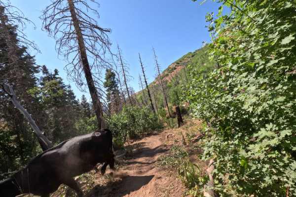
Bennie Creek - FS 8071
Bennie Creek is a 2.5-mile trail, which is part of the Payson/Mount Nebo trail system. It begins at a 3-way intersection with Loafer Mountain singletrack and hiking trails and heads west. The trail is entirely downhill when ridden in this direction. It terminates at FS 015 (paved road). This is a sh...
Learn more about Bennie Creek - FS 8071
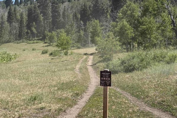
Jones Ranch North - FS 8123
The Jones Ranch North trail is a continuation of the Jones Ranch South trail in the Payson/Mount Nebo trail system. Jones Ranch North starts from the East end of Rock Spring near a stream. It runs 1.8 miles north before intersecting FS 015 (paved road). Caution: There is a cattle gate near the south...
Learn more about Jones Ranch North - FS 8123

Loafer Mountain - FS 8098
Loafer Mountain is a short trail in the Payson/Mount Nebo singletrack system. It's 1.1 miles long and starts in a small pull-off on FS 015 (paved road). It can be easy to miss if there are cars in the parking area. From here, the track drops down into the woods and travels north until it intersects ...
Learn more about Loafer Mountain - FS 8098
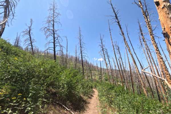
Sheepherder Hill - FS 8099
Sheepherder Hill is a difficult trail in the Payson/Mount Nebo trail system. It begins from the Sheepherder Trailhead parking lot, off of FS 015, and travels 5 miles southwest to Santaquin Meadows Road. The track is a steady climb of about 900 feet when ridden this direction. There's sometimes a lar...
Learn more about Sheepherder Hill - FS 8099
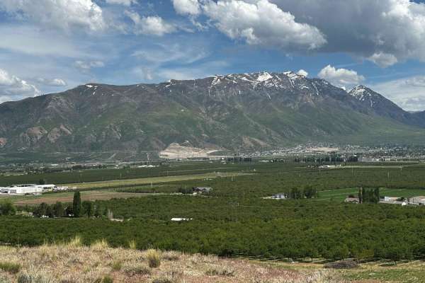
Dead End Overview
This trail has amazing 360-degree views, but ultimately you'll climb to a point where you won't be able to pass unless you're on a dirt bike or maybe a true off-road built side-by-side. Decent amount of climbing, and no gnarly obstacles per se, but high clearance is needed. If you do the loop it wil...
Learn more about Dead End Overview
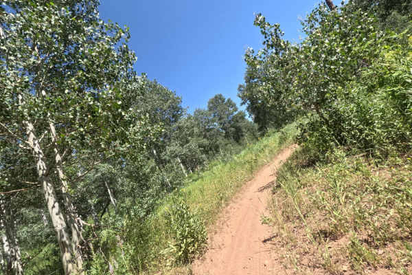
Jones Ranch South - FS 8123
Jones Ranch South is a short connecting trail in the Payson/Mount Nebo single-track system. This trail branches off from the east end of Rock Spring and continues traveling east for 0.7 miles. It finally ends in a field next to FS 015 (paved road). This field is frequently used for camping, so be aw...
Learn more about Jones Ranch South - FS 8123
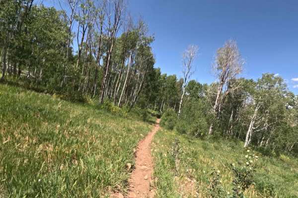
Shram Creek - FS 8124
Shram Creek trail is a singletrack located in the center of the Payson/Mt Nebo trail network. It begins from Sheepherder Trailhead and runs South for 2.4 miles. Along the way, you'll gain about 1,000 feet of elevation. This trail is flowy and fun to ride in either direction. It's well-maintained, wi...
Learn more about Shram Creek - FS 8124
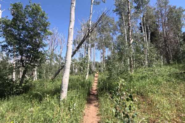
Frank Young Canyon - FS 8097
Frank Young Canyon Trail is a short trail near the middle of the Payson/Mount Nebo trail system. This trail breaks off from Rock Spring and runs South, where it ends at FS 015 (paved road). The total trail length is 1.3 miles, and you gain 300 feet of elevation traveling South. The track begins in a...
Learn more about Frank Young Canyon - FS 8097
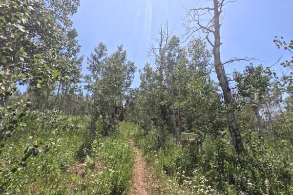
Lizard Lake - FS 8069
Lizard Lake is a short, 0.7-mile-long trail in the Payson/Mountt Nebo single track system. It travels South from Rock Spring trail and gains about 400 feet of elevation in this direction. The trail terminates in a field at FS 015 (paved road). This trail is primarily through woods, which are thick w...
Learn more about Lizard Lake - FS 8069
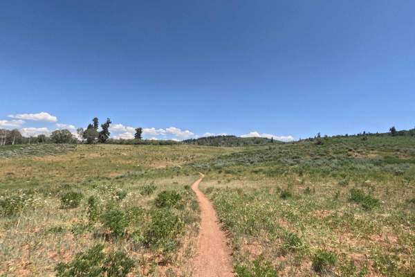
Rock Spring - FS 8101
Rock Spring is a 4.5-mile route that connects the majority of the single-track trails in the Payson/My Nebo area. This trail runs West to East, starting at FR 70014 (dirt road) and ending at FR 015 (paved road). The beginning can be difficult to spot, since it drops downhill from the forest road. Th...
Learn more about Rock Spring - FS 8101
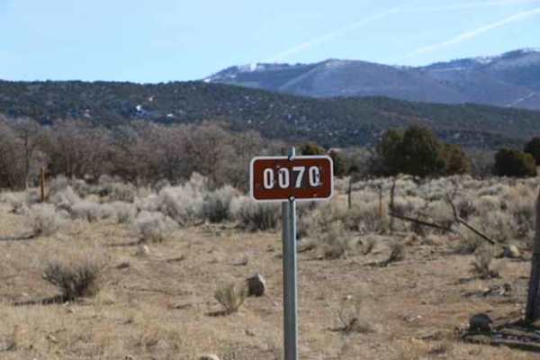
Lake Fork-Indianola - FS 50070
Easy, non-graded trail that travels through the Lake Fork Wildlife Management Area as well as the Manti La Sal Forest. This trail starts in Indianola and ends on Highway 89 or vice versa, depending on the direction of travel. The trail itself is easy going with no technical spots and is wide enough ...
Learn more about Lake Fork-Indianola - FS 50070
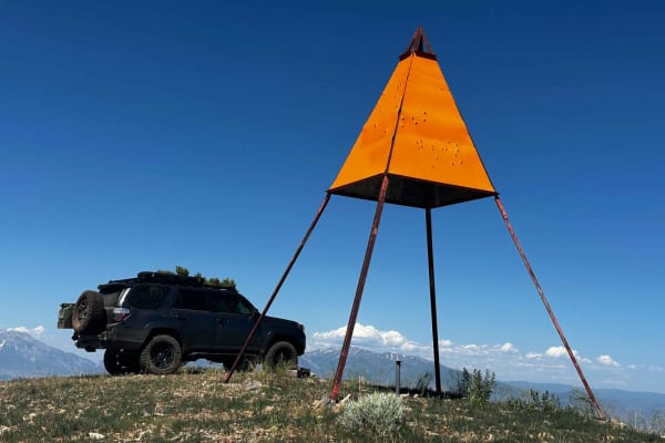
West Crest
The West Crest trail runs along the spine of West Mountain in southern Utah County. Hypothetically it can be done fully from the north to south (or vice versa) without having to do an out and back. Having tried this from various directions, logistically it is difficult to do due to a very steep sect...
Learn more about West Crest
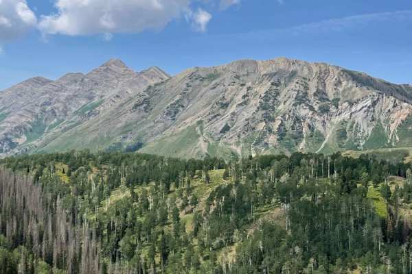
Twin Knolls/Big Swing
This is a VERY short out and back with fantastic views and an amazing swing at the trail end. Right as soon as you turn off the paved road the trail will fork. The left is a 4WD high clearance climb, the road to the right is way more mellow (think Subaru friendly) and will get you to the same dest...
Learn more about Twin Knolls/Big Swing
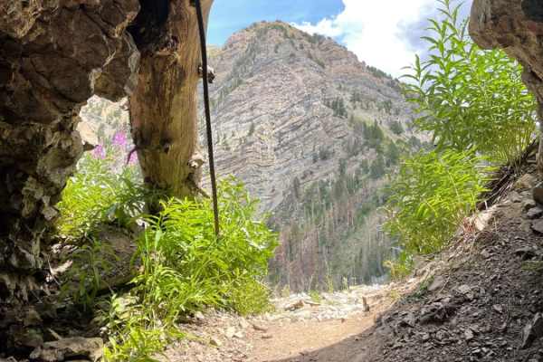
Mona Pole Road
This is a very fun and not too technical trail. This trail runs between the Nebo Scenic Loop and comes out just east of Mona, Utah. Mona has a gas station if needed. The trail can be driven in either direction. If you start in Mona, then you're doing more climbing and it's quite rocky for the first ...
Learn more about Mona Pole Road
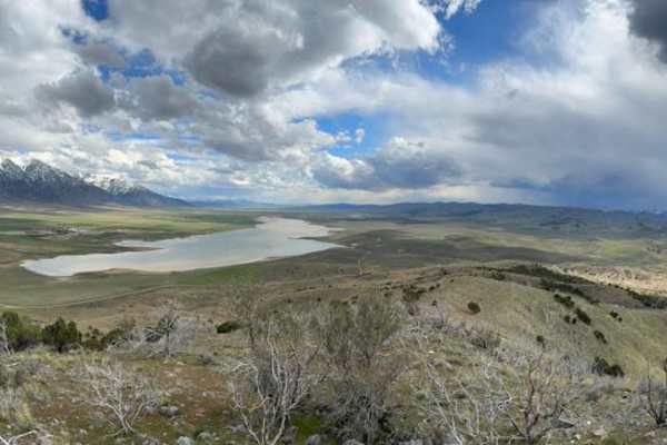
Mona Reservoir Overlook
Short and steep out and back with stunning views. You will pass through multiple parcels of privately owned land, however, they are not posted. There is a gate at the Artistic Stone Masonry lot (evident by the pallets of decorative stone) that is closed, but again, no sign is posted. Just be respect...
Learn more about Mona Reservoir Overlook
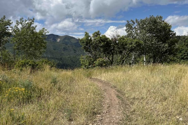
Left Fork Maple Canyon (8006)
Left Fork Maple Canyon branches from the Mapleton-Sawmill Hollow trail and travels west to the parking lot at Maple Diamond Fork. Riding this direction, the single-track trail is wide and primarily downhill. There's loose gravel and small rocks on the east side of the trail, which then turns into a ...
Learn more about Left Fork Maple Canyon (8006)
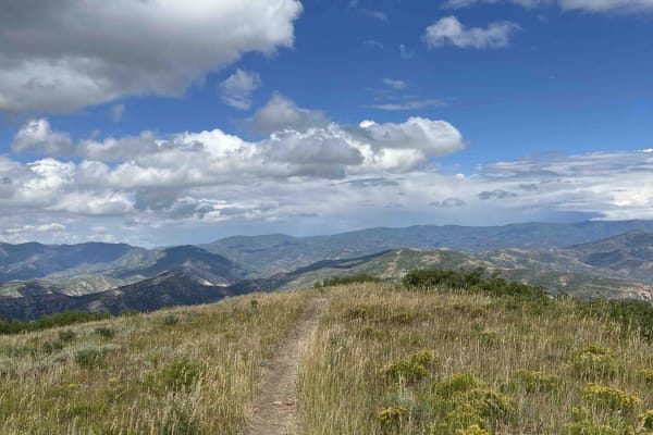
Little Diamond (8016)
Little Diamond Trail runs along a ridge south from the Mapleton-Sawmill Hollow Trail and eventually intersects with Diamond Fork Road. Heading towards the road, you'll drop ~2,300 feet in elevation. The beginning of the trail has a steep, washed-out section that would be difficult to ride up (north)...
Learn more about Little Diamond (8016)
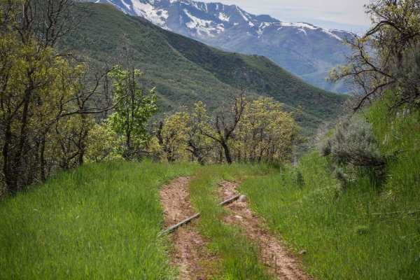
Long Hollow ATV
Long Hollow is a 7.3-mile-long ATV trail in the Uinta National Forest southeast of Provo, Utah. It connects to several other ATV trails in the area, including Teat Mountain, making for a fun day ride on quads. The south entrance is accessed from Long Hollow Road, which is a steep dirt turn-off from ...
Learn more about Long Hollow ATV
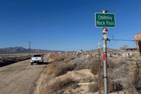
Chimney Rock Pass
Easy, non-graded trail that travels from Highway 68 to Little Moab. There are several different ways to access Little Moab, but this one seems to be the most direct route from Highway 68. Nothing technical, and a passenger car could easily make it on this route. There are several offshoots to explor...
Learn more about Chimney Rock Pass
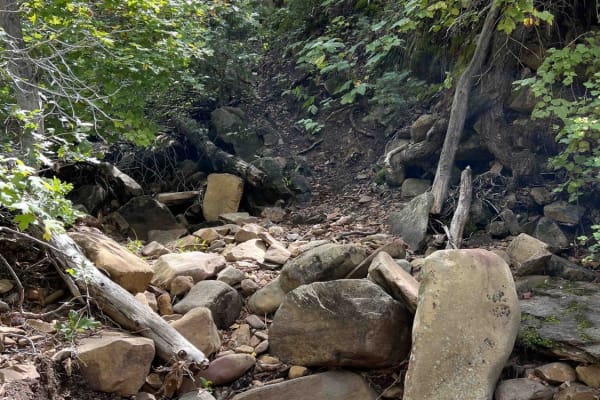
Right Fork Days Canyon (8004)
Right Fork Days Canyon splits off from Left Fork Days Canyon trail. This single-track trail dead ends after about a mile of riding. The entrance is easy to miss and doesn't have any signage. This route starts with a winding hill climb and then follows a stream. It is very difficult once in the strea...
Learn more about Right Fork Days Canyon (8004)
ATV trails near Elk Ridge, Utah
Explore ATV-friendly trails near you. These trails are accessible for vehicles up to 50 inches wide, perfect for ATVs and smaller off-road machines.
Dead End Overview
This trail has amazing 360-degree views, but ultimately you'll climb to a point where you won't be able to pass unless you're on a dirt bike or maybe a true off-road built side-by-side. Decent amount of climbing, and no gnarly obstacles per se, but high clearance is needed. If you do the loop it wil...
Learn more about Dead End Overview
Lake Fork-Indianola - FS 50070
Easy, non-graded trail that travels through the Lake Fork Wildlife Management Area as well as the Manti La Sal Forest. This trail starts in Indianola and ends on Highway 89 or vice versa, depending on the direction of travel. The trail itself is easy going with no technical spots and is wide enough ...
Learn more about Lake Fork-Indianola - FS 50070
West Crest
The West Crest trail runs along the spine of West Mountain in southern Utah County. Hypothetically it can be done fully from the north to south (or vice versa) without having to do an out and back. Having tried this from various directions, logistically it is difficult to do due to a very steep sect...
Learn more about West Crest
Twin Knolls/Big Swing
This is a VERY short out and back with fantastic views and an amazing swing at the trail end. Right as soon as you turn off the paved road the trail will fork. The left is a 4WD high clearance climb, the road to the right is way more mellow (think Subaru friendly) and will get you to the same dest...
Learn more about Twin Knolls/Big Swing
UTV/side-by-side trails near Elk Ridge, Utah
Find UTV and side-by-side trails near you. These trails accommodate vehicles up to 60 inches wide, ideal for UTVs, side-by-sides, and wider off-road rigs.
Dead End Overview
This trail has amazing 360-degree views, but ultimately you'll climb to a point where you won't be able to pass unless you're on a dirt bike or maybe a true off-road built side-by-side. Decent amount of climbing, and no gnarly obstacles per se, but high clearance is needed. If you do the loop it wil...
Learn more about Dead End Overview
Lake Fork-Indianola - FS 50070
Easy, non-graded trail that travels through the Lake Fork Wildlife Management Area as well as the Manti La Sal Forest. This trail starts in Indianola and ends on Highway 89 or vice versa, depending on the direction of travel. The trail itself is easy going with no technical spots and is wide enough ...
Learn more about Lake Fork-Indianola - FS 50070
West Crest
The West Crest trail runs along the spine of West Mountain in southern Utah County. Hypothetically it can be done fully from the north to south (or vice versa) without having to do an out and back. Having tried this from various directions, logistically it is difficult to do due to a very steep sect...
Learn more about West Crest
Twin Knolls/Big Swing
This is a VERY short out and back with fantastic views and an amazing swing at the trail end. Right as soon as you turn off the paved road the trail will fork. The left is a 4WD high clearance climb, the road to the right is way more mellow (think Subaru friendly) and will get you to the same dest...
Learn more about Twin Knolls/Big Swing
The onX Offroad Difference
onX Offroad combines trail photos, descriptions, difficulty ratings, width restrictions, seasonality, and more in a user-friendly interface. Available on all devices, with offline access and full compatibility with CarPlay and Android Auto. Discover what you're missing today!
Open Trail Map