
Dirt Bike Trails
Near Edmonton, Kentucky
Explore All Dirt Bike Trails Near Edmonton, Kentucky
Dirt Bike Trails Near Edmonton, Kentucky
Discover the best dirt bike trails near you. Browse trail maps, check difficulty ratings, and find your next adventure — whether you're looking for a quick ride or an all-day expedition.
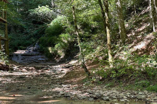
Waterfall Trail
This section of the trail takes you back to a scenic waterfall. The trail winds around a ridge with some tight turns but is not technical in nature. The waterfall is a cascade type that you can climb and is a great place to take photos or eat a light lunch.
Learn more about Waterfall Trail
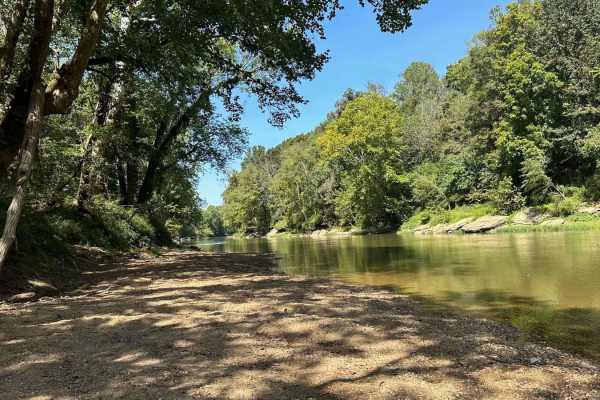
River Beach Access
The trail follows along the edge of a field before dropping down by the water's edge. You may encounter a few small mud holes on your way. The beach is rocky and big enough to fit several vehicles. There are optional steep climbs to return to the main trail if you want a challenge.
Learn more about River Beach Access
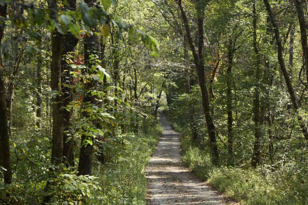
Ugly Creek - Mammoth Cave NP
Ugly Creek Road is a 3.5-mile one-way trail that is located within Mammoth Cave National Park. The trail begins off Green River Ferry Road (1352) and ends on Dennison Ferry Road. The trail can be run in either direction; however, there is a possible impassable water crossing closer to the Green Rive...
Learn more about Ugly Creek - Mammoth Cave NP
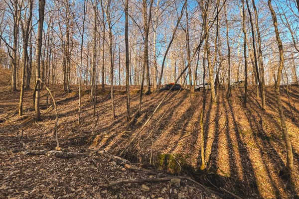
Hance Hollow Road - Macon County Tour
Hance Hollow Road is an old county road that is now rarely used. It's a steady steep descent or climb on a narrow road with tight switchbacks. It is located in a heavily wooded area in northeastern middle Tennessee on the Macon County Tour, or M.C.T. In the fall, you'll find colorful foliage in a ca...
Learn more about Hance Hollow Road - Macon County Tour
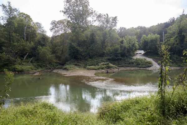
Houchin Ferry - Mammoth Cave NP
Houchin Ferry Road is a 5-mile out-and-back trail that is located within Mammoth Cave National Park. The trail begins off Ollie Road and ends along the Green River. There is no longer a possible way to cross the river at the end of the trail so you must turn back. Along the trail are a few parking a...
Learn more about Houchin Ferry - Mammoth Cave NP
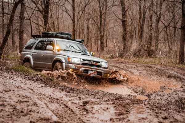
Shiloh's Playground
Shiloh's Playground consists of multiple muddy lines through some tight woods. It can be done in full-size 4x4s, SxS, or dirt bikes. If unloading on a trailer, there is a dirt lot across the paved road for parking/unloading. From this lot, you can also access the creek and drive through to get to sm...
Learn more about Shiloh's Playground
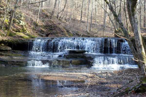
Long Fork Waterfall
Woodard Road is not a technical route;it is an easy gravel road leading down to a shallow creek crossing that includes a waterfall. The creek is shallow but the rock bottom can be slick. You can drive across it and continue further down the road or just turn around and head back out.
Learn more about Long Fork Waterfall
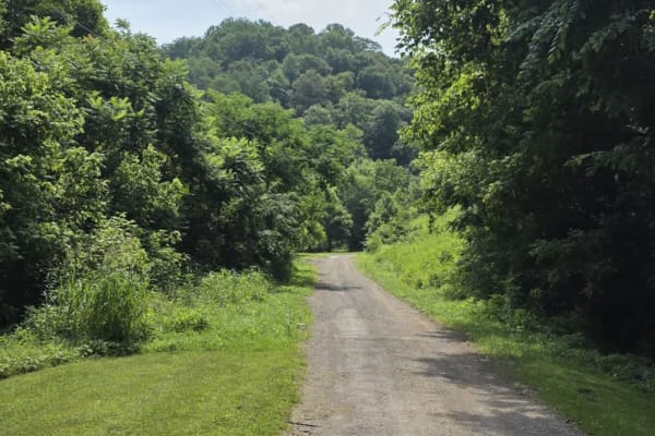
Dry Branch to Dixon Creek Road - Macon County Tour
This stretch of the iconic Macon County Tour offers a scenic drive through gently rolling hills and a patchwork of open farmland, blending rural charm with a few rugged elements. The road is primarily gravel, interrupted by a very brief paved connector that leads into a striking elevation change--co...
Learn more about Dry Branch to Dixon Creek Road - Macon County Tour
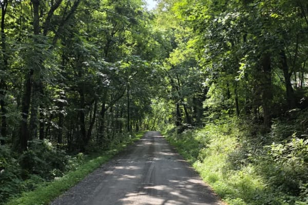
Sullivan Hollow Road - Macon County Tour
This scenic off-road trail, part of the Macon County Tour (MCT), offers an easy yet engaging drive through Tennessee's rolling backcountry. While the route follows a graded path, multiple washouts and narrow stretches without shoulders--some with steep drop-offs--add a layer of caution to the otherw...
Learn more about Sullivan Hollow Road - Macon County Tour
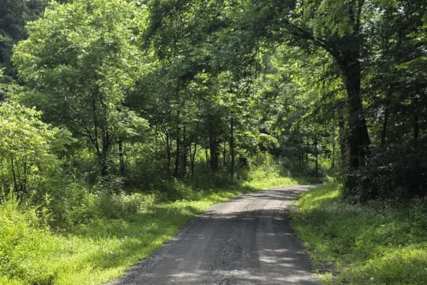
Gravley Hill Road - Macon County Tour
Winding through the gentle terrain of northern Tennessee, this graded gravel trail marks the starting point of the iconic Macon County Tour (MCT), a 100+ mile off-road journey that explores the rolling hills and hardwood forests of Tennessee and Kentucky. While generally easy and well-maintained, th...
Learn more about Gravley Hill Road - Macon County Tour
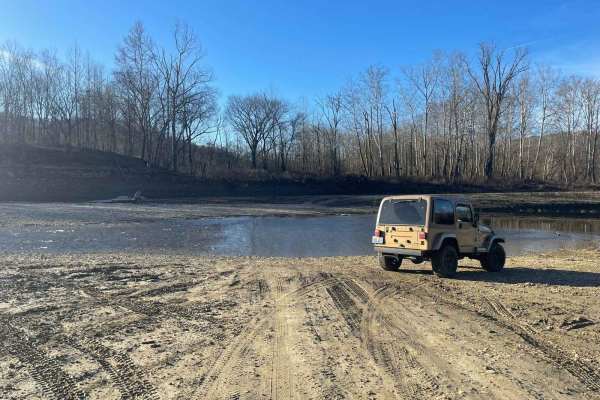
Oil Center WMA Main Via Ringgold Road
Note that this trail is impassable during high pool seasons of Lake Cumberland, from around March to October. Exercise caution and observe the water level. This route provides access through one of four roads to the Lake Cumberland WMA at Oil Center. Please keep in mind that this area is maintained ...
Learn more about Oil Center WMA Main Via Ringgold Road
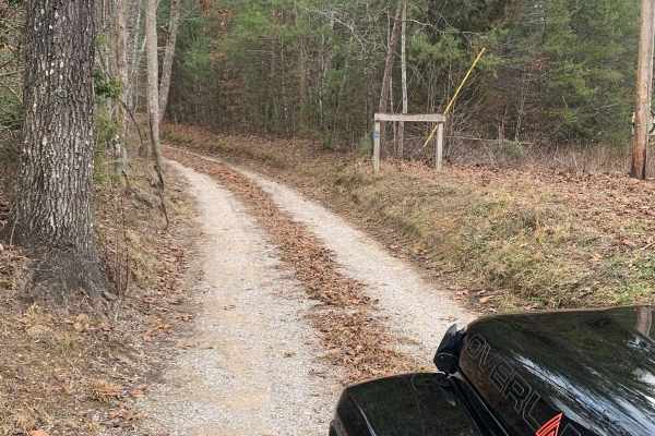
Bandy Creek Trek
This is a combination of dirt, gravel, and single-track in-the-woods roads. There really aren't a lot of difficult obstacles to make a note of other than a few areas that are washed out on Duncan Hollow Road. We had cell service off and on during this drive (Verizon). There weren't any great views a...
Learn more about Bandy Creek Trek
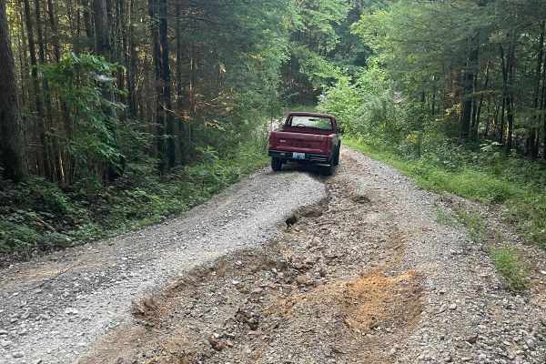
Bear Creek Falls (5138)
Access to a beautiful waterfall into the Rockcastle River. Characteristics of an old Forest Service Road. Large gravel, dirt, and shallow water crossings. Some washouts around one foot deep. Beautiful drive through a less-trafficked area of Daniel Boone National Forest. There is a possibility of dow...
Learn more about Bear Creek Falls (5138)
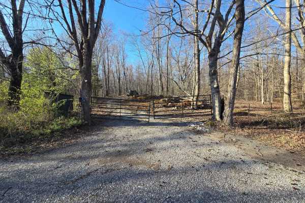
GMP Pavilion Road 1
The “Back Gate” entrance at Golden Mountain Offroad Park is a gravel access road that leads directly to the intersection of the main park road and Pavilion Road 2. This short, easy drive is primarily used by tow rigs and campers accessing the RV areas, making it well-maintained and suitable for all ...
Learn more about GMP Pavilion Road 1
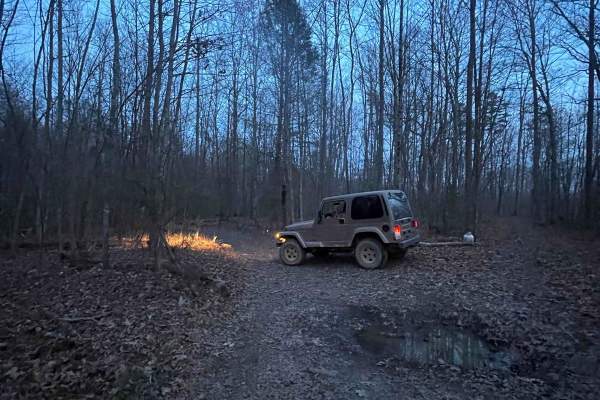
4005A
This trail is more like the old school Appalachian four wheeling trails than most Forest Service roads. There's no gravel, some tight cuts between trees, and a few mud holes. If you're trying to avoid scratches, then stay away--lots of low hanging limbs and branches. There are various offshoots that...
Learn more about 4005A
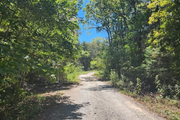
Cedar Forest Road
This trail is only open to vehicles that are registered and street legal. If your vehicle is not registered or street legal, do not attempt this trail. If you're up for some light trail riding under a canopy provided by beautiful, mature trees, Cedar Forest Road in the Cedars of Lebanon State Forest...
Learn more about Cedar Forest Road
ATV trails near Edmonton, Kentucky
Explore ATV-friendly trails near you. These trails are accessible for vehicles up to 50 inches wide, perfect for ATVs and smaller off-road machines.
Waterfall Trail
This section of the trail takes you back to a scenic waterfall. The trail winds around a ridge with some tight turns but is not technical in nature. The waterfall is a cascade type that you can climb and is a great place to take photos or eat a light lunch.
Learn more about Waterfall Trail
River Beach Access
The trail follows along the edge of a field before dropping down by the water's edge. You may encounter a few small mud holes on your way. The beach is rocky and big enough to fit several vehicles. There are optional steep climbs to return to the main trail if you want a challenge.
Learn more about River Beach Access
Ugly Creek - Mammoth Cave NP
Ugly Creek Road is a 3.5-mile one-way trail that is located within Mammoth Cave National Park. The trail begins off Green River Ferry Road (1352) and ends on Dennison Ferry Road. The trail can be run in either direction; however, there is a possible impassable water crossing closer to the Green Rive...
Learn more about Ugly Creek - Mammoth Cave NP
Hance Hollow Road - Macon County Tour
Hance Hollow Road is an old county road that is now rarely used. It's a steady steep descent or climb on a narrow road with tight switchbacks. It is located in a heavily wooded area in northeastern middle Tennessee on the Macon County Tour, or M.C.T. In the fall, you'll find colorful foliage in a ca...
Learn more about Hance Hollow Road - Macon County Tour
UTV/side-by-side trails near Edmonton, Kentucky
Find UTV and side-by-side trails near you. These trails accommodate vehicles up to 60 inches wide, ideal for UTVs, side-by-sides, and wider off-road rigs.
Waterfall Trail
This section of the trail takes you back to a scenic waterfall. The trail winds around a ridge with some tight turns but is not technical in nature. The waterfall is a cascade type that you can climb and is a great place to take photos or eat a light lunch.
Learn more about Waterfall Trail
River Beach Access
The trail follows along the edge of a field before dropping down by the water's edge. You may encounter a few small mud holes on your way. The beach is rocky and big enough to fit several vehicles. There are optional steep climbs to return to the main trail if you want a challenge.
Learn more about River Beach Access
Ugly Creek - Mammoth Cave NP
Ugly Creek Road is a 3.5-mile one-way trail that is located within Mammoth Cave National Park. The trail begins off Green River Ferry Road (1352) and ends on Dennison Ferry Road. The trail can be run in either direction; however, there is a possible impassable water crossing closer to the Green Rive...
Learn more about Ugly Creek - Mammoth Cave NP
Hance Hollow Road - Macon County Tour
Hance Hollow Road is an old county road that is now rarely used. It's a steady steep descent or climb on a narrow road with tight switchbacks. It is located in a heavily wooded area in northeastern middle Tennessee on the Macon County Tour, or M.C.T. In the fall, you'll find colorful foliage in a ca...
Learn more about Hance Hollow Road - Macon County Tour
The onX Offroad Difference
onX Offroad combines trail photos, descriptions, difficulty ratings, width restrictions, seasonality, and more in a user-friendly interface. Available on all devices, with offline access and full compatibility with CarPlay and Android Auto. Discover what you're missing today!
Open Trail Map