
Dirt Bike Trails
Near Deschutes River Woods, Oregon
Explore All Dirt Bike Trails Near Deschutes River Woods, Oregon
Dirt Bike Trails Near Deschutes River Woods, Oregon
Discover the best dirt bike trails near you. Browse trail maps, check difficulty ratings, and find your next adventure — whether you're looking for a quick ride or an all-day expedition.
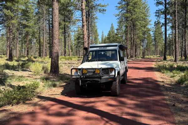
FS 4604
FS 4604 begins at the back of the trailhead parking area and ends near the middle of the Big Burn Road. The trail is smooth for most of the trail besides a 25-yard stretch of a small rocky road in the middle that requires 4WD and potentially high clearance depending on weather conditions. This trail...
Learn more about FS 4604
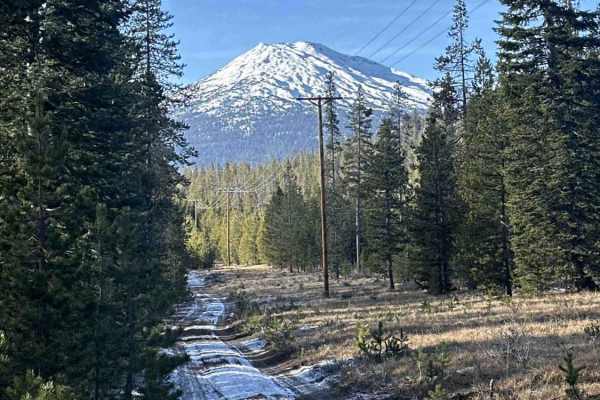
FS 4100-490
This trail follows a Forest Service road beneath power lines and offers a wide range of obstacles, including easy to intermediate whoops, mild rock gardens, and manageable hill climbs and descents. Terrain varies from soft to hard dirt depending on the season, with a mix of straight sections and mor...
Learn more about FS 4100-490
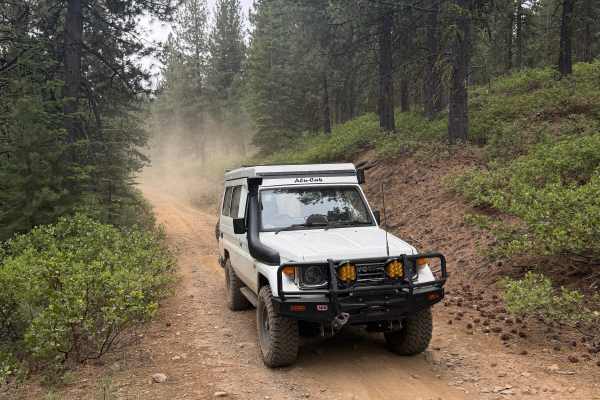
Swede Ridge Road
Swede Ridge Road is a connector from Big Burn Road to Cascade Lakes Highway. It is intertwined with plenty of Meisner Snow Park trails for winter sports, as well as some camping spots along the way. The road is very easy, and any vehicle should be capable of driving it when the weather permits.
Learn more about Swede Ridge Road
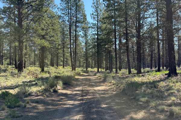
Big Burn Road
Big Burn Road is one of the primary routes between Cascade Lakes Highway and NW Skyliners Road. It is an easy trail with no obstacles and is mainly used as an entry point to smaller surrounding trails. Phil’s Trailhead bike paths zig-zag across Big Burn Road, so be cautious of cyclists. The trail is...
Learn more about Big Burn Road

4609000
This trail begins as a well-maintained road but progressively becomes rougher, with increasingly rocky terrain, deep undulations, and sections where a 4x4 may be necessary. This route suits high-clearance 4x4 vehicles, SxSs, and ATVs. One particularly rough section comes up suddenly near a designate...
Learn more about 4609000
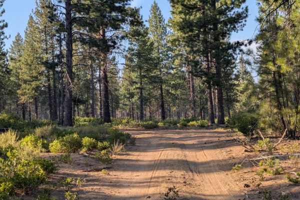
FS 4601322
This fun little trail is user-maintained and consists primarily of sand and silt, with some bumpy sections and plenty of curves along the route. The changing surface and winding layout make it an enjoyable trail to explore. Numerous bicycle trails and tracks crisscross the area, offering plenty of c...
Learn more about FS 4601322
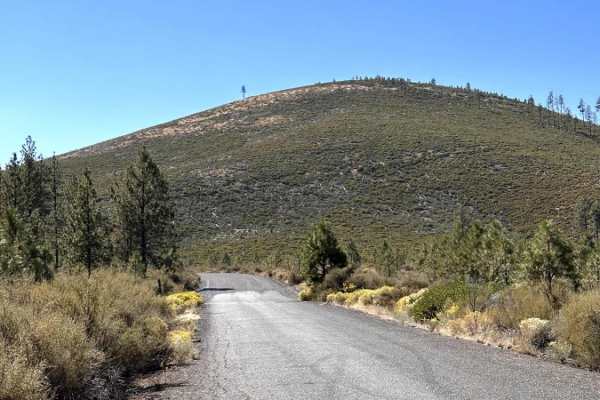
Bessie to Lava
Easy-going connector trail between Bessie Butte in the China Hat area, to the Lava Cast Forest. During the summer months, this is a beautiful, relatively tame way to get between these two areas. It's a bit narrow in places, depending on growth. But, with relatively low traffic, it's a great spot to ...
Learn more about Bessie to Lava
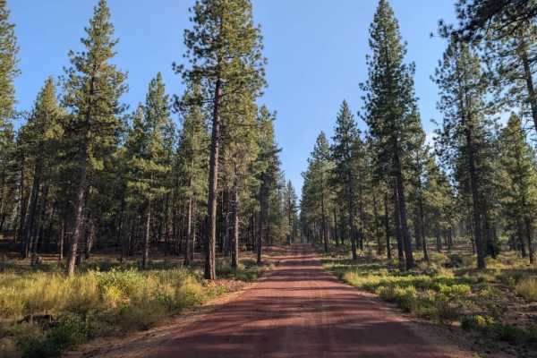
FS 4601300
This well-maintained, double-wide forest road begins at the main road with a red gravel surface and provides easy access through the surrounding forest. The road eventually reaches a gate that is currently open and appears to be seasonally accessible. Beyond the gate, the route leads toward a large ...
Learn more about FS 4601300

FS 4601310
The road itself is generally enjoyable to travel but includes frequent man-made speed humps spaced every few hundred meters. Because the road is smooth and scenic in places, it can be easy to pick up more speed than expected, so use caution when approaching these features. Cyclists are common throug...
Learn more about FS 4601310
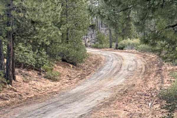
Forest Road 4613-000
This starts out as a basic forest service road. wide, flat, easy uphills. It is a bit choppy at first, but smooths out over time. As it moves along, it gets a little narrower but is still more than wide enough for full-size cars/trucks. There aren't any major obstacles of concern under normal condit...
Learn more about Forest Road 4613-000
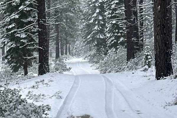
Forest Road 4130-000
This trail consists of dirt, mud, and gravel during spring, summer, and fall, with snow covering portions of the route at times in winter. Terrain is generally uneven and basic, with occasional deeper ruts, uphill sections, and minor washouts. Low-clearance 4WD and AWD vehicles may have difficulty i...
Learn more about Forest Road 4130-000

FS 4612220
This user-maintained sandy, silty track is short but offers an exciting, technical ride, with several sections where the road has been washed away, exposing rocky terrain. The route requires a high-clearance vehicle, and some areas are particularly challenging during the rainy season, when water dam...
Learn more about FS 4612220
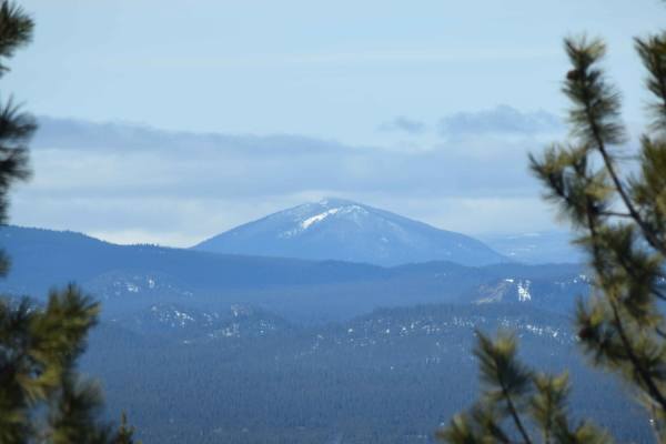
Lava Cast Forest Trail
The Lava Cast Forest Trail is an easy, scenic unpaved route perfect for beginners, stock four-wheel-drive vehicles, and high-clearance rigs looking for a memorable off-road detour near Sunriver, Oregon. Spanning approximately 12.3 miles, this trail takes adventurers through a beautiful volcanic land...
Learn more about Lava Cast Forest Trail
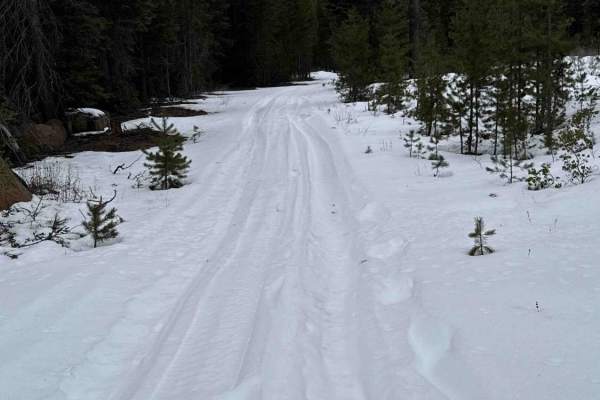
FS 4133-000
This is a pretty easy, basic, forest service road. You will encounter mostly dirt, but it could be muddy and snow-covered at times, depending on the time of year. As with any Forest Service road or trail period, you should always be cautious of downed trees on the road. This is a pretty easy trail, ...
Learn more about FS 4133-000
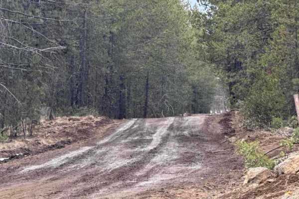
FS 4140-000
This is a pretty fun Forest Service road. Mostly dirt with some small, fairly easy rock gardens, but they are very passable for all ages and experience levels. Will encounter mud after heavy rains and some snow in the winter months. Roads are rutted at times, and as always, be cautious and prepared ...
Learn more about FS 4140-000
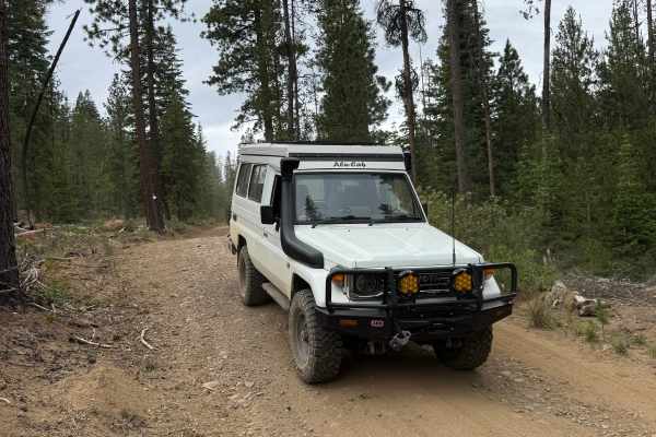
Big Spring Burn Road
A short parallel sister to the Big Burn Road north of here. The trail is predominantly used by mountain bikers but can also be utilized as a connector from Swede Ridge Road to Cascade Lakes Highway. It has some bumpy sections depending on the weather, but it is a very easy trail.
Learn more about Big Spring Burn Road
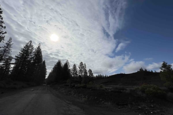
Lava Cast Forest 9720
Lava Cast forest road 9720 is a 8.5 mile gravel road that winds through the Deschutes National Forest eventually bringing you to the Lava Cast Forest loop trail. This trail is a one-mile loop that leads you through the 6,000-year-old lava flows that once took over this area. The facilities here are ...
Learn more about Lava Cast Forest 9720
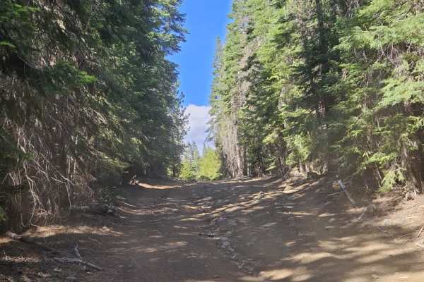
FS 4180500
This trail is narrow, sandy, and rocky, with several technical sections where low range is recommended. While much of the trail consists of sandy terrain, there are approximately six rocky sections where low range is definitely required. The trail climbs to the top of the mountain, rewarding travele...
Learn more about FS 4180500
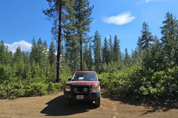
FS 4100110
A beautiful trail through dense forest with a forest floor covered in pine needles and pine cones beneath towering pine trees. There are some rocky sections, particularly where the trail crosses ATV and SxS routes. Expect a few off-camber sections throughout the route.
Trees have been cleared from t...
Learn more about FS 4100110
Lava Top Butte Caves
This trail leads to the closest point to Lava Top Butte. There are some lava tubes nearby that are worth checking out. There are several caves along a straight line due north of 43.87986, -121.2113. This is not a maintained fire road. It is best-attempted mid to late spring to allow ample snowmelt.
Learn more about Lava Top Butte Caves
ATV trails near Deschutes River Woods, Oregon
Explore ATV-friendly trails near you. These trails are accessible for vehicles up to 50 inches wide, perfect for ATVs and smaller off-road machines.
FS 4604
FS 4604 begins at the back of the trailhead parking area and ends near the middle of the Big Burn Road. The trail is smooth for most of the trail besides a 25-yard stretch of a small rocky road in the middle that requires 4WD and potentially high clearance depending on weather conditions. This trail...
Learn more about FS 4604
FS 4100-490
This trail follows a Forest Service road beneath power lines and offers a wide range of obstacles, including easy to intermediate whoops, mild rock gardens, and manageable hill climbs and descents. Terrain varies from soft to hard dirt depending on the season, with a mix of straight sections and mor...
Learn more about FS 4100-490
Swede Ridge Road
Swede Ridge Road is a connector from Big Burn Road to Cascade Lakes Highway. It is intertwined with plenty of Meisner Snow Park trails for winter sports, as well as some camping spots along the way. The road is very easy, and any vehicle should be capable of driving it when the weather permits.
Learn more about Swede Ridge Road
Big Burn Road
Big Burn Road is one of the primary routes between Cascade Lakes Highway and NW Skyliners Road. It is an easy trail with no obstacles and is mainly used as an entry point to smaller surrounding trails. Phil’s Trailhead bike paths zig-zag across Big Burn Road, so be cautious of cyclists. The trail is...
Learn more about Big Burn Road
UTV/side-by-side trails near Deschutes River Woods, Oregon
Find UTV and side-by-side trails near you. These trails accommodate vehicles up to 60 inches wide, ideal for UTVs, side-by-sides, and wider off-road rigs.
FS 4604
FS 4604 begins at the back of the trailhead parking area and ends near the middle of the Big Burn Road. The trail is smooth for most of the trail besides a 25-yard stretch of a small rocky road in the middle that requires 4WD and potentially high clearance depending on weather conditions. This trail...
Learn more about FS 4604
FS 4100-490
This trail follows a Forest Service road beneath power lines and offers a wide range of obstacles, including easy to intermediate whoops, mild rock gardens, and manageable hill climbs and descents. Terrain varies from soft to hard dirt depending on the season, with a mix of straight sections and mor...
Learn more about FS 4100-490
Swede Ridge Road
Swede Ridge Road is a connector from Big Burn Road to Cascade Lakes Highway. It is intertwined with plenty of Meisner Snow Park trails for winter sports, as well as some camping spots along the way. The road is very easy, and any vehicle should be capable of driving it when the weather permits.
Learn more about Swede Ridge Road
Big Burn Road
Big Burn Road is one of the primary routes between Cascade Lakes Highway and NW Skyliners Road. It is an easy trail with no obstacles and is mainly used as an entry point to smaller surrounding trails. Phil’s Trailhead bike paths zig-zag across Big Burn Road, so be cautious of cyclists. The trail is...
Learn more about Big Burn Road
The onX Offroad Difference
onX Offroad combines trail photos, descriptions, difficulty ratings, width restrictions, seasonality, and more in a user-friendly interface. Available on all devices, with offline access and full compatibility with CarPlay and Android Auto. Discover what you're missing today!
Open Trail Map