
Dirt Bike Trails
Near Blue Mountain, Mississippi
Explore All Dirt Bike Trails Near Blue Mountain, Mississippi
Dirt Bike Trails Near Blue Mountain, Mississippi
Discover the best dirt bike trails near you. Browse trail maps, check difficulty ratings, and find your next adventure — whether you're looking for a quick ride or an all-day expedition.
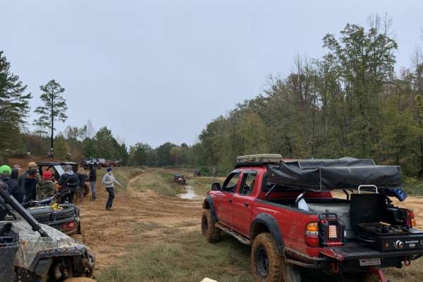
WaterFall Alley
WaterFall Alley is an exciting off-road loop designed for riders looking to test their skills against slick elevation changes and muddy terrain within the Barnyard Mud Boggers (BMB) off-road park. Located in Fulton, Mississippi, along the Tombigbee River, this park spans over 700 acres of prime mud-...
Learn more about WaterFall Alley
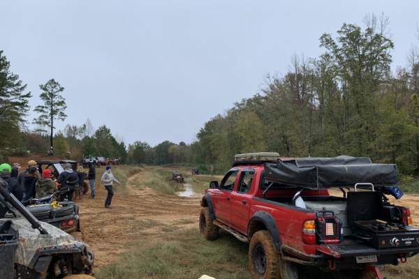
The Gutter
The Gutter is a 1.3-mile off-road loop within the Barnyard Mud Boggers (BMB) Offroad Park near Fulton, Mississippi. Serving as an introduction to the 700-acre park, the trail winds through a dense hardwood forest with mild elevation changes between 290 and 402 feet, connecting with various other tra...
Learn more about The Gutter
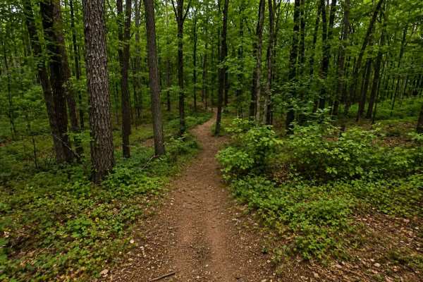
Thompson Creek Trail
A nice winding trail with a few obstacles along the way. Beautiful stunning scenery and very peaceful. This is a family friendly trail for all riders. Sardis lake is accessible from many of the side spur trails that lead to the beaches and lake bottoms. Riders of all types of machines are required t...
Learn more about Thompson Creek Trail
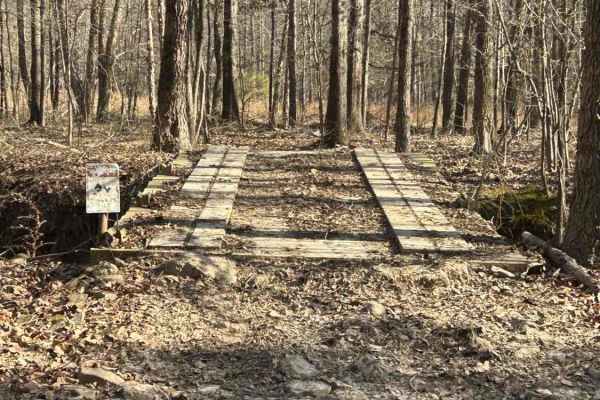
Shoals Lane
This is a smooth and easy trail with some small mud holes. The trail has a wooden bridge that was designed and built by a 10-year-old child who won a science fair with it. A little open field riding for about 100 yards, and then it returns into the woods on a nice, smooth, winding trail.
Learn more about Shoals Lane
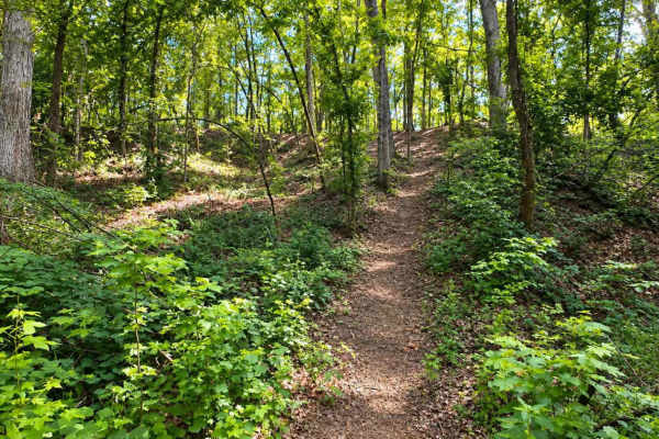
Splinter Hill Trail
This trail is for experienced riders. Coming into the woods from the field, there is a small creek to cross. Very manageable, but use caution on the washouts. The big hill itself has a steep incline that bends to the right and back to the left until the top of the hill is reached. The rest of the tr...
Learn more about Splinter Hill Trail
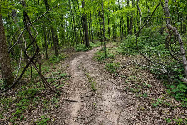
Billy's Bypass
A super fun trail that winds through the woods and up and down some small rolling hills. The trails are clean with not many obstacles. There is a creek to cross but it's very manageable. This trail can be ridden at a quick speed or at a slow pace. This is a beautiful trail through the forest that's...
Learn more about Billy's Bypass
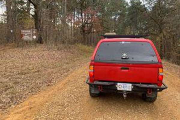
Witch Dance Hill
Witch Dance Hill is a scenic, 4.6-mile gravel drive through the Tombigbee National Forest in Mississippi. The well-maintained, flat gravel surface is rated 1 for technical difficulty, making it fully accessible to standard two-wheel-drive vehicles under normal conditions. Winding eastward from Count...
Learn more about Witch Dance Hill

Hickahala Creek Trail
Start off in a wide area outside the parking area. From there, take the trail riding along the creek banks. It can be muddy at times, but it's hard ground. About half a mile down the trail, the trail becomes sandy. There are 2 small ditches to cross with very shallow water running in them. The ditch...
Learn more about Hickahala Creek Trail
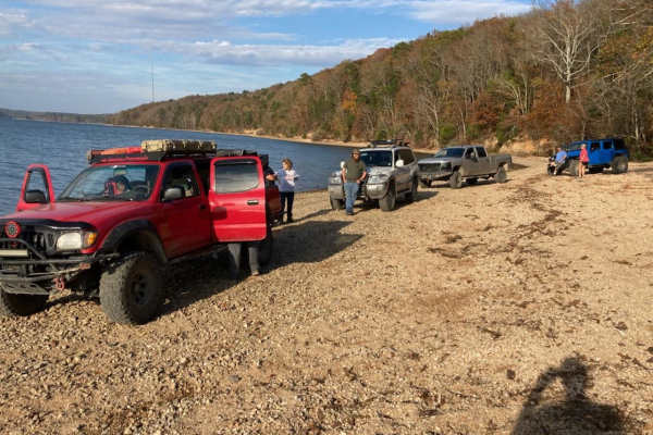
Pebble Beach
Pebble Beach is an exciting, moderately challenging trail perfect for drivers of capable four-wheel-drive vehicles and SxSs looking to test their skills and rigs on a mix of rugged terrain and water obstacles. Spanning approximately 6.2 miles, this route begins with a technical, high-clearance secti...
Learn more about Pebble Beach

Road 105
Road 105 is an ideal scenic route for novice off-roaders and those seeking a low-stress dirt road drive through the dense forests of northwest Alabama near Pickwick Lake. The route provides a perfect training ground for inexperienced drivers to build confidence behind the wheel while navigating a mo...
Learn more about Road 105
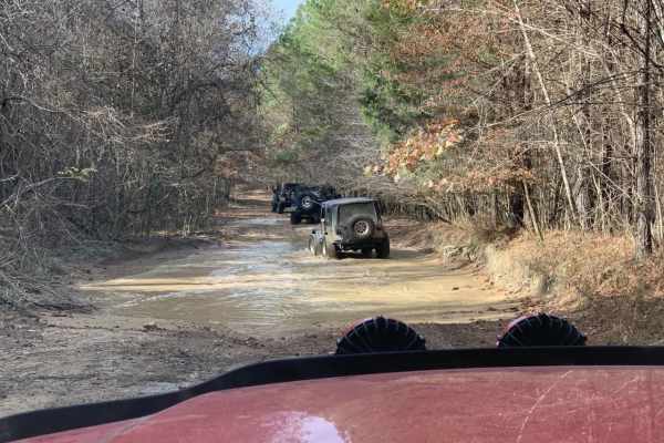
Austin Hollow
Austin Hollow is an exciting, short spur trail designed for intermediate offroaders looking to test their vehicles against wet, muddy terrain on their way to a beautiful waterfall. Branching off Hitchcock Lane near the Rainbow Falls Loop, this route spans just over a half-mile and descends roughly 4...
Learn more about Austin Hollow
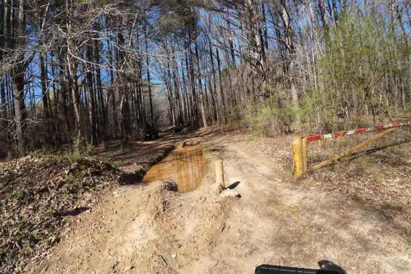
South Lake Trail
A challenging trail on the south side of Arkabutla Lake in Mississippi. This trail is mostly in wooded areas and some lake bottom areas. This is a challenging trail due to all of the deep ruts, water crossings, and some washouts. Inexperienced riders should ride with experienced riders to help guide...
Learn more about South Lake Trail

Rainbow Falls Loop
Rainbow Falls Loop is a moderately challenging, 6.9-mile off-road trail in northwest Alabama's Lauderdale Wildlife Management Area. The route starts with approximately one mile of maintained gravel road before transitioning to rugged dirt paths with deep ruts, mud, and seasonal water pooling.
The t...
Learn more about Rainbow Falls Loop
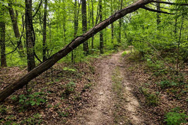
Bushwhacker Loop
A beautiful scenic trail that is mostly smooth with few obstructions. This is the ideal trail for beginners and experienced riders. Lots of trees of all sorts and some open areas with brush on both sides of the trail. Take this trail for a nice relaxing ride through the woods with great places to st...
Learn more about Bushwhacker Loop
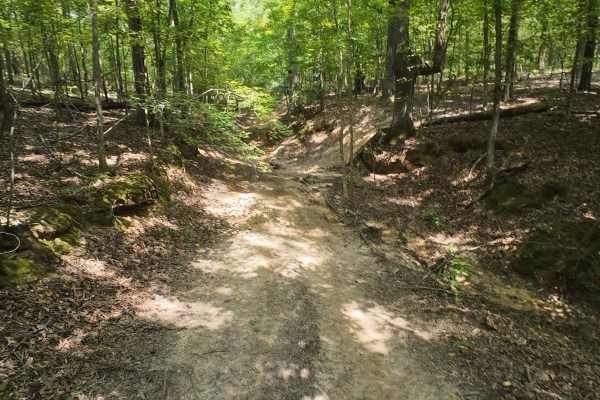
SIP Off Road Trail
The trail starts in the woods, riding alongside a small creek. The trail then turns into rolling hills that are easy and some that are technical with a steep grade. Three of the hills have slight washouts or ruts. Patience is important, and you must be mindful when approaching those hazards. The tra...
Learn more about SIP Off Road Trail
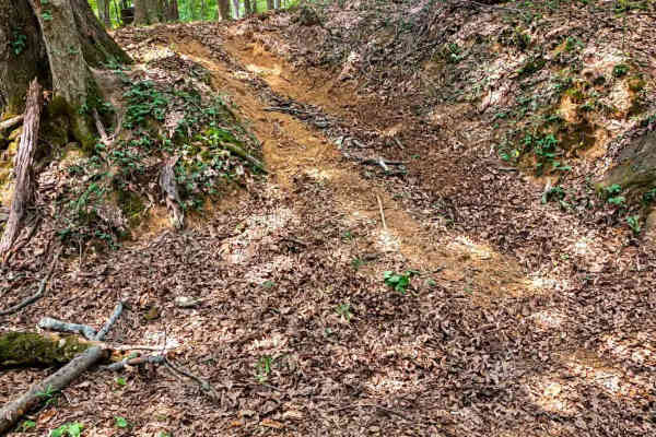
Old Ruins Trail
This is a beautiful trail with plenty of exploration. There's an old ruined homestead that has many rooms with rotted-out floors and a few small buildings behind it. The trail takes you up a small, steep hill and bends to the right before going down another small hill. The trail comes out to the lak...
Learn more about Old Ruins Trail
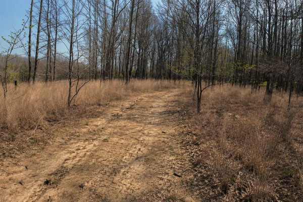
Ark Island Trail
This is a fairly easy trail with not many obstacles. There are a few small mudholes with easy bypasses around them and some minor washouts. The trail is a nice casual trail for all levels of riders. This is trail is lots of fun going in and out of the wooded areas. Riders can ride this trail fairly...
Learn more about Ark Island Trail
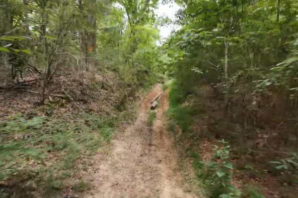
Wheeler Woods Trail
A good, fun-filled adventure trail for semi-experienced and experienced riders. This trail offers rolling hills, mud holes, washouts, and ditch crossings. Fairly easy trail for seasoned riders with a few obstacles along the way. Riders can make a slow, casual ride or can ride fast over most of the ...
Learn more about Wheeler Woods Trail
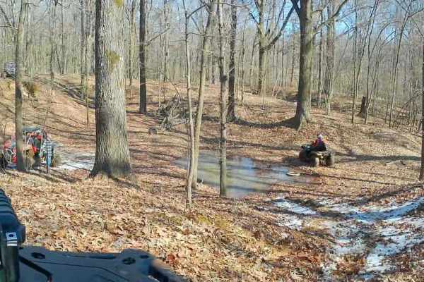
Crawford's Point Trail
The trail starts at the Pleasant Hill Public Use Area. Follow the boat ramp to the end where there's a dirt trail and go south. Follow it around until you see the trail veering to the left. You will enter the woods from there on a good trail and follow it through rolling hills, small ditch crossings...
Learn more about Crawford's Point Trail
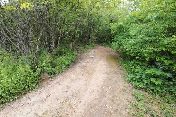
Burnett Trail
A trail mostly in the woods with some rolling hills, a few washouts, a steep hill with a washout, and a ditch crossing. It's a fun trail that's manageable for experienced riders. Beginners need to be accompanied by experienced riders because of the washouts. Lots of beautiful scenery with some over...
Learn more about Burnett Trail
ATV trails near Blue Mountain, Mississippi
Explore ATV-friendly trails near you. These trails are accessible for vehicles up to 50 inches wide, perfect for ATVs and smaller off-road machines.
WaterFall Alley
WaterFall Alley is an exciting off-road loop designed for riders looking to test their skills against slick elevation changes and muddy terrain within the Barnyard Mud Boggers (BMB) off-road park. Located in Fulton, Mississippi, along the Tombigbee River, this park spans over 700 acres of prime mud-...
Learn more about WaterFall Alley
The Gutter
The Gutter is a 1.3-mile off-road loop within the Barnyard Mud Boggers (BMB) Offroad Park near Fulton, Mississippi. Serving as an introduction to the 700-acre park, the trail winds through a dense hardwood forest with mild elevation changes between 290 and 402 feet, connecting with various other tra...
Learn more about The Gutter
Thompson Creek Trail
A nice winding trail with a few obstacles along the way. Beautiful stunning scenery and very peaceful. This is a family friendly trail for all riders. Sardis lake is accessible from many of the side spur trails that lead to the beaches and lake bottoms. Riders of all types of machines are required t...
Learn more about Thompson Creek Trail
Shoals Lane
This is a smooth and easy trail with some small mud holes. The trail has a wooden bridge that was designed and built by a 10-year-old child who won a science fair with it. A little open field riding for about 100 yards, and then it returns into the woods on a nice, smooth, winding trail.
Learn more about Shoals Lane
UTV/side-by-side trails near Blue Mountain, Mississippi
Find UTV and side-by-side trails near you. These trails accommodate vehicles up to 60 inches wide, ideal for UTVs, side-by-sides, and wider off-road rigs.
Thompson Creek Trail
A nice winding trail with a few obstacles along the way. Beautiful stunning scenery and very peaceful. This is a family friendly trail for all riders. Sardis lake is accessible from many of the side spur trails that lead to the beaches and lake bottoms. Riders of all types of machines are required t...
Learn more about Thompson Creek Trail
Shoals Lane
This is a smooth and easy trail with some small mud holes. The trail has a wooden bridge that was designed and built by a 10-year-old child who won a science fair with it. A little open field riding for about 100 yards, and then it returns into the woods on a nice, smooth, winding trail.
Learn more about Shoals Lane
Billy's Bypass
A super fun trail that winds through the woods and up and down some small rolling hills. The trails are clean with not many obstacles. There is a creek to cross but it's very manageable. This trail can be ridden at a quick speed or at a slow pace. This is a beautiful trail through the forest that's...
Learn more about Billy's Bypass
Hickahala Creek Trail
Start off in a wide area outside the parking area. From there, take the trail riding along the creek banks. It can be muddy at times, but it's hard ground. About half a mile down the trail, the trail becomes sandy. There are 2 small ditches to cross with very shallow water running in them. The ditch...
Learn more about Hickahala Creek Trail
The onX Offroad Difference
onX Offroad combines trail photos, descriptions, difficulty ratings, width restrictions, seasonality, and more in a user-friendly interface. Available on all devices, with offline access and full compatibility with CarPlay and Android Auto. Discover what you're missing today!
Open Trail Map