
Dirt Bike Trails
Near Blanche, Tennessee
Explore All Dirt Bike Trails Near Blanche, Tennessee
Dirt Bike Trails Near Blanche, Tennessee
Discover the best dirt bike trails near you. Browse trail maps, check difficulty ratings, and find your next adventure — whether you're looking for a quick ride or an all-day expedition.
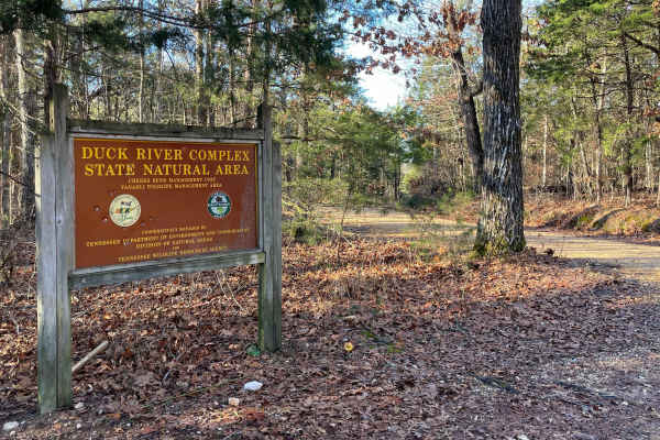
Cheek's Bend Road
Part of the Duck River Complex State Natural Area and Yanahli Wildlife Management Area trail system. No fee is required to drive Cheek’s Bend Road. Access is open year-round. Visitors hiking in the area may optionally contribute via an online donation system available by QR code at the hiking trailh...
Learn more about Cheek's Bend Road
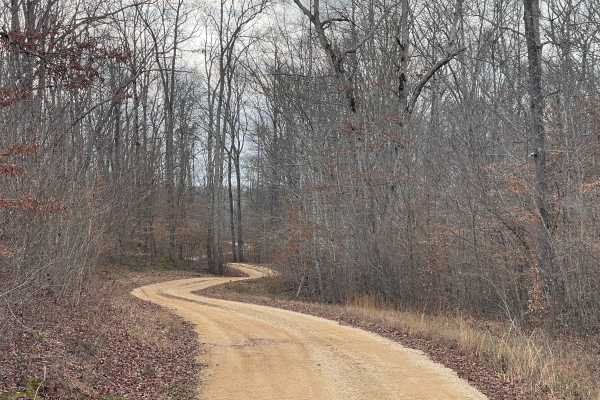
Burns Bottoms Road
Part of the Laurel Hill Wildlife Management Area Trail System. Drivers must possess a valid annual Hunt/Fish license, available online. Access is open year-round and restricted to daylight hours only (closed dusk to dawn). Burns Bottoms Road is a maintained gravel and dirt route winding through mixe...
Learn more about Burns Bottoms Road

VFW Road
Part of the Laurel Hill Wildlife Management Area trail system. A permit is not required to access this lake trail, only to fish. Access is open year-round and restricted to daylight hours only (closed dusk to dawn).
The VFW Lake Track is a short gravel access route that follows the shoreline of VFW...
Learn more about VFW Road
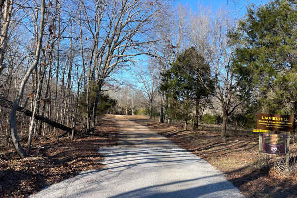
Artemis Lane
Artemis Lane is a primary interior access route within Laurel Hill Wildlife Management Area and one of the longest drivable tracks in the system at approximately six miles. Drivers must possess a valid annual Hunt/Fish license, available at GoOutdoorsTennessee.com. Tennessee resident licenses are $3...
Learn more about Artemis Lane
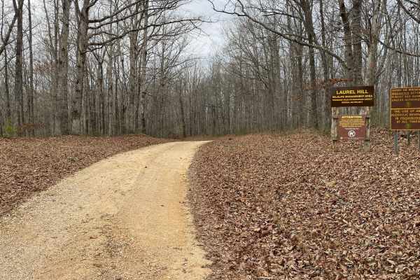
Finnie Road
Finnie Road is a gravel access route within Laurel Hill Wildlife Management Area, providing vehicle access through mixed hardwood forest and connecting interior management roads. Drivers must possess a valid annual Hunt/Fish license, available at GoOutdoorsTennessee.com. Tennessee resident licenses ...
Learn more about Finnie Road
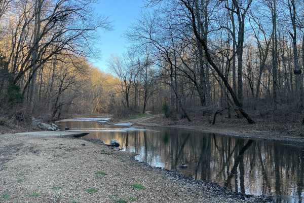
CC Road
CC Road is a short but important connector route within the Laurel Hill Wildlife Management Area, serving as one of the primary eastern access points into the WMA. The road links Laurel Hill Road on the east with Artemis Lane to the west, transitioning from pavement at the entrance to gravel once in...
Learn more about CC Road
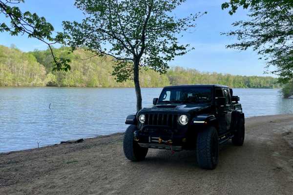
Peter Cave Road
Part of the Laurel Hill Wildlife Management Area Trail System. Drivers must possess a valid annual Hunt/Fish license, available online. Access is open year-round and restricted to daylight hours only (closed dusk to dawn). -- Peter Cave Rd. is a short access spur that provides direct entry to the we...
Learn more about Peter Cave Road
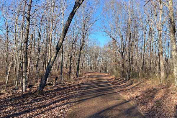
Laurel Hill Road
Laurel Hill Road is a scenic east–west traverse across the northern end of the Laurel Hill Wildlife Management Area, connecting Natchez Trace Parkway on the west to CC Road on the east. While both termini begin on pavement, the route quickly transitions to well-maintained gravel once inside the WMA,...
Learn more about Laurel Hill Road
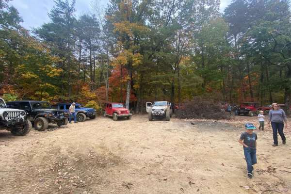
Overlook
This trail has off-camber terrain and deep ruts with some mud holes along the way up. Once there, it is a beautiful view of the valley and mountains! Also, a short walk to the right at the trail's end will take you to a waterfall. If it has rained, it's an especially beautiful sight.
Learn more about Overlook

Powerline to Jumpoff Road
Powerline to Jumpoff Road is a challenging, 2.8-mile unpaved trail located near South Pittsburg Mountain in Marion County, Tennessee, making it an excellent destination for experienced offroaders seeking a technical test of vehicle articulation and clearance. Branching off State Route 156, this rout...
Learn more about Powerline to Jumpoff Road
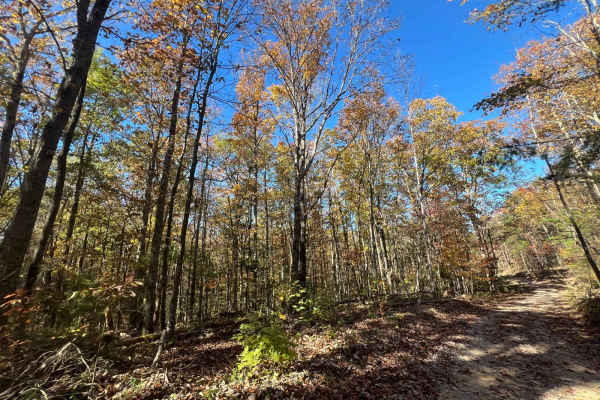
Flat Mountain Road - FS 270C
This is a tight, short out-and-back trail that winds through large stands of pine trees and passes old logging roads, along with a gate or two that are unlocked seasonally. Be sure to bring a saw, as fallen trees continue to block further access. The trail can be slick when muddy, so remember to tre...
Learn more about Flat Mountain Road - FS 270C
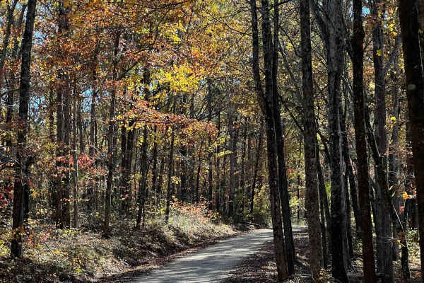
Indian Tomb Hollow Road
Indian Tomb Hollow County Road 86 is a scenic and heavily traveled forest route, known for its picturesque creek and charming bridge. This stretch of road is especially stunning during the fall when the foliage is in full color. Be mindful that the road can become slick after rain, so exercise cauti...
Learn more about Indian Tomb Hollow Road
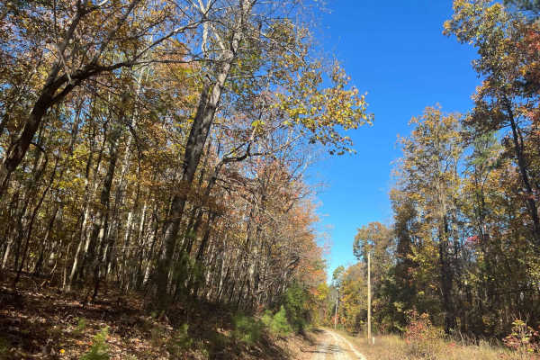
County Road 198 - FS272
This is a sparsely traveled trail that follows the telephone lines and weaves through private property, offering beautiful views of the local farmlands and surrounding landscape. The trail can be tricky during the muddy season, so be sure to check local conditions before heading out, and remember to...
Learn more about County Road 198 - FS272
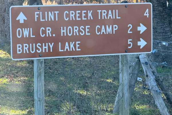
County Road 90 - FS 259
County Road 90 begins as a paved route meandering through picturesque farmland before transitioning into the lush expanse of the Bankhead National Forest. Along the way, travelers can enjoy abundant wildlife and admire charming, historic generational farmhouses lining the roadside. The route also pr...
Learn more about County Road 90 - FS 259
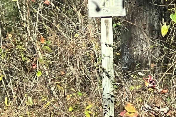
County Road 81 - FS 268
Forest Service Road 268 is a scenic, two-way country road that provides extensive access to other areas and trails. It offers ample opportunities for wildlife viewing and smooth, flowing travel. However, like many rural roads, it can be slick after rain or during muddy conditions. Be sure to leave n...
Learn more about County Road 81 - FS 268
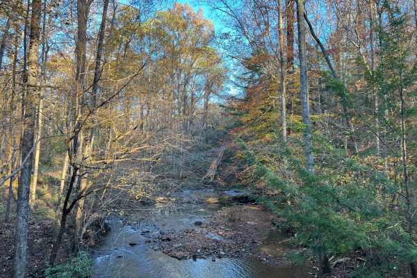
Brushy Creek Road - NF 254
This scenic road through the heart of the Bankhead National Forest offers not only a breathtaking drive but also access to fascinating historic sites waiting to be explored at its end. Along the way, you'll encounter numerous streams and picturesque bridges, each adding to the natural beauty of this...
Learn more about Brushy Creek Road - NF 254
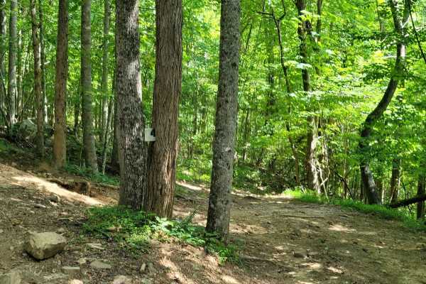
Trail 4
AOP Trail 4 - Mars is a short and simple connector trail that features a hard-packed route with lots of smaller rocks with little to no mud. While Trail 4 - Mars does not have any difficult features, it is a great trail to tie into others to make a good cruising route.
Learn more about Trail 4
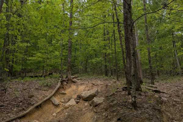
Trail 90
Trail 90 is a steep, winding trail at the top of the park with a lot of rock obstacles approaching 2 to 3 feet tall. The park rating for this trail is Blue (Moderate). A Park Day-Use Trail Pass is required to access this system of trails. Cell service is spotty in places, and trail conditions can ch...
Learn more about Trail 90
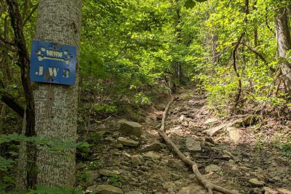
JW3
JW3 is yet another fun trail with some steep climbs and rock obstacles. The trail is named after Jeeps and Wrenches, a club based in Nashville that originally cleared this trail. The park rating for this trail is Blue (Moderate). A Park Day-Use Trail Pass is required to access this system of trails....
Learn more about JW3
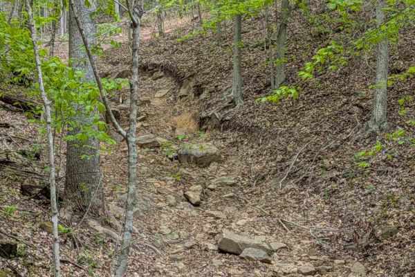
JW1
JW1 is a short, steep trail that connects Trails 4 and 17. Its main obstacle is a deep rut in a turn at the top of the hill. The trail is named after Jeeps and Wrenches, a club based in Nashville that originally cleared this trail. The park rating for this trail is Blue (Moderate). A Park Day-Use Tr...
Learn more about JW1
ATV trails near Blanche, Tennessee
Explore ATV-friendly trails near you. These trails are accessible for vehicles up to 50 inches wide, perfect for ATVs and smaller off-road machines.
Cheek's Bend Road
Part of the Duck River Complex State Natural Area and Yanahli Wildlife Management Area trail system. No fee is required to drive Cheek’s Bend Road. Access is open year-round. Visitors hiking in the area may optionally contribute via an online donation system available by QR code at the hiking trailh...
Learn more about Cheek's Bend Road
Burns Bottoms Road
Part of the Laurel Hill Wildlife Management Area Trail System. Drivers must possess a valid annual Hunt/Fish license, available online. Access is open year-round and restricted to daylight hours only (closed dusk to dawn). Burns Bottoms Road is a maintained gravel and dirt route winding through mixe...
Learn more about Burns Bottoms Road
VFW Road
Part of the Laurel Hill Wildlife Management Area trail system. A permit is not required to access this lake trail, only to fish. Access is open year-round and restricted to daylight hours only (closed dusk to dawn).
The VFW Lake Track is a short gravel access route that follows the shoreline of VFW...
Learn more about VFW Road
Artemis Lane
Artemis Lane is a primary interior access route within Laurel Hill Wildlife Management Area and one of the longest drivable tracks in the system at approximately six miles. Drivers must possess a valid annual Hunt/Fish license, available at GoOutdoorsTennessee.com. Tennessee resident licenses are $3...
Learn more about Artemis Lane
UTV/side-by-side trails near Blanche, Tennessee
Find UTV and side-by-side trails near you. These trails accommodate vehicles up to 60 inches wide, ideal for UTVs, side-by-sides, and wider off-road rigs.
Cheek's Bend Road
Part of the Duck River Complex State Natural Area and Yanahli Wildlife Management Area trail system. No fee is required to drive Cheek’s Bend Road. Access is open year-round. Visitors hiking in the area may optionally contribute via an online donation system available by QR code at the hiking trailh...
Learn more about Cheek's Bend Road
Burns Bottoms Road
Part of the Laurel Hill Wildlife Management Area Trail System. Drivers must possess a valid annual Hunt/Fish license, available online. Access is open year-round and restricted to daylight hours only (closed dusk to dawn). Burns Bottoms Road is a maintained gravel and dirt route winding through mixe...
Learn more about Burns Bottoms Road
VFW Road
Part of the Laurel Hill Wildlife Management Area trail system. A permit is not required to access this lake trail, only to fish. Access is open year-round and restricted to daylight hours only (closed dusk to dawn).
The VFW Lake Track is a short gravel access route that follows the shoreline of VFW...
Learn more about VFW Road
Artemis Lane
Artemis Lane is a primary interior access route within Laurel Hill Wildlife Management Area and one of the longest drivable tracks in the system at approximately six miles. Drivers must possess a valid annual Hunt/Fish license, available at GoOutdoorsTennessee.com. Tennessee resident licenses are $3...
Learn more about Artemis Lane
The onX Offroad Difference
onX Offroad combines trail photos, descriptions, difficulty ratings, width restrictions, seasonality, and more in a user-friendly interface. Available on all devices, with offline access and full compatibility with CarPlay and Android Auto. Discover what you're missing today!
Open Trail Map