
Dirt Bike Trails
Near Barstow, California
Explore All Dirt Bike Trails Near Barstow, California
Dirt Bike Trails Near Barstow, California
Discover the best dirt bike trails near you. Browse trail maps, check difficulty ratings, and find your next adventure — whether you're looking for a quick ride or an all-day expedition.
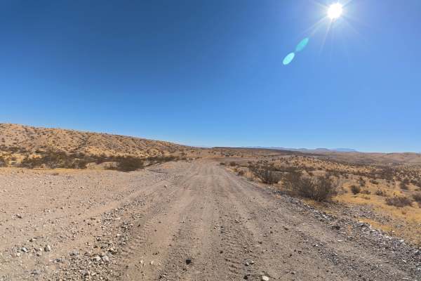
Stoddard Cross
This wide trail crosses the BLM area over very fine, loose sand, with plenty of room for vehicles to pass. Expect frequent washboards and ruts beginning around 6–8 inches deep. Around 1.5 miles, the ruts increase significantly to approximately 16 inches deep. The soft sand can become considerably mo...
Learn more about Stoddard Cross
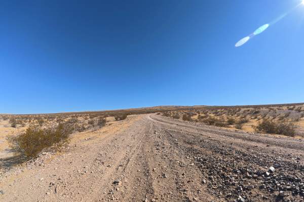
Barstow Cross
This narrow trail continues from Townsend Street across extremely soft, fine sand with little room for vehicles to pass. Ruts begin around 6–8 inches deep, with frequent washes, washboards, and whoops throughout. Several steep, loose-sand hill climbs add difficulty, and 4WD or AWD is required. Appro...
Learn more about Barstow Cross

North Barstow to The Husky Memorial
This trail starts in Barstow, California, navigating through the northern Barstow hills and then into the northwest end of the Mojave Desert. It travels through single-track hill climbs and scenic passes, exploring lava flows and petroglyphs and ending up at what is known as the Husky Memorial. You ...
Learn more about North Barstow to The Husky Memorial
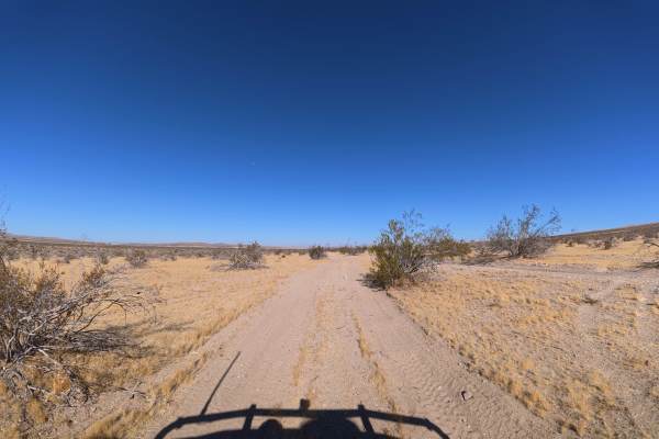
Townsend Street
This single-wide trail travels through extremely soft sand with little room for vehicles to pass. Near the beginning, ruts and washouts reach 12–14 inches deep. The combination of deep washes and loose sand can make maintaining traction difficult, particularly when wet. 4WD or AWD is required for th...
Learn more about Townsend Street
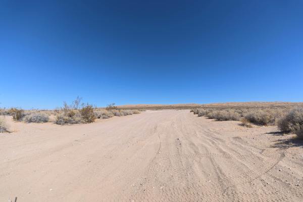
Outlet Center Road North
This soft-sand trail travels north through the open desert, with ruts beginning around 6–8 inches deep and large whoops reaching 2–3 feet tall. The combination of loose sand, ruts, whoops, and hill climbs can make traction challenging, particularly when wet. 4WD or AWD is highly recommended for this...
Learn more about Outlet Center Road North
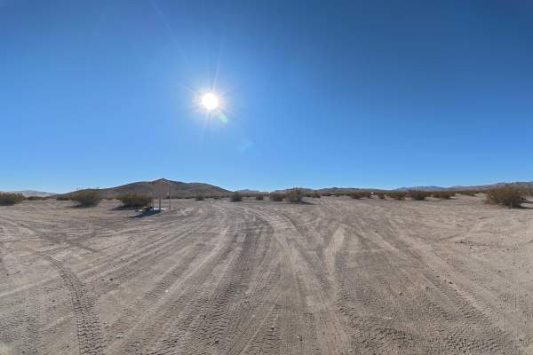
Outlet Center Road
This wide, sandy route travels across the Stoddard Valley Open Riding Area, a large OHV area with extensive dispersed camping and a 14-day camping limit. The main staging area has room for hundreds of vehicles and includes a restroom. Ruts begin around 2–6 inches deep, while around 1.6 miles in, rou...
Learn more about Outlet Center Road
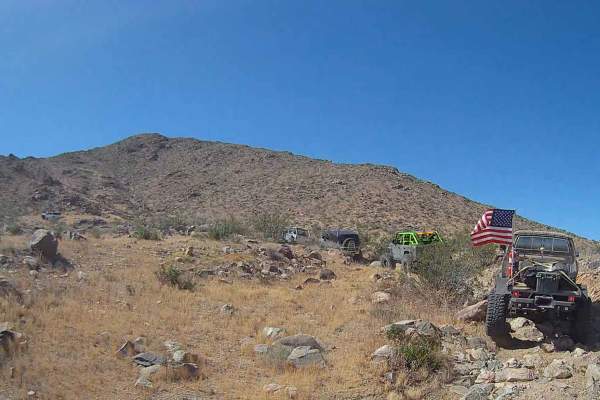
Pumpkin Eater
This trail changes frequently, with loose rocks that may shift after each vehicle passes. Conditions vary based on traffic, weather, and vehicle setup, and travel time can range from extended recovery scenarios to a relatively quick run. This trail typically requires at least 40-inch tires for a smo...
Learn more about Pumpkin Eater
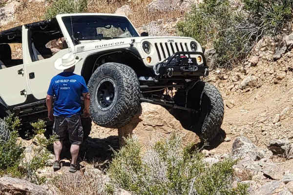
Jack Rabbit
This trail is relatively new (2024) and winds through the hills, where you will encounter challenging sections such as waterfalls, steep climbs up loose material, rocky canyons, and off-camber areas. The rocks tend to move around, so the line will change from vehicle to vehicle. Desert pinstripes an...
Learn more about Jack Rabbit
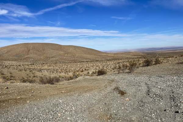
Main Staging Area Into the Desert
This trail begins at the main staging area near the pit toilets and the gated rock quarry. The main trail begins with big hard packed wide rolling hills. Once you cut onto the side trail, it becomes narrow and sandy with a loose short hill climb at the beginning. The trail then snakes around through...
Learn more about Main Staging Area Into the Desert

Intermediate Hill Climb to Whoops Section
A short but good warm-up-to-hill climbs. The main face is mostly packed, leading up from a sandy wash. Once at the top, one could continue and keep climbing or take the intermediate loop back down the hill to the left and over the next small, easy climb. The trail becomes a little rocky and loose at...
Learn more about Intermediate Hill Climb to Whoops Section
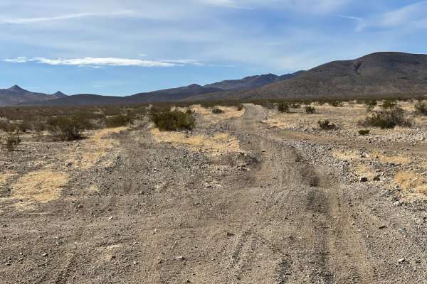
The Main North to South Access Wash
The Main North to South Access Wash is an easy 2.3-mile sandy connector route within the Stoddard Valley OHV Recreation Area, providing a direct link between the central valley and the northern open riding section. Perfect for beginner and intermediate riders, this wide wash easily accommodates onco...
Learn more about The Main North to South Access Wash
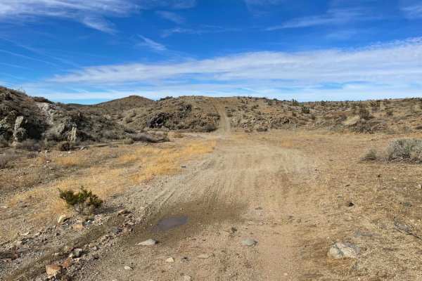
Burned Out Cars Loop
This trail heads out from the staging area to some burned cars that reside by the telephone pole line. One van, right side up, and one car, upside down. Both shot up and burned out. From the burned-out cars, you head into the hills and take the main route through the sandy, deep burmed corners in th...
Learn more about Burned Out Cars Loop
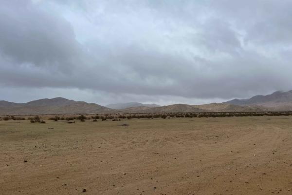
Stoddard Mountain Road
This is the main graded trail into the OHV area. It is mostly well-graded with plenty of washboard bumps and mild transitions to make life easier for those towing trailers. There is a pit toilet on the way in, and once you pass the quarry, the trail becomes a little more narrow and more whooped out....
Learn more about Stoddard Mountain Road
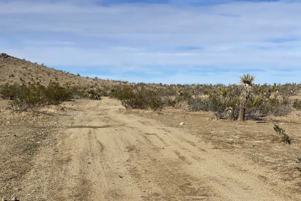
Oh Look, Joshua Trees
This is a fun loop through the hills featuring sandy washes, a steep rocky hill climb or descent (depending on the direction you travel), lots of terrain changes, and of course, Joshua trees. As you crest the hills, you will have killer views, and you might see a desert fox and birds of prey. There ...
Learn more about Oh Look, Joshua Trees

Phillips Loop
Phillips Loop is an exciting moderate off-road trail in the Calico Mountains, perfect for high-clearance stock SUVs and drivers looking to explore historic mining country. Stretching approximately 4.6 miles with a maximum elevation of 2,834 feet, this scenic route takes adventurers through rugged de...
Learn more about Phillips Loop

Wall Street Canyon Overlook
The Wall Street Canyon Overlook is a rugged, fun drive through the heart of the Calico Mountains. Visit the massive Bismarck Mine, then continue into the narrow Wall Street Canyon. The trip ends at a 100-ft.-high ledge above the canyon's lower end. This area is excellent for green-sticker vehicles, ...
Learn more about Wall Street Canyon Overlook

Doran Canyon - BLM CM7631
Doran Canyon (CM7631) is a 3.3-mile point-to-point (bi-directional) trail rated 6 of 10 located in San Bernardino County. Doran Canyon is a well-marked BLM trail within the Barstow Management Area. The trail starts just north of Ghost Town Road, and as you approach the trailhead, you will see three ...
Learn more about Doran Canyon - BLM CM7631

Wall Street Canyon Trail
Take the back roads into Calico through the Wall Street Canyon Trail. Enjoy beautiful canyon views through this winding route that starts behind the Calico Mountains and takes you all the way to the heart of Calico at the Bismark Mine. The route isn't difficult at all, but there is a steep hill clim...
Learn more about Wall Street Canyon Trail
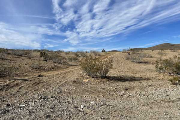
Sandy Hill Camp Overlook
Sandy Hill Camp Overlook is a scenic two-mile trail in the Stoddard Valley OHV Recreation Area, perfect for four-wheel-drive vehicles and SxSs seeking a campsite with panoramic valley views. This route winds through soft sand washes bordering the main staging area and climbs to a high point around 3...
Learn more about Sandy Hill Camp Overlook

Kramer Arch
An awesome quick side trail in the Calico Mountains off Phillips Canyon West Trail. Loop around the mountain where you will be welcomed with a short, rocky climb before you drive down (or up, depending on how you do the loop) Kramer Arch. Kramer Arch is a natural and beautiful formation in the moun...
Learn more about Kramer Arch
ATV trails near Barstow, California
Explore ATV-friendly trails near you. These trails are accessible for vehicles up to 50 inches wide, perfect for ATVs and smaller off-road machines.
Stoddard Cross
This wide trail crosses the BLM area over very fine, loose sand, with plenty of room for vehicles to pass. Expect frequent washboards and ruts beginning around 6–8 inches deep. Around 1.5 miles, the ruts increase significantly to approximately 16 inches deep. The soft sand can become considerably mo...
Learn more about Stoddard Cross
Barstow Cross
This narrow trail continues from Townsend Street across extremely soft, fine sand with little room for vehicles to pass. Ruts begin around 6–8 inches deep, with frequent washes, washboards, and whoops throughout. Several steep, loose-sand hill climbs add difficulty, and 4WD or AWD is required. Appro...
Learn more about Barstow Cross
Townsend Street
This single-wide trail travels through extremely soft sand with little room for vehicles to pass. Near the beginning, ruts and washouts reach 12–14 inches deep. The combination of deep washes and loose sand can make maintaining traction difficult, particularly when wet. 4WD or AWD is required for th...
Learn more about Townsend Street
Outlet Center Road North
This soft-sand trail travels north through the open desert, with ruts beginning around 6–8 inches deep and large whoops reaching 2–3 feet tall. The combination of loose sand, ruts, whoops, and hill climbs can make traction challenging, particularly when wet. 4WD or AWD is highly recommended for this...
Learn more about Outlet Center Road North
UTV/side-by-side trails near Barstow, California
Find UTV and side-by-side trails near you. These trails accommodate vehicles up to 60 inches wide, ideal for UTVs, side-by-sides, and wider off-road rigs.
Stoddard Cross
This wide trail crosses the BLM area over very fine, loose sand, with plenty of room for vehicles to pass. Expect frequent washboards and ruts beginning around 6–8 inches deep. Around 1.5 miles, the ruts increase significantly to approximately 16 inches deep. The soft sand can become considerably mo...
Learn more about Stoddard Cross
Barstow Cross
This narrow trail continues from Townsend Street across extremely soft, fine sand with little room for vehicles to pass. Ruts begin around 6–8 inches deep, with frequent washes, washboards, and whoops throughout. Several steep, loose-sand hill climbs add difficulty, and 4WD or AWD is required. Appro...
Learn more about Barstow Cross
Townsend Street
This single-wide trail travels through extremely soft sand with little room for vehicles to pass. Near the beginning, ruts and washouts reach 12–14 inches deep. The combination of deep washes and loose sand can make maintaining traction difficult, particularly when wet. 4WD or AWD is required for th...
Learn more about Townsend Street
Outlet Center Road North
This soft-sand trail travels north through the open desert, with ruts beginning around 6–8 inches deep and large whoops reaching 2–3 feet tall. The combination of loose sand, ruts, whoops, and hill climbs can make traction challenging, particularly when wet. 4WD or AWD is highly recommended for this...
Learn more about Outlet Center Road North
The onX Offroad Difference
onX Offroad combines trail photos, descriptions, difficulty ratings, width restrictions, seasonality, and more in a user-friendly interface. Available on all devices, with offline access and full compatibility with CarPlay and Android Auto. Discover what you're missing today!
Open Trail Map