
Dirt Bike Trails
Near Absarokee, Montana
Explore All Dirt Bike Trails Near Absarokee, Montana
Dirt Bike Trails Near Absarokee, Montana
Discover the best dirt bike trails near you. Browse trail maps, check difficulty ratings, and find your next adventure — whether you're looking for a quick ride or an all-day expedition.
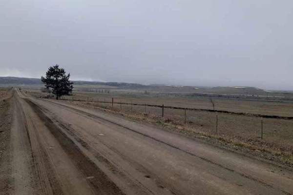
Stillwater River Road
This is a well-maintained gravel road that follows the Stillwater River. It's open year-round with limited access during heavy snowy weather. The first 6.5 miles is a paved two-lane road west of Absarokee before turning into gravel and then back into pavement 1.2 miles before the junction with Nye R...
Learn more about Stillwater River Road
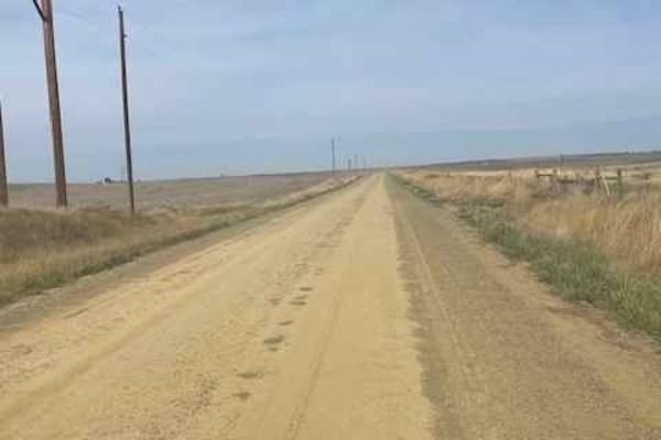
Columbus Molt Road
This is a gravel road connector from Columbus to Molt. You will see more antelope and cows than cars or people along this route. Most of the road is surrounded by private property, so zero camping opportunities exist. There are services in Columbus, but none in Molt, so be prepared. There is fairly ...
Learn more about Columbus Molt Road
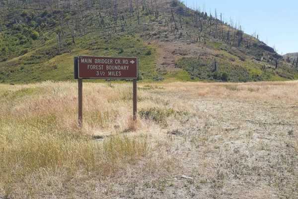
Bridger Creek Cruise
Enjoy this easy cruise, along Bridger Creek, off of Bridger Creek Road, named Main Bridger Creek Road. This route leads into the Gallatin National Forest; via sections of private and BLM land, the road starts out wide and clear gravel with room for passing vehicles as the route gets into the Nationa...
Learn more about Bridger Creek Cruise
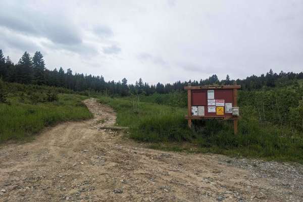
Benbow Jeep Trail
Benbow Jeep Trail is a 4x4 trail located in the Custer National Forest in Montana. It is 8.5 miles long and travel time is about 2 hours from parking to the mine site. The trail is rated as moderate to difficult and is best suited for experienced off-road drivers. It is open from May to October. The...
Learn more about Benbow Jeep Trail
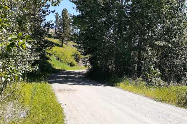
West Bridger Creek Cruise
A well-established trail, with some paved and gravel patches leading to the National Forest, the last 5 miles are the main dirt trail. The trail can be driven up to the Tie Cutter Gulch TH; from that point, vehicle width is restricted to less than 50 inches and dates of use. One will encounter some ...
Learn more about West Bridger Creek Cruise
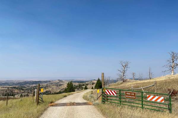
Iron Mountain Road
Iron Mountain Road is a very scenic gravel road that becomes slightly narrower the further along you drive. Once passing the entrance gate you officially enter Gallatin National Forest and dispersed campsites can be found along the road with fire rings. From the entrance is at 7.6 miles to campsite ...
Learn more about Iron Mountain Road
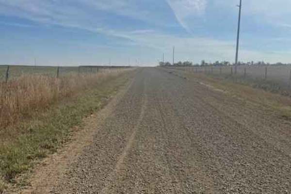
Rapelje Road
This is a gravel road connector from Big Timber to Rapelje. You will see more antelope and cows than cars or people along this route. Most of the road is surrounded by private property, so zero camping opportunities exist. There are services in Big Timber, but none in Rapelje, so be prepared. There...
Learn more about Rapelje Road
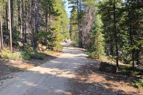
Lower Parkside
Lower Parkside is a 2.3-mile off-highway vehicle connector route along Rock Creek that provides a scenic, short passage for SxSs and four-wheel-drive enthusiasts looking to transition between nearby trail networks. Starting at an elevation of 7,215 feet and descending to 6,691 feet, the trail featur...
Learn more about Lower Parkside
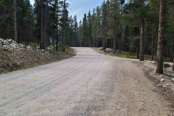
Main Fork Rock Creek
This trail runs along Rock Creek and has some amazing views. Some spots have lose rocks but most of it is packed dirt. There are great spots to stop along the way down by the creek so you can go fly fishing or just relax a little and have lunch. You could get to the end of the trail with most off ro...
Learn more about Main Fork Rock Creek
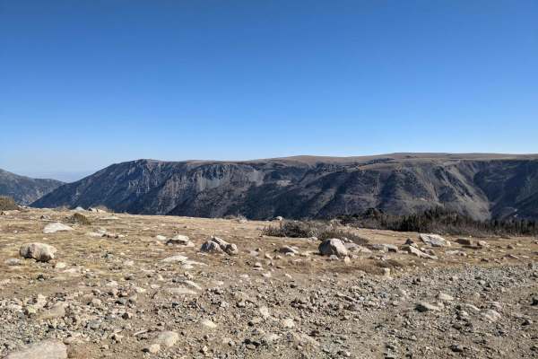
Hellroaring Plateau
Hellroaring Road is a 4x4 trail located in the Custer Gallatin National Forest outside Red Lodge, Montana near the base of the Beartooth Highway. The trail is out and back, about 6 miles long each way, and takes about 1.5hr to reach the top. It is not particularly technical but very rocky and narrow...
Learn more about Hellroaring Plateau
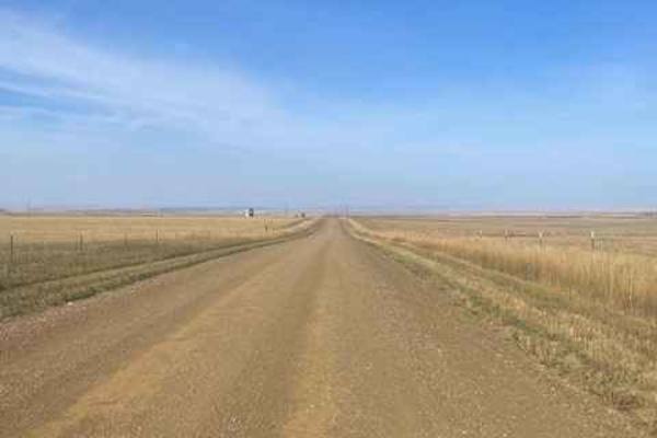
Molt Rapelje Road
This is a gravel road connector from Molt to Rapelje. You will see more antelope and cows than cars or people along this route. Most of the road is surrounded by private property, so there are no camping opportunities on this route. There are no services between the two small towns, so be prepared w...
Learn more about Molt Rapelje Road
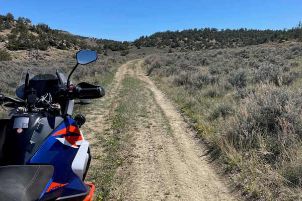
Hatcher Pass
Hatcher Pass is an out-and-back off of Cottonwood Road. There are a couple of loose and slightly rutted sections, but nothing challenging. This trail ends at a closed gate bordering private property and you will have to turn around. There is a decent campground about a quarter mile in with some shad...
Learn more about Hatcher Pass

Hunt Creek
Hunt Creek is an easy road up to Ridge Road. It is a little loose and slightly rutted in places but it's a more fun route to take than Cottonwood Road. There are a couple of side spurs that have some nice climbs over to Cottonwood Road if you are feeling a little spicy. Avoid this trail when it's r...
Learn more about Hunt Creek
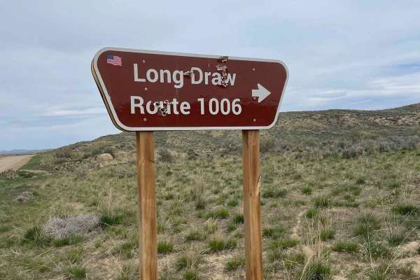
Long Draw Road
This is a fun way up to Ridge Road that is pretty loose and fairly rutted in spots. This is a great trail to warm up on early in the year, as it is rideable months before the Bighorns will be. Depending on the weather, it might be possible to ride this all year long. Avoid this trail during the rain...
Learn more about Long Draw Road
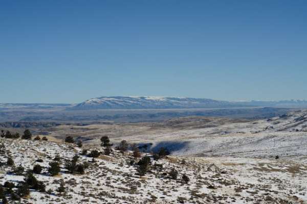
Meeteetse Trail
Meeteetse Trail, east access, is located on the Montana and Wyoming border just south of Belfry, MT. The west trail can be accessed just south of Red Lodge, Montana. When accessing the Meeteetse Trail from north of the Montana/Wyoming border, turn off Highway 72 onto Chance Road, which is paved. Aft...
Learn more about Meeteetse Trail
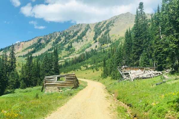
Lulu Pass
Lulu Pass is a scenic and historic mountain trail near Cooke City, Montana, perfect for intermediate four-wheel-drive enthusiasts seeking a mix of high-alpine views and historical mining relics. Spanning approximately 3 miles with an elevation gain of over 1,000 feet, the route begins near Fisher Cr...
Learn more about Lulu Pass
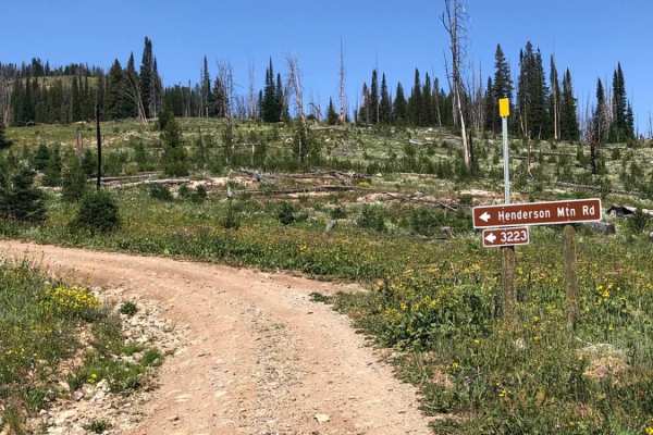
Henderson Mountain Road
Henderson Mountain Road is accessible from Daisy Pass Road and leads to an old abandoned mine at the top of the mountain. It is a rutted, single-lane shelf road with loose gravel but is worth the drive for the views at the top. You'll cross a plateau near the top and find an ATV/dirt bike spur of th...
Learn more about Henderson Mountain Road
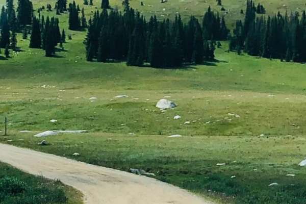
Fantan Loop to Sawtooth Lake
Easy access to this trail is from the Beartooth Highway. The road begins as a maintained 2-lane forest service road but turns into a rocky, rutted 1-lane trail leading to Sawtooth Lake. Expect boulders up to 12" and shallow stream crossings as you wind your way through the Shoshone National Forest....
Learn more about Fantan Loop to Sawtooth Lake
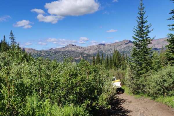
Independence Pass
Independence Pass takes you from the bottom of the Boulder River Valley up through a very wooded trail with occasional glimpses of the surrounding mountains up to Blue Lake at the summit. Camping towards the top is abundant with many great places to pull off and make camp. Be aware of the dense bea...
Learn more about Independence Pass
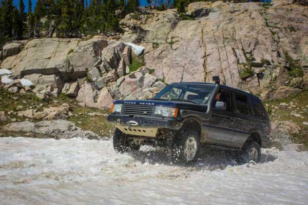
Goose Lake
A scenic, pleasant trail that takes you to the edge of the Absaroka-Beartooth wilderness. This trail has snow late into the summer, and it may be impassable due to snow into late July, or you may be fighting through snow fields near the top. There are a ton of lakes along the trail, perfect for camp...
Learn more about Goose Lake
ATV trails near Absarokee, Montana
Explore ATV-friendly trails near you. These trails are accessible for vehicles up to 50 inches wide, perfect for ATVs and smaller off-road machines.
Stillwater River Road
This is a well-maintained gravel road that follows the Stillwater River. It's open year-round with limited access during heavy snowy weather. The first 6.5 miles is a paved two-lane road west of Absarokee before turning into gravel and then back into pavement 1.2 miles before the junction with Nye R...
Learn more about Stillwater River Road
Columbus Molt Road
This is a gravel road connector from Columbus to Molt. You will see more antelope and cows than cars or people along this route. Most of the road is surrounded by private property, so zero camping opportunities exist. There are services in Columbus, but none in Molt, so be prepared. There is fairly ...
Learn more about Columbus Molt Road
Bridger Creek Cruise
Enjoy this easy cruise, along Bridger Creek, off of Bridger Creek Road, named Main Bridger Creek Road. This route leads into the Gallatin National Forest; via sections of private and BLM land, the road starts out wide and clear gravel with room for passing vehicles as the route gets into the Nationa...
Learn more about Bridger Creek Cruise
Benbow Jeep Trail
Benbow Jeep Trail is a 4x4 trail located in the Custer National Forest in Montana. It is 8.5 miles long and travel time is about 2 hours from parking to the mine site. The trail is rated as moderate to difficult and is best suited for experienced off-road drivers. It is open from May to October. The...
Learn more about Benbow Jeep Trail
UTV/side-by-side trails near Absarokee, Montana
Find UTV and side-by-side trails near you. These trails accommodate vehicles up to 60 inches wide, ideal for UTVs, side-by-sides, and wider off-road rigs.
Stillwater River Road
This is a well-maintained gravel road that follows the Stillwater River. It's open year-round with limited access during heavy snowy weather. The first 6.5 miles is a paved two-lane road west of Absarokee before turning into gravel and then back into pavement 1.2 miles before the junction with Nye R...
Learn more about Stillwater River Road
Columbus Molt Road
This is a gravel road connector from Columbus to Molt. You will see more antelope and cows than cars or people along this route. Most of the road is surrounded by private property, so zero camping opportunities exist. There are services in Columbus, but none in Molt, so be prepared. There is fairly ...
Learn more about Columbus Molt Road
Bridger Creek Cruise
Enjoy this easy cruise, along Bridger Creek, off of Bridger Creek Road, named Main Bridger Creek Road. This route leads into the Gallatin National Forest; via sections of private and BLM land, the road starts out wide and clear gravel with room for passing vehicles as the route gets into the Nationa...
Learn more about Bridger Creek Cruise
Benbow Jeep Trail
Benbow Jeep Trail is a 4x4 trail located in the Custer National Forest in Montana. It is 8.5 miles long and travel time is about 2 hours from parking to the mine site. The trail is rated as moderate to difficult and is best suited for experienced off-road drivers. It is open from May to October. The...
Learn more about Benbow Jeep Trail
The onX Offroad Difference
onX Offroad combines trail photos, descriptions, difficulty ratings, width restrictions, seasonality, and more in a user-friendly interface. Available on all devices, with offline access and full compatibility with CarPlay and Android Auto. Discover what you're missing today!
Open Trail Map