
Dirt Bike Trails
Near Abiquiu, New Mexico
Explore All Dirt Bike Trails Near Abiquiu, New Mexico
Dirt Bike Trails Near Abiquiu, New Mexico
Discover the best dirt bike trails near you. Browse trail maps, check difficulty ratings, and find your next adventure — whether you're looking for a quick ride or an all-day expedition.
El Puertecito Pass
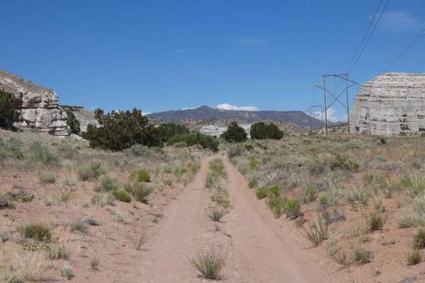
El Puertecito Pass is an out-and-back trail that tracks through a moderate portion of the Arroyo del Cobre before passing between the El Puertecito Pass at the base of the two taller peaks in the area and eventually ends at a private land boundary. Starting on a primarily dirt surface single vehicle...
Learn more about El Puertecito Pass
FS 23/FS 137 Abiquiu to El Rito
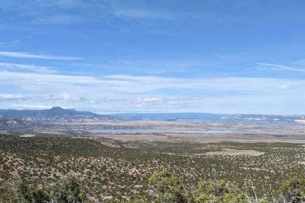
This trail begins by turning right onto FS 23 from US 84 North, just south of Route 96 turn off to the lake. You will begin climbing in elevation and the views to the west of Cerro Pedernal and Abiquiu Lake improve steadily up to ~7,500 ft elevation. There will be scenic overlooks along the ridge to...
Learn more about FS 23/FS 137 Abiquiu to El Rito
Abiquiu Dam
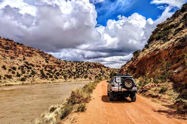
Abiquiu Dam trail starts with a short paved section at the top of the dam and works its way down some switchbacks to the base of the dam where the road turns to dirt. This trail follows along the western bank of the Chama River below Abiquiu Reservoir. The entire area has several interesting sites, ...
Learn more about Abiquiu Dam
Sierra Negra Canyon
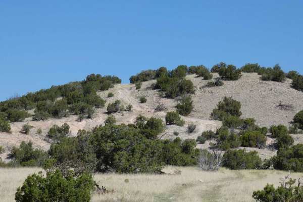
Sierra Negra Canyon is a point-to-point trail that connects from FS-23/FS137 Abiquiu to El Rito down to SR-554, which can be run from either direction. For a more challenging experience, it is suggested to begin at the southern entrance located off of SR-554 and follow the arid desert road to the no...
Learn more about Sierra Negra Canyon
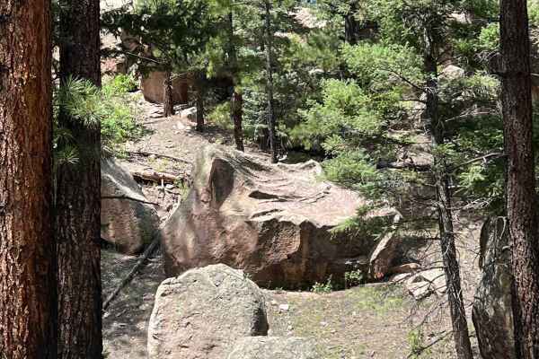
Boulder Wash - FR 451
The "road less traveled" describes this peaceful, unique high mountain trail. The peacefulness is due to the trail being sheltered from the wind and the uniqueness is due to the gigantic boulders that line your way. If you hike through the boulders to the west, breathtaking views can be seen. At the...
Learn more about Boulder Wash - FR 451
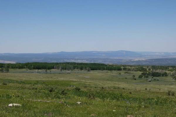
Green Camp Canyon
Green Camp Canyon is an overlander and camper's paradise. The well-maintained service trail is surrounded by thick trees and lush green foliage, with no obstacles over 10 inches in size that are only found at the north end of the trail at a small rocky section. Several spots on both sides of the tra...
Learn more about Green Camp Canyon
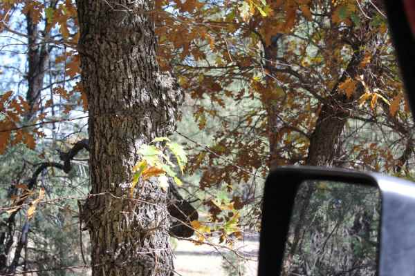
Rio Del Oso
This is a tight and narrow unmaintained forest service road that traverses through sand and rock while following Rio Del Oso Creek. The last leg of the trail is the most challenging. The road enters the creek bed and becomes a rock garden, with one small waterfall climb followed by a loose hill with...
Learn more about Rio Del Oso
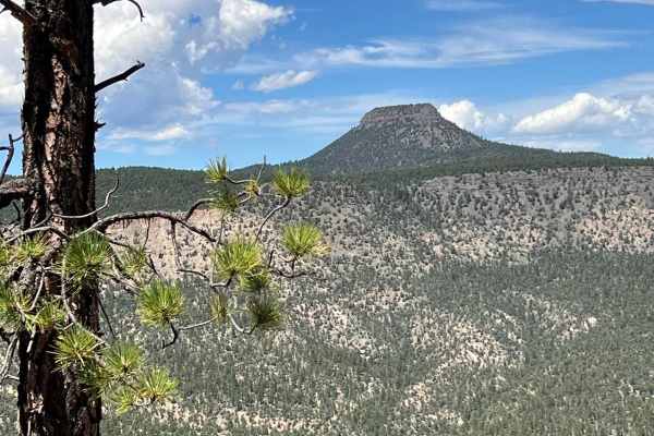
View Point - FR 449 V
This trail is rough with rocks, mud holes, ruts, and erosion issues. There are a number of off-camber spots. Ponderosa Pine trees and branches narrow the trail. It is not a well-traveled trail. At the end, a short walk leads to breathtaking views of Cerro Pedernal and the Abiquiu Valley.
Learn more about View Point - FR 449 V
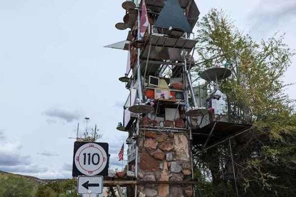
FS 44 El Rito to Vallecitos
This is a scenic, well-maintained US FS road connecting El Rito and Vallecitos. There are no services in either small mountain community besides the restaurant El Farolito (cash only). With a number of other US FS roads branching off FS 44, this route makes for a wonderful jumping-off point. There a...
Learn more about FS 44 El Rito to Vallecitos
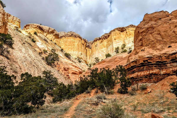
Chama Canyon Cliffside Loop
The Chama Canyon Cliffside Loop is an optional scenic trail that diverges from Chama Canyon and follows the base of colorfully layered cliffs. Though short in length, the trail offers some amazing views. This trail offers a handful of interesting dispersed camping sites along with areas to explore b...
Learn more about Chama Canyon Cliffside Loop
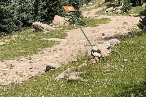
Cienega Redonda - FS 27
This rocky route travels through a dense forest along a mesa top with several unavoidable mud holes. The road is eroded and rutted in places, and fallen trees may need to be moved depending on vehicle width. There are no suitable camping areas along Forest Service Road 27.
Learn more about Cienega Redonda - FS 27
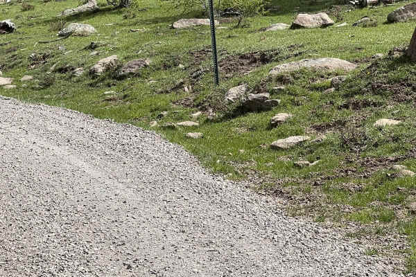
Burny Cole Point - FR 99
This route has incredible views near FR 144 of Canones Creek and in the distance of Abiquiu Valley. The elevation is over 10,000 feet at the highest point. Two local wildland firefighters named this trail in remembrance of their Australian Shepards, Burny and Coal. Ironically, numerous forest fires ...
Learn more about Burny Cole Point - FR 99
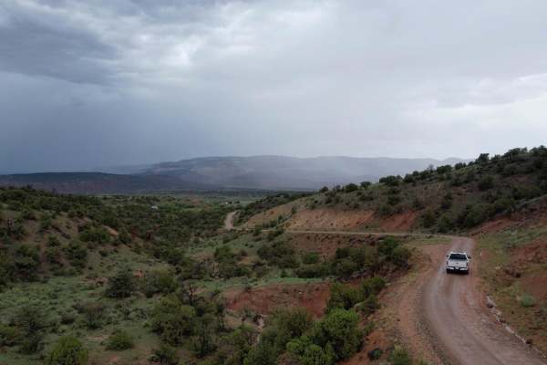
Encino Mountain Trail
This trail takes you up into the Santa Fe National Forest. This is an easy trail for most with AWD or 4WD. Make sure you have gas as this is a vast mountain range where you can drive all the way to Espanola if you want. We did the trek as a (pass-through) starting on the Clara Peak Trail and then tu...
Learn more about Encino Mountain Trail
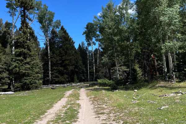
FR 449
This is a relatively easy 5.7 mile route off of FR 144. The route winds through Ponderosa Pines and Aspens with some beautiful, secluded camping spots. It also leads to a choice of other trails including the scenic, challenging FR 449 View Point trail and FR 448 Chihuahuenos Spur which loops back to...
Learn more about FR 449
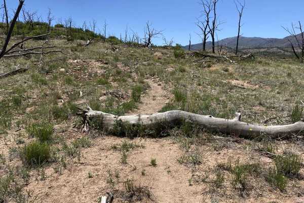
Corral Jumper
Corral Jumper is a short trail, that connects FS Roads 831 and 445C. The trail can be rather hard to find at first and may require some route-finding skills but does offer a few small log jumps that traverse up the mountain side and ends up at FS445C. It offers a few challenges with small embedded r...
Learn more about Corral Jumper
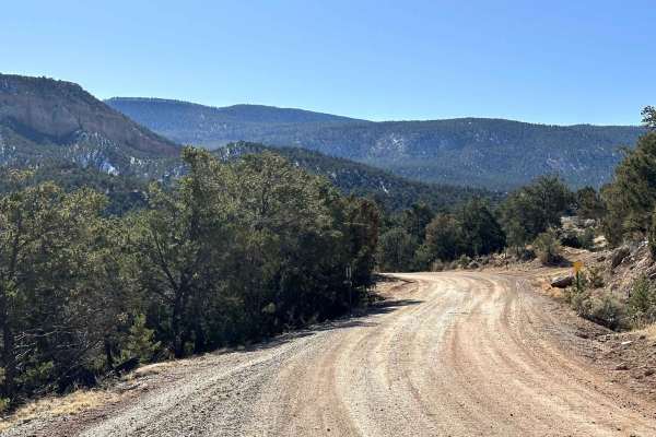
Coyote Camp Run
Beautiful scenic canyon drive to the Coyote Canyon Camping Area. The route is a maintained gravel/dirt road that starts in the town of Coyote, New Mexico. The route takes you south approximately 6.5 miles ending at a designated campground. In early spring and winter, riders can expect possible snow ...
Learn more about Coyote Camp Run
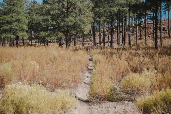
Corral Canyon
Corral Canyon is a 4.2-mile single track in the Sante Fe National Forest north of the town of Los Alamos and is probably the most fun and most popular dirt bike trail in this area. It's a fast and flowy dirt trail through a sparse pine tree forest. It's kind of sandy, but mostly dirt, and very smoot...
Learn more about Corral Canyon
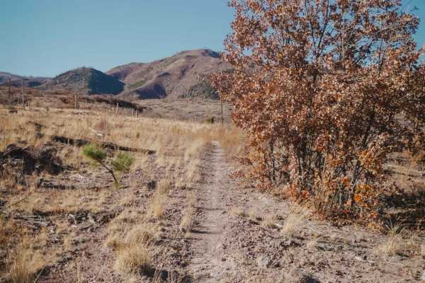
Pine Spring
Pine Spring is an intermediate single track in the Sante Fe National Forest north of the town of Los Alamos. Both entrances to the trail are pretty faint and hidden, so a GPS track is super helpful to get onto this trail. The north end is a faint trail off Road 445 near the west end of Corral Canyon...
Learn more about Pine Spring
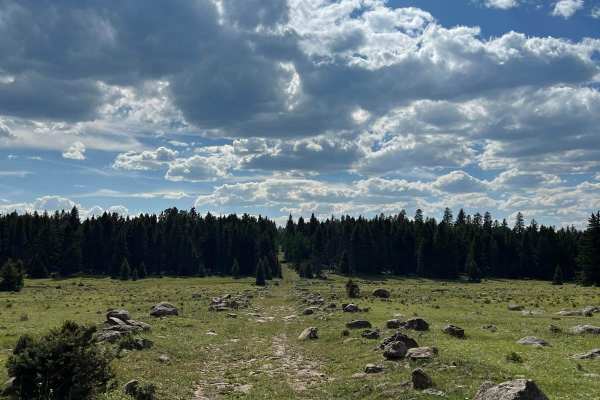
FR 99N Gemstone Shortcut
This is a peaceful rocky shortcut with boulders bordering the trail. The rocks look like they are waiting to be cut into gems. The route is faint in spots and not well-traveled. Some of the mud holes can be avoided. It connects FR 100 Encino and FR 99 Burny and Cole Point and saves over 6 miles as a...
Learn more about FR 99N Gemstone Shortcut
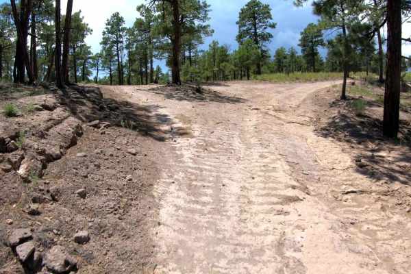
Pajarito - FR 446CC
Pajarito (FR446CC) serves as an access road used to connect users to the northern trail system. The road begins at the end of Maria's Canyon, with a notable landmark, the large open grazing area that usually is accompanied by a large watering hole. Just past this landmark, Pajarito begins as you con...
Learn more about Pajarito - FR 446CC
ATV trails near Abiquiu, New Mexico
Explore ATV-friendly trails near you. These trails are accessible for vehicles up to 50 inches wide, perfect for ATVs and smaller off-road machines.
El Puertecito Pass
El Puertecito Pass is an out-and-back trail that tracks through a moderate portion of the Arroyo del Cobre before passing between the El Puertecito Pass at the base of the two taller peaks in the area and eventually ends at a private land boundary. Starting on a primarily dirt surface single vehicle...
Learn more about El Puertecito Pass
FS 23/FS 137 Abiquiu to El Rito
This trail begins by turning right onto FS 23 from US 84 North, just south of Route 96 turn off to the lake. You will begin climbing in elevation and the views to the west of Cerro Pedernal and Abiquiu Lake improve steadily up to ~7,500 ft elevation. There will be scenic overlooks along the ridge to...
Learn more about FS 23/FS 137 Abiquiu to El Rito
Abiquiu Dam
Abiquiu Dam trail starts with a short paved section at the top of the dam and works its way down some switchbacks to the base of the dam where the road turns to dirt. This trail follows along the western bank of the Chama River below Abiquiu Reservoir. The entire area has several interesting sites, ...
Learn more about Abiquiu Dam
Sierra Negra Canyon
Sierra Negra Canyon is a point-to-point trail that connects from FS-23/FS137 Abiquiu to El Rito down to SR-554, which can be run from either direction. For a more challenging experience, it is suggested to begin at the southern entrance located off of SR-554 and follow the arid desert road to the no...
Learn more about Sierra Negra Canyon
UTV/side-by-side trails near Abiquiu, New Mexico
Find UTV and side-by-side trails near you. These trails accommodate vehicles up to 60 inches wide, ideal for UTVs, side-by-sides, and wider off-road rigs.
El Puertecito Pass
El Puertecito Pass is an out-and-back trail that tracks through a moderate portion of the Arroyo del Cobre before passing between the El Puertecito Pass at the base of the two taller peaks in the area and eventually ends at a private land boundary. Starting on a primarily dirt surface single vehicle...
Learn more about El Puertecito Pass
FS 23/FS 137 Abiquiu to El Rito
This trail begins by turning right onto FS 23 from US 84 North, just south of Route 96 turn off to the lake. You will begin climbing in elevation and the views to the west of Cerro Pedernal and Abiquiu Lake improve steadily up to ~7,500 ft elevation. There will be scenic overlooks along the ridge to...
Learn more about FS 23/FS 137 Abiquiu to El Rito
Abiquiu Dam
Abiquiu Dam trail starts with a short paved section at the top of the dam and works its way down some switchbacks to the base of the dam where the road turns to dirt. This trail follows along the western bank of the Chama River below Abiquiu Reservoir. The entire area has several interesting sites, ...
Learn more about Abiquiu Dam
Sierra Negra Canyon
Sierra Negra Canyon is a point-to-point trail that connects from FS-23/FS137 Abiquiu to El Rito down to SR-554, which can be run from either direction. For a more challenging experience, it is suggested to begin at the southern entrance located off of SR-554 and follow the arid desert road to the no...
Learn more about Sierra Negra Canyon
The onX Offroad Difference
onX Offroad combines trail photos, descriptions, difficulty ratings, width restrictions, seasonality, and more in a user-friendly interface. Available on all devices, with offline access and full compatibility with CarPlay and Android Auto. Discover what you're missing today!
Open Trail Map