
Beginner Off-Road Trails
Near Winthrop, Washington
Explore All Beginner Trails Near Winthrop, Washington
Beginner Off-Road Trails Near Winthrop, Washington
Discover the best beginner-friendly off-road trails near you. These easier, lower-rated trails are a great place to start — browse trail maps, check difficulty ratings, and find your next adventure.
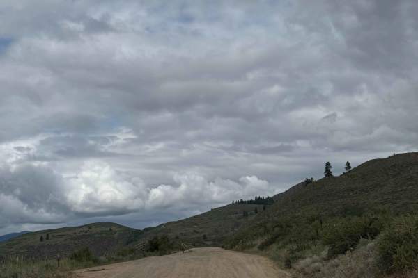
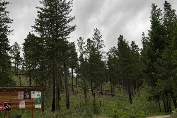
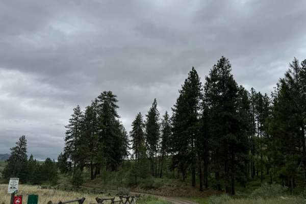
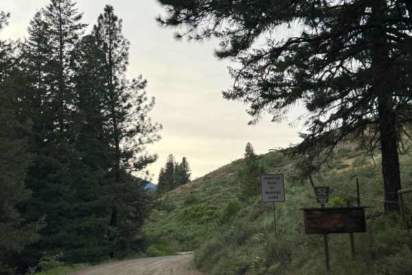
Washout Road - FS 5009-300
This is a dirt-based forest road that starts on State of Washington land and then travels into the Okanogan National Forest. At the beginning, there is a water crossing that is approximately a foot deep, but the ground is made of cement paving stones and provides traction. The trail has lots of wash...
Learn more about Washout Road - FS 5009-300
FS 5008-100
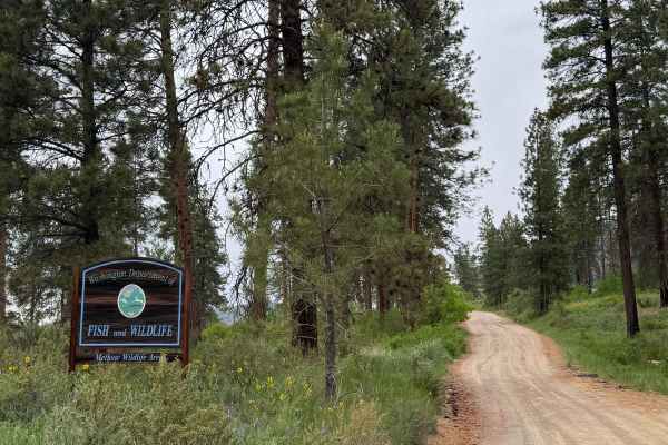
This dirt-based trail starts in State of Washington land, then travels into the National Forest. A Discover Pass is required to enjoy the state land. The trail gradually climbs over 2,100 feet in elevation over 6.6 miles before ending in the forest. There are potholes 4-6 inches deep and minor ruts ...
Learn more about FS 5008-100
Pearrygin Creek Road
This is a narrow, one lane, dirt based trail on State of Washington land. A Discover Pass is required to enjoy this area, and the trail is marked as No ATVs Allowed. The trail travels through a Forage Study area, and ends in a loop turnaround spot on the ledge above Pearrygin Creek. This is a short...
Learn more about Pearrygin Creek Road
Lester Road
This is a scenic shelf trail that connects Road 1631 and Road 1637. There is one steeper hill grade on the western end of the trail and a handful of longer and gradual hill grades throughout the rest of the trail. Now and then you'll catch views down the hill and into neighboring little valleys. Bik...
Learn more about Lester Road
Cougar Lake Road
This dirt-based forest road travels from the National Forest through State of Washington land. You will need a Discover Pass to enjoy the state land and lake area. It leads you to Cougar Lake and the campground there that has a vault-style toilet. Once you pass the lake, there is a water crossing th...
Learn more about Cougar Lake Road
FS 5008-200
This is a dirt based forest road that begins wide and then narrows to one lane and has some two track. The trail climbs over 1,800 feet in elevation, and has switchbacks with large drop offs/ledges near the end. There is minor ruts and wash along the trail and some overgrown vegetation, but any vehi...
Learn more about FS 5008-200
FS 5009-200
This forest road begins as a dirt-based, wide trail, then it narrows and gradually climbs the entire way. The trail climbs over 1,800 feet in elevation over 8.2 miles. The road becomes a shelf road with extreme drop-offs, but you will have beautiful views of the surrounding peaks. The trail starts w...
Learn more about FS 5009-200
Ramsey - FS 5009-100
This is a dirt-based forest road in the National Forest near Ramsey Peak. The trail has switchbacks and ledges as it climbs over 1,500 feet in elevation over 4.9 miles. The road gets narrow and turns to one vehicle wide with places to pass. There are two-track sections, sections of washboard, and mi...
Learn more about Ramsey - FS 5009-100
Campbell Lake Road
This is a dirt-based road that travels on State of Washington land. A Discover Pass is required to enjoy this area. The trail leads you past Campbell Lake, where there is an information board and a vault-style toilet. Once you go past the lake, the trail only goes a little further before ending at a...
Learn more about Campbell Lake Road
Bear T.S. FY - FS 5009-390
This is a dirt-based forest road that is narrow and one vehicle wide, with an occasional place to pass. There are areas of the trail that are two-track, and also sections that have a bumpy, rock garden. There are minor ruts and wash, and also ledges with decent drop-offs. The forest is thick in this...
Learn more about Bear T.S. FY - FS 5009-390
Gordon - FS 5009-400
This is a dirt-based forest road that gradually climbs just in front of Ramsey Peak. The trail is narrow and mostly one vehicle wide, with places to pass. The trail climbs around 950 feet in elevation over 2.5 miles, and the last push at the end is steep with a 13% pitch up loose gravel. There are m...
Learn more about Gordon - FS 5009-400
Balky Hill Road - 1637
If you're looking for an alternate road option from Highway 20 into the Okanogan National Forest, here is one. It's an easy, 2WD friendly, dirt road - complete with the typical washboards and small bumpy sections throughout. There are private residences for the first half until you get closer to the...
Learn more about Balky Hill Road - 1637
Cub Creek Road
This is a hard-packed, gravel-based forest road that travels around 16 miles. The trail gradually gains over 2,000 feet in elevation to about the 8-mile mark, then loses 1,800 feet. The road is winding and has minor ruts and wash, with only one section of heavy washout that is manageable by any vehi...
Learn more about Cub Creek Road
Newby Creek (4350100)
Sometimes trails lead to spectacular destinations and other times they have the promise of leading to something and end up going nowhere. Newby Creek trail is one of those routes that unfortunately doesn't lead to anything and is a curiosity as to why it even exists. Maybe a service road at some poi...
Learn more about Newby Creek (4350100)
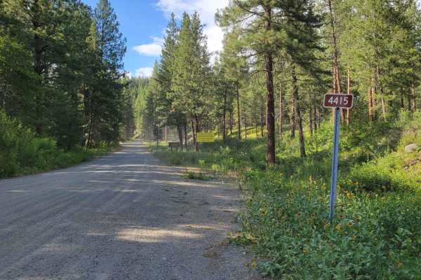
Cow Creek Road 4415040
From off of Little Bridge Creek trail, this nearly five-mile trail weaves and winds its way up Thompson Ridge, eventually ending atop a wide-open lookout spot. The trail begins as a spacious two-track and is fairly easy and non-technical for most of the way. Occasional erosion rut/gutter and mild ro...
Learn more about Cow Creek Road 4415040
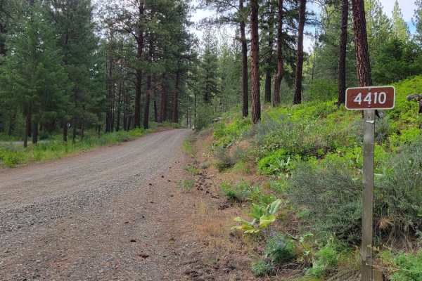
NF 4410 - Thompson Road
This is a gentle and easy forest road that connects Twisp River Road and Patterson Lake Road. It is 2WD friendly with nothing difficult or technical to note. The worst of it was washboarded sections and occasional pot holes. It is a routinely trafficked road as there are several mountain bike trails...
Learn more about NF 4410 - Thompson Road
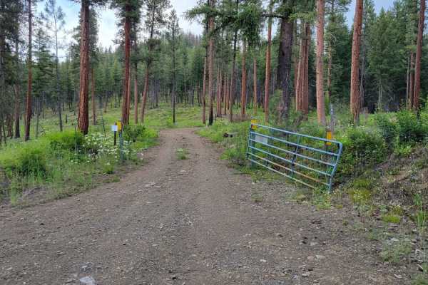
FR 4415 - Little Bridge Creek
Turning North off of Twisp River Road, this nearly seven mile trail leads deep into Okanogan National Forest. There is a posted warning sign: "Entering Burned Area. Increased risk of flooding, fallen trees, rocks, and debris flow." Even though the trail eventually dead-ends, there are several primit...
Learn more about FR 4415 - Little Bridge Creek
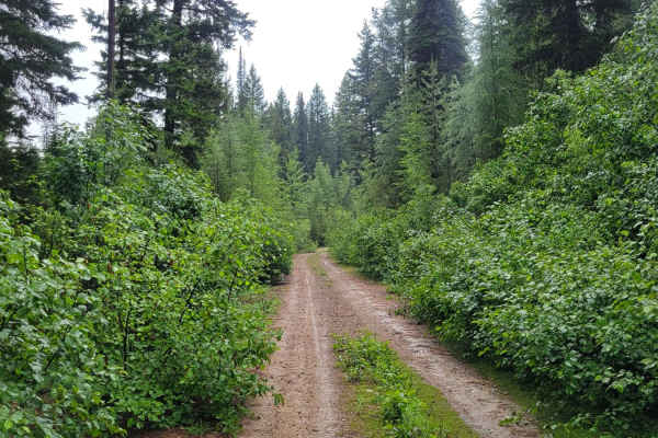
Cabin Creek
From off of Little Bridge Creek Trail, this little out-and-back two-track trail leads to the top of the ridge for a spectacular view down the valley. The trail itself is not well-traversed. It is very narrow with vegetation overgrowth - expect pin-striping on wider vehicles. Towards the top, the tra...
Learn more about Cabin Creek
FS 5010-100
Dirt-based forest road that starts out wide, then turns into a narrow shelf road. There are minor ruts and wash leading up to the 3.7-mile mark of the trail, where extreme washout has taken the trail away, and the road has been closed beyond that point. There are beautiful views of the surrounding p...
Learn more about FS 5010-100
Forest Road 4235-100
As an alternative mountain route, this is a seven-mile loop through the forest. The Northern section is immensely overgrown and narrow, with fallen trees on/over trail likely, and where pin-striping from brushing vegetation is guaranteed. The trail itself is not technical or difficult and is 2WD cap...
Learn more about Forest Road 4235-100
Beginner ATV trails near Winthrop, Washington
Explore ATV-friendly trails near you. These trails are accessible for vehicles up to 50 inches wide, perfect for ATVs and smaller off-road machines.
Washout Road - FS 5009-300
This is a dirt-based forest road that starts on State of Washington land and then travels into the Okanogan National Forest. At the beginning, there is a water crossing that is approximately a foot deep, but the ground is made of cement paving stones and provides traction. The trail has lots of wash...
Learn more about Washout Road - FS 5009-300
FS 5008-100
This dirt-based trail starts in State of Washington land, then travels into the National Forest. A Discover Pass is required to enjoy the state land. The trail gradually climbs over 2,100 feet in elevation over 6.6 miles before ending in the forest. There are potholes 4-6 inches deep and minor ruts ...
Learn more about FS 5008-100
Lester Road
This is a scenic shelf trail that connects Road 1631 and Road 1637. There is one steeper hill grade on the western end of the trail and a handful of longer and gradual hill grades throughout the rest of the trail. Now and then you'll catch views down the hill and into neighboring little valleys. Bik...
Learn more about Lester Road
Cougar Lake Road
This dirt-based forest road travels from the National Forest through State of Washington land. You will need a Discover Pass to enjoy the state land and lake area. It leads you to Cougar Lake and the campground there that has a vault-style toilet. Once you pass the lake, there is a water crossing th...
Learn more about Cougar Lake Road
Beginner UTV/side-by-side trails near Winthrop, Washington
Find UTV and side-by-side trails near you. These trails accommodate vehicles up to 60 inches wide, ideal for UTVs, side-by-sides, and wider off-road rigs.
Washout Road - FS 5009-300
This is a dirt-based forest road that starts on State of Washington land and then travels into the Okanogan National Forest. At the beginning, there is a water crossing that is approximately a foot deep, but the ground is made of cement paving stones and provides traction. The trail has lots of wash...
Learn more about Washout Road - FS 5009-300
FS 5008-100
This dirt-based trail starts in State of Washington land, then travels into the National Forest. A Discover Pass is required to enjoy the state land. The trail gradually climbs over 2,100 feet in elevation over 6.6 miles before ending in the forest. There are potholes 4-6 inches deep and minor ruts ...
Learn more about FS 5008-100
Pearrygin Creek Road
This is a narrow, one lane, dirt based trail on State of Washington land. A Discover Pass is required to enjoy this area, and the trail is marked as No ATVs Allowed. The trail travels through a Forage Study area, and ends in a loop turnaround spot on the ledge above Pearrygin Creek. This is a short...
Learn more about Pearrygin Creek Road
Lester Road
This is a scenic shelf trail that connects Road 1631 and Road 1637. There is one steeper hill grade on the western end of the trail and a handful of longer and gradual hill grades throughout the rest of the trail. Now and then you'll catch views down the hill and into neighboring little valleys. Bik...
Learn more about Lester Road
The onX Offroad Difference
onX Offroad combines trail photos, descriptions, difficulty ratings, width restrictions, seasonality, and more in a user-friendly interface. Available on all devices, with offline access and full compatibility with CarPlay and Android Auto. Discover what you're missing today!
Open Trail Map