
Beginner Off-Road Trails
Near Toco, Texas
Explore All Beginner Trails Near Toco, Texas
Beginner Off-Road Trails Near Toco, Texas
Discover the best beginner-friendly off-road trails near you. These easier, lower-rated trails are a great place to start — browse trail maps, check difficulty ratings, and find your next adventure.
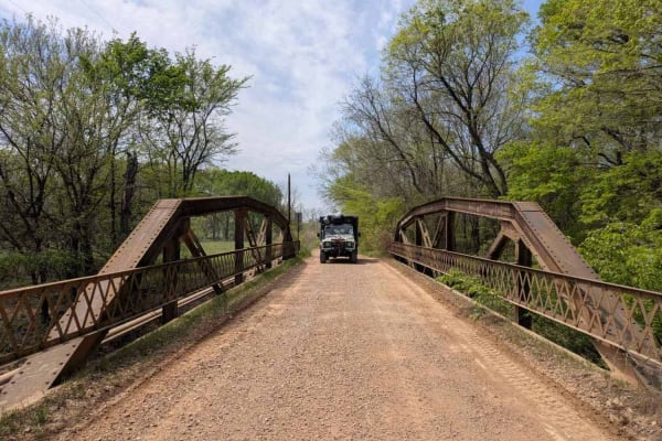
North Wade Road
Beginning as a narrow and winding route through a dense forest, the trail quickly does not seem to be used frequently. Early in the journey, you will cross a bridge situated beside an old railway structure, surrounded by lush, green, and swampy lands dotted with trees. The well-maintained gravel pat...
Learn more about North Wade Road
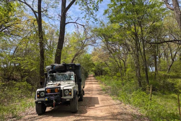
Bumpass Road
This narrow, off-road gravel trail winds through a humid, almost subtropical landscape of expansive green pastures and shaded woodland. Trees grow close to the roadside, with drainage channels helping manage runoff, and a large, striking tree in the center of the trail serves as a memorable natural ...
Learn more about Bumpass Road
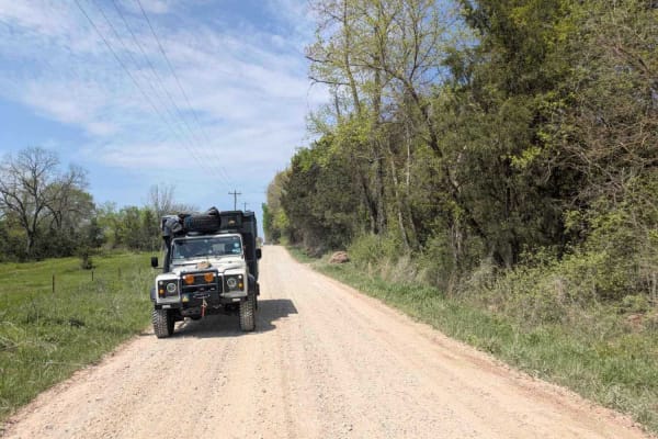
Hendrix Access Road
This well-maintained gravel trail winds through a scenic mix of open pastures, lightly wooded areas, and rural cattle ranches, offering a smooth and accessible drive suitable for any vehicle. Along the route, an old bridge crossing a stream--marked by signs of past flooding--adds character to the ot...
Learn more about Hendrix Access Road
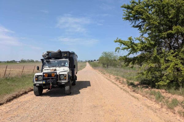
Bringham Road
This gravel route traverses open green fields with few trees, featuring a generally maintained road surface that includes small rocky sections and sandy stretches, neither of which pose a significant challenge. The further you travel, the smoother the road becomes if heading from south to north. Whi...
Learn more about Bringham Road
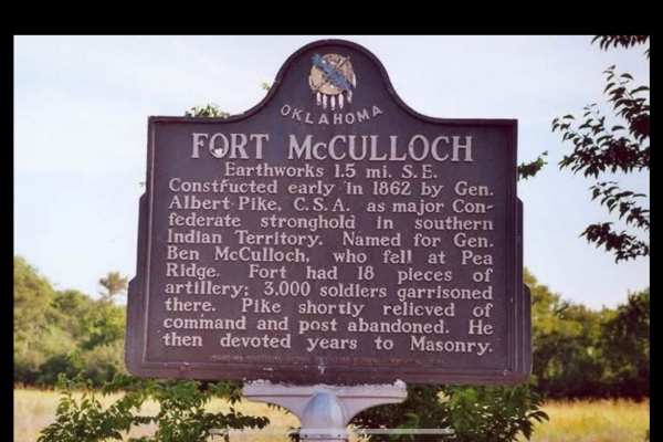
Fort McCulloch Road Trail
The Fort McCulloch trail system combines the Butterfield Trail, Valley Trail, and Prairie View Road into a scenic and enjoyable loop that showcases the diverse terrain of the area. Starting on Butterfield, you’ll wind through wooded sections with tight tree lines and mild rocky patches that keep the...
Learn more about Fort McCulloch Road Trail
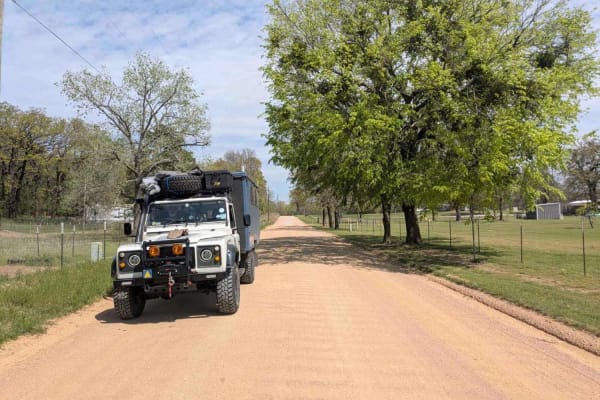
Platter Flats Campground Access Road
Set in an agricultural region, this off-road route offers a pleasant and scenic drive along a well-maintained gravel road, with occasional stretches of worn pavement and minor corrugation. The trail winds through green pastures, open fields, and dense forest, with elm, pine, cedar, and other trees l...
Learn more about Platter Flats Campground Access Road
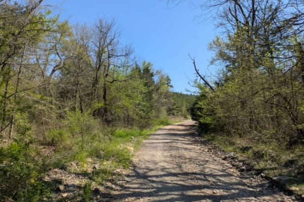
Ouachita National Forest Access Road
This scenic off-road route follows a well-maintained gravel surface that is typically wide yet tapers to narrower sections at times. You will notice drainage ditches running along its edges, and during April there is considerable flowing water. The trail features expansive quarries that serve as pos...
Learn more about Ouachita National Forest Access Road
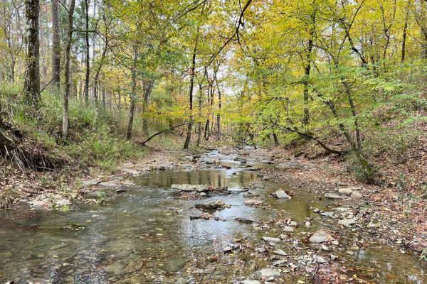
Glover River Camp Route
This trail links a few different forest roads together to end at an amazing open camp area with room for several rigs and easy access to the glover river. It has several small water crossings and minor obstacles. Some of the trail is very tight, and most of it is slow rolling. It has amazing views ...
Learn more about Glover River Camp Route

Anderson Trail
This scenic off-road route, known as the Anderson Trail, serves as a primary connector between higher and lower trails in the region. Although it is predominantly well-maintained gravel, a handful of rocky sections and muddy puddles--particularly in April--add an element of challenge. Two vehicles c...
Learn more about Anderson Trail
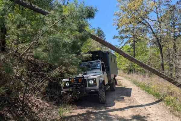
53250
This off-road trail winds through a dense forest, revealing a narrow track that shows signs of limited upkeep, particularly through overgrowth and numerous muddy, rock-bottomed holes often present during April. Several off-camber stretches and areas of water damage add challenges, alongside a few mo...
Learn more about 53250

Shell Rock Road
This road is mostly rock/shale/gravel Forest Service Road. It is a rough rocky road with deep shoulder drop-offs from 3' to 30' in some areas. There is Shell Rock creek that runs along it. The foliage in the fall makes for an excellent trail. Wildlife is out along this trail. The trail can be run in...
Learn more about Shell Rock Road
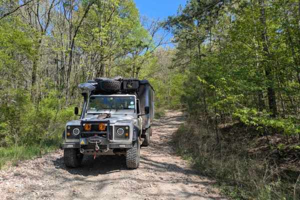
52420
This route commences with a rocky, off-camber descent toward a low-level water crossing, after which the path narrows and becomes increasingly rugged, requiring slow travel in low gear. Water damage has significantly eroded the surface, forming deep, off-camber ruts and heavily rutted ascents and de...
Learn more about 52420
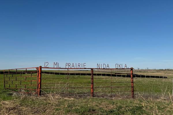
Twelve Mile Prairie Trail #1
The 12-mile Prairie Trail begins at Horse Creek Road and ends at Dunn Road or vice versa, and rolls out across open country that mixes prairie stretches, scattered timber, and gentle elevation changes. The route follows a series of old rural paths that feel untouched and authentic, giving the ride a...
Learn more about Twelve Mile Prairie Trail #1
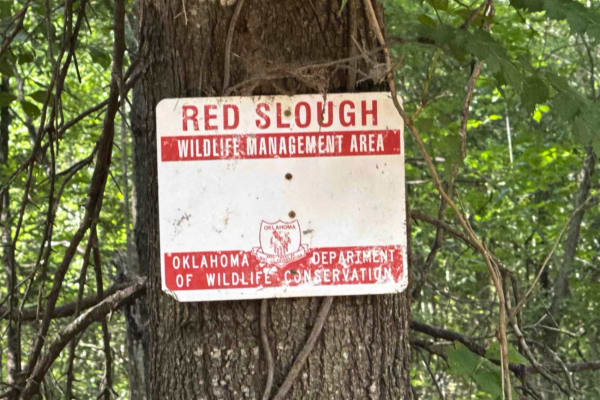
Red Slough
This is a small trail I have wanted to post for years. It is an old Rice Farm from many years ago. The drive is fine and easily accessible by most vehichles, although if it is wet at all then it will require an ATV to handle the mud. The road the finishes the journey is known as "Mudline", and it ea...
Learn more about Red Slough
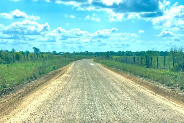
Tuckers Corner CR4306
This is a rural dirt road that winds through open cattle fields, featuring minor washes along the route. The road surface is a mix of gravel and red dirt, with narrow passing lanes in certain areas that require caution when meeting oncoming traffic. It is generally passable in dry conditions but can...
Learn more about Tuckers Corner CR4306
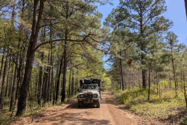
53140
This off-road route presents a scenic journey along a mostly flat, well-maintained gravel surface, although it is quite narrow with trees lining the edges. The trail features a deceptively steep ascent that may require some vehicles to shift into a lower gear for optimal performance. Once past the c...
Learn more about 53140
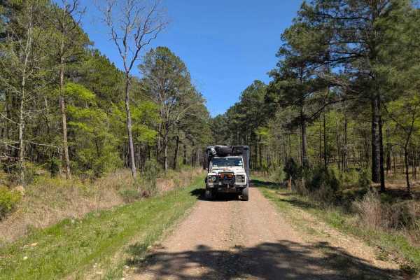
53500 Creek Trail
This narrow, short, and flat trail is exceptionally beautiful and offers a delightful experience for off-road enthusiasts. The route winds through a pristine forest before reaching a clear creek featuring a submerged concrete passway. At the trail's end, a sign--indicating the trail opens in October...
Learn more about 53500 Creek Trail
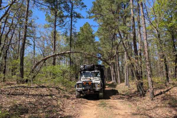
53300
This off-road trail leads adventurers to a creek along narrow, wet UTV pathways. The route appears to be poorly maintained, featuring rocky, off-camber sections with relatively steep ascents and descents. It passes over several beautiful creeks, adding to its rugged charm. As the drive continues, th...
Learn more about 53300
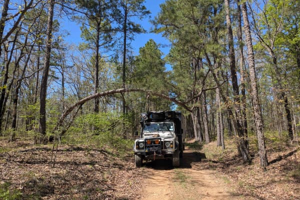
53350
This off-road trail presents a rugged challenge with its rocky surface that gradually narrows while becoming off-camber, showing clear signs of water damage. In several areas, the forest is encroaching on the path, increasing the risk of pinstriping, and fallen trees are scattered along the route. N...
Learn more about 53350
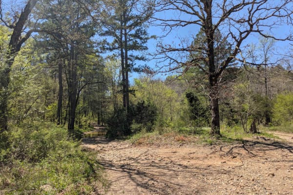
52750
This narrow, short, and flat trail is exceptionally beautiful and offers a delightful experience for off-road enthusiasts. The route winds through a pristine forest before reaching a clear creek featuring a submerged concrete passway. At the trail's end, a sign--indicating the trail opens in October...
Learn more about 52750
Beginner ATV trails near Toco, Texas
Explore ATV-friendly trails near you. These trails are accessible for vehicles up to 50 inches wide, perfect for ATVs and smaller off-road machines.
Ouachita National Forest Access Road
This scenic off-road route follows a well-maintained gravel surface that is typically wide yet tapers to narrower sections at times. You will notice drainage ditches running along its edges, and during April there is considerable flowing water. The trail features expansive quarries that serve as pos...
Learn more about Ouachita National Forest Access Road
Anderson Trail
This scenic off-road route, known as the Anderson Trail, serves as a primary connector between higher and lower trails in the region. Although it is predominantly well-maintained gravel, a handful of rocky sections and muddy puddles--particularly in April--add an element of challenge. Two vehicles c...
Learn more about Anderson Trail
53250
This off-road trail winds through a dense forest, revealing a narrow track that shows signs of limited upkeep, particularly through overgrowth and numerous muddy, rock-bottomed holes often present during April. Several off-camber stretches and areas of water damage add challenges, alongside a few mo...
Learn more about 53250
Shell Rock Road
This road is mostly rock/shale/gravel Forest Service Road. It is a rough rocky road with deep shoulder drop-offs from 3' to 30' in some areas. There is Shell Rock creek that runs along it. The foliage in the fall makes for an excellent trail. Wildlife is out along this trail. The trail can be run in...
Learn more about Shell Rock Road
Beginner UTV/side-by-side trails near Toco, Texas
Find UTV and side-by-side trails near you. These trails accommodate vehicles up to 60 inches wide, ideal for UTVs, side-by-sides, and wider off-road rigs.
Ouachita National Forest Access Road
This scenic off-road route follows a well-maintained gravel surface that is typically wide yet tapers to narrower sections at times. You will notice drainage ditches running along its edges, and during April there is considerable flowing water. The trail features expansive quarries that serve as pos...
Learn more about Ouachita National Forest Access Road
Glover River Camp Route
This trail links a few different forest roads together to end at an amazing open camp area with room for several rigs and easy access to the glover river. It has several small water crossings and minor obstacles. Some of the trail is very tight, and most of it is slow rolling. It has amazing views ...
Learn more about Glover River Camp Route
Anderson Trail
This scenic off-road route, known as the Anderson Trail, serves as a primary connector between higher and lower trails in the region. Although it is predominantly well-maintained gravel, a handful of rocky sections and muddy puddles--particularly in April--add an element of challenge. Two vehicles c...
Learn more about Anderson Trail
53250
This off-road trail winds through a dense forest, revealing a narrow track that shows signs of limited upkeep, particularly through overgrowth and numerous muddy, rock-bottomed holes often present during April. Several off-camber stretches and areas of water damage add challenges, alongside a few mo...
Learn more about 53250
The onX Offroad Difference
onX Offroad combines trail photos, descriptions, difficulty ratings, width restrictions, seasonality, and more in a user-friendly interface. Available on all devices, with offline access and full compatibility with CarPlay and Android Auto. Discover what you're missing today!
Open Trail Map