
Beginner Off-Road Trails
Near St. Helena, California
Explore All Beginner Trails Near St. Helena, California
Beginner Off-Road Trails Near St. Helena, California
Discover the best beginner-friendly off-road trails near you. These easier, lower-rated trails are a great place to start — browse trail maps, check difficulty ratings, and find your next adventure.

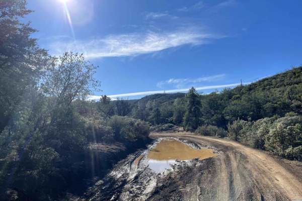
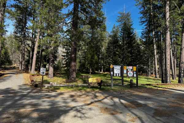
Cement Creek
This trail has great views throughout with a spectacular view of Lake Berryessa at its highest elevation point. Expect to drive dirt, gravel and mud along the out and back trail. There are also many dispersed camping sites along the way. After 11.4 miles the trail does dead end on a private property...
Learn more about Cement Creek
Devilhead Road
This is an easy fire road in dry weather and a fun mud run in wet weather. The road doubles as the southern entrance to Knoxville, OHV, and Berryessa Snow Mountain National Monument. It then splits into access for Adams Ridge, Cement Creek, and Hunting Creek trails. While not very challenging, it do...
Learn more about Devilhead Road

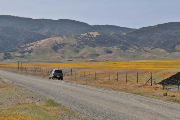
Dunnigan Hill
The main connector between the north and south entrances of the Knoxville OHV area. Very active with power sports vehicles, as many marked and unmarked trails crisscross this trail. An easy trail with good views of the mountains, including. Mt. Saint Helena in Napa. It also passes by the only develo...
Learn more about Dunnigan Hill
Bear Valley Road Trail
Easy dirt trail with connections to the Berryessa Snow Mountain Monument area Trails with wildflower sights in Spring and the main road to The Wilbur Hot Springs. Beautiful scenery of the Bear Valley in Lake and Colusa Counties in Spring with Bear Creek passing next to the trail. Near the end of the...
Learn more about Bear Valley Road Trail

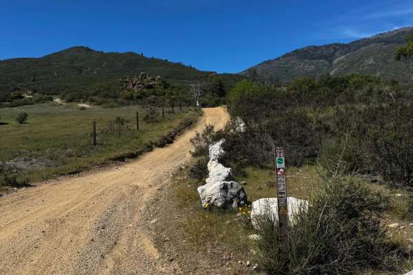
Walker Ridge Road to Indian Valley Reservoir Road
Walker Ridge Road is one of the main entrances to the Indian Valley Reservoir (CDFW) and the Walker Ridge Recreation Area (BLM). The road is gravel and accessible by most high-clearance vehicles. There are plenty of OHV and 4x4 trails off the main road. Walker Ridge Recreation Area allows all types ...
Learn more about Walker Ridge Road to Indian Valley Reservoir Road
Cold Spring
Cold Spring is an inviting off-road spur trail ideal for high-clearance four-wheel-drive vehicles, SxSs, and dirt bikes seeking a quiet mountain escape with panoramic views of the Indian Valley Reservoir. Branching off the county-maintained Bartlett Springs Road near Cold Spring Mountain, this route...
Learn more about Cold Spring

Bartlett Springs Road
Bartlett Springs Road begins southeast of Mendocino National Forest and boasts excellent views. This route passes through BLM land, and there are plenty of offshoots from the trail. There are also opportunities for camping, hiking, mountain biking, fishing, hunting, and recreational shooting. Cell s...
Learn more about Bartlett Springs Road

Mendo-Lake Road
An easy scenic route over mountain ridges through South Cow Mountain OHV that connects lakeport to Ukiah. This is the main dirt road through cow mountain that has multiple harder trails off either side and has multiple campgrounds that are easily accessible by 2WDd vehicles. There are excellent view...
Learn more about Mendo-Lake Road
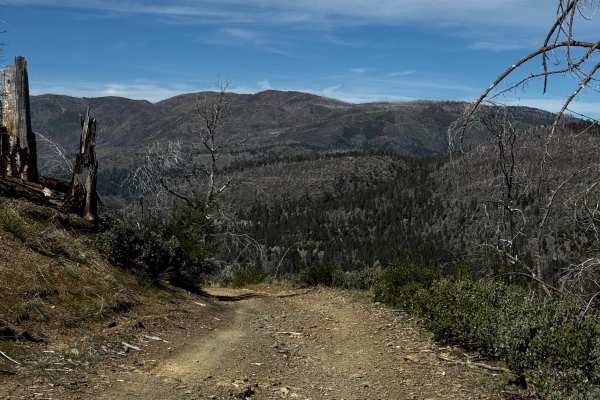
Wilblain - FS 16N18
Narrow trail connecting Mendocino Scenic Corridor and Richardson Glade. More of a tighter two-track section with lots of off-camber and washes to navigate through. You will encounter tough vegetation in some sections and get some pinstripes. Goes through a burned area, so it might have fallen trees ...
Learn more about Wilblain - FS 16N18
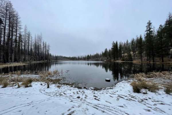
Letts Lake
This trail is a little less than 4 miles and leads to Letts Lake and campground. As the only lake in the lower half of Mendocino NF, it is worth visiting. There are four campsites around the lake; each has a handful of first come, first serve sites. You may also swim and fish in the lake.
Learn more about Letts Lake
Letts Valley - FS 17N02
This is more of a straightforward gravel fire road. It has most of the surrounding trails attached to it and is also the dirt way to Letts Lake and campgrounds. Some sections of the road are deteriorating, so be careful since they are on the shelf part of the trail.
Learn more about Letts Valley - FS 17N02
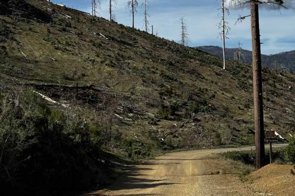
Stony Slope - FS 17N89
Out-and-back trail, big dispersed camp area at the end of the trail for multiple vehicles. There are a few spots to pass, and a dirt bike trail is towards the beginning. has a few ledges from erosion and some washes. Toward the end of the trail, before it descends into the camp spot, there is a good...
Learn more about Stony Slope - FS 17N89
East Letts - FS 17N02k
This trail used to be longer, but erosion turned it into half just a dirt bike trail. This trial ends at a bit of a turn around that you could unload your bikes and hit the other trails from that point. It's also a connector to the Old Letts Trail. This trail is single vehicle wide, and there are a ...
Learn more about East Letts - FS 17N02k
Mill Valley Spur C - FS 17N02C
Single wide trail but smooth. This trail connects the main Letts Valley trail to Mill Valley Campground. If you miss it, you'll have to go way around and take a difficulty 4/10 trail to get to the campground. This trail will be for people who don't have a capable vehicle to make it on the harder tra...
Learn more about Mill Valley Spur C - FS 17N02C
Richardson Glade - FS 17N26
Single wide trail with one end being an out-and-back. The south end has dispersed campsites on the edge of the ridge, which are awesome but also very exposed. The trail has many washes and ditches, and will get narrow enough to cause pin stripes. The trail also goes through a burned area.
Learn more about Richardson Glade - FS 17N26
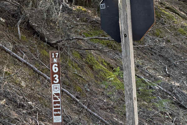
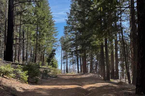
Sanborn - FS 17N63
Mostly a wide fire road connecting the road to Potato Hill Trail. There are some small washes, and it narrows at a few sections to one vehicle wide. Good views from the top of the trail. Seasonal close and will close for wet weather. Had a few low-hanging trees and a tree down across the top of the...
Learn more about Sanborn - FS 17N63
Champagne - FS 17N79
This trail immediately starts climbing. Has many rolling water drainages and rocky sections. Start to get good views of the canyon as well. Crossing a road and continuing on the other side, it's easy to see and is marked. Good warm-up before going on the Potato Hill trail that gets pretty steep.
Learn more about Champagne - FS 17N79
Letts Ridge Trailhead Entrance
This is the beginning of the Letts Ridge trail. Past this is only for dirtbikes and other smaller OHV machines. This trail will also take you to the Champagne trail wh8ch also connects to Potato Hill. At the end is a big area to unload to do the rest of the Letts Ridge trail. A lot of whoops-style b...
Learn more about Letts Ridge Trailhead Entrance
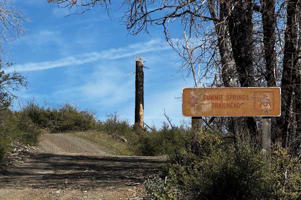
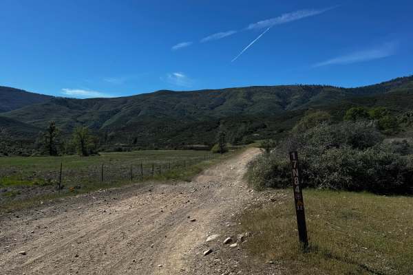
Boundary Road - FS 17N06
This trail takes you up to the Summit Springs trailhead. Gets steep in some sections, mixed with smaller washes. There is a section of the trail beginning to wash out, so use caution. Near the top of the trail, there are nice places to dispersed camp with big views of the canyon and places with tabl...
Learn more about Boundary Road - FS 17N06

Pilot Grove - FS 16N01
The trail connects Elk Mountain Road to Deer Valley Campground. 1 to 2 vehicles wide as you go along. The trail is more like a fire service road, well-maintained with minimal washouts. Mostly stay in the trees, which is nice and shaded. Deer Valley Campground is a Primative site with two pit toilets...
Learn more about Pilot Grove - FS 16N01
Beginner ATV trails near St. Helena, California
Explore ATV-friendly trails near you. These trails are accessible for vehicles up to 50 inches wide, perfect for ATVs and smaller off-road machines.
Dunnigan Hill
The main connector between the north and south entrances of the Knoxville OHV area. Very active with power sports vehicles, as many marked and unmarked trails crisscross this trail. An easy trail with good views of the mountains, including. Mt. Saint Helena in Napa. It also passes by the only develo...
Learn more about Dunnigan Hill
Bear Valley Road Trail
Easy dirt trail with connections to the Berryessa Snow Mountain Monument area Trails with wildflower sights in Spring and the main road to The Wilbur Hot Springs. Beautiful scenery of the Bear Valley in Lake and Colusa Counties in Spring with Bear Creek passing next to the trail. Near the end of the...
Learn more about Bear Valley Road Trail
Walker Ridge Road to Indian Valley Reservoir Road
Walker Ridge Road is one of the main entrances to the Indian Valley Reservoir (CDFW) and the Walker Ridge Recreation Area (BLM). The road is gravel and accessible by most high-clearance vehicles. There are plenty of OHV and 4x4 trails off the main road. Walker Ridge Recreation Area allows all types ...
Learn more about Walker Ridge Road to Indian Valley Reservoir Road
Cold Spring
Cold Spring is an inviting off-road spur trail ideal for high-clearance four-wheel-drive vehicles, SxSs, and dirt bikes seeking a quiet mountain escape with panoramic views of the Indian Valley Reservoir. Branching off the county-maintained Bartlett Springs Road near Cold Spring Mountain, this route...
Learn more about Cold Spring
Beginner UTV/side-by-side trails near St. Helena, California
Find UTV and side-by-side trails near you. These trails accommodate vehicles up to 60 inches wide, ideal for UTVs, side-by-sides, and wider off-road rigs.
Dunnigan Hill
The main connector between the north and south entrances of the Knoxville OHV area. Very active with power sports vehicles, as many marked and unmarked trails crisscross this trail. An easy trail with good views of the mountains, including. Mt. Saint Helena in Napa. It also passes by the only develo...
Learn more about Dunnigan Hill
Bear Valley Road Trail
Easy dirt trail with connections to the Berryessa Snow Mountain Monument area Trails with wildflower sights in Spring and the main road to The Wilbur Hot Springs. Beautiful scenery of the Bear Valley in Lake and Colusa Counties in Spring with Bear Creek passing next to the trail. Near the end of the...
Learn more about Bear Valley Road Trail
Walker Ridge Road to Indian Valley Reservoir Road
Walker Ridge Road is one of the main entrances to the Indian Valley Reservoir (CDFW) and the Walker Ridge Recreation Area (BLM). The road is gravel and accessible by most high-clearance vehicles. There are plenty of OHV and 4x4 trails off the main road. Walker Ridge Recreation Area allows all types ...
Learn more about Walker Ridge Road to Indian Valley Reservoir Road
Cold Spring
Cold Spring is an inviting off-road spur trail ideal for high-clearance four-wheel-drive vehicles, SxSs, and dirt bikes seeking a quiet mountain escape with panoramic views of the Indian Valley Reservoir. Branching off the county-maintained Bartlett Springs Road near Cold Spring Mountain, this route...
Learn more about Cold Spring
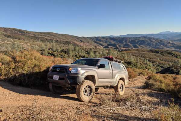
The onX Offroad Difference
onX Offroad combines trail photos, descriptions, difficulty ratings, width restrictions, seasonality, and more in a user-friendly interface. Available on all devices, with offline access and full compatibility with CarPlay and Android Auto. Discover what you're missing today!
Open Trail Map