
Beginner Off-Road Trails
Near Sims, Illinois
Explore All Beginner Trails Near Sims, Illinois
Beginner Off-Road Trails Near Sims, Illinois
Discover the best beginner-friendly off-road trails near you. These easier, lower-rated trails are a great place to start — browse trail maps, check difficulty ratings, and find your next adventure.
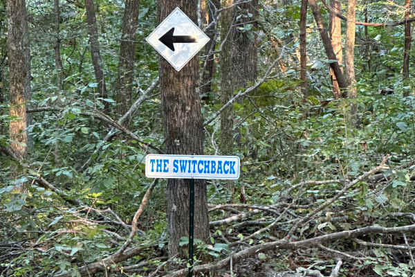
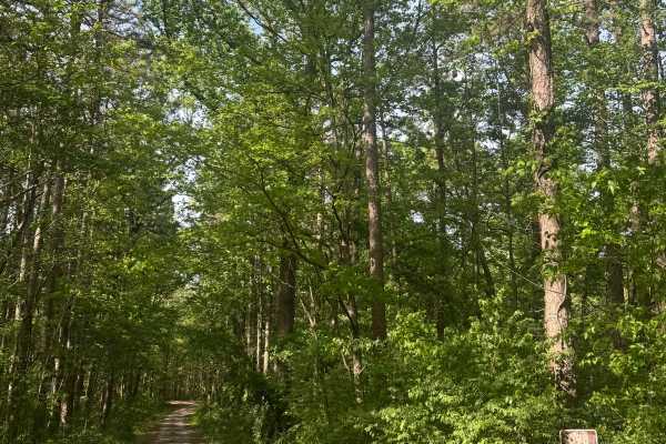
The Switchback
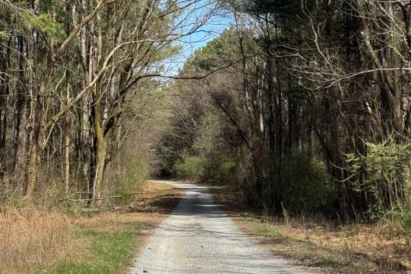
"The Switchback" (aka "Wooded Racetrack") is a 0.7-mile loop. You can access it from a few different trails, but the easiest is off of Old Highway 13. Once you see signs showing you where to enter, just follow the arrows. The most important part of this trail, since it is a loop, follow the arrows a...
Learn more about The Switchback
East Field Access Trail
The East Field access trail is the main route leading to the Haul Road. A few side trails are also accessible through this road, such as the Olive Trail, along with some short hill-climb crossover routes to Old Highway 13. The East Field trail is accessed through the east side of the campground, and...
Learn more about East Field Access Trail
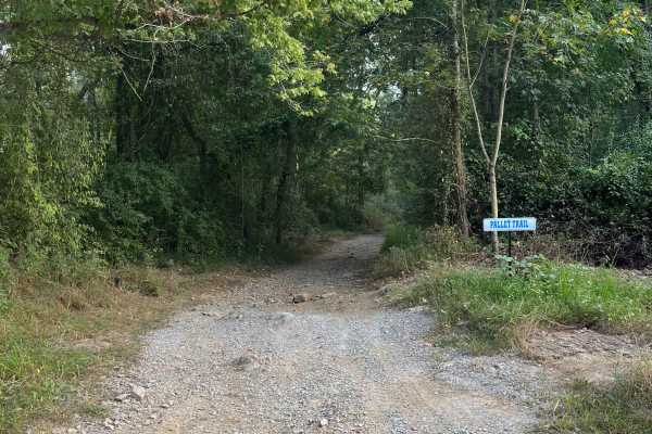
Pallet Trail
The Pallet Trail is one of the main routes through the south portion of the forest, and gives riders access to many secondary and tertiary routes. At the north side, this trail is accessed from Old Route 13 and begins with a mixture of gravel and dirt. The surface composition throughout the trail co...
Learn more about Pallet Trail
Open Ponds Trail
The Open Ponds trail can be accessed through the Blue Bird Trail or the east side of the Long Wall Access Trail. This trail traverses along ridges between a number of ponds, and through the valleys of strip hills. When approached from the north side, the Open Ponds Trail begins with a descent and cr...
Learn more about Open Ponds Trail
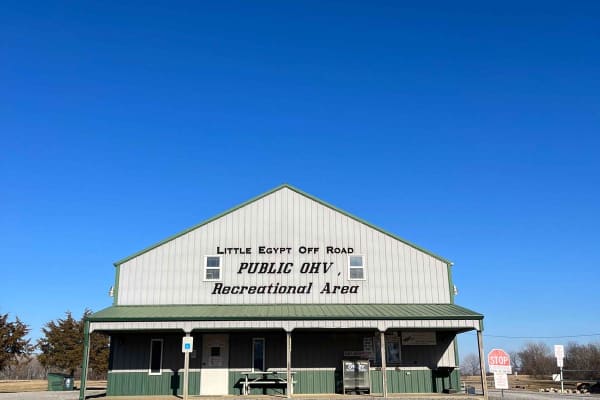
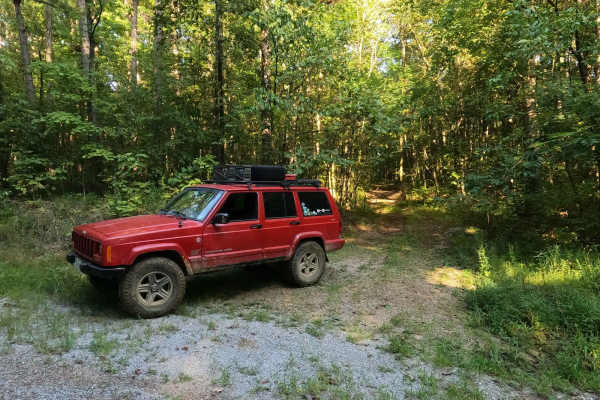
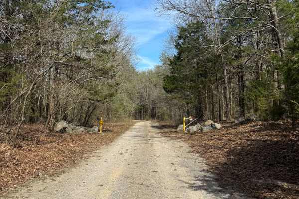
Little Egypt Off-Road OHV Park Entrance
Welcome to Little Egypt Off-Road OHV Park! Our hours of operation are 8 AM to 5 PM on Saturdays and Sundays, including most holidays. We offer over 50 miles of trails, from beginner access roads to challenging single-track, extending throughout our roughly 1000-acre park. Side-by-sides, ATVs, and d...
Learn more about Little Egypt Off-Road OHV Park Entrance
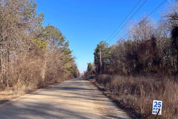
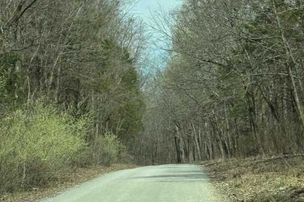
Old Highway 13
At Little Egypt Off Road, there's a 1.5-mile portion of the former Illinois Highway 13. This is one of the main access routes throughout the property, as it stretches the entire width of the park. The main feature of this route is the overpass across the Amax Haul Road. When following this road from...
Learn more about Old Highway 13
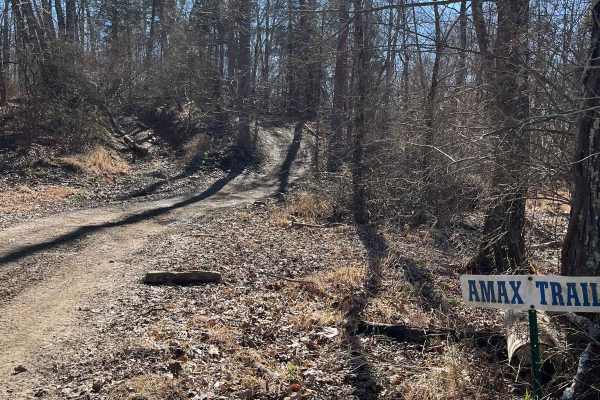
Amax Trail
The Amax Trail can be seen from the main gate to Little Egypt Off Road and is the westernmost main trail on the property. It traverses from alongside Old Route 13 to the Boundary Trail on the south end. The Amax Trail overlooks the creek bottoms that make up the southwest corner of the property, a g...
Learn more about Amax Trail
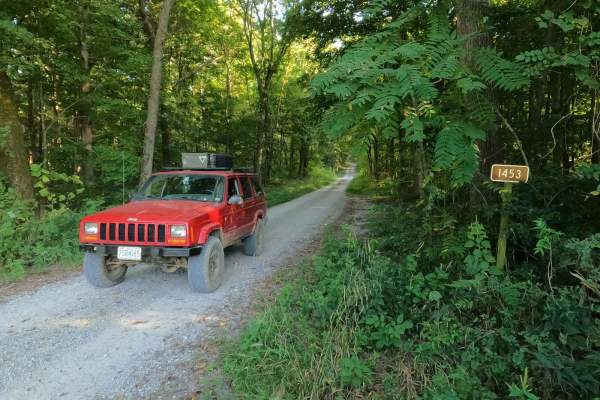
Stone Face Lane - FS 1453
Stone Face Lane/Recreation Area FS 1453 is a gravel access road to the hiking trail and scenic bluff rock overlook of the same name. It is a part of the Eagle Mountain area within the Hidden Springs sector of Shawnee National Forest. The lane is short but provides a great place to stage and meet up ...
Learn more about Stone Face Lane - FS 1453
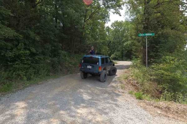
Eagle Mountain Fire Road
The Eagle Mountain Fire Road is a gravel service road through the Eagle Mountain area in the most northern section of the Hidden Springs sector of Shawnee National Forest. The road acts as a main artery road that most of the other trails in the area are connected to or even loop back to. It is mostl...
Learn more about Eagle Mountain Fire Road
Wamble Mountain Spur Road - FS 707A
Wamble Mountain Spur Road FS 707A is a natural-improved trail in Shawnee National Forest near the Eagle Mountain area, within the Hidden Springs Sector. The FS 707A is best described as your uncle's secret hunting road; few know about it, and the entrance gives the vibe that no one uses it. However,...
Learn more about Wamble Mountain Spur Road - FS 707A

High Knob Trail
High Knob Trail is a gravel route within Shawnee National Forest that travels through an equestrian campground before climbing to a scenic overlook. Drivers should use caution when passing through the campground area, yielding to horses and minimizing speed and dust. The trail gradually gains elevat...
Learn more about High Knob Trail
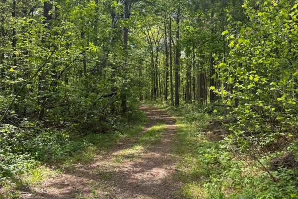
River to River Trail
River to River Trail is a gravel route within Shawnee National Forest that provides access to backcountry hiking and equestrian trails. The road is generally easy to follow and travels through a more remote section of the forest, offering a quieter experience for those looking to explore beyond main...
Learn more about River to River Trail
Burden Falls Trail
Burden Falls Trail is a gravel road within Shawnee National Forest that provides access to multiple hiking points leading to Burden Falls. The route is easy to follow and consists of typical forest gravel terrain with minimal obstacles. Along the trail, visitors will find several access points for h...
Learn more about Burden Falls Trail
Cadiz Campground Trail
The Cadiz Campground Trail begins within Shawnee National Forest at Cadiz Campground, a primitive-style campground that offers designated campsites with fire pits, restroom facilities, and a water fill spigot. The route starts as a maintained gravel road and provides easy access from within the camp...
Learn more about Cadiz Campground Trail
Burden Falls Road
Burden Falls Road is a gravel route within Shawnee National Forest that connects the small community of McCormick to Burden Falls Road (402). The road is generally easy to follow and consists of typical forest gravel terrain with occasional uneven sections. This route provides a quieter, more scenic...
Learn more about Burden Falls Road
Lake Of Egypt Campground Drive - FS 871A
This route leads to a primitive campground area within Shawnee National Forest overlooking Lake of Egypt. The trail follows a partially maintained gravel road with frequent tree limbs overhanging that may limit access for larger vehicles. Due to tight clearances, this route is best suited for truck ...
Learn more about Lake Of Egypt Campground Drive - FS 871A
Bell Smith Spring Rope Swing Trail
Bell Smith Spring Rope Swing Trail is a gravel road within Shawnee National Forest that leads to a spring-fed swimming area known for its rope swings and deep water access. The route is easy to navigate and follows a typical forest gravel surface with minimal obstacles. At the end of the trail, visi...
Learn more about Bell Smith Spring Rope Swing Trail
Hickory Point Boat Ramp - FS 871
This route follows a gravel road within Shawnee National Forest and leads to the Hickory Point Boat Ramp at Lake of Egypt. At the Y-intersection, this route branches away from the campground access and continues toward the water. The road surface is similar throughout, consisting of gravel with some...
Learn more about Hickory Point Boat Ramp - FS 871
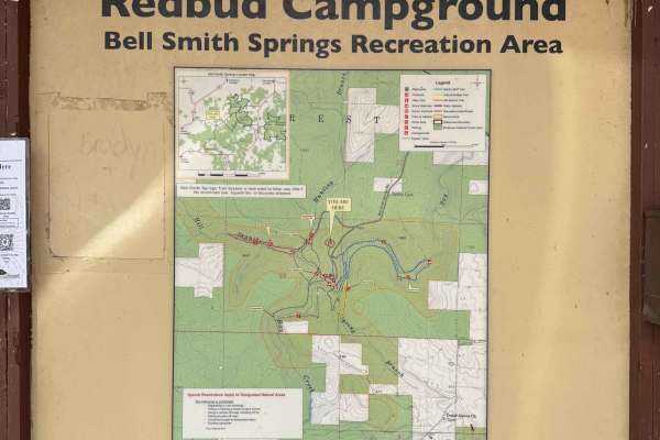
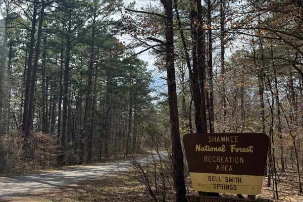
Bell Smith Spring Hiking Area
Bell Smith Springs Trailhead Access is a gravel and partially paved road within Shawnee National Forest that leads to the main hiking trailhead and campground area at Bell Smith Springs. The route is easy to navigate and suitable for most vehicles, making it a primary access point for visitors to th...
Learn more about Bell Smith Spring Hiking Area

Goose Ridge Trail
Goose Ridge Trail is a gravel route within Shawnee National Forest that offers a straightforward out-and-back drive through forest terrain. The road is generally easy to follow, with some ruts that may develop after rainfall and occasional tree limbs overhanging the route. This trail provides a rela...
Learn more about Goose Ridge Trail
Beginner ATV trails near Sims, Illinois
Explore ATV-friendly trails near you. These trails are accessible for vehicles up to 50 inches wide, perfect for ATVs and smaller off-road machines.
The Switchback
"The Switchback" (aka "Wooded Racetrack") is a 0.7-mile loop. You can access it from a few different trails, but the easiest is off of Old Highway 13. Once you see signs showing you where to enter, just follow the arrows. The most important part of this trail, since it is a loop, follow the arrows a...
Learn more about The Switchback
East Field Access Trail
The East Field access trail is the main route leading to the Haul Road. A few side trails are also accessible through this road, such as the Olive Trail, along with some short hill-climb crossover routes to Old Highway 13. The East Field trail is accessed through the east side of the campground, and...
Learn more about East Field Access Trail
Pallet Trail
The Pallet Trail is one of the main routes through the south portion of the forest, and gives riders access to many secondary and tertiary routes. At the north side, this trail is accessed from Old Route 13 and begins with a mixture of gravel and dirt. The surface composition throughout the trail co...
Learn more about Pallet Trail
Open Ponds Trail
The Open Ponds trail can be accessed through the Blue Bird Trail or the east side of the Long Wall Access Trail. This trail traverses along ridges between a number of ponds, and through the valleys of strip hills. When approached from the north side, the Open Ponds Trail begins with a descent and cr...
Learn more about Open Ponds Trail
Beginner UTV/side-by-side trails near Sims, Illinois
Find UTV and side-by-side trails near you. These trails accommodate vehicles up to 60 inches wide, ideal for UTVs, side-by-sides, and wider off-road rigs.
The Switchback
"The Switchback" (aka "Wooded Racetrack") is a 0.7-mile loop. You can access it from a few different trails, but the easiest is off of Old Highway 13. Once you see signs showing you where to enter, just follow the arrows. The most important part of this trail, since it is a loop, follow the arrows a...
Learn more about The Switchback
East Field Access Trail
The East Field access trail is the main route leading to the Haul Road. A few side trails are also accessible through this road, such as the Olive Trail, along with some short hill-climb crossover routes to Old Highway 13. The East Field trail is accessed through the east side of the campground, and...
Learn more about East Field Access Trail
Pallet Trail
The Pallet Trail is one of the main routes through the south portion of the forest, and gives riders access to many secondary and tertiary routes. At the north side, this trail is accessed from Old Route 13 and begins with a mixture of gravel and dirt. The surface composition throughout the trail co...
Learn more about Pallet Trail
Open Ponds Trail
The Open Ponds trail can be accessed through the Blue Bird Trail or the east side of the Long Wall Access Trail. This trail traverses along ridges between a number of ponds, and through the valleys of strip hills. When approached from the north side, the Open Ponds Trail begins with a descent and cr...
Learn more about Open Ponds Trail
The onX Offroad Difference
onX Offroad combines trail photos, descriptions, difficulty ratings, width restrictions, seasonality, and more in a user-friendly interface. Available on all devices, with offline access and full compatibility with CarPlay and Android Auto. Discover what you're missing today!
Open Trail Map