
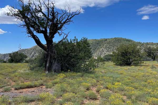
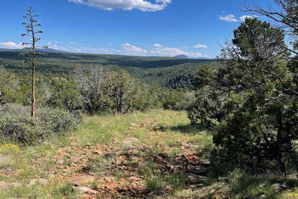
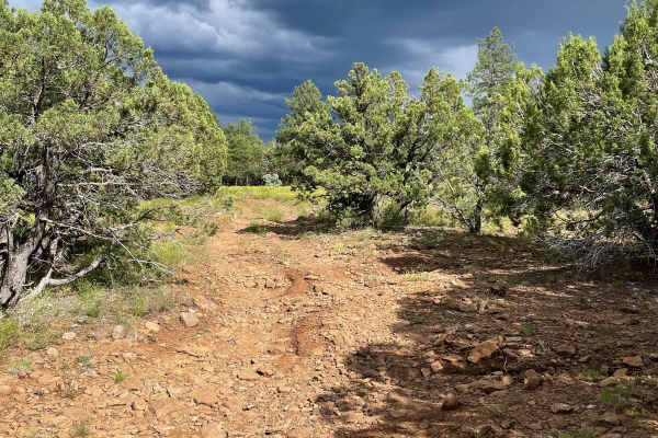
Beginner Off-Road Trails
Near Sedona, Arizona
Explore All Beginner Trails Near Sedona, Arizona
Beginner Off-Road Trails Near Sedona, Arizona
Discover the best beginner-friendly off-road trails near you. These easier, lower-rated trails are a great place to start — browse trail maps, check difficulty ratings, and find your next adventure.
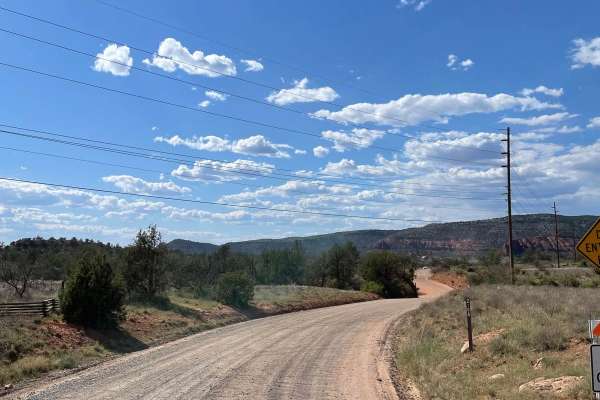
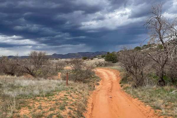
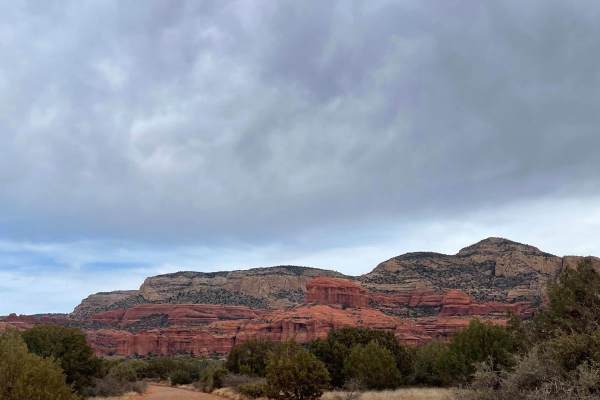
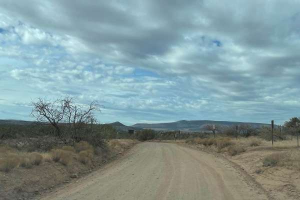
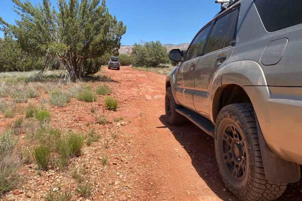
Alternative Access to Cathedral Rock
This short, maintained gravel road leads to the back side of the iconic Cathedral Rock. Along this road is Baldwin Trailhead. This hiking trailhead provides access to hiking trails to the most popular destination in Sedona, Cathedral Rock. The road ends at a turnaround that doesn't allow parking, bu...
Learn more about Alternative Access to Cathedral Rock
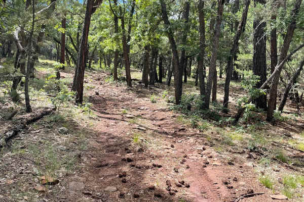
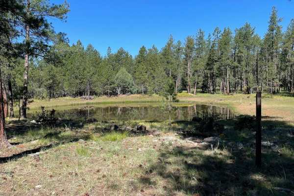
Committee Tank Trail
Committee Tank Trail stretches just over one mile long and is a portion of FS 9494F. The surface of this trail alternates between dirt and rocks. The trail is relatively flat and takes you past Committee Tank which will be on your right. After passing this tank, the trail becomes much more rocky as ...
Learn more about Committee Tank Trail
Scrub Oak Bypass
This short trail connects Forest Road 9495F with Forest Road 9494F. The majority of this trail is dirt with a small rock garden as you start to traverse up a small hill climb. At the end of this small climb, is a small section of loose rocks all over the trail's surface. This short trail takes you t...
Learn more about Scrub Oak Bypass
Boynton Canyon Road
This very short trail is maintained and has lots of OHV activity coming and going. There are very nice views of Bear Mountain to the north while traveling on this road. This trail provides access to the north entrance of the Greasy Spoon Trail. There is also a parking area for OHV unloading and load...
Learn more about Boynton Canyon Road
Ranch Loop OHV
This OHV trail clocks in right at 8 miles long and provides beautiful views of Sedona on the north end. This is a very popular trail and you are almost guaranteed to see others driving/riding. The route has many different surfaces, ranging from dirt, sand, rock, and gravel. The sandy areas are not d...
Learn more about Ranch Loop OHV
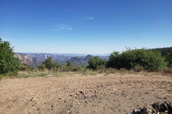
FS 9499G to Viewpoint
This short trail starts at the beginning of Forest Road 9499G and rolls through the ponderosas of the Coconino National Forest. The vast majority of this trail is an easy-going dirt road that has some potential for a few mud holes. The last part of this trail becomes much more rocky and ends at a ni...
Learn more about FS 9499G to Viewpoint
FS 153E
Forest Road 153E stretches just over two miles long and starts off of Schnebly Hill Road. As you start the trail, you will see two dispersed camping spots on your left. The trail travels to the Northwest and becomes more rocky the farther you go. The views on this trail are of Ponderosas, which give...
Learn more about FS 153E
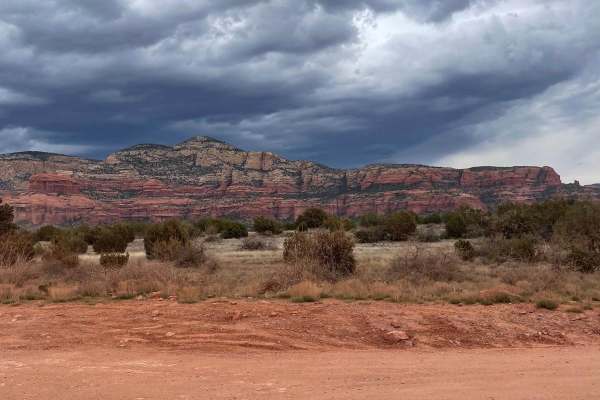
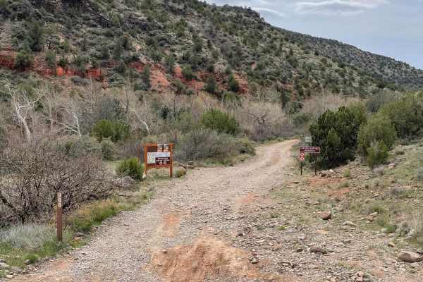
525 to 795 Palatki Heritage Site
This well-maintained road takes you through the Red Rock District of the Coconino National Forest. Starting on FS Road 525, it turns onto FS Road 795 which leads you to the Palatki Heritage Site. This historical site has ancient ruins and well-preserved petroglyphs. Most 2WD vehicles can travel this...
Learn more about 525 to 795 Palatki Heritage Site
Sycamore Pass Road
This trail starts as a maintained road which turns to unmaintained as you get farther up the trail. The total distance of this trail is 8.5 miles, taking you from the start of FS Road 525C to the top of Sycamore Pass, which is the end of FS Road 525C. The last mile to Sycamore Pass becomes a little ...
Learn more about Sycamore Pass Road
Lower Oak Creek Access #3
This trail is mostly a maintained dirt road except for the last part that hugs Oak Creek. There are several designated camping sites along this trail. The trail becomes covered with river rock once you start traveling next to Oak Creek. There are several places to pull over when you are next to Oak ...
Learn more about Lower Oak Creek Access #3
Schnebly Hill Radio Towers
This short trail takes you up across Shnebly Hill and down to Schnebly Hill Trail which is a guided route. This trail is a dirt road that has some small erosion ruts from water runoff. After a good rain, there is potential for some small mud holes. There are a few small rocky surfaces on this trail ...
Learn more about Schnebly Hill Radio Towers
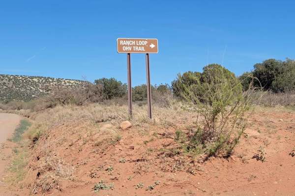
Ranch Loop OHV
This OHV trail clocks in right at 8 miles long and provides beautiful views of Sedona on the north end. This is a very popular trail and you are almost guaranteed to see others driving/riding. The route has many different surfaces, ranging from dirt, sand, rock, and gravel. The sandy areas are not d...
Learn more about Ranch Loop OHV
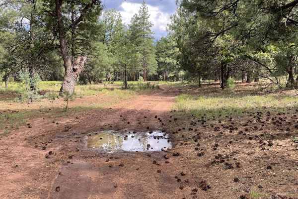
Deadwood Tank
This scenic point-to-point trail is located under the pines of the Coconino National Forest near Munds Park, AZ, and can be combined with Crazy Park trail to become a bumpy, but fun, loop trail. The trail is a mixture of rutted dirt of varying depth and loose and buried rocks of varying height. High...
Learn more about Deadwood Tank
Little Round Mountain
This road is not maintained in the winter. It varies in technicality, but you will find rocky sections, rutted areas, and fallen trees to go over or around. In the wet season, this road will become extremely muddy and has a tendency for flash floods. This trail has had fire damage, so be aware of fa...
Learn more about Little Round Mountain
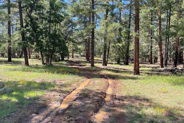
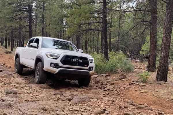
FS 778
Forest Road 778 is a beautiful forest drive that winds through both private property and well-established forest. The trail is lined with young pine trees and a rich carpet of forest ferns, creating a vibrant and lush forest floor. As the trail progresses, it passes through a few low-lying areas bef...
Learn more about FS 778
FS 6352
FS 6352 starts off of North FS 80 Guided Trail and travels West. As you begin to travel, the trail starts off a little rocky and transitions from rocky areas to a dirt trail. The trail then intersects with FS 80A and snakes toward Robbers Roost Tank. After Robbers Roost Tank, the trail has several a...
Learn more about FS 6352
Outlaw Pass - FRS 9549
Prepare for an exhilarating adventure along the mesmerizing Outlaw Pass! This trail offers thrilling yet manageable challenges, making it the perfect shortcut between Sycamore Pass and Outlaw, or vice versa. Nestled within the breathtaking Coconino National Forest, the trail winds through terrain ad...
Learn more about Outlaw Pass - FRS 9549
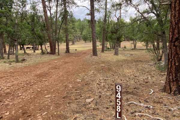
FS 9459J
Forest Road 9459J is a short trail that connects back to Schnebly Hill Road. You will travel through Ponderosas and a small meadow that gives way to Camp Tank. Then, the trail travels along the foot of a small hill and ends at Schnebly Hill Road. This trail looks like it would be a muddy mess after ...
Learn more about FS 9459J
Thomas Point Connector
This scenic connector trail is found under the pines of the Coconino National Forest west of Munds Park, AZ. The trail is a mix of rutted dirt and both loose and buried rock, making for a bumpy connection to or from Thomas Point Trail. High clearance and 4x4 are recommended, and trail difficulty wil...
Learn more about Thomas Point Connector
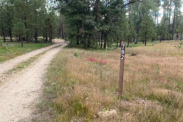
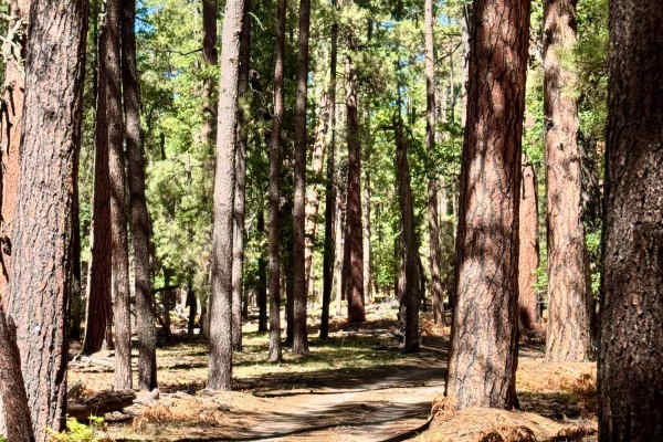
East Buzzard Ridge
East Buzzard Ridge trail (FS RD 792) is a scenic point-to-point trail under the Ponderosa pines of the Coconino National Forest northwest of Sedona, AZ. The trail, which can be accessed by most vehicles, does not offer much as far as technicality, but does offer several viewpoints of the surrounding...
Learn more about East Buzzard Ridge
Beginner ATV trails near Sedona, Arizona
Explore ATV-friendly trails near you. These trails are accessible for vehicles up to 50 inches wide, perfect for ATVs and smaller off-road machines.
Alternative Access to Cathedral Rock
This short, maintained gravel road leads to the back side of the iconic Cathedral Rock. Along this road is Baldwin Trailhead. This hiking trailhead provides access to hiking trails to the most popular destination in Sedona, Cathedral Rock. The road ends at a turnaround that doesn't allow parking, bu...
Learn more about Alternative Access to Cathedral Rock
Committee Tank Trail
Committee Tank Trail stretches just over one mile long and is a portion of FS 9494F. The surface of this trail alternates between dirt and rocks. The trail is relatively flat and takes you past Committee Tank which will be on your right. After passing this tank, the trail becomes much more rocky as ...
Learn more about Committee Tank Trail
Scrub Oak Bypass
This short trail connects Forest Road 9495F with Forest Road 9494F. The majority of this trail is dirt with a small rock garden as you start to traverse up a small hill climb. At the end of this small climb, is a small section of loose rocks all over the trail's surface. This short trail takes you t...
Learn more about Scrub Oak Bypass
Boynton Canyon Road
This very short trail is maintained and has lots of OHV activity coming and going. There are very nice views of Bear Mountain to the north while traveling on this road. This trail provides access to the north entrance of the Greasy Spoon Trail. There is also a parking area for OHV unloading and load...
Learn more about Boynton Canyon Road
Beginner UTV/side-by-side trails near Sedona, Arizona
Find UTV and side-by-side trails near you. These trails accommodate vehicles up to 60 inches wide, ideal for UTVs, side-by-sides, and wider off-road rigs.
Alternative Access to Cathedral Rock
This short, maintained gravel road leads to the back side of the iconic Cathedral Rock. Along this road is Baldwin Trailhead. This hiking trailhead provides access to hiking trails to the most popular destination in Sedona, Cathedral Rock. The road ends at a turnaround that doesn't allow parking, bu...
Learn more about Alternative Access to Cathedral Rock
Committee Tank Trail
Committee Tank Trail stretches just over one mile long and is a portion of FS 9494F. The surface of this trail alternates between dirt and rocks. The trail is relatively flat and takes you past Committee Tank which will be on your right. After passing this tank, the trail becomes much more rocky as ...
Learn more about Committee Tank Trail
Scrub Oak Bypass
This short trail connects Forest Road 9495F with Forest Road 9494F. The majority of this trail is dirt with a small rock garden as you start to traverse up a small hill climb. At the end of this small climb, is a small section of loose rocks all over the trail's surface. This short trail takes you t...
Learn more about Scrub Oak Bypass
Boynton Canyon Road
This very short trail is maintained and has lots of OHV activity coming and going. There are very nice views of Bear Mountain to the north while traveling on this road. This trail provides access to the north entrance of the Greasy Spoon Trail. There is also a parking area for OHV unloading and load...
Learn more about Boynton Canyon Road
The onX Offroad Difference
onX Offroad combines trail photos, descriptions, difficulty ratings, width restrictions, seasonality, and more in a user-friendly interface. Available on all devices, with offline access and full compatibility with CarPlay and Android Auto. Discover what you're missing today!
Open Trail Map