
Beginner Off-Road Trails
Near River Park, Florida
Explore All Beginner Trails Near River Park, Florida
Beginner Off-Road Trails Near River Park, Florida
Discover the best beginner-friendly off-road trails near you. These easier, lower-rated trails are a great place to start — browse trail maps, check difficulty ratings, and find your next adventure.
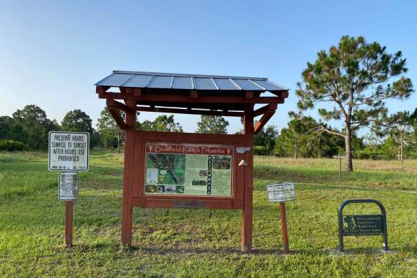
Bluefield Ranch Preserve
This is a flat, graded gravel and dirt road that leads to the Bluefield Ranch Preserve. The trail receives regular maintenance in the form of grading as the trail not only serves the Preservation area, but also the adjacent and surrounding cattle ranches and farms. This is a very scenic ride, and th...
Learn more about Bluefield Ranch Preserve
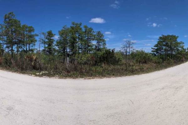
South Grade Trail
The South Grade Trail connects the North Grade Trail and the Indian Trail Road, with the Tomate Field Grade Trail intersecting it in the middle. This route has several designated hunting trails and campsites, including sites J, K, L, M, and N, and trails 3, 6, 8, and 9. The Florida Trail also inters...
Learn more about South Grade Trail

Stumpers Grade Trail
Stumpers Grade Trail is a gravel trail starting at the south entrance of J.W. Corbett Wildlife Management Area and ending at the Indian Trail. This trail has several designated hunting trails and campsites, including hunting trails 7, 9, 10, and 11, as well as Campsite P. A section of the Florida Tr...
Learn more about Stumpers Grade Trail

Indian Trail Road
Made up of gravel, this trail is used mainly to connect the South Grade Trail and the Stumper's Grade Trail. With the M-O Canal running parallel to the trail, you know right when you're on it! This trail gives beautiful views of sunrises and sunsets with a beautiful Florida Wilderness landscape. Thi...
Learn more about Indian Trail Road
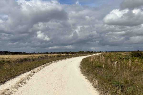
Road 10 - Three Lakes WMA
Road 10 is the southern part of the Prairie Lakes Road and connects County Road 60 at the south end and Road 16 at the north end of the trail. It is located in the southwest part of the Three Lakes WMA and gives you access to several trails in the area and the South Hunter Campground. The road condi...
Learn more about Road 10 - Three Lakes WMA
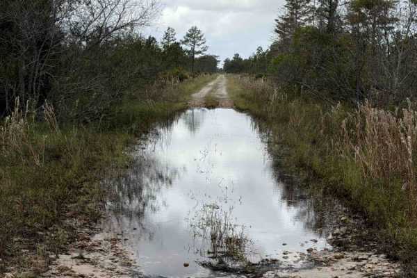
Williams Road - Three Lakes WMA
Williams Road takes you all the way from US Route 441 to the west end of the northeast part of the Three Lakes WMA and gives you access to several trails in that area. The road conditions are a mixture of packed sand, loose sand, and some deep holes that can turn into 2-foot deep mud holes after rai...
Learn more about Williams Road - Three Lakes WMA
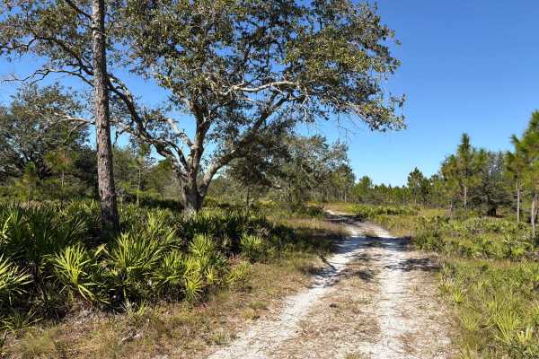
Road 15 - Three Lakes WMA
Road 15 connects Williams Road at the west end and Long Loop Road 4 at the east end in the northeast part of the Three Lakes WMA. The road conditions are a mixture of packed sand, loose sand, and some deep holes that can turn into 2-foot deep mud holes after rainy days. The road is not always wide e...
Learn more about Road 15 - Three Lakes WMA
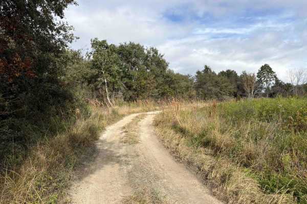
Road 8 Loop - Three Lakes WMA
Road 8 Loop starts and ends at Road 10, the southern part of the Prairie Lakes Road. It is located in the southwest part of the Three Lakes WMA and gives you access to Lake Marian and Fodderstack Slough. The road conditions are a mixture of packed sand, loose sand, and some deep holes that can turn ...
Learn more about Road 8 Loop - Three Lakes WMA
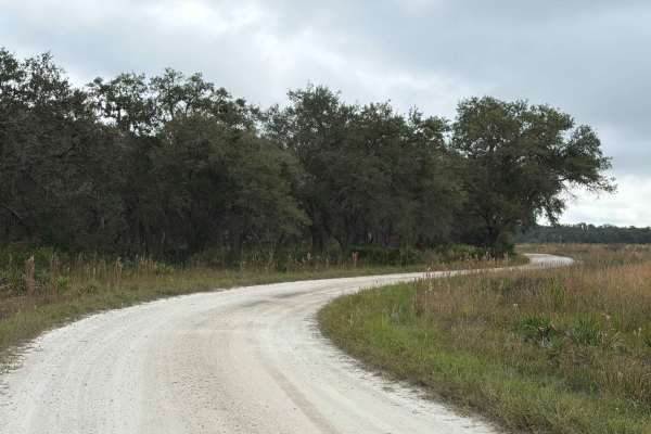
Boat Ramp Road - Three Lakes WMA
Boat Ramp Road takes you from Road 16 to the boat ramp on the south riverbank of Lake Jackson. It is located in the southwest part of the Three Lakes WMA. The road conditions are a mixture of packed sand, loose sand, and some deep holes that can turn into 2-foot deep mud holes after rainy days. Ther...
Learn more about Boat Ramp Road - Three Lakes WMA
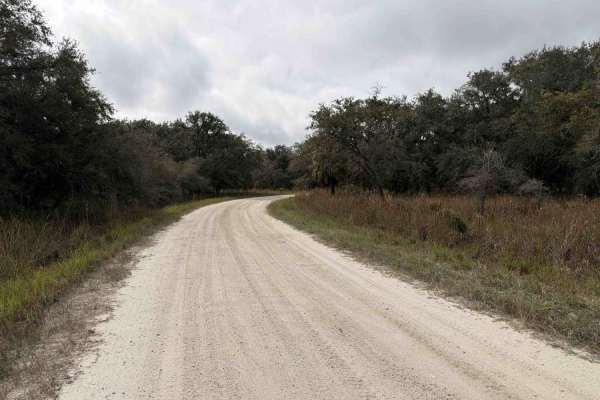
Sailor Hammock Road - Three Lakes WMA
Sailor Hammock Road takes you from Road 16 to the south riverbank of Lake Jackson. It is located in the southwest part of the Three Lakes WMA. The road conditions are a mixture of packed sand, loose sand, and some deep holes that can turn into 2-foot deep mud holes after rainy days. There are a few ...
Learn more about Sailor Hammock Road - Three Lakes WMA
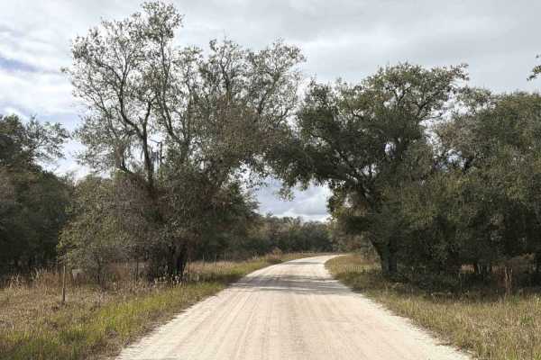
Road 16 - Three Lakes WMA
Road 16 is the northern part of the Prairie Lakes Road and connects Road 10 at the south end and State Route 523 at the north end of the trail. It is located in the southwest part of the Three Lakes WMA and gives you access to several trails in the area, a primitive boat ramp at the Jackson Canal, a...
Learn more about Road 16 - Three Lakes WMA
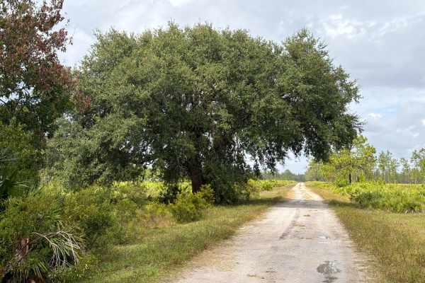
Road 1 - Three Lakes WMA
Road 1 starts and ends at Williams Road in the northeast part of the Three Lakes WMA and gives and gives you access to several trails in the area. The road conditions are a mixture of packed sand, loose sand, and some deep holes that can turn into 2-foot deep mud holes after rainy days. The road is ...
Learn more about Road 1 - Three Lakes WMA
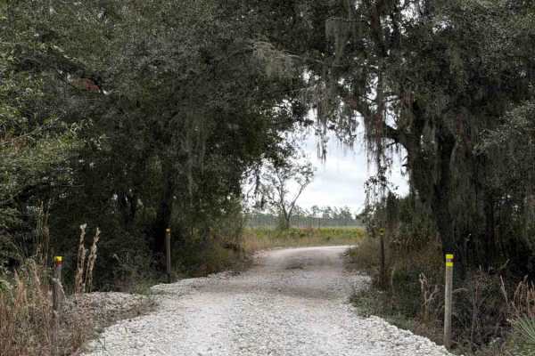
Road 19 - Three Lakes WMA
Road 19 connects Road 16 on the south end and Road 5 at the north end of the trail. It is located in the southwest part of the Three Lakes WMA and gives you access to the Prairie Lakes Unit and a Group Camp Site with several picnic tables. The road conditions are a mixture of packed sand, loose sand...
Learn more about Road 19 - Three Lakes WMA
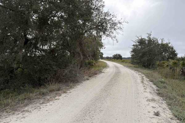
Road 5 - Three Lakes WMA
A daily-use or recreational permit is required to enter the Water Management Area. Road 5 connects Road 19 on the south end and SR-523 at the north end of the trail. It is located in the southwest part of the Three Lakes WMA and gives you access to the North Hunter Campground. The road conditions ar...
Learn more about Road 5 - Three Lakes WMA
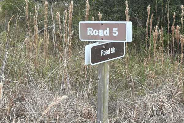
Road 5b - Three Lakes WMA
Road 5b starts at Road 5 at the north end of the trail. It is located in the southwest part of the Three Lakes WMA and gives you access to Lake Jackson. The road conditions are a mixture of packed sand, loose sand, and some deep holes that can turn into 2-foot deep mud holes after rainy days. There ...
Learn more about Road 5b - Three Lakes WMA
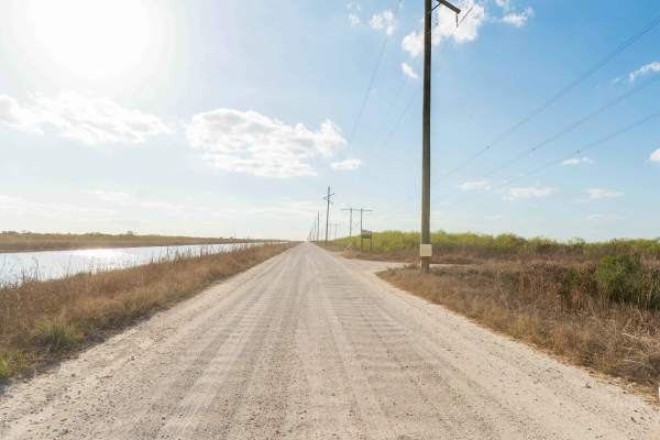
North Miami Canal Connect
North Miami Trail Connect runs along a canal corridor and leads to a public boat ramp. The surface is primarily dirt and sand and can become muddy in low-lying sections, especially after rain. Conditions vary depending on recent weather. The route follows the waterway closely and provides access to ...
Learn more about North Miami Canal Connect
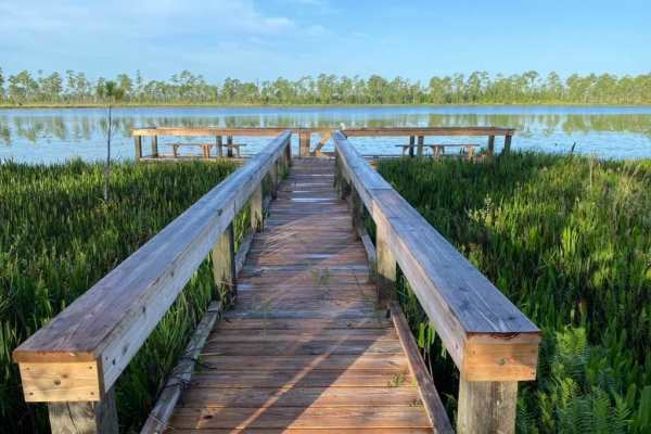
Lake Goodwin Road
This is a scenic ride through the Arbuckle Wildlife Management Area. The trail is accessed of the north end of School Bus Road within the Arbuckle Wildlife Management Area northeast of Avon Park. School Bus Road is compacted red clay, but can be a little slick when wet during heavy rain events. Trai...
Learn more about Lake Goodwin Road
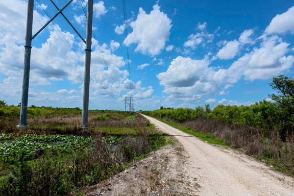
West Upper Miami Canal Connect
The West Upper Miami Canal Connect runs west of the main canal corridor, a surface of hardpack dirt, sand, and scattered rocks. While the main path is generally firm in dry weather, it transitions into a network of multiple narrow, one-lane roads that require careful navigation due to very limited p...
Learn more about West Upper Miami Canal Connect
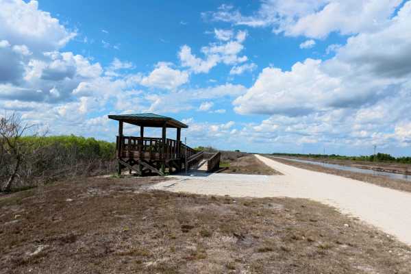
Rotenberger Perimeter Trail
The Rotenberger Perimeter Trail offers a scenic and rugged outline around the conservation area, defined by a narrow track that frequently develops heavy washboards and requires a steady pace. This trail is a premier destination for wildlife viewing and fishing, featuring a dedicated overlook statio...
Learn more about Rotenberger Perimeter Trail
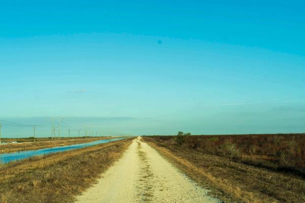
South Miami Canal Connect
South Miami Canal Connect just north of the Everglades Wildlife Management Area, which runs along a canal with a hardpack dirt and sand surface mixed with scattered rocks. Grass lines the lower sections near the water, and the opposite side includes open access commonly used by ATVs, SxS, and buggie...
Learn more about South Miami Canal Connect
Beginner ATV trails near River Park, Florida
Explore ATV-friendly trails near you. These trails are accessible for vehicles up to 50 inches wide, perfect for ATVs and smaller off-road machines.
Bluefield Ranch Preserve
This is a flat, graded gravel and dirt road that leads to the Bluefield Ranch Preserve. The trail receives regular maintenance in the form of grading as the trail not only serves the Preservation area, but also the adjacent and surrounding cattle ranches and farms. This is a very scenic ride, and th...
Learn more about Bluefield Ranch Preserve
Road 10 - Three Lakes WMA
Road 10 is the southern part of the Prairie Lakes Road and connects County Road 60 at the south end and Road 16 at the north end of the trail. It is located in the southwest part of the Three Lakes WMA and gives you access to several trails in the area and the South Hunter Campground. The road condi...
Learn more about Road 10 - Three Lakes WMA
Williams Road - Three Lakes WMA
Williams Road takes you all the way from US Route 441 to the west end of the northeast part of the Three Lakes WMA and gives you access to several trails in that area. The road conditions are a mixture of packed sand, loose sand, and some deep holes that can turn into 2-foot deep mud holes after rai...
Learn more about Williams Road - Three Lakes WMA
Road 15 - Three Lakes WMA
Road 15 connects Williams Road at the west end and Long Loop Road 4 at the east end in the northeast part of the Three Lakes WMA. The road conditions are a mixture of packed sand, loose sand, and some deep holes that can turn into 2-foot deep mud holes after rainy days. The road is not always wide e...
Learn more about Road 15 - Three Lakes WMA
Beginner UTV/side-by-side trails near River Park, Florida
Find UTV and side-by-side trails near you. These trails accommodate vehicles up to 60 inches wide, ideal for UTVs, side-by-sides, and wider off-road rigs.
Bluefield Ranch Preserve
This is a flat, graded gravel and dirt road that leads to the Bluefield Ranch Preserve. The trail receives regular maintenance in the form of grading as the trail not only serves the Preservation area, but also the adjacent and surrounding cattle ranches and farms. This is a very scenic ride, and th...
Learn more about Bluefield Ranch Preserve
Road 10 - Three Lakes WMA
Road 10 is the southern part of the Prairie Lakes Road and connects County Road 60 at the south end and Road 16 at the north end of the trail. It is located in the southwest part of the Three Lakes WMA and gives you access to several trails in the area and the South Hunter Campground. The road condi...
Learn more about Road 10 - Three Lakes WMA
Williams Road - Three Lakes WMA
Williams Road takes you all the way from US Route 441 to the west end of the northeast part of the Three Lakes WMA and gives you access to several trails in that area. The road conditions are a mixture of packed sand, loose sand, and some deep holes that can turn into 2-foot deep mud holes after rai...
Learn more about Williams Road - Three Lakes WMA
Road 15 - Three Lakes WMA
Road 15 connects Williams Road at the west end and Long Loop Road 4 at the east end in the northeast part of the Three Lakes WMA. The road conditions are a mixture of packed sand, loose sand, and some deep holes that can turn into 2-foot deep mud holes after rainy days. The road is not always wide e...
Learn more about Road 15 - Three Lakes WMA
The onX Offroad Difference
onX Offroad combines trail photos, descriptions, difficulty ratings, width restrictions, seasonality, and more in a user-friendly interface. Available on all devices, with offline access and full compatibility with CarPlay and Android Auto. Discover what you're missing today!
Open Trail Map