
Beginner Off-Road Trails
Near Red Lodge, Montana
Explore All Beginner Trails Near Red Lodge, Montana
Beginner Off-Road Trails Near Red Lodge, Montana
Discover the best beginner-friendly off-road trails near you. These easier, lower-rated trails are a great place to start — browse trail maps, check difficulty ratings, and find your next adventure.
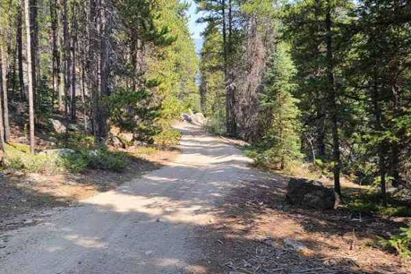
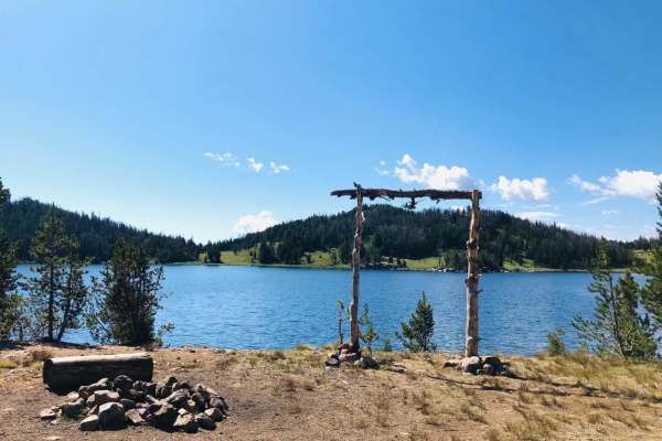
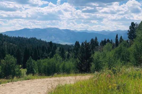
Lower Parkside
This trail is mainly just for OHV vehicles to get from one trail to another trail. There are some sandy spots with one hill that is pretty steep with loose rocks. This trail goes along Rock Creek, so it could be used for fishing or even a drop-off for white water rafting. Expect moderate traffic, ma...
Learn more about Lower Parkside
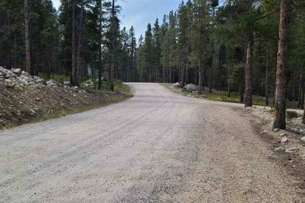
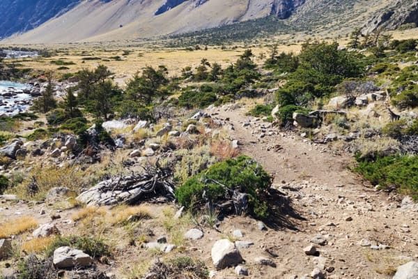
Main Fork Rock Creek
This trail runs along Rock Creek and has some amazing views. Some spots have lose rocks but most of it is packed dirt. There are great spots to stop along the way down by the creek so you can go fly fishing or just relax a little and have lunch. You could get to the end of the trail with most off ro...
Learn more about Main Fork Rock Creek
Meeteetse Trail
Meeteetse Trail, east access, is located on the Montana and Wyoming border just south of Belfry, MT. The west trail can be accessed just south of Red Lodge, Montana. When accessing the Meeteetse Trail from north of the Montana/Wyoming border, turn off Highway 72 onto Chance Road, which is paved. Aft...
Learn more about Meeteetse Trail

Hunt Creek
Hunt Creek is an easy road up to Ridge Road. It is a little loose and slightly rutted in places but it's a more fun route to take than Cottonwood Road. There are a couple of side spurs that have some nice climbs over to Cottonwood Road if you are feeling a little spicy. Avoid this trail when it's r...
Learn more about Hunt Creek
Hatcher Pass
Hatcher Pass is an out-and-back off of Cottonwood Road. There are a couple of loose and slightly rutted sections, but nothing challenging. This trail ends at a closed gate bordering private property and you will have to turn around. There is a decent campground about a quarter mile in with some shad...
Learn more about Hatcher Pass
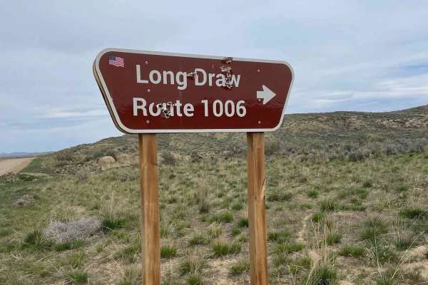
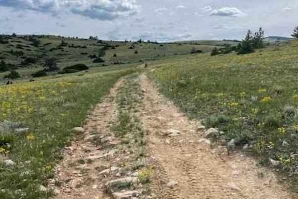
Long Draw Road
This is a fun way up to Ridge Road that is pretty loose and fairly rutted in spots. This is a great trail to warm up on early in the year, as it is rideable months before the Bighorns will be. Depending on the weather, it might be possible to ride this all year long. Avoid this trail during the rain...
Learn more about Long Draw Road
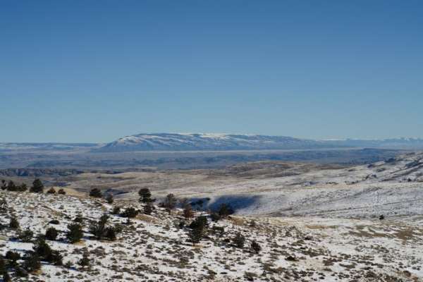
Little Rock Creek
Little Rock Creek runs out of the Beartooth Mountains and is located in Shoshone National Forest West of the town of Clark, Wyoming. There are two very long and difficult trailheads;the one on the right fork goes to the top of the Beartooths, and the one on the left goes to Deep Lake. These trails a...
Learn more about Little Rock Creek
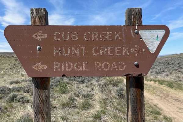
Ridge Road #1005
Ridge Road is the backbone of the Elk Basin area. It starts in Montana and goes into Wyoming. This is mostly an easy route with access to several other trails in the area. There is a great campsite just on the Wyoming side with magnificent views of the Beartooth Mountains. This road is a mess when r...
Learn more about Ridge Road #1005
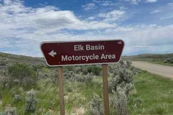
East Basin Road CW 2078
This road cuts right through the Elk Basin Motorcycle Area, so be aware of little kids on motorcycles and four-wheelers. The first three miles of this road are easy, but the last two are what give it the 3 rating. This is where it gets steep and slightly technical. 4WD is necessary to safely naviga...
Learn more about East Basin Road CW 2078
Fantan Lake Road
This is a rutted, one-lane dirt trail leading to Fantan Lake. It had 6-8" obstacles and after rains, was full of mud holes along with a couple of small stream crossings Several dispersed camping areas were around the lake. Please be aware that this is Grizzly Bear country and plan accordingly.
Learn more about Fantan Lake Road
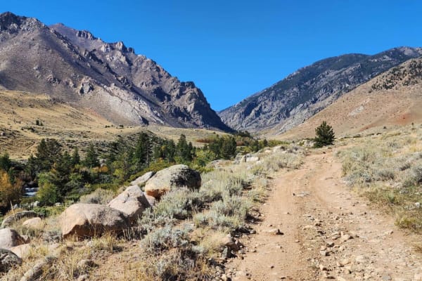
Clarks Fork Canyon
Clarks Fork Canyon is located in the Shoshone National Forest West of Clark, Wyoming. This is an out-and-back trail running East-West with a round trip distance of approximately 8 miles. Due to the flooding, the switchbacks are too treacherous to navigate with a vehicle, but it is still available t...
Learn more about Clarks Fork Canyon
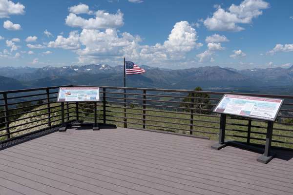
Clay Butte Lookout Tower
This trail is a well-maintained dirt spur off the Beartooth Highway (US-212), climbing 800 feet to the Clay Butte Lookout Tower with occasional pullouts to pass two-way traffic. The trail starts in a pine forest with wildflower meadows in the summer before rising above the treeline for 360 views of ...
Learn more about Clay Butte Lookout Tower
Pryor Mountain Road
One of the many access routes to the Pryor Mountains, is Pryor Mountain Road, south of Bridger, MT. Top off your tank in Bridger and head south. Approximately 1.25 miles south on Highway 310 after the merge of Highway 72 to Cody, WY and Highway 310 to Lovell, WY, turn left (east) on Prior Mountain...
Learn more about Pryor Mountain Road
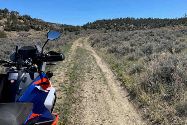
Ghost Creek
This little-traveled trail begins as a 2 lane dirt road running through the forest and then turns into a dirt track following a ridge with the surrounding mountains as a backdrop. It follows a private property fence line, crosses over a small creek crossing, and leads to a secluded meadow bordering ...
Learn more about Ghost Creek
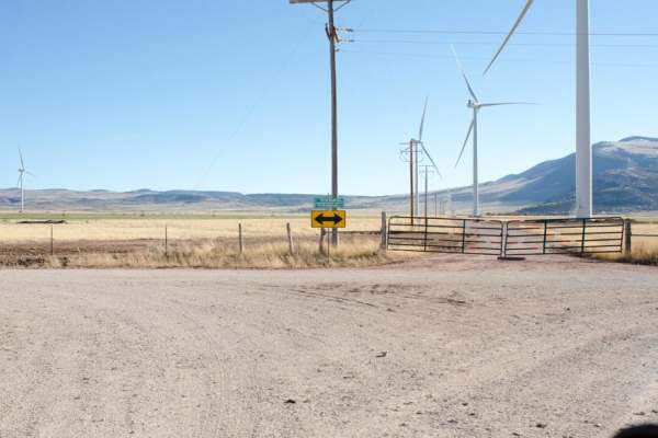
South Pryor Mountain Road
South Pryor Mountain road will lead to South Railbed Road which eventually leads to Warren, MT. Windmills are abundant in this area known as the Pryor Mountain Wind Project. South Pryor Mountain Road is a short stretch of road and is well maintained and accessible by most vehicles during the dry s...
Learn more about South Pryor Mountain Road
Miller Trail #2496
Miller Trail begins approximately 0.5 miles from the intersection of South Railbed Road and South Pryor Mountain Road. The trail is marked at the top only for some reason, but not at the bottom, so it is easy to miss. There is a nice staging area about 0.25 miles in to unload 4x4s. The trail itself ...
Learn more about Miller Trail #2496
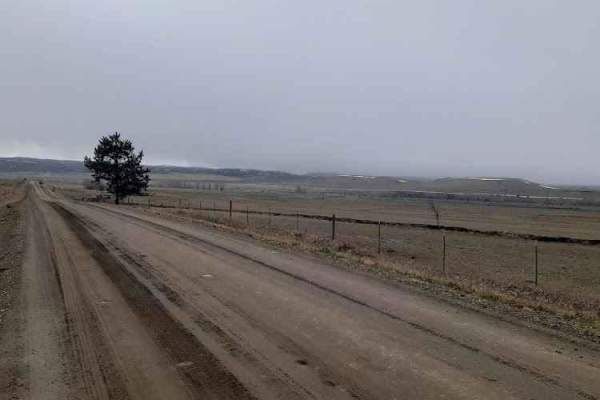
Stillwater River Road
This is a well-maintained gravel road that follows the Stillwater River. It's open year-round with limited access during heavy snowy weather. The first 6.5 miles is a paved two-lane road west of Absarokee before turning into gravel and then back into pavement 1.2 miles before the junction with Nye R...
Learn more about Stillwater River Road
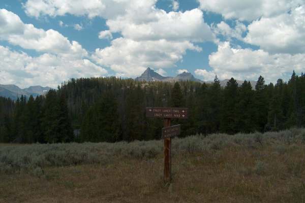
Crazy Lakes
The Crazy Lakes Road travels through a beautiful, remote area near the Wyoming-Montana border. The main route, Crazy Lakes Road, leads to the Absaroka Beartooth Wilderness boundary while short side spurs can be driven to reach Lily Lake, Little Moose Lake, and the area's primitive dispersed campsite...
Learn more about Crazy Lakes
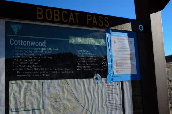
Cottonwood Road
Cottonwood Road, located between Highway 310 and Highway 72, south of Bridger, Montana, provides motorized and OHV access to over 100 square miles of BLM and State land. Bobcat Pass Road, to the west, is accessible by Cottonwood Road and provides miles of braided roads throughout the 100 plus square...
Learn more about Cottonwood Road
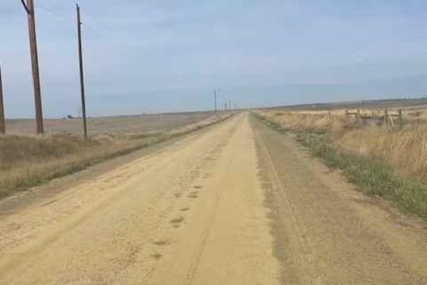
Columbus Molt Road
This is a gravel road connector from Columbus to Molt. You will see more antelope and cows than cars or people along this route. Most of the road is surrounded by private property, so zero camping opportunities exist. There are services in Columbus, but none in Molt, so be prepared. There is fairly ...
Learn more about Columbus Molt Road
Beginner ATV trails near Red Lodge, Montana
Explore ATV-friendly trails near you. These trails are accessible for vehicles up to 50 inches wide, perfect for ATVs and smaller off-road machines.
Lower Parkside
This trail is mainly just for OHV vehicles to get from one trail to another trail. There are some sandy spots with one hill that is pretty steep with loose rocks. This trail goes along Rock Creek, so it could be used for fishing or even a drop-off for white water rafting. Expect moderate traffic, ma...
Learn more about Lower Parkside
Main Fork Rock Creek
This trail runs along Rock Creek and has some amazing views. Some spots have lose rocks but most of it is packed dirt. There are great spots to stop along the way down by the creek so you can go fly fishing or just relax a little and have lunch. You could get to the end of the trail with most off ro...
Learn more about Main Fork Rock Creek
Meeteetse Trail
Meeteetse Trail, east access, is located on the Montana and Wyoming border just south of Belfry, MT. The west trail can be accessed just south of Red Lodge, Montana. When accessing the Meeteetse Trail from north of the Montana/Wyoming border, turn off Highway 72 onto Chance Road, which is paved. Aft...
Learn more about Meeteetse Trail
Hunt Creek
Hunt Creek is an easy road up to Ridge Road. It is a little loose and slightly rutted in places but it's a more fun route to take than Cottonwood Road. There are a couple of side spurs that have some nice climbs over to Cottonwood Road if you are feeling a little spicy. Avoid this trail when it's r...
Learn more about Hunt Creek
Beginner UTV/side-by-side trails near Red Lodge, Montana
Find UTV and side-by-side trails near you. These trails accommodate vehicles up to 60 inches wide, ideal for UTVs, side-by-sides, and wider off-road rigs.
Lower Parkside
This trail is mainly just for OHV vehicles to get from one trail to another trail. There are some sandy spots with one hill that is pretty steep with loose rocks. This trail goes along Rock Creek, so it could be used for fishing or even a drop-off for white water rafting. Expect moderate traffic, ma...
Learn more about Lower Parkside
Main Fork Rock Creek
This trail runs along Rock Creek and has some amazing views. Some spots have lose rocks but most of it is packed dirt. There are great spots to stop along the way down by the creek so you can go fly fishing or just relax a little and have lunch. You could get to the end of the trail with most off ro...
Learn more about Main Fork Rock Creek
Hunt Creek
Hunt Creek is an easy road up to Ridge Road. It is a little loose and slightly rutted in places but it's a more fun route to take than Cottonwood Road. There are a couple of side spurs that have some nice climbs over to Cottonwood Road if you are feeling a little spicy. Avoid this trail when it's r...
Learn more about Hunt Creek
Hatcher Pass
Hatcher Pass is an out-and-back off of Cottonwood Road. There are a couple of loose and slightly rutted sections, but nothing challenging. This trail ends at a closed gate bordering private property and you will have to turn around. There is a decent campground about a quarter mile in with some shad...
Learn more about Hatcher Pass
The onX Offroad Difference
onX Offroad combines trail photos, descriptions, difficulty ratings, width restrictions, seasonality, and more in a user-friendly interface. Available on all devices, with offline access and full compatibility with CarPlay and Android Auto. Discover what you're missing today!
Open Trail Map