
Beginner Off-Road Trails
Near Red Lake, Arizona
Explore All Beginner Trails Near Red Lake, Arizona
Beginner Off-Road Trails Near Red Lake, Arizona
Discover the best beginner-friendly off-road trails near you. These easier, lower-rated trails are a great place to start — browse trail maps, check difficulty ratings, and find your next adventure.
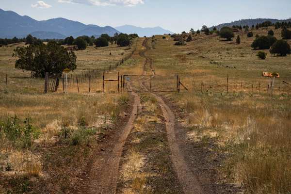
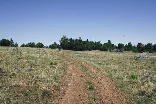
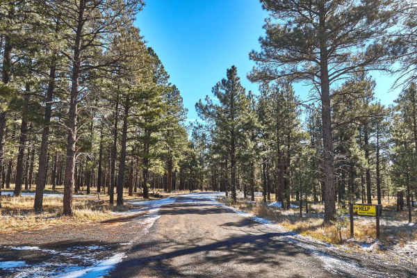
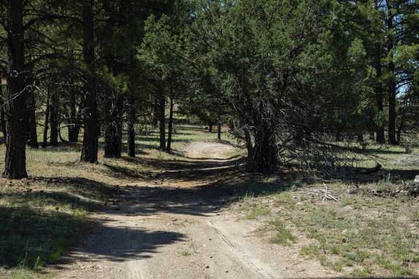
Pipeline Center
The Pipeline Center trail is a clear-cut through this section of the Kaibab National Forest. This trail can be run on its own, with all of the sections as one trail, or as an access point to access better and more interesting sections of this spectacular forest. Rocky, with hills and wash crossings,...
Learn more about Pipeline Center
Clark Airport Connector
This trail is a connector trail, and travels from the airport in Williams, AZ to the Kaibab National Forest to the East. The Western side of this trail is mostly two lanes wide of red rock and crushed cinders that are native to this area and used for roads and driveways. As you proceed East, the tra...
Learn more about Clark Airport Connector
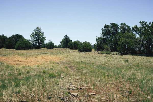
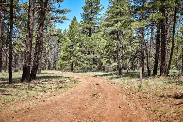
Pasture Mash
While there are no obstacles on Pasture Mash, there is also no cell service. This trail is rocky, with some rocks larger and more precarious than others. There are a few sections of narrow trees and mud ruts, with erosion and washouts present. This area goes through a section of the Kaibab National ...
Learn more about Pasture Mash
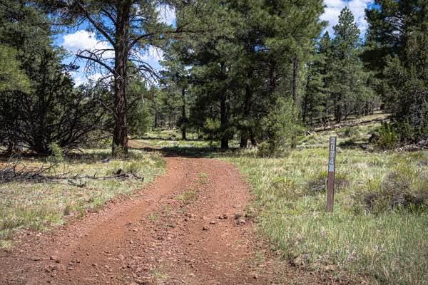
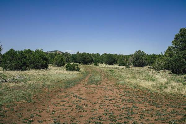
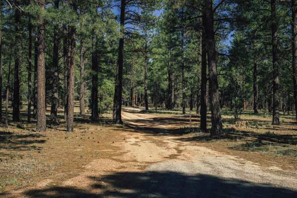
Pine Creek
The Pine Creek Loop trail is an interesting trail. This trail winds and waves its way through the Ponderosa Pines and Juniper trees that make up this section of the Kaibab National Forest. Cattle graze in this area, so be sure to pay attention, as they have a propensity to end up in the middle of th...
Learn more about Pine Creek
Old 74a
Old 74 Road is a dirt trail that goes in and out of the towering ponderosa pines to the large meadows of this area of the Kaibab National Forest. Long grass meadows showcase the antelope, deer, and cattle grazing in the area. Don't be surprised to see elk up in the trees, keeping cool. There are no ...
Learn more about Old 74a
Hunters View
Hunters View is named for the amazing view available in all directions. There are no major obstacles on this trail, aside from some sneaky rocks that jut out just when you're getting comfortable with this incredible trail. This trail goes from the meadow to the woods of ponderosa pine. In the long g...
Learn more about Hunters View
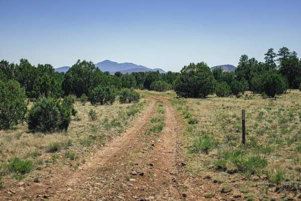
9191s
9191s is a trail that is typically a narrow one-lane dirt path. There are rocky sections, but there are no major obstacles on this trail. There is erosion that could lead to washouts, and other, larger rocks being exposed. There is no cell service in this section of the Kaibab National Forest, so of...
Learn more about 9191s
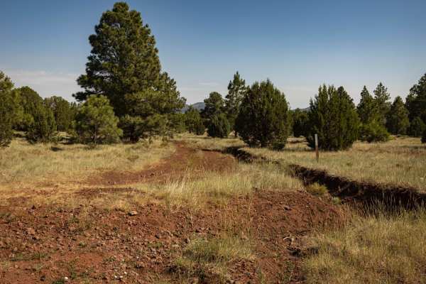
Red Lake to Pipeline
The Red Lake to Pipeline Trail is a one-lane trail. At points along this trail, there are deep mud ruts filled with rock that make this a less-than-smooth trail. The trail does traverse some hills, and those are rocky as well, with line choice being the thing that chews up your brain power on this t...
Learn more about Red Lake to Pipeline
FR 2082
FR 2082 is a short trail that is single vehicle-wide. With mud ruts and deep puddles, this trail could be challenging after rain or snow, but don't worry, as there are no obstacles on this trail over 12". You might see elk or cattle keeping cool in the shade of the Ponderosa Pines.
Learn more about FR 2082
FR 71
FR 71 starts as a beautiful, wide road that traverses a large meadow. In this meadow, there are several pull-through campsites that could accommodate trailers up to fifth wheels. Out the East side of the meadow, however, the road quickly becomes a single-lane mud track with ruts and off-camber water...
Learn more about FR 71
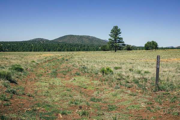
Hunters Meadow
The Hunters Meadow Trail cuts east/west across a huge open grassy area. Bordered on all sides by ponderosa pine, the meadow itself is speckled with juniper trees and long grasses. It's in these grasses you'll most likely see the deer, elk, and antelope that call this section of the Kaibab National F...
Learn more about Hunters Meadow
Old 707 Road
The Old 707 Road is a dirt trail that is one-lane dirt and rock trail that cuts through this section of the Kaibab National Forest. There are some spots of erosion, as well as random sporadic rock gardens, but they aren't really obstacles as much as speed bumps. There are no major obstacles on this ...
Learn more about Old 707 Road
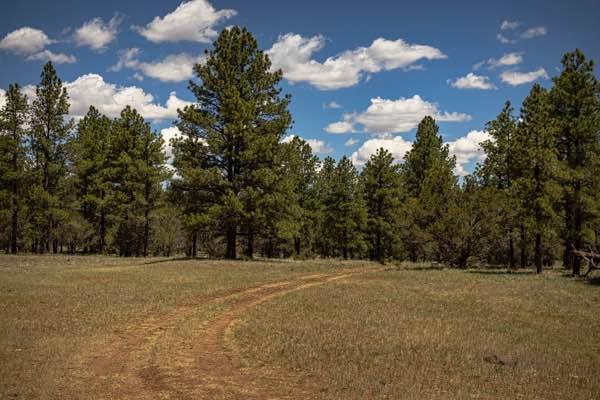
The Wooded Curve
The Wooded Curve is another connector-type trail that cruises through this section of the Kaibab National Forest. This trail is fun and flows, with the curves winding their way through the towering Ponderosa Pines. There are no obstacles on this trail, but also no cell service, so offline maps are a...
Learn more about The Wooded Curve
FR9192E
FR 9192E is a dirt single-lane trail that journeys across the plain speckled with Juniper Trees and sage. This trail has sections of rocks, and some erosion, but other than that there are no obstacles along this trail. You might see antelope, deer, and elk in this section of the forest, as well as j...
Learn more about FR9192E
Hardy's Downhill
Hardy's Downhill is a one-lane mostly dirt trail that skirts the South side of Hardy Hill. Near the hill, there is a short steep downhill (traveling from East to West on the trail) of loose cinders. This is one of the highlights of the trail, as it is fun. The cinders might shift while you drive ove...
Learn more about Hardy's Downhill
Hunter Hill Camp
The Hunter Hill Camp trail is a fun little section of this area of the Kaibab National Forest. The northern section of the trail traces a ridgeline of ponderosa pine trees as you go slowly up and up. That section of trail culminates at the top of a little round area where an Austin-Powers-type turn ...
Learn more about Hunter Hill Camp
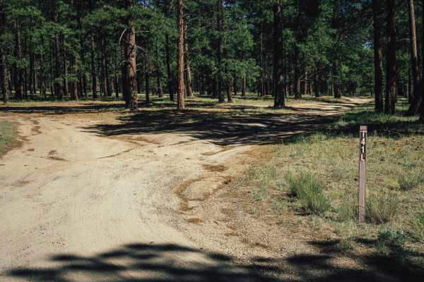
141L
141L is a dirt trail that bobs and weaves through this section of the Kaibab National Forest. This trail goes beautifully off into the ponderosa pine trees that make up this part of the forest. There are no obstacles on this trail, but there is also no cell service either. As is typical in Arizona, ...
Learn more about 141L
2072 Loop
The 2072 Loop Trail is a pleasant trail that dips in and out of the ponderosa pines and large meadows that make up this area of the Kaibab National Forest. Rocky at times, this trail has no major obstacles. It does, however, have mud ruts that can be quite problematic if you catch them after a rain ...
Learn more about 2072 Loop
Old 714 Road
The Old 714 Road is a dirt road that skirts the changing landscape of this section of the Kaibab National Forest. You'll go from open grassland to juniper trees and underbrush to towering ponderosa pines. There are no major obstacles on this trail, but there are rocky sections and mud ruts, with som...
Learn more about Old 714 Road
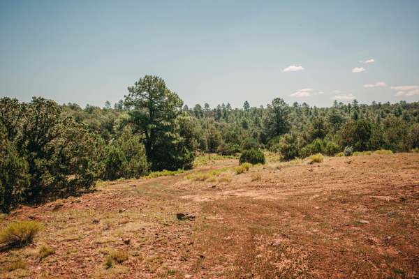
Squaw
The Squaw Trail was such a pleasant surprise to encounter! This trail meanders pleasantly through a beautiful Ponderosa Pine section of the Kaibab National Forest. There are some sections of wildfire evidence as you drive through a burn scar, but mostly this trail traverses a healthy forest. The tra...
Learn more about Squaw
Beginner ATV trails near Red Lake, Arizona
Explore ATV-friendly trails near you. These trails are accessible for vehicles up to 50 inches wide, perfect for ATVs and smaller off-road machines.
Pipeline Center
The Pipeline Center trail is a clear-cut through this section of the Kaibab National Forest. This trail can be run on its own, with all of the sections as one trail, or as an access point to access better and more interesting sections of this spectacular forest. Rocky, with hills and wash crossings,...
Learn more about Pipeline Center
Clark Airport Connector
This trail is a connector trail, and travels from the airport in Williams, AZ to the Kaibab National Forest to the East. The Western side of this trail is mostly two lanes wide of red rock and crushed cinders that are native to this area and used for roads and driveways. As you proceed East, the tra...
Learn more about Clark Airport Connector
Pasture Mash
While there are no obstacles on Pasture Mash, there is also no cell service. This trail is rocky, with some rocks larger and more precarious than others. There are a few sections of narrow trees and mud ruts, with erosion and washouts present. This area goes through a section of the Kaibab National ...
Learn more about Pasture Mash
Pine Creek
The Pine Creek Loop trail is an interesting trail. This trail winds and waves its way through the Ponderosa Pines and Juniper trees that make up this section of the Kaibab National Forest. Cattle graze in this area, so be sure to pay attention, as they have a propensity to end up in the middle of th...
Learn more about Pine Creek
Beginner UTV/side-by-side trails near Red Lake, Arizona
Find UTV and side-by-side trails near you. These trails accommodate vehicles up to 60 inches wide, ideal for UTVs, side-by-sides, and wider off-road rigs.
Pipeline Center
The Pipeline Center trail is a clear-cut through this section of the Kaibab National Forest. This trail can be run on its own, with all of the sections as one trail, or as an access point to access better and more interesting sections of this spectacular forest. Rocky, with hills and wash crossings,...
Learn more about Pipeline Center
Clark Airport Connector
This trail is a connector trail, and travels from the airport in Williams, AZ to the Kaibab National Forest to the East. The Western side of this trail is mostly two lanes wide of red rock and crushed cinders that are native to this area and used for roads and driveways. As you proceed East, the tra...
Learn more about Clark Airport Connector
Pasture Mash
While there are no obstacles on Pasture Mash, there is also no cell service. This trail is rocky, with some rocks larger and more precarious than others. There are a few sections of narrow trees and mud ruts, with erosion and washouts present. This area goes through a section of the Kaibab National ...
Learn more about Pasture Mash
Pine Creek
The Pine Creek Loop trail is an interesting trail. This trail winds and waves its way through the Ponderosa Pines and Juniper trees that make up this section of the Kaibab National Forest. Cattle graze in this area, so be sure to pay attention, as they have a propensity to end up in the middle of th...
Learn more about Pine Creek
The onX Offroad Difference
onX Offroad combines trail photos, descriptions, difficulty ratings, width restrictions, seasonality, and more in a user-friendly interface. Available on all devices, with offline access and full compatibility with CarPlay and Android Auto. Discover what you're missing today!
Open Trail Map