
Beginner Off-Road Trails
Near Perryville, Arkansas
Explore All Beginner Trails Near Perryville, Arkansas
Beginner Off-Road Trails Near Perryville, Arkansas
Discover the best beginner-friendly off-road trails near you. These easier, lower-rated trails are a great place to start — browse trail maps, check difficulty ratings, and find your next adventure.
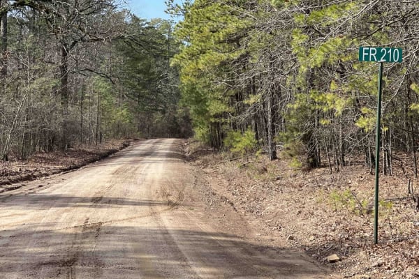
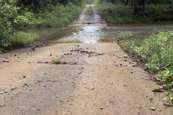
Link Mountain Road 210
Starting the trail to the east, it's an easy gravel road for the first 5 miles or so. Then it turns into a muddy mess with high ruts in the middle which make it hard for a low clearance vehicle to make it through certain sections. You can see this in the photo at mile 5.9. There are some really grea...
Learn more about Link Mountain Road 210
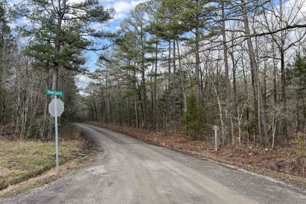
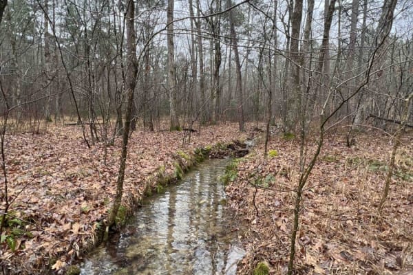
Brown Creek Road 805
Brown Creek winds you through the forest with beautiful views, lots of creek crossings, and campsites. This trail will also lead you to the Ouachita National Recreation trail which is a 223-mile trail, there are two entrance points along this route to access this trail. This route could be a basecam...
Learn more about Brown Creek Road 805

Lake Sylvia to Winona Lake and HWY9
This trail starts at Lake Sylvia State Park where camping, swimming and water/electric sites are available if needed. Its a great place to explore. After leaving Lake Sylvia this route takes you to LAKE WINONA (you will see the intersection where you can pick up a rule pamphlet and turn right to Win...
Learn more about Lake Sylvia to Winona Lake and HWY9
North Fork Pinnacle Road 132C
I started the trail in 2-wheel drive but not far into the trail, I had to put it in 4L. This is due to the clearance issues and needing to go slow for uneven ground. This trail closes in the summer and is open in the fall and winter. They use the trail during the summer as a hiking trail. Great trai...
Learn more about North Fork Pinnacle Road 132C
Wallace Bridge Road
Wallace Bridge Road is a beautiful gravel road that is woven through the Ouachita National Forest. This is a very well-maintained gravel road that passes through farmland in Deberrie, Arkansas, and runs along the Fourche LaFave River. This road is suitable for most vehicles as there are limited obst...
Learn more about Wallace Bridge Road

Long Caney 849 to South Fourche LaFave River
The Northern entrance into the Ouachita National Forest leads to a beautiful large quiet campsite on the South Fourche LaFave River. The road leading to this location is gravel when coming from the north. Once you turn right on Long Caney, it turns into a mud hole road all the way to camp. Lots of t...
Learn more about Long Caney 849 to South Fourche LaFave River
FS 29340
FS 29340 is a maintained gravel/dirt road that connects Long Caney Bypass to CR 182. Along the Ridgeline, you will get some fantastic views of the Ouachita National Forest and will often see Deer and other wildlife. There are a couple of low water bridges that are 6-12 inches deep, depending on the ...
Learn more about FS 29340

North Fork Road 86
This trail is an easy gravel road. Cell phone service was attainable along this route. Great pull-off campsites for trailers and overland rigs. Lots of trails to explore that branch off this road. Quads, SxS, and dirt bikes would be great up here as there are marked signs. Please note that if it is ...
Learn more about North Fork Road 86
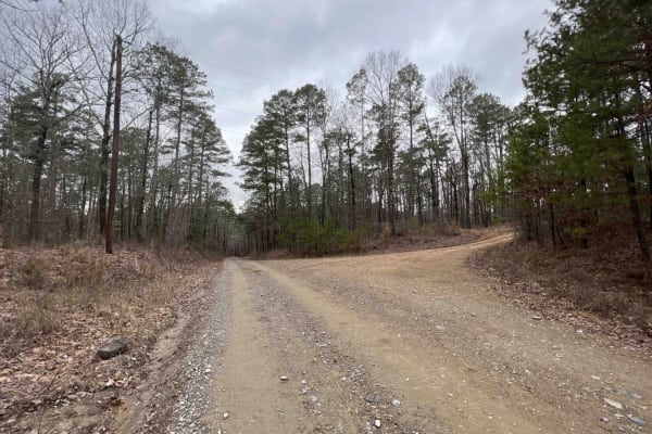
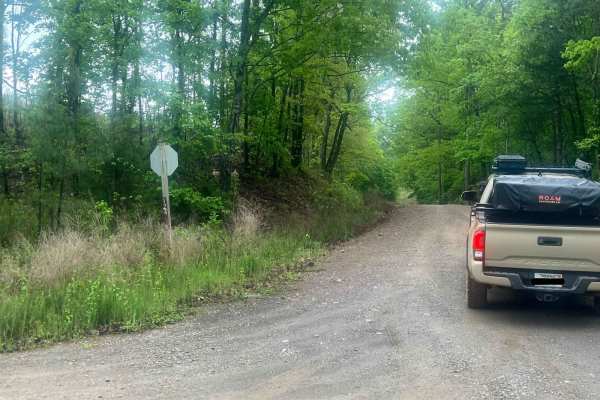
Long Caney bypass
This trail is a very easy, smooth trail. There is a small dip into a shallow creek crossing, but overall, a smooth, simple trail. It connects County Road 86 to County Road 849, also known as Long Caney Road. There are turnaround spots and it's wide enough for two vehicles.
Learn more about Long Caney bypass

Flatside Pinnacle
Flatside Pinnacle Road is an easy gravel road that weaves through the Ouachita National Forest. Under normal, dry conditions, this trail does not have any technical obstacles. In various places, the road may only be one lane wide, making it difficult to pass. This trail leads from Trail 86 on the no...
Learn more about Flatside Pinnacle
Wildcat Mountain 179
It's called Wildcat for a reason, this road isn't for the faint of hearts. 4low is required in certain sections of this road. Coming from the east side it starts out as an easy gravel road that any regular car could go through but then at mile 1.8, it turns into a 4x4 road only. The road is complete...
Learn more about Wildcat Mountain 179
Alum Fork Road 114
Alum Fork or Forest Road 114 is an excellent way to navigate through the beautiful Ouachita National Forest without ever having to touch the pavement. It has several dispersed camping areas and winds its way around Lake Winona if you're wanting to catch some fish or get the kayak on the water. Wildl...
Learn more about Alum Fork Road 114
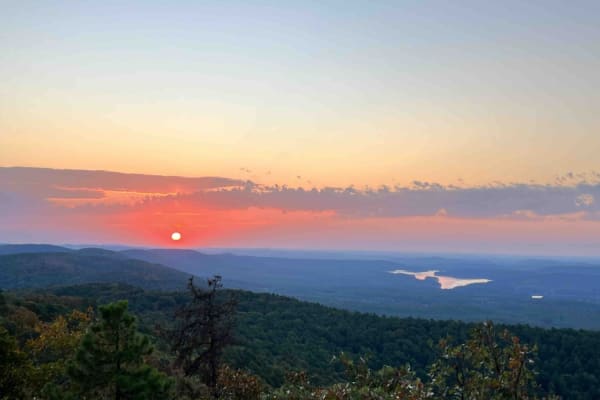
Crystal Mountain
Crystal Mountain spur road is the gateway to one of the most beautiful camping spots in Arkansas. With a peak of 1,680 feet, you can see for miles. At the top of this majestic peak, you have three camping spots that face the east. This makes for some of the most amazing sunrises Arkansas has to offe...
Learn more about Crystal Mountain
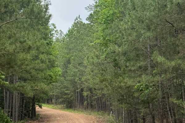
Blue Jay Hollow
Blue Jay Hollow is a gravel road in the Ouchita National Forest that winds through dense pines and rolling hills. This trail is 2 cars wide in most places making it easy for passing. There are no major obstacles along the way, and campsites are sparse as most roadside land is private property.
Learn more about Blue Jay Hollow
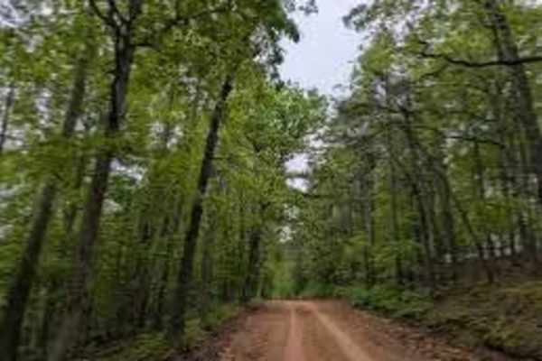
Muse Mountain Road
Muse Mountain is about 9 miles long in the National Forest. This trail is great to start your off-roading adventure into the Ouachita National Forest. Muse Mountain offers water crossings, camping, mud, and some light off-camber action. It is very common to encounter sightings of deer, turkey, and e...
Learn more about Muse Mountain Road
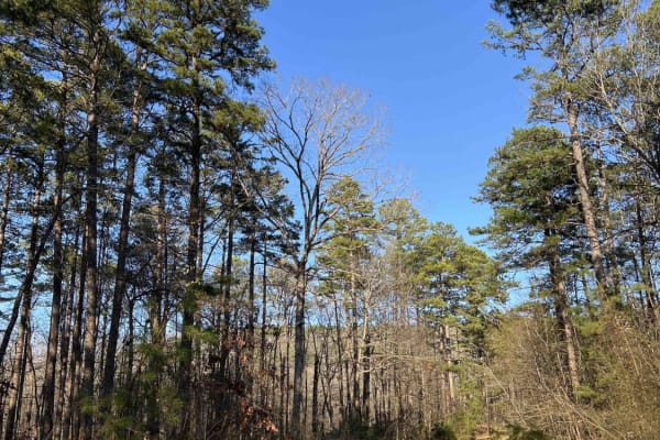
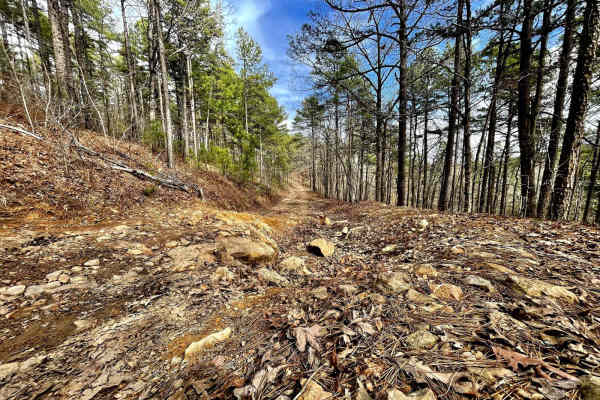
West Forked Mountain FR124
This is a maintained forest road. There are some rocky eroded sections at the north end but it is passable with a 2WD vehicle with good clearance. Along the trail are stunning views of Forked Mountain. There are sections with good views of the mountains, which are picturesque in the fall when the le...
Learn more about West Forked Mountain FR124
Main Mountain Road 83
Main Mountain Road features an easy gravel road with lots of campsites, views of the valley, small creeks, waterfalls, logging operations, and 4x4 trails to explore with quads and SxS. There is a hiking trail to Cove Mountain where there is also a campsite with a view. There are trees down all along...
Learn more about Main Mountain Road 83
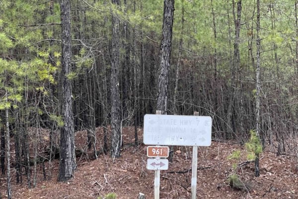
Alum Divide 961
Another rolling, easy gravel road that leads you to more hiking entrances, scenic viewpoints, or even just a new route to the famous Hot Springs, Arkansas. This Ouachita National Forest Service Road gives you some great campsites with lots of trees and pine trees for shade during the summer months. ...
Learn more about Alum Divide 961
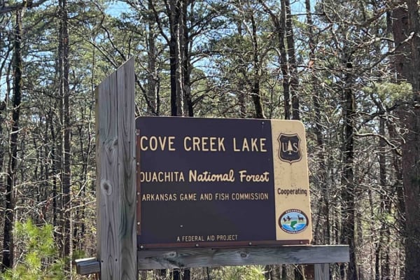
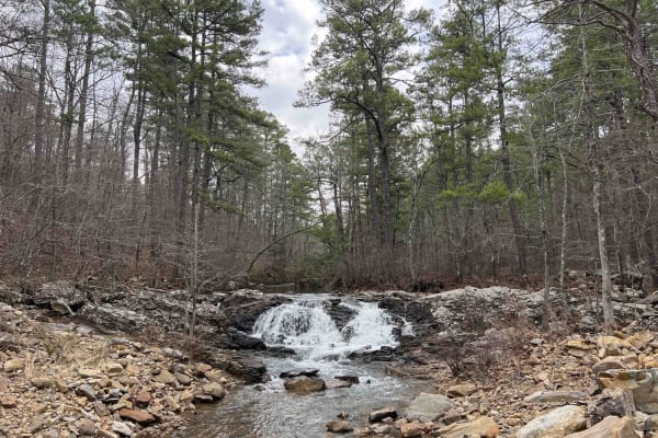
Cove Creek Lake/Link Mountain Road 210
This is an uneven, rocky, muddy road with several washouts and deep water areas when it's raining. This road may be impassable during heavy rains. Three campsites along this road are pretty nice. There is also a 4x4 trail that starts right after you cross the dam. There is a boat launch area at the ...
Learn more about Cove Creek Lake/Link Mountain Road 210
North Fork Road/Trail 86
North Fork Road is a beautiful gravel trail that winds through the Ouachita National Forest. This trail provides access to many of Arkansas' hidden outdoor attractions. This road is heavily trafficked and has a few blind curves. There are no technical sections along this trail, so no 4WD is necessar...
Learn more about North Fork Road/Trail 86
Beginner ATV trails near Perryville, Arkansas
Explore ATV-friendly trails near you. These trails are accessible for vehicles up to 50 inches wide, perfect for ATVs and smaller off-road machines.
Link Mountain Road 210
Starting the trail to the east, it's an easy gravel road for the first 5 miles or so. Then it turns into a muddy mess with high ruts in the middle which make it hard for a low clearance vehicle to make it through certain sections. You can see this in the photo at mile 5.9. There are some really grea...
Learn more about Link Mountain Road 210
Brown Creek Road 805
Brown Creek winds you through the forest with beautiful views, lots of creek crossings, and campsites. This trail will also lead you to the Ouachita National Recreation trail which is a 223-mile trail, there are two entrance points along this route to access this trail. This route could be a basecam...
Learn more about Brown Creek Road 805
North Fork Pinnacle Road 132C
I started the trail in 2-wheel drive but not far into the trail, I had to put it in 4L. This is due to the clearance issues and needing to go slow for uneven ground. This trail closes in the summer and is open in the fall and winter. They use the trail during the summer as a hiking trail. Great trai...
Learn more about North Fork Pinnacle Road 132C
Wallace Bridge Road
Wallace Bridge Road is a beautiful gravel road that is woven through the Ouachita National Forest. This is a very well-maintained gravel road that passes through farmland in Deberrie, Arkansas, and runs along the Fourche LaFave River. This road is suitable for most vehicles as there are limited obst...
Learn more about Wallace Bridge Road
Beginner UTV/side-by-side trails near Perryville, Arkansas
Find UTV and side-by-side trails near you. These trails accommodate vehicles up to 60 inches wide, ideal for UTVs, side-by-sides, and wider off-road rigs.
Link Mountain Road 210
Starting the trail to the east, it's an easy gravel road for the first 5 miles or so. Then it turns into a muddy mess with high ruts in the middle which make it hard for a low clearance vehicle to make it through certain sections. You can see this in the photo at mile 5.9. There are some really grea...
Learn more about Link Mountain Road 210
Brown Creek Road 805
Brown Creek winds you through the forest with beautiful views, lots of creek crossings, and campsites. This trail will also lead you to the Ouachita National Recreation trail which is a 223-mile trail, there are two entrance points along this route to access this trail. This route could be a basecam...
Learn more about Brown Creek Road 805
North Fork Pinnacle Road 132C
I started the trail in 2-wheel drive but not far into the trail, I had to put it in 4L. This is due to the clearance issues and needing to go slow for uneven ground. This trail closes in the summer and is open in the fall and winter. They use the trail during the summer as a hiking trail. Great trai...
Learn more about North Fork Pinnacle Road 132C
Wallace Bridge Road
Wallace Bridge Road is a beautiful gravel road that is woven through the Ouachita National Forest. This is a very well-maintained gravel road that passes through farmland in Deberrie, Arkansas, and runs along the Fourche LaFave River. This road is suitable for most vehicles as there are limited obst...
Learn more about Wallace Bridge Road
The onX Offroad Difference
onX Offroad combines trail photos, descriptions, difficulty ratings, width restrictions, seasonality, and more in a user-friendly interface. Available on all devices, with offline access and full compatibility with CarPlay and Android Auto. Discover what you're missing today!
Open Trail Map