
Beginner Off-Road Trails
Near Murray, Kentucky
Explore All Beginner Trails Near Murray, Kentucky
Beginner Off-Road Trails Near Murray, Kentucky
Discover the best beginner-friendly off-road trails near you. These easier, lower-rated trails are a great place to start — browse trail maps, check difficulty ratings, and find your next adventure.
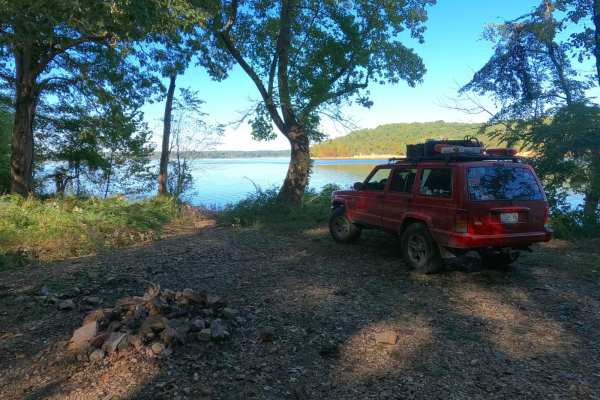
Mays Hollow Road - FS 343
Mays Hollow Road FS 343 is a natural-improved forestry road through the southeast corner of the southern Kentucky section, Kentucky Lake side, of the Land Between the Lakes National Recreation Area. This trail is placed along the hillside leading from Eagle Point ridge top to the south Turkey Bay sh...
Learn more about Mays Hollow Road - FS 343
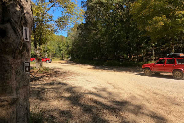
1 to 2 Road
The 1 to 2 Road, is a semi-maintained creek gravel and dirt primary road, with natural tendencies, connecting point to point from the 1 intersection to the 2 intersection in Turkey Bay OHV, within the Land Between the Lakes National Recreation Area. Its official ID is part of Forestry M01. After get...
Learn more about 1 to 2 Road
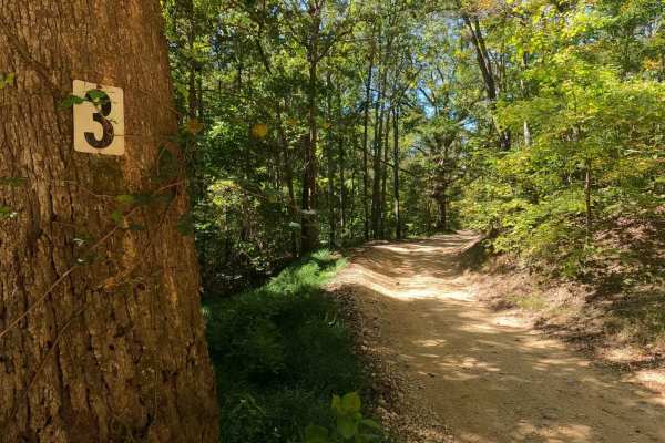
3 to 4 Road
The 3 to 4 Road, is a semi-maintained creek gravel and dirt primary road, connecting point to point from the 3 intersection to the 4 intersection in Turkey Bay OHV, within the Land Between the Lakes National Recreation Area. Its official ID is part of Forestry M01. The Road is a short and simple exa...
Learn more about 3 to 4 Road
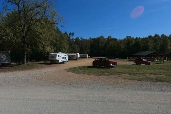
Mays Camp - FS 167 D2
The Mays Camp, also referred to as Turkey Trot Camp, is a popular camp road at Turkey Bay OHV, within the Land Between the Lakes National Recreation Area. Its pet name and official ID is Mays Camping Area FS 167 Spur D2. It features a flat-laying road starting with the small event pavilion and Turke...
Learn more about Mays Camp - FS 167 D2
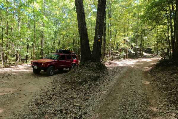
2 to 3 Road
The 2 to 3 Road is a semi-maintained creek gravel and dirt primary road, with natural tendencies, connecting point to point from the 2 intersection at the "V Tree" to the 3 intersection in Turkey Bay OHV, within the Land Between the Lakes National Recreation Area. Its official ID is part of Forestry...
Learn more about 2 to 3 Road
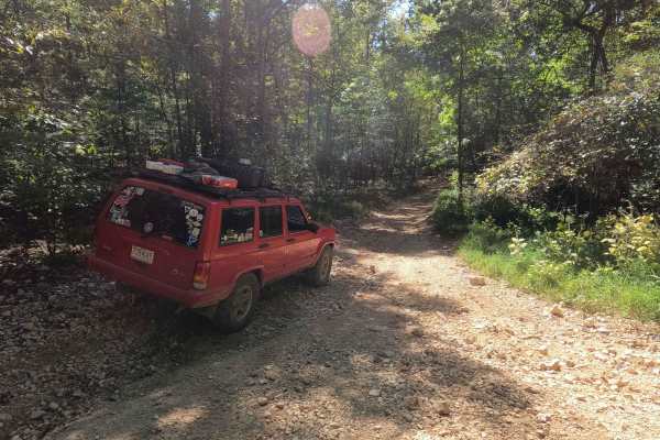
3 to A Road
The 3 to A Road is a semi-maintained primary road with a blend of dirt and natural rock, connecting point to point from the 3 intersection to the A intersection within the Land Between the Lakes National Recreation Area. Its official ID is part of Forestry M04. Going north to south at the 3 intersec...
Learn more about 3 to A Road
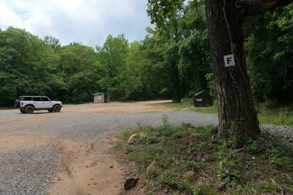
F to E Road
The Turkey Bay F to E Road, is a generally maintained primary gravel/dirt road connecting point to point from the F intersection to E intersection inside the Turkey Bay OHV Area, within the Land Between the Lakes National Recreation Area, it is officially IDs under part of the Forestry M02. The road...
Learn more about F to E Road
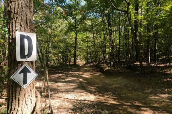
2 to D Road
The 2 to D Road is a semi-maintained creek gravel and dirt primary road, with natural tendencies, connecting point to point from the 2 intersection to the D intersection in Turkey Bay OHV, within the Land Between the Lakes National Recreation Area. Its official ID is the Forestry M05. At the 2 inter...
Learn more about 2 to D Road
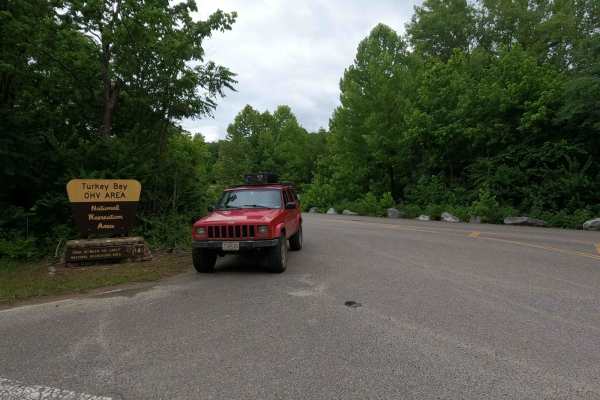
Turkey Bay Gate FSR 167
Turkey Bay Gate FSR 167 is the paved entry to gravel main hub and parking section of the Turkey Bay OHV Area, within the Land Between the Lakes National Recreation Area. At the entry you pass the picture worthy Turkey Bay OHV forestry sign, which shortly leads you to the sign in and fee gate house. ...
Learn more about Turkey Bay Gate FSR 167
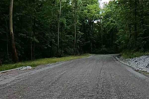
Turkey Creek Road FSR 167
The Turkey Creek Road FSR 167, is the Gravel main hub road and parking section along the southern boundary of the Turkey Bay OHV Area, within the Land Between the Lakes National Recreation Area. The road features generally easy-riding gravel for the first 3/4 of its length, crossing a few mild low w...
Learn more about Turkey Creek Road FSR 167
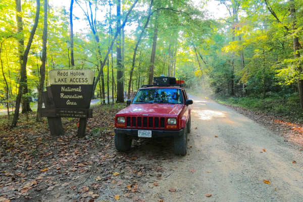
Redd Hollow Road - FS 171
Redd Hollow Road FS 171 is a gravel forestry route through the southwest corner of the Kentucky section, Kentucky Lake side, of the Land Between the Lakes National Recreation Area. This route is simple, coming off the ridge top where the Woodland Trace road lays, and following gradually downhill to ...
Learn more about Redd Hollow Road - FS 171
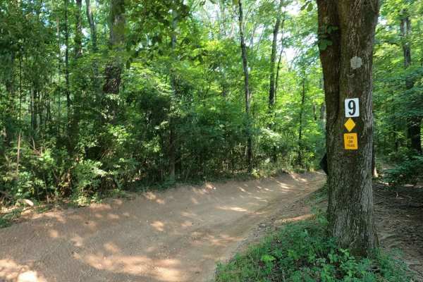
9 to 8 Road
The Turkey Bay 9 to 8 Road is a generally maintained primary gravel/creek bottom road, connecting point to point from the 9 intersection to the 8 intersection inside the Turkey Bay OHV Area, within the Land Between the Lakes National Recreation Area. Its official ID is forestry M01. The road starts ...
Learn more about 9 to 8 Road
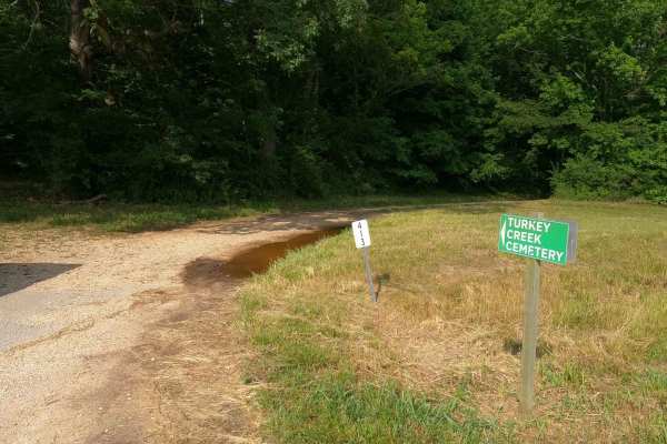
Turkey Creek Cemetery Road - FS 413
Turkey Creek Cemetery Road FS 413 is a gravel forest service road through the inland center-south Kentucky section, of the Land Between the Lakes National Recreation Area. The Turkey Creek Cemetery Road features a road that parallels to the north of Turkey Creek, and to the north of the road is a hi...
Learn more about Turkey Creek Cemetery Road - FS 413
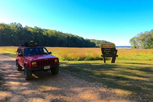
Colson Hollow Road - FS 169
Colson Hollow Road FS 169 is a gravel forestry road through the southwest corner of the southern Kentucky section, Kentucky Lake side, of the Land Between the Lakes National Recreation Area. It features an easy, maintained flow, going down a mild grade into the hollow with mild soft spots where the ...
Learn more about Colson Hollow Road - FS 169
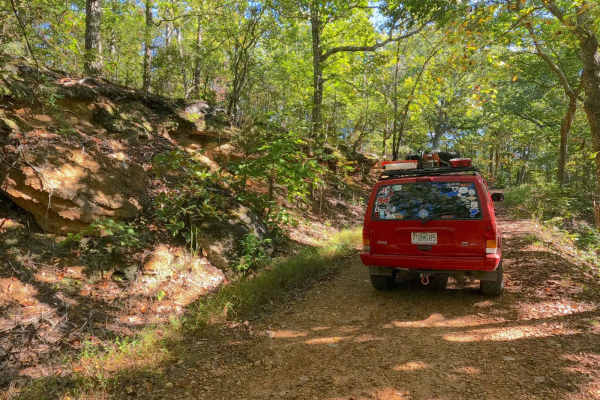
Eagle Point - FS 168
Eagle Point FS 168 is a gravel forestry road through the southwest corner of the Kentucky section, Kentucky Lake side, of the Land Between the Lakes National Recreation Area. This road features small rolling hills and beautiful tree lines, with rutted gravel sections, minimal water collection spots ...
Learn more about Eagle Point - FS 168
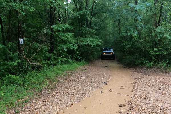
8 to E Road
The Turkey Bay 8 to E Road is a generally maintained primary gravel/dirt road connecting point to point from the 8 intersection to E intersection inside the Turkey Bay OHV area, within the Land Between the Lakes National Recreation Area, this road's official Forest ID is the M06. The road begins on ...
Learn more about 8 to E Road
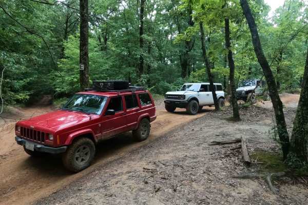
D to E Road
The Turkey Bay E to D Road is a generally maintained primary gravel/dirt road connecting point to point from the E intersection to the D intersection inside the Turkey Bay OHV area, within the Land Between the Lakes National Recreation Area, this road is part of the official Forest route M02. This r...
Learn more about D to E Road
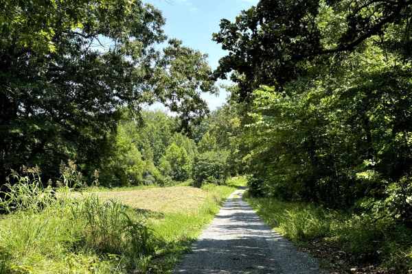
Fords Bay Road
Fords Bay Road connects the main road (Woodlands Trace National Scenic Byway) with CR 165 and CR 347 which takes you to Fords Bay on Lake Barkley. The trail is a gravel forestry road with some soft sand spots that can turn into mud holes after heavy rain. Usually, this is a very easy road. The land ...
Learn more about Fords Bay Road
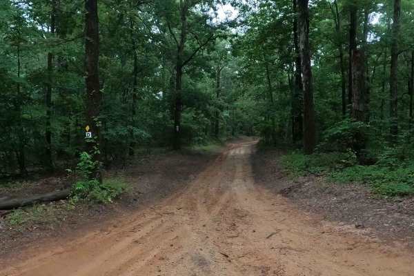
D to 5 Road
The Turkey Bay D to 5 Road is a generally maintained primary dirt road connecting point to point from the D intersection to 5 intersection inside the Turkey Bay OHV area, within the Land Between the Lakes National Recreation Area, this road is part of the official Forest route M02. This road leads t...
Learn more about D to 5 Road
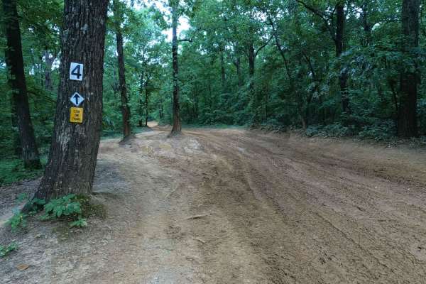
5 to 4 Road
The 5 to 4 Road is a semi-maintained, creek gravel and dirt primary road connecting point to point from the 5 intersection and going downhill to the 4 intersection in Turkey Bay OHV, within the Land Between the Lakes National Recreation Area. Its official ID is forestry M01. The road on its eastern ...
Learn more about 5 to 4 Road
Beginner ATV trails near Murray, Kentucky
Explore ATV-friendly trails near you. These trails are accessible for vehicles up to 50 inches wide, perfect for ATVs and smaller off-road machines.
1 to 2 Road
The 1 to 2 Road, is a semi-maintained creek gravel and dirt primary road, with natural tendencies, connecting point to point from the 1 intersection to the 2 intersection in Turkey Bay OHV, within the Land Between the Lakes National Recreation Area. Its official ID is part of Forestry M01. After get...
Learn more about 1 to 2 Road
3 to 4 Road
The 3 to 4 Road, is a semi-maintained creek gravel and dirt primary road, connecting point to point from the 3 intersection to the 4 intersection in Turkey Bay OHV, within the Land Between the Lakes National Recreation Area. Its official ID is part of Forestry M01. The Road is a short and simple exa...
Learn more about 3 to 4 Road
Mays Camp - FS 167 D2
The Mays Camp, also referred to as Turkey Trot Camp, is a popular camp road at Turkey Bay OHV, within the Land Between the Lakes National Recreation Area. Its pet name and official ID is Mays Camping Area FS 167 Spur D2. It features a flat-laying road starting with the small event pavilion and Turke...
Learn more about Mays Camp - FS 167 D2
2 to 3 Road
The 2 to 3 Road is a semi-maintained creek gravel and dirt primary road, with natural tendencies, connecting point to point from the 2 intersection at the "V Tree" to the 3 intersection in Turkey Bay OHV, within the Land Between the Lakes National Recreation Area. Its official ID is part of Forestry...
Learn more about 2 to 3 Road
Beginner UTV/side-by-side trails near Murray, Kentucky
Find UTV and side-by-side trails near you. These trails accommodate vehicles up to 60 inches wide, ideal for UTVs, side-by-sides, and wider off-road rigs.
1 to 2 Road
The 1 to 2 Road, is a semi-maintained creek gravel and dirt primary road, with natural tendencies, connecting point to point from the 1 intersection to the 2 intersection in Turkey Bay OHV, within the Land Between the Lakes National Recreation Area. Its official ID is part of Forestry M01. After get...
Learn more about 1 to 2 Road
3 to 4 Road
The 3 to 4 Road, is a semi-maintained creek gravel and dirt primary road, connecting point to point from the 3 intersection to the 4 intersection in Turkey Bay OHV, within the Land Between the Lakes National Recreation Area. Its official ID is part of Forestry M01. The Road is a short and simple exa...
Learn more about 3 to 4 Road
Mays Camp - FS 167 D2
The Mays Camp, also referred to as Turkey Trot Camp, is a popular camp road at Turkey Bay OHV, within the Land Between the Lakes National Recreation Area. Its pet name and official ID is Mays Camping Area FS 167 Spur D2. It features a flat-laying road starting with the small event pavilion and Turke...
Learn more about Mays Camp - FS 167 D2
2 to 3 Road
The 2 to 3 Road is a semi-maintained creek gravel and dirt primary road, with natural tendencies, connecting point to point from the 2 intersection at the "V Tree" to the 3 intersection in Turkey Bay OHV, within the Land Between the Lakes National Recreation Area. Its official ID is part of Forestry...
Learn more about 2 to 3 Road
The onX Offroad Difference
onX Offroad combines trail photos, descriptions, difficulty ratings, width restrictions, seasonality, and more in a user-friendly interface. Available on all devices, with offline access and full compatibility with CarPlay and Android Auto. Discover what you're missing today!
Open Trail Map