
Beginner Off-Road Trails
Near Munds Park, Arizona
Explore All Beginner Trails Near Munds Park, Arizona
Beginner Off-Road Trails Near Munds Park, Arizona
Discover the best beginner-friendly off-road trails near you. These easier, lower-rated trails are a great place to start — browse trail maps, check difficulty ratings, and find your next adventure.
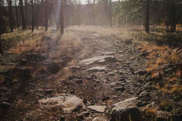
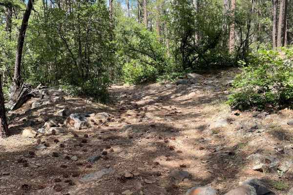
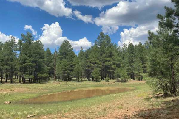
Frog Tank Loop
Frog Tank Loop is a 3.4-mile 62-inch trail in the Munds Park OHV system that prohibits full-width vehicles. It makes a loop, intersecting with both Iron Springs Connector and Leap Frog Trail. The west and northern half of the loop has some bigger boulders and small ledges in the trail. The southern ...
Learn more about Frog Tank Loop
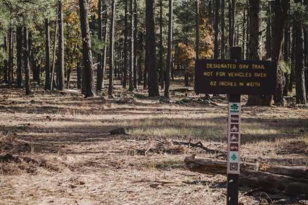
Leap Frog
Leap Frog is a 62-inch trail that prohibits full-width vehicles in the Munds Park OHV system. The south end starts on the Frog Tank Loop and makes a semi-loop as it rides north and then back south to meet up with Rocky Road. Much of the trail is very rocky, with lots of small loose rocks in the tra...
Learn more about Leap Frog
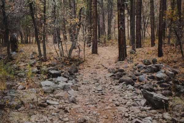
Munds Canyon
Munds Canyon is a 2.5-mile-long OHV trail designated for vehicles 62 inches or less. It starts at the Munds Park Trailhead off FS Road 240. The southern beginning is pretty easy, with smooth and flowy sections of trail between the tall pine trees. It becomes rockier in sections as it heads north, bu...
Learn more about Munds Canyon
Willard
Willard is an easy single track in the Kelly Motorized Trail System that is much easier and less rocky than the parallel Interstate Trail. This one is a smooth, fast, and flowy trail through a dry pine tree forest, with few rocks in the trail to watch out for. Any of the rocks are easy to avoid. The...
Learn more about Willard
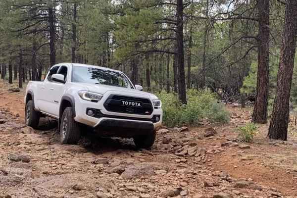
FS 9469R
Forest Road 9469R is just short of 2 miles long and traverses around a small hill. The trail starts as a maintained road but changes quickly to a dirt road that gets rockier as you travel farther. As you ride this trail, watch out for large rocks on the trail's surface that may sneak up on you if yo...
Learn more about FS 9469R
FS 9459J
Forest Road 9459J is a short trail that connects back to Schnebly Hill Road. You will travel through Ponderosas and a small meadow that gives way to Camp Tank. Then, the trail travels along the foot of a small hill and ends at Schnebly Hill Road. This trail looks like it would be a muddy mess after ...
Learn more about FS 9459J
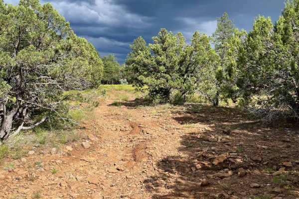
FR 226
Forest Road 226 runs Northwest to Southeast, opposite the famous "Schnebley Hill". This rocky trail will take you through the mixed pines of the Coconino National Forest through burn scars and past many primitive large pull-through-type campsites. With no obstacles over 12", this dirt road is unmain...
Learn more about FR 226
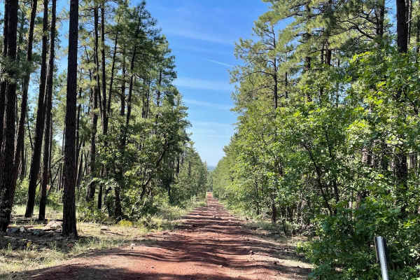
Schnebly Hill Road
Schnebly Hill Road is one of Sedona's most iconic and scenic routes, connecting the red rock canyons below to the pine-covered Mogollon Rim above. Best traveled east to west, this trail is known not for technical obstacles, but for its unrelenting rock garden--a bumpy, rough surface that stretches f...
Learn more about Schnebly Hill Road
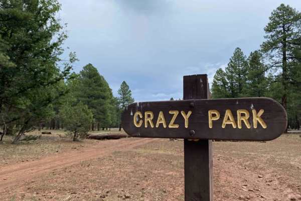
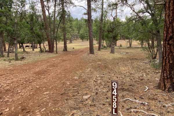
Crazy Park
Scenic point-to-point trail under the pines of the Coconino National Forest near Munds Park, AZ. The route is a combination of rutted dirt and loose and buried rock that terminates just past Crazy Park at a trail closure (9458M). The route is bumpy, but not challenging;will require high clearance an...
Learn more about Crazy Park
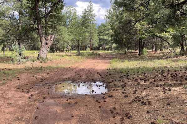
FS 9459G
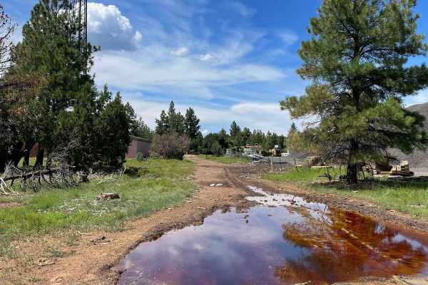
This short rocky trail is just shy of one mile long. As you start the trail, there will be a nice camping site on your left right off Schnebly Hill Trail. The trail takes you right next to residential and commercial properties as the trail goes North. This trail has lots of mud puddles after a decen...
Learn more about FS 9459G
Ritter Road (Newman Park)
Easy, but beautiful, forest road through the Ponderosa pines of the Coconino National Forest west of Munds Park, AZ. Along this route, you will find many dispersed campsites and access to other 4x4 trails in the area. As always, be a steward of our public lands and national forests; observe Tread Li...
Learn more about Ritter Road (Newman Park)
FS 9467V
Forest Road 9467V is a short easy trail through the Ponderosa Pines. The trail starts just off of FR 226 Guided Trail. You will see Ewe Tank as you start traveling down this road. There is a massive camping spot next to this tank and an OHV track around the tank. As you continue down this dirt trail...
Learn more about FS 9467V
Red Clay Way
This is a fun point-to-point trail under the pines of the Coconino National Forest near Munds Park, AZ, that can be utilized as a connector to other trails in the area. This 3.5-mile gradual incline is a mixture of rutted dirt and both loose and buried rocks. It's a bumpy but fun ride that will requ...
Learn more about Red Clay Way
FS 153E
Forest Road 153E stretches just over two miles long and starts off of Schnebly Hill Road. As you start the trail, you will see two dispersed camping spots on your left. The trail travels to the Northwest and becomes more rocky the farther you go. The views on this trail are of Ponderosas, which give...
Learn more about FS 153E

Graffiti Tunnel Loop
Scenic loop under the Ponderosa pines of the Coconino National Forest near Munds Park, AZ. The route starts off on a mostly dirt trail with some erosion and ruts of varying depth. As you venture further from the start, rocks and partially buried boulders dominate the single-lane track. Although not ...
Learn more about Graffiti Tunnel Loop
FS 226E
Forest Service Road 226E is an easy-going dirt trail with slight grades. The first section of this trail starts off a little rocky and evens out to a dirt surface. You will pass a cattle guard and from there, the trail eases down a gentle grade. There is a small rut from water runoff that follows th...
Learn more about FS 226E
Thomas Point Connector
This scenic connector trail is found under the pines of the Coconino National Forest west of Munds Park, AZ. The trail is a mix of rutted dirt and both loose and buried rock, making for a bumpy connection to or from Thomas Point Trail. High clearance and 4x4 are recommended, and trail difficulty wil...
Learn more about Thomas Point Connector
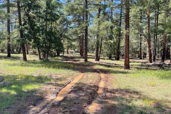
Deadwood Tank
This scenic point-to-point trail is located under the pines of the Coconino National Forest near Munds Park, AZ, and can be combined with Crazy Park trail to become a bumpy, but fun, loop trail. The trail is a mixture of rutted dirt of varying depth and loose and buried rocks of varying height. High...
Learn more about Deadwood Tank
Schnebly Hill Radio Towers
This short trail takes you up across Shnebly Hill and down to Schnebly Hill Trail which is a guided route. This trail is a dirt road that has some small erosion ruts from water runoff. After a good rain, there is potential for some small mud holes. There are a few small rocky surfaces on this trail ...
Learn more about Schnebly Hill Radio Towers
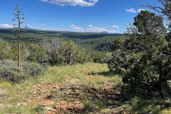
FS 9499G to Viewpoint
This short trail starts at the beginning of Forest Road 9499G and rolls through the ponderosas of the Coconino National Forest. The vast majority of this trail is an easy-going dirt road that has some potential for a few mud holes. The last part of this trail becomes much more rocky and ends at a ni...
Learn more about FS 9499G to Viewpoint
Beginner ATV trails near Munds Park, Arizona
Explore ATV-friendly trails near you. These trails are accessible for vehicles up to 50 inches wide, perfect for ATVs and smaller off-road machines.
Frog Tank Loop
Frog Tank Loop is a 3.4-mile 62-inch trail in the Munds Park OHV system that prohibits full-width vehicles. It makes a loop, intersecting with both Iron Springs Connector and Leap Frog Trail. The west and northern half of the loop has some bigger boulders and small ledges in the trail. The southern ...
Learn more about Frog Tank Loop
Leap Frog
Leap Frog is a 62-inch trail that prohibits full-width vehicles in the Munds Park OHV system. The south end starts on the Frog Tank Loop and makes a semi-loop as it rides north and then back south to meet up with Rocky Road. Much of the trail is very rocky, with lots of small loose rocks in the tra...
Learn more about Leap Frog
Munds Canyon
Munds Canyon is a 2.5-mile-long OHV trail designated for vehicles 62 inches or less. It starts at the Munds Park Trailhead off FS Road 240. The southern beginning is pretty easy, with smooth and flowy sections of trail between the tall pine trees. It becomes rockier in sections as it heads north, bu...
Learn more about Munds Canyon
FS 9469R
Forest Road 9469R is just short of 2 miles long and traverses around a small hill. The trail starts as a maintained road but changes quickly to a dirt road that gets rockier as you travel farther. As you ride this trail, watch out for large rocks on the trail's surface that may sneak up on you if yo...
Learn more about FS 9469R
Beginner UTV/side-by-side trails near Munds Park, Arizona
Find UTV and side-by-side trails near you. These trails accommodate vehicles up to 60 inches wide, ideal for UTVs, side-by-sides, and wider off-road rigs.
Frog Tank Loop
Frog Tank Loop is a 3.4-mile 62-inch trail in the Munds Park OHV system that prohibits full-width vehicles. It makes a loop, intersecting with both Iron Springs Connector and Leap Frog Trail. The west and northern half of the loop has some bigger boulders and small ledges in the trail. The southern ...
Learn more about Frog Tank Loop
Leap Frog
Leap Frog is a 62-inch trail that prohibits full-width vehicles in the Munds Park OHV system. The south end starts on the Frog Tank Loop and makes a semi-loop as it rides north and then back south to meet up with Rocky Road. Much of the trail is very rocky, with lots of small loose rocks in the tra...
Learn more about Leap Frog
Munds Canyon
Munds Canyon is a 2.5-mile-long OHV trail designated for vehicles 62 inches or less. It starts at the Munds Park Trailhead off FS Road 240. The southern beginning is pretty easy, with smooth and flowy sections of trail between the tall pine trees. It becomes rockier in sections as it heads north, bu...
Learn more about Munds Canyon
FS 9469R
Forest Road 9469R is just short of 2 miles long and traverses around a small hill. The trail starts as a maintained road but changes quickly to a dirt road that gets rockier as you travel farther. As you ride this trail, watch out for large rocks on the trail's surface that may sneak up on you if yo...
Learn more about FS 9469R
The onX Offroad Difference
onX Offroad combines trail photos, descriptions, difficulty ratings, width restrictions, seasonality, and more in a user-friendly interface. Available on all devices, with offline access and full compatibility with CarPlay and Android Auto. Discover what you're missing today!
Open Trail Map