Schnebly Hill Road

Total Miles11
Technical Rating
2Easy
Best TimeSpring, Summer, Fall, Winter
Trail TypeFull-Width Road
Accessible By
Open Trail Map

Trail Overview

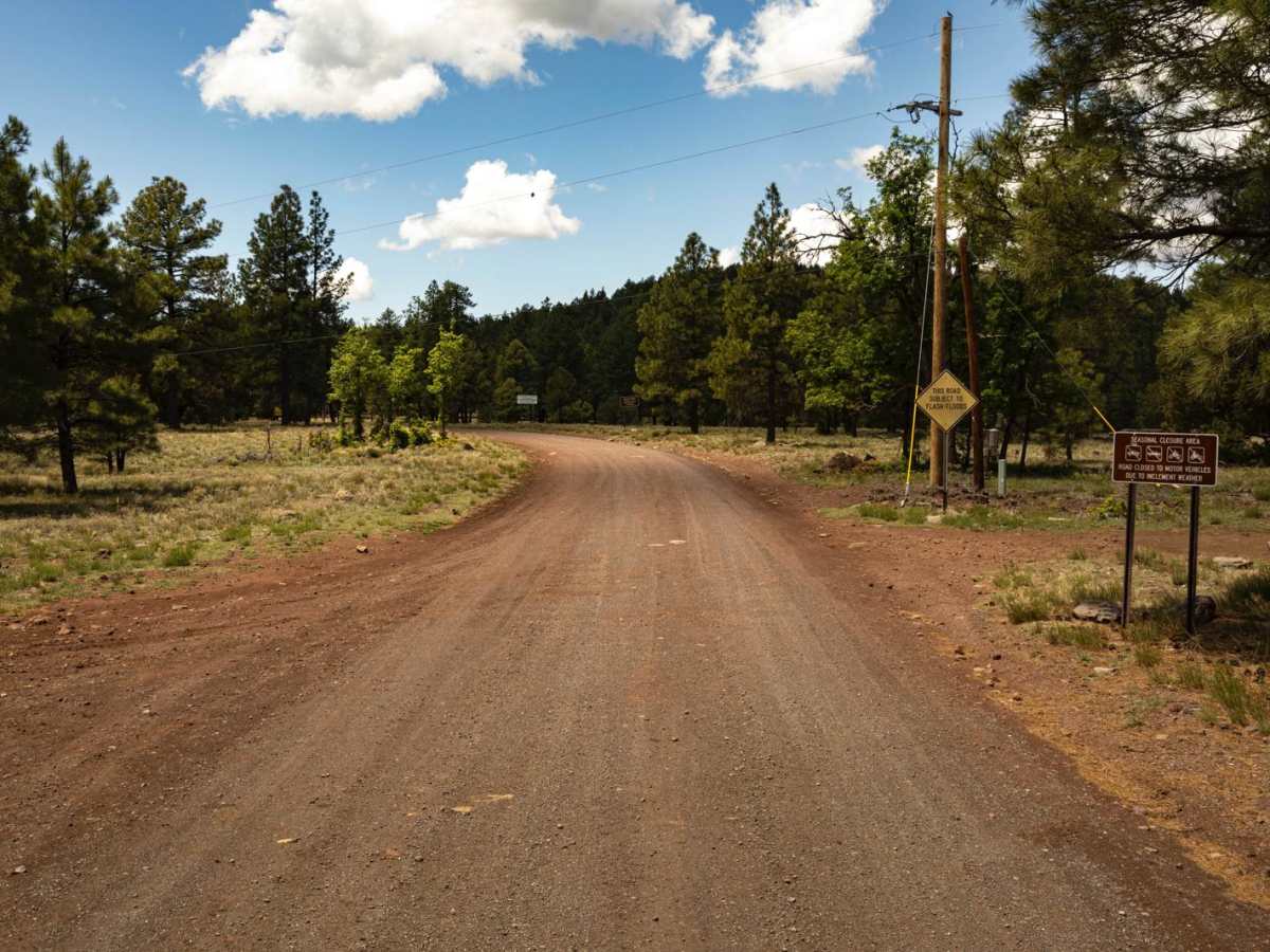
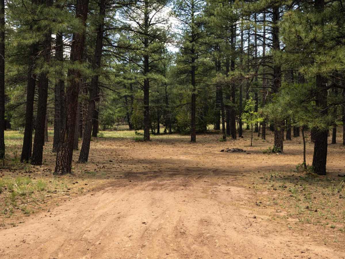
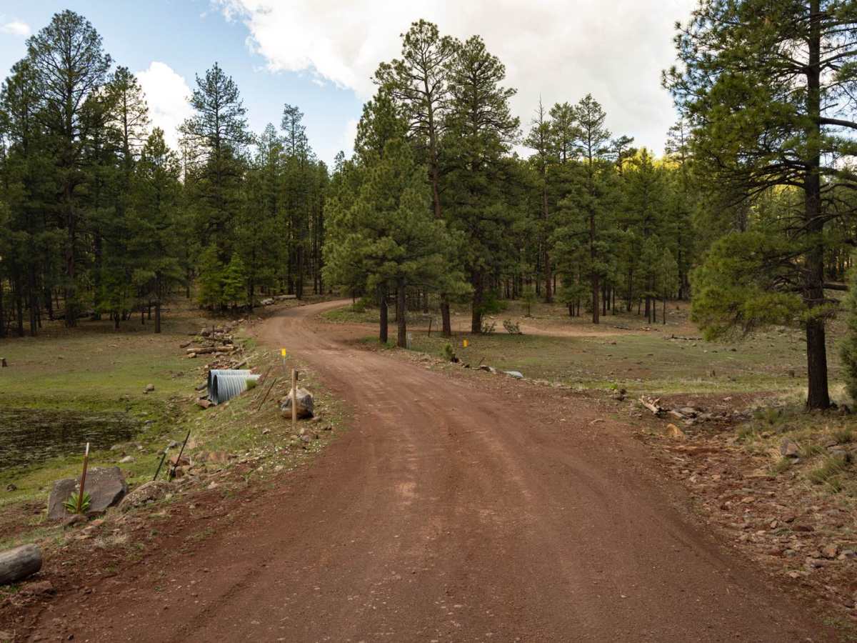
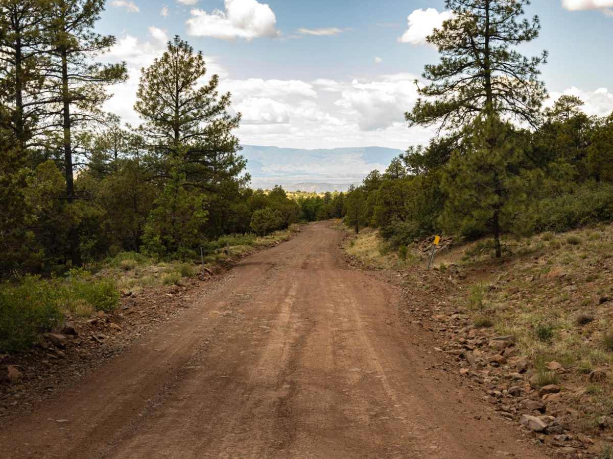
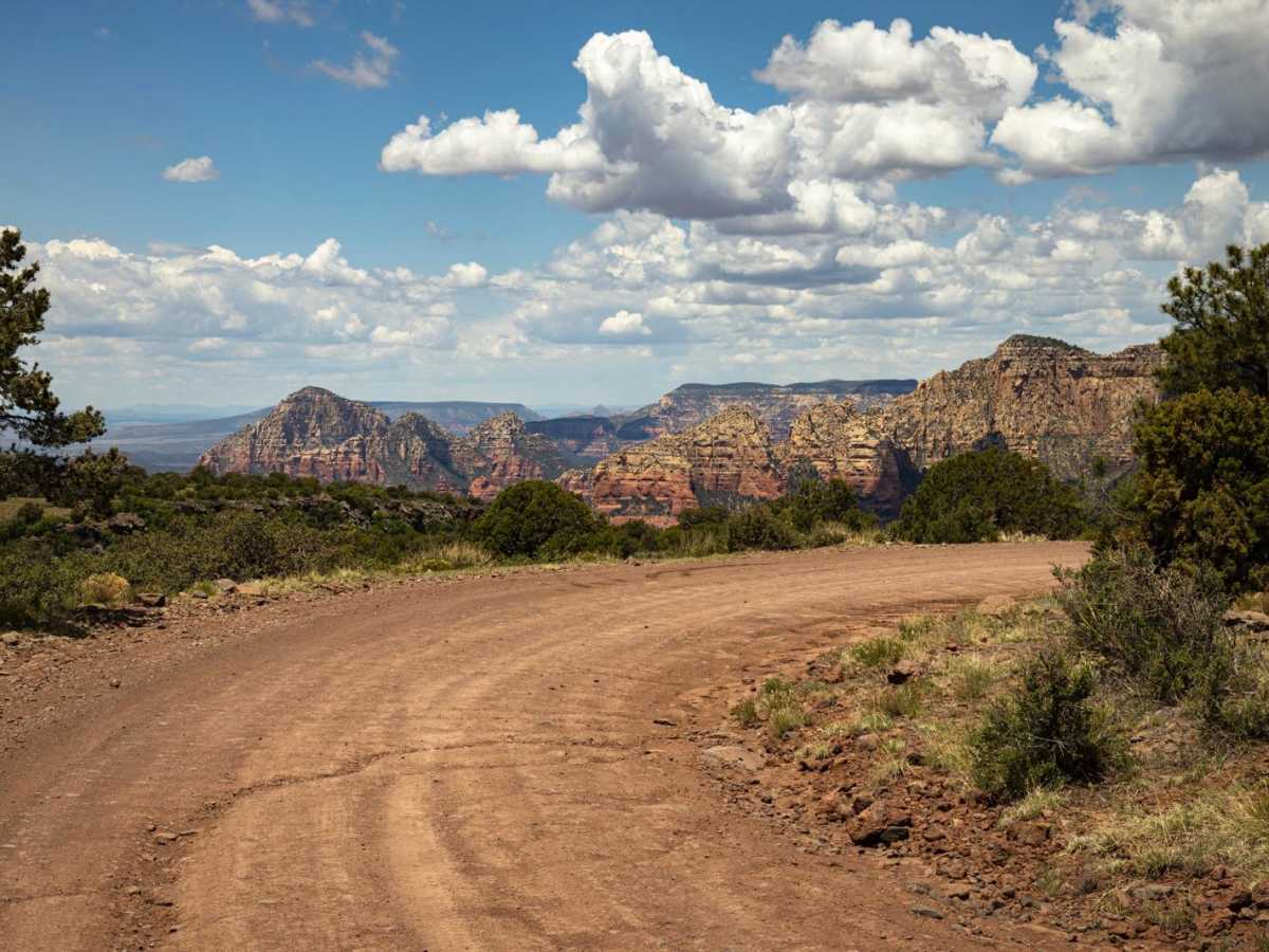
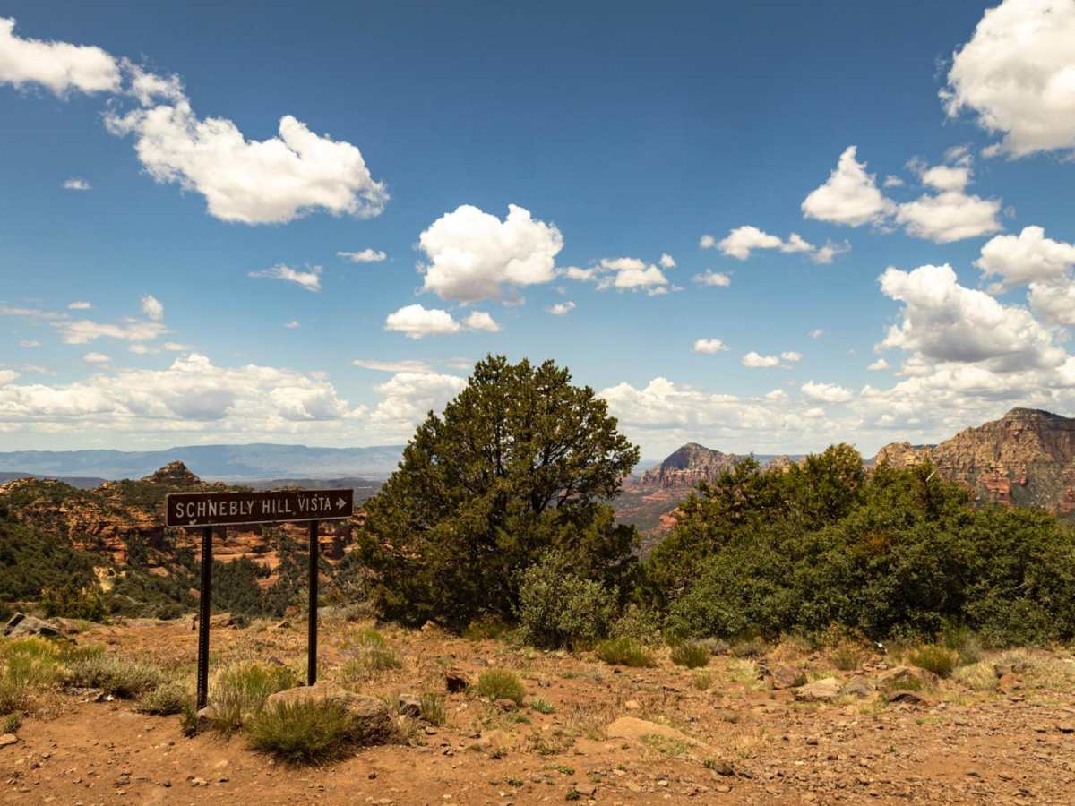
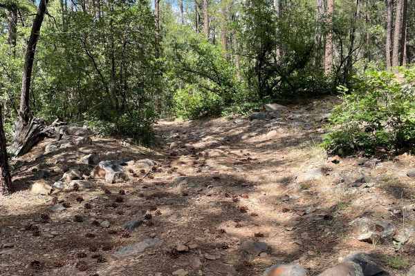
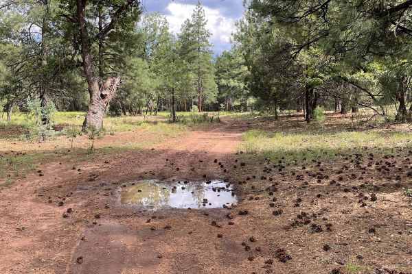
Schnebly Hill Road is one of Sedona's most iconic and scenic routes, connecting the red rock canyons below to the pine-covered Mogollon Rim above. Best traveled east to west, this trail is known not for technical obstacles, but for its unrelenting rock garden--a bumpy, rough surface that stretches from bottom to rim overlook above. Despite the lack of true obstacles, the continuous loose rock, embedded boulders, and ledges make for a slow and methodical drive. Drivers will be constantly picking their line to avoid tire damage or excess vehicle rattle, especially in stock rigs. It's not difficult--just rough. Along the way, there are several pullouts and side paths that lead to incredible red rock viewpoints, some requiring a short walk for the best perspective. The Schnebly Hill Vista near the top offers a stunning overlook and is the natural endpoint for most travelers. There are campsites along the rim, tucked into the trees - some with primitive fire rings. Remember, if you do have a fire, please check local and county regulations, as this area is prone to large and uncontrollable wildfires. Expect heavy traffic, especially during peak months. The route is a favorite of the Pink Jeep Tours, and their presence adds to the energy but can slow down progress. This is a classic Arizona off-road experience--not hard, but relentlessly bumpy with big payoffs in views. Plan to take your time, enjoy the scenery, and keep an eye out for the best pullouts.

Photos of Schnebly Hill Road

Difficulty

This isn't a difficult trail, just rocky and bumpy throughout. Though it's well-traveled, the trail can change over time due to use and weather. There are no major obstacles along this trail, and even the bigger rocks have room to go around them.

History

Schnebly Hill Road's history begins as the Munds Wagon Trail, a route established by rancher Jim Munds to move cattle between the Verde Valley and higher grazing areas in the 1800s. In 1902, J.J. Thompson, with funding from local groups, improved the trail, and in 1930, the current Schnebly Hill Road was built. The road is named after entrepreneur Carl Schnebly, who settled in the area and used the improved road to transport goods.

Technical Rating

2

Status Reports

Add Status Report
J m
Jul 03, 2026
Open
Eric Yi
Jul 01, 2026
Open
Trail has some of the best views, but the actual trail itself is easy. Also its just rocky, which got old pretty quick. Lowkey just did it for the badge lol
Chad Dechnik
Jun 19, 2026
Open
I would say this trail is a 2/10 when heading from Sedona until you get to the sign for seasonal road closure. From there it’s a 5/10 until you get to the rim then it’s a 1/10. I’m on 33s with skids and a 1” lift. I hit my frame rail once on the taller rocks.
Zach Hill
May 28, 2026
Open
35 psi 31 tires 2 inch lift heavily loaded 4runnerr made it just fine but would say it’s probably a 4 or 5 instead of.a 2
Aaron Breckenridge
May 26, 2026
Open
Lots of unavoidable 12” rocks. Took it from I17 entrance downhill and it was very slow going. Passed 4 Jeeps going uphill, as well as a Chevy Equinox that looked a bit under prepared.
Steve
May 24, 2026
Open
The trail rating on this trail is a bit deceptive. For a built out Jeep this could be a 2, but for smaller less modified vehicles, this is more of a 4-5. Very rocky, some large rocks, and eroded in places from rain. We have driven this trail 2 times in a lifted A/T tires modified Rav 4, and made it but did scape the under carrage on large boulders. It was slow going, and other drivers were very nice in asking if we were doing OK. We can manage other 2/10 trails no problem, which is why this is deceptive on the rating. So use caution if your not in a modified Jeep. It does have beautiful vistas but it comes at a cost of a rough rocky road. We have done it twice in the Rav, and I think we can check it off the list.
Luke Vold
May 23, 2026
Open
Busy day on the trail cam in off I-17 and made our way down. Trail starts off nice nothing to bad for stock vehicles, after the lookout it’s has some good rock gardens and some tight spots. Did the whole trail in 2wd and 37’s around 15 psi. Anything under 35’s I wouldn’t suggest doing this trail. It could probably be done with patience and locking the right lines. Honest feedback, I have done this trail once and probably won’t do it again. The views are nice tho.
Angie Yttri
May 22, 2026
Open
Easy trail with great views. Easy fire road from 17 to the gate where camping ends. At this point the trail gets rocky but can be done in a stock Wrangler.
Backcountry4Life
May 16, 2026
Open
Rockiest part is near the top coming from Sedona. I would rate this a 4-5. Small stock SUVs can do levels 1-2, but a 4x4 high clearance is definitely recommended if you plan to make it to the top. Once you get to the top, the rest of the way to I-17 is a level 1.
Adam Yin
May 15, 2026
Open
Andrew Parde
May 05, 2026
Open
Trail was not horrible but at 5-8 mph in a platinum Tundra with only a level, and 35s, very rough. Was the view worth it? Probably. But if I did it again, I’d go the long way around. I went up the huckaby rd side from town.
TROY OVERBY
Apr 17, 2026
Open
Drove up to rim from Sedona and then back down. Biggest boulders and rocks just before reaching rim.
Travis LeJeune
Apr 14, 2026
Open
Trail was great with a few areas where choosing the best line made it very manageable. Passed where the tour jeeps turn around the trail has one area where I'd say at least 8in. of clearance is needed. After that the trail got a bit muddy but smoother.
forsites only
Apr 05, 2026
Open
The trail was a bumpy ride! I used a 2024 STOCK Tacoma, no lift no nothing! Aired down to 20 PSI and going about 4-8mph. Started at East Sedona to I17 going to Flagstaff. Trail was easy for the stock taco and it’s my first time off-roading too!
Brian Mensing
Apr 01, 2026
Open
Stayed in 2wd aired down to 25, but wish I went lower. It is rocky & bumpy the entire time. Took my kids & at 4 miles in they were done being bounced side to side the entire time. Didn’t continue on the remaining 7miles. Turned around at the merry go round. Pretty views, but would not do this one again.

Schnebly Hill Road Trail can be accessed by the following ride types:

  • Single Track
  • 50 Inch
  • 60 Inch
  • High Clearance
  • Full Width

Schnebly Hill Road Map

The onX Offroad Difference

onX Offroad combines trail photos, descriptions, difficulty ratings, width restrictions, seasonality, and more in a user-friendly interface. Available on all devices, with offline access and full compatibility with CarPlay and Android Auto. Discover what you're missing today!

Open Trail Map