
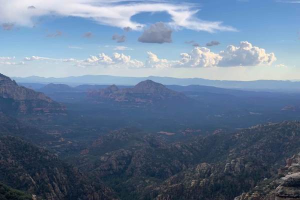
Beginner Off-Road Trails
Near Mountainaire, Arizona
Explore All Beginner Trails Near Mountainaire, Arizona
Beginner Off-Road Trails Near Mountainaire, Arizona
Discover the best beginner-friendly off-road trails near you. These easier, lower-rated trails are a great place to start — browse trail maps, check difficulty ratings, and find your next adventure.
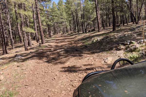
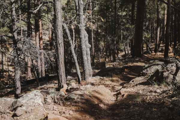
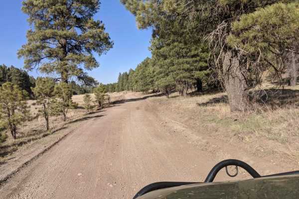
Howard Trail #245
This trail is not suited for low-clearance vehicles. This road is rough and has a few small sections of rocks to crawl. It is a bumpy, slow-moving trail and it will get extremely muddy when wet. The road has spotty cell phone service in sections. This road is not winter-maintained.
Learn more about Howard Trail #245
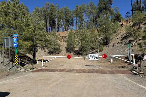
I-17 to Howard Trail
This trail connects the Howard Trail system to I-17. This route is right off I-17, however, it is seasonal and the gate could be closed and locked. The trail is typically closed in the wintertime when snow may be present on the trail system. This is to help preserve this amazing trail with its aston...
Learn more about I-17 to Howard Trail
Howard's Spur
Howard's Spur is an easy trail designated for vehicles 62 inches wide or less. This trail is farther north from the bulk of the 62-inch trails in the Munds Park OHV System but can be connected to by the many Jeep roads in the area and made into a loop with Howard's Trail. This one is easier than so...
Learn more about Howard's Spur
Airport Connector
Airport Connector is a 0.7-mile short connector trail in the middle of the Airport Trail loop that connects the north and south halves of the loop. It's an easy trail that is a good way to shortcut your ride if you don't want to ride all 17 miles of the Airport Trail. Taking the Airport Connector cu...
Learn more about Airport Connector
Jump
Jump is an easy single track in the Kelly Motorized Trail System that has fewer rocks than some of the surrounding single tracks, making it one of the easier ones in the area. It's mostly flat and curvy as it winds beneath the tall pine trees in this dry pine forest. There are a couple of tighter tr...
Learn more about Jump
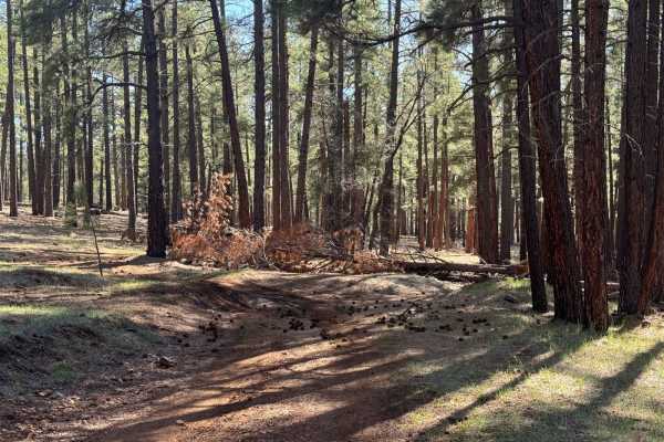
I-17 to Pumphouse Wash
This is a fun little route to Pumphouse Wash. There is an area about halfway in, off to the north, that is a pit and is frequently used for shooting--use caution in the area. There are a few down trees with a trail around them that can be a tight fit for full-size trucks. There's also frequent dirt ...
Learn more about I-17 to Pumphouse Wash
00132d Road
00132d Road offers an easy and scenic 2.8-mile offroad drive through the pine-forested terrain south of Flagstaff near Priest Draw, making it ideal for beginners and scenic cruisers alike. Situated at an elevation between 6,890 and 7,010 feet, this simple dirt route features unique sections of brigh...
Learn more about 00132d Road
FS 132 and Chill
This longer trail is a very chill and enjoyable drive. You will travel through the ponderosa pines of the Coconino National Forest. The forest will give way to a handful of meadows of grass that might hold antelope if you are lucky. There is camping along this trail but sites are more on the souther...
Learn more about FS 132 and Chill
00237 Road
This road does have rough rocky patches, but nothing too crazy. There is a water crossing when it's raining or during winter thaw. Not suited for low clearance vehicles. Typically unmaintained in winter. There is access to camp spots, but camping is allowed only in designated areas. Hiking trails an...
Learn more about 00237 Road
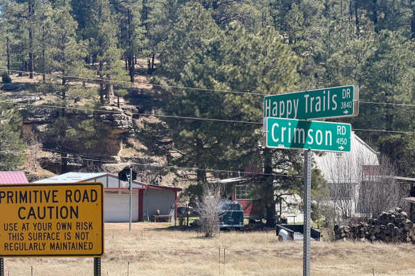
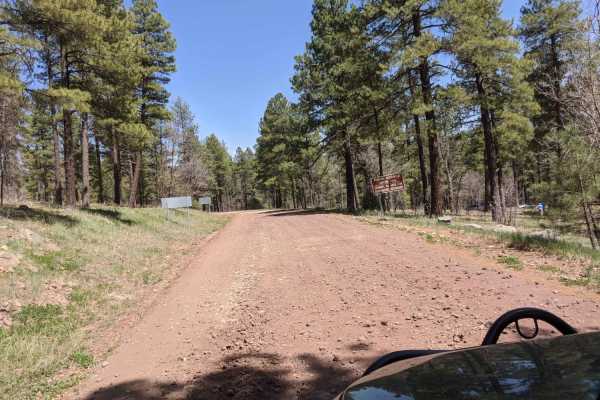
Crimson Road to FS 132 Junction
This is a short road that connects Crimson Road to FR 132. However, the last section that connects it is private access only. There is no public easement, so you must have permission from the home owner to crossover from Crimson Road to FS 132.
Learn more about Crimson Road to FS 132 Junction
Lower Lake Mary Semi Loop
This trail clocks in at 3.4 miles long and provides access to the southwest side of Lower Lake Mary. The trail is a maintained dirt road that has some small rocky sections on the southern portion. Camping is only allowed on the first mile of the northwestern part of this road. In this area, there ar...
Learn more about Lower Lake Mary Semi Loop
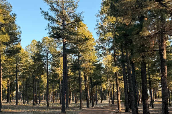
Lost Logger Trail
Hidden among Flagstaff’s tall pines, this easy Level 2 trail follows an old logging road rarely used today. The path is wide and forgiving, with gentle grades, packed dirt, and scattered pine needles. Ideal for beginners and relaxed cruising, it offers quiet forest scenery, cool shade, and a peacefu...
Learn more about Lost Logger Trail
09487x Road
09487x Road is a short, scenic forest route in the Coconino National Forest that offers a rugged, slow-moving crawl through beautiful ponderosa pine country for high-clearance 4WD vehicles. Spanning approximately 1.8 miles, this unpaved route connects Forest Service Road 236 near Half Pint Tank and ...
Learn more about 09487x Road
Fry Lake 9018H
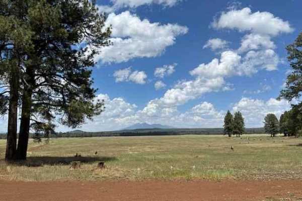
A more exciting route that leads to the Edge of the World from 89A. This offshoot of Fry Park starts in a dense old-growth Ponderosa pine stand and opens up to a stunning grassland with clear views of local peaks. The terrain starts pocked with ruts, small rock fields and roots, then opens up to a d...
Learn more about Fry Lake 9018H
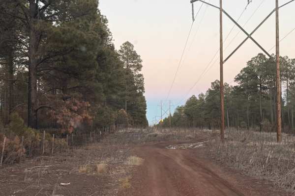
Flagstaff Powerline Trail
This scenic off-road trail near Flagstaff follows established powerlines through dense pine forest and cool high-country terrain. The route is mostly smooth and well-traveled, making it accessible for most high-clearance vehicles. Rated a 2 overall, it features one moderate obstacle that adds a bit ...
Learn more about Flagstaff Powerline Trail
Backside of Tuthill
The Backside of Tuthill is an easy trail off shoot from the Edge of The World Trail. This area is very shaded and often very muddy. A very easy trail and a fun adventure. This trail ends at a spot where there are boulders blocking the roadways onto the military base. (see pictures)
Learn more about Backside of Tuthill

Graffiti Tunnel Loop
Scenic loop under the Ponderosa pines of the Coconino National Forest near Munds Park, AZ. The route starts off on a mostly dirt trail with some erosion and ruts of varying depth. As you venture further from the start, rocks and partially buried boulders dominate the single-lane track. Although not ...
Learn more about Graffiti Tunnel Loop
Edge of the World
Edge of the World (FS RD 231) is a wonderfully scenic, and easy, a route traversing through AZ State Trust land and Coconino National Forest leaving Flagstaff and heading South toward the East Pocket Lookout. Start your adventure through the Ponderosa pines by passing a couple of parks en route to R...
Learn more about Edge of the World
Woody Ridge - FS 535B
This trail begins on the west end in a massive open meadow before eventually entering the forest. Early on, you’ll encounter some deeper washouts that can create off-camber situations, though most have workable drive-arounds. The road is primarily dirt with scattered rocks, but as you gain elevation...
Learn more about Woody Ridge - FS 535B
00296 Road
00296 Road, also known as Forest Service Road 296, is an easy-going, scenic dirt track near Lower Lake Mary in Arizona that serves as a perfect escape for beginner offroaders and wildlife watchers alike. Winding through the scenic ponderosa pine country south of Flagstaff, this 2.9-mile route offers...
Learn more about 00296 Road
Beginner ATV trails near Mountainaire, Arizona
Explore ATV-friendly trails near you. These trails are accessible for vehicles up to 50 inches wide, perfect for ATVs and smaller off-road machines.
Howard Trail #245
This trail is not suited for low-clearance vehicles. This road is rough and has a few small sections of rocks to crawl. It is a bumpy, slow-moving trail and it will get extremely muddy when wet. The road has spotty cell phone service in sections. This road is not winter-maintained.
Learn more about Howard Trail #245
I-17 to Howard Trail
This trail connects the Howard Trail system to I-17. This route is right off I-17, however, it is seasonal and the gate could be closed and locked. The trail is typically closed in the wintertime when snow may be present on the trail system. This is to help preserve this amazing trail with its aston...
Learn more about I-17 to Howard Trail
Howard's Spur
Howard's Spur is an easy trail designated for vehicles 62 inches wide or less. This trail is farther north from the bulk of the 62-inch trails in the Munds Park OHV System but can be connected to by the many Jeep roads in the area and made into a loop with Howard's Trail. This one is easier than so...
Learn more about Howard's Spur
I-17 to Pumphouse Wash
This is a fun little route to Pumphouse Wash. There is an area about halfway in, off to the north, that is a pit and is frequently used for shooting--use caution in the area. There are a few down trees with a trail around them that can be a tight fit for full-size trucks. There's also frequent dirt ...
Learn more about I-17 to Pumphouse Wash
Beginner UTV/side-by-side trails near Mountainaire, Arizona
Find UTV and side-by-side trails near you. These trails accommodate vehicles up to 60 inches wide, ideal for UTVs, side-by-sides, and wider off-road rigs.
Howard Trail #245
This trail is not suited for low-clearance vehicles. This road is rough and has a few small sections of rocks to crawl. It is a bumpy, slow-moving trail and it will get extremely muddy when wet. The road has spotty cell phone service in sections. This road is not winter-maintained.
Learn more about Howard Trail #245
I-17 to Howard Trail
This trail connects the Howard Trail system to I-17. This route is right off I-17, however, it is seasonal and the gate could be closed and locked. The trail is typically closed in the wintertime when snow may be present on the trail system. This is to help preserve this amazing trail with its aston...
Learn more about I-17 to Howard Trail
Howard's Spur
Howard's Spur is an easy trail designated for vehicles 62 inches wide or less. This trail is farther north from the bulk of the 62-inch trails in the Munds Park OHV System but can be connected to by the many Jeep roads in the area and made into a loop with Howard's Trail. This one is easier than so...
Learn more about Howard's Spur
I-17 to Pumphouse Wash
This is a fun little route to Pumphouse Wash. There is an area about halfway in, off to the north, that is a pit and is frequently used for shooting--use caution in the area. There are a few down trees with a trail around them that can be a tight fit for full-size trucks. There's also frequent dirt ...
Learn more about I-17 to Pumphouse Wash
The onX Offroad Difference
onX Offroad combines trail photos, descriptions, difficulty ratings, width restrictions, seasonality, and more in a user-friendly interface. Available on all devices, with offline access and full compatibility with CarPlay and Android Auto. Discover what you're missing today!
Open Trail Map