
Beginner Off-Road Trails
Near Meadow, Utah
Explore All Beginner Trails Near Meadow, Utah
Beginner Off-Road Trails Near Meadow, Utah
Discover the best beginner-friendly off-road trails near you. These easier, lower-rated trails are a great place to start — browse trail maps, check difficulty ratings, and find your next adventure.
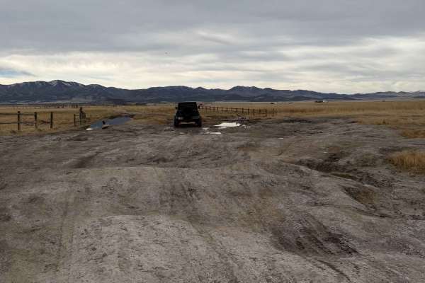
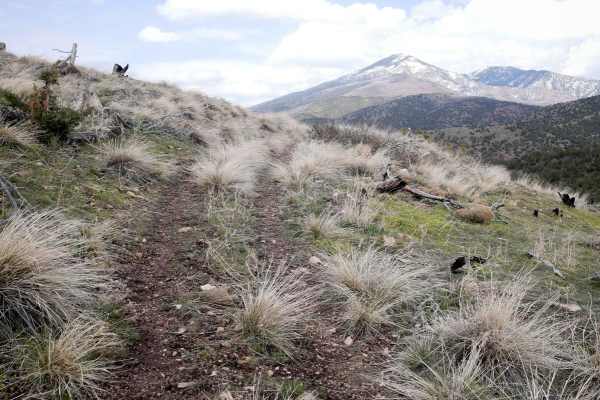
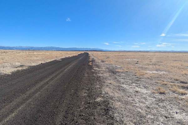
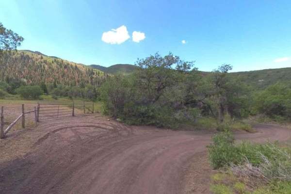
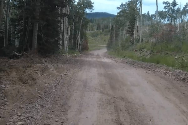
Meadow Hot Springs Road
The road runs from the town of Meadow out to Meadow Hot Springs. It starts out as a maintained, graded, gravel road that is passable in any vehicle. Where the loop starts, there is a parking area for visitors who wish to walk out to the hot springs. There are also trails that go out to the hot sprin...
Learn more about Meadow Hot Springs Road
Clear Lake Road
The Clear Lake Road is a well-maintained, graded gravel road accessible by all vehicles. The east end of the road is located in the town of Flowell, Utah, which is west of Fillmore, Utah. There are no services in Flowell. Fillmore will be the best option for fuel or other amenities. The west end of ...
Learn more about Clear Lake Road
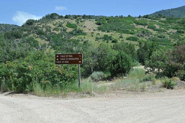
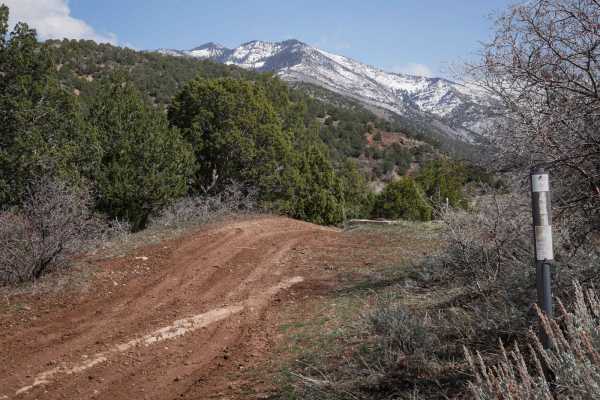
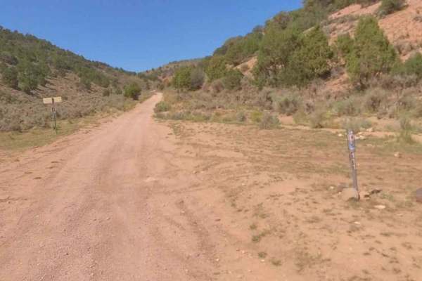
Chalk Creek Road/PST 03A
It is a stunning canyon trail that runs between Fillmore, UT, to the west and connects with Paiute01 near Indian Springs USFS Guard Station to the east. This trail initially starts as a well-improved dirt road from west to east due to access to several USFS picnic areas interspersed along the creek ...
Learn more about Chalk Creek Road/PST 03A
431
431 is a short ATV route that starts at the Chalk Creek Trailhead and goes into the Fishlake National Forest for a mile until it connects with 327. The trail is decently wide and easy for vehicles 50" or less for the whole route. It meanders into the mountains, through grassy rolling hills, mostly o...
Learn more about 431
327
327 is a short and scenic ATV trail in the Paiute ATV Trail Area in the Fishlake National Forest near Fillmore, Utah. It's a continuation of Trail 431, starting at a short and steep hill climb up a small hill. It continues on the ridge line of the rolling hills and meanders around the meadows and fo...
Learn more about 327
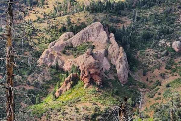
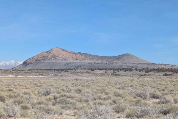
Goat Springs-Devil's Arm Chair-FSR40500
Goat Springs-Devils Arm Chair is a 6.2-mile (12.4-mile round trip) out-and-back trail rated 3 of 10 located in Millard County. The trail is located within the Fishlake National Forest, Fillmore Ranger District. Goats Springs trail is a destination trail that leads out to the Devil's Arm Chair a uniq...
Learn more about Goat Springs-Devil's Arm Chair-FSR40500
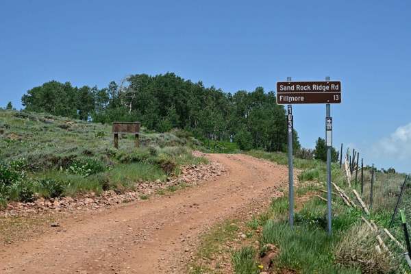
Sand Rock Ridge Road/PST 03B
A nice leisurely trail was mapped from near White Pine Peak's radio towers to Fillmore, UT's outskirts. This trail is part of the Paiute Trail system designated as PST03B. Running the trail from east to west is significant in that at approximately 2.9 miles, the trail becomes exclusively a descent a...
Learn more about Sand Rock Ridge Road/PST 03B
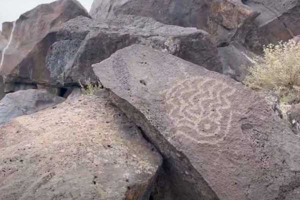
Devil's Kitchen - CR 3551
Devils Kitchen is a 2.1-mile (4.2-mile round trip) out-and-back destination trail rated 2 of 10 located in Millard County. The trail is an intermittently maintained road that leads to the Devil's Kitchen Petroglyph site. The road is packed gravel and dirt, and is suitable for any 4WD and most 2WD ve...
Learn more about Devil's Kitchen - CR 3551
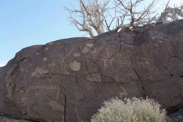
Hole in the Rock Site - CR 4123
This is a 5.6-mile point-to-point destination trail that leads to the Hole in the Rock Petroglyph Site. This is a 2 of 10-rated trail located in Millard County. The trail is a maintained gravel and dirt road that can be used by any 4WD and most 2WD vehicles. The trail will lead to a small parking ar...
Learn more about Hole in the Rock Site - CR 4123
Squidike Road
The Squidike Road is a graded gravel road with patches of washboard. It goes around the west side of the Flowell Lava Flow. On the south end, there is a restroom and parking area at the Lava Tubes trailhead. The north end drops out on the Clear Lake Road. From this road, there are many roads where y...
Learn more about Squidike Road
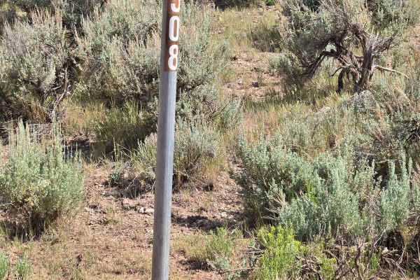
FSR 40508/ FSR 40655 Loop
The trail is primarily used by ranchers on horseback or ATV. This is a very narrow trail with sagebrush on both sides. This is a very scenic area with rock formations and small trees. Watering holes are in the area so be watchful of wildlife. The smell of sage is strong and enjoyable.
Learn more about FSR 40508/ FSR 40655 Loop
Watts Mountain Road- FS 40111
Watts Mountain Road is a 10.7-mile point-to-point trail rated 2 of 10 located in Sevier County. The trail starts on the western side of the community of Elsinore and is the gateway into the Fishlake National Forest, Fillmore Ranger District. Watts Mountain Road is the main north/south track that run...
Learn more about Watts Mountain Road- FS 40111

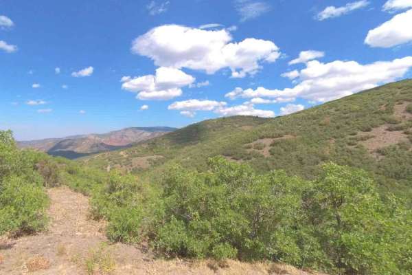
Strawberry Canyon
Strawberry Canyon is a stunning out-and-back trail that offers a perfect mix of technical driving and high-alpine scenery. The trail winds alongside the vibrant red rock walls of the canyon, opening up into expansive, lush meadows. Width Restriction: This is a 60-inch trail. It is strictly for narro...
Learn more about Strawberry Canyon
Trail Spring Bench- FS 40107
Trail Spring Bench is a 4.4-mile point-to-point trail rated 3 of 10 located in Millard County. This trail runs along the west side and then crosses the Pavant Mountain Range. It is within the Fishlake National Forest, Fillmore Ranger District. Trail Spring Road is part of the original Paiute Trail N...
Learn more about Trail Spring Bench- FS 40107
Cummings Creek Road- FS 41680
Cummings Creek Road is a 4.3-mile point-to-point trail rated 3 of 10 located in Millard County. This trail runs along the west side of the Pavant Mountain Range and is within the Fishlake National Forest, Fillmore Ranger District. Cummings Creek Road is part of the original Paiute Trail Network the ...
Learn more about Cummings Creek Road- FS 41680
FS-40956
FSR40956 is a 1.1-mile point-to-point trail rated 3 of 10 located in Millard County. This connector trail links Watts Mountain Road with Trail Spring Bench and is part of the Paiute Trail Network #1. This section of trail offers high altitude (above 7500') dispersed camping in open meadows or along ...
Learn more about FS-40956
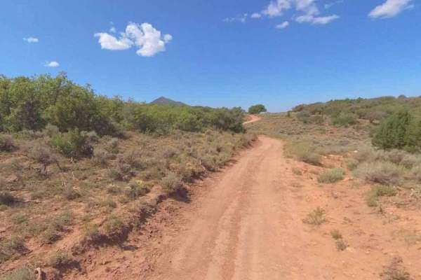
Paiute 1 to Richfield-Pioneer
This trail is a little bit harder. There are different rock formations with a little more clearance requirement. It also gets narrower as it is a side-by-side part of the trail. A minimum high clearance is a must. There are watering ponds and corrals along this part. Look for deer, elk, and other wi...
Learn more about Paiute 1 to Richfield-Pioneer
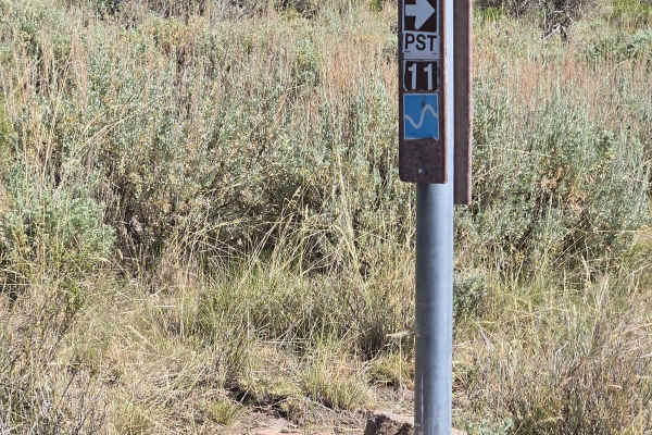
Paiute Side Trail
This is a side trail that shortens the ride from the P11 trail down into Joseph instead of taking the P11 trail all the way into Elsinore. It is mostly flat with some narrow twisting sections. You need to watch out for cows since they are all over and don't often move off the road.
Learn more about Paiute Side Trail
Rockwood - FSR40110
This trail starts where FS40110 and FS18 meet. Take the left to go South on FS40110 and follow it down to the J at the bottom of the trail. You will see lots of cows and water tanks for the animals. Most of this trail is graded across grassy plains. You'll have great mountain views. The fields of sa...
Learn more about Rockwood - FSR40110
Road to Quick Dip
There are boulders in the road. This should not be traveled except by high clearance vehicles and 4X4. It is a wonderful trip down to the pond at the gate for the Paiute Trail # 1. This is gated for 50" wide vehicles with a black trail rating. The area offers a watering spot for wildlife and cattle ...
Learn more about Road to Quick Dip
Beginner ATV trails near Meadow, Utah
Explore ATV-friendly trails near you. These trails are accessible for vehicles up to 50 inches wide, perfect for ATVs and smaller off-road machines.
Meadow Hot Springs Road
The road runs from the town of Meadow out to Meadow Hot Springs. It starts out as a maintained, graded, gravel road that is passable in any vehicle. Where the loop starts, there is a parking area for visitors who wish to walk out to the hot springs. There are also trails that go out to the hot sprin...
Learn more about Meadow Hot Springs Road
Clear Lake Road
The Clear Lake Road is a well-maintained, graded gravel road accessible by all vehicles. The east end of the road is located in the town of Flowell, Utah, which is west of Fillmore, Utah. There are no services in Flowell. Fillmore will be the best option for fuel or other amenities. The west end of ...
Learn more about Clear Lake Road
Chalk Creek Road/PST 03A
It is a stunning canyon trail that runs between Fillmore, UT, to the west and connects with Paiute01 near Indian Springs USFS Guard Station to the east. This trail initially starts as a well-improved dirt road from west to east due to access to several USFS picnic areas interspersed along the creek ...
Learn more about Chalk Creek Road/PST 03A
431
431 is a short ATV route that starts at the Chalk Creek Trailhead and goes into the Fishlake National Forest for a mile until it connects with 327. The trail is decently wide and easy for vehicles 50" or less for the whole route. It meanders into the mountains, through grassy rolling hills, mostly o...
Learn more about 431
Beginner UTV/side-by-side trails near Meadow, Utah
Find UTV and side-by-side trails near you. These trails accommodate vehicles up to 60 inches wide, ideal for UTVs, side-by-sides, and wider off-road rigs.
Meadow Hot Springs Road
The road runs from the town of Meadow out to Meadow Hot Springs. It starts out as a maintained, graded, gravel road that is passable in any vehicle. Where the loop starts, there is a parking area for visitors who wish to walk out to the hot springs. There are also trails that go out to the hot sprin...
Learn more about Meadow Hot Springs Road
Clear Lake Road
The Clear Lake Road is a well-maintained, graded gravel road accessible by all vehicles. The east end of the road is located in the town of Flowell, Utah, which is west of Fillmore, Utah. There are no services in Flowell. Fillmore will be the best option for fuel or other amenities. The west end of ...
Learn more about Clear Lake Road
Chalk Creek Road/PST 03A
It is a stunning canyon trail that runs between Fillmore, UT, to the west and connects with Paiute01 near Indian Springs USFS Guard Station to the east. This trail initially starts as a well-improved dirt road from west to east due to access to several USFS picnic areas interspersed along the creek ...
Learn more about Chalk Creek Road/PST 03A
Goat Springs-Devil's Arm Chair-FSR40500
Goat Springs-Devils Arm Chair is a 6.2-mile (12.4-mile round trip) out-and-back trail rated 3 of 10 located in Millard County. The trail is located within the Fishlake National Forest, Fillmore Ranger District. Goats Springs trail is a destination trail that leads out to the Devil's Arm Chair a uniq...
Learn more about Goat Springs-Devil's Arm Chair-FSR40500
The onX Offroad Difference
onX Offroad combines trail photos, descriptions, difficulty ratings, width restrictions, seasonality, and more in a user-friendly interface. Available on all devices, with offline access and full compatibility with CarPlay and Android Auto. Discover what you're missing today!
Open Trail Map