
Beginner Off-Road Trails
Near Lower Frisco, New Mexico
Explore All Beginner Trails Near Lower Frisco, New Mexico
Beginner Off-Road Trails Near Lower Frisco, New Mexico
Discover the best beginner-friendly off-road trails near you. These easier, lower-rated trails are a great place to start — browse trail maps, check difficulty ratings, and find your next adventure.
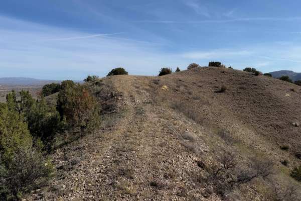
956
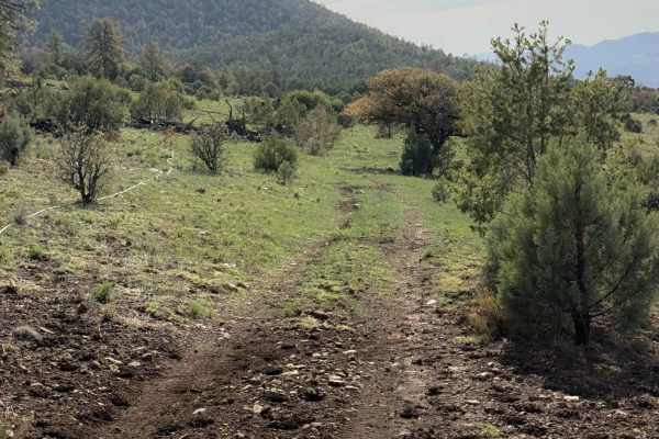
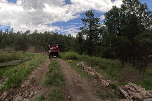
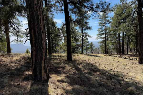
ATV Trail 956 goes through a scenic high desert terrain of rolling hills with juniper trees. The trail surface is a mix of dirt and loose rock, with several sections more heavily covered in scattered loose rock. The trail goes up and over the small hills, with small climbs and descents, but is overa...
Learn more about 956
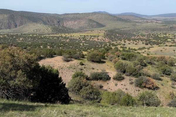
Apache Peak Road
Apache Peak Road trail in the Gila National Forest is a captivating off-road experience that takes you deep into the heart of the wilderness. As you embark on this adventure, you'll find yourself surrounded by the rugged beauty of the Gila Mountains and the enchanting atmosphere of the forest. The t...
Learn more about Apache Peak Road
954
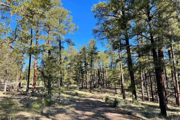
ATV trail 954 is an interesting out-and-back spur off of #952 that goes through Pole Water Gap Canyon. Most of the trail is an easy two-track that curves through the dry and sparse ponderosa pine forest; however, it is pretty faint and a lightly trafficked route, requiring some good navigational ski...
Learn more about 954
952
952 is an easy ATV trail that goes through the Gila National Forest for over 4 miles near Apache Creek, New Mexico. It’s mostly a dirt two-track that is pretty wide, meandering through a dry and sparse ponderosa forest, through wide open grassy glades. The trail goes through several cattle gates and...
Learn more about 952
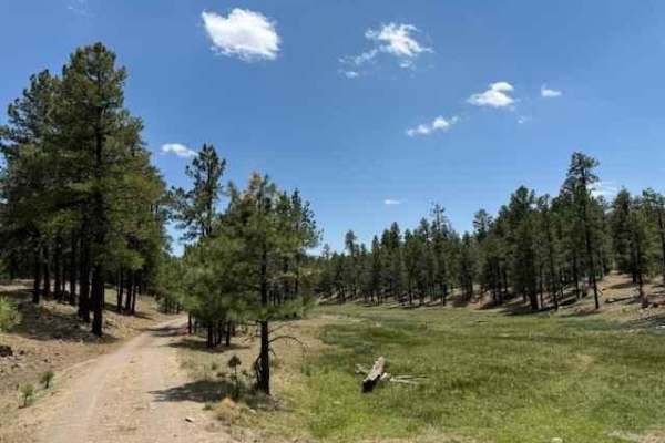
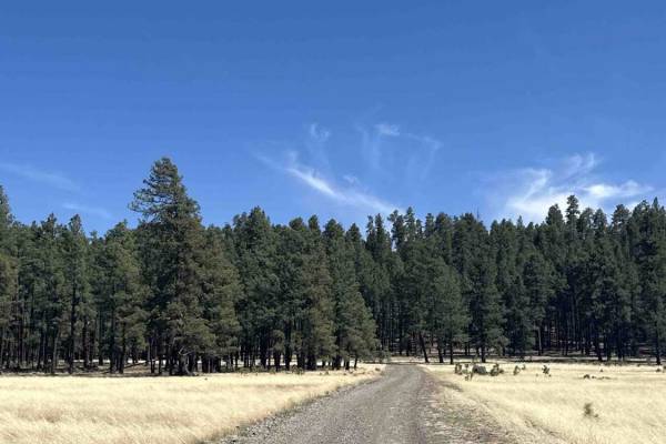
950
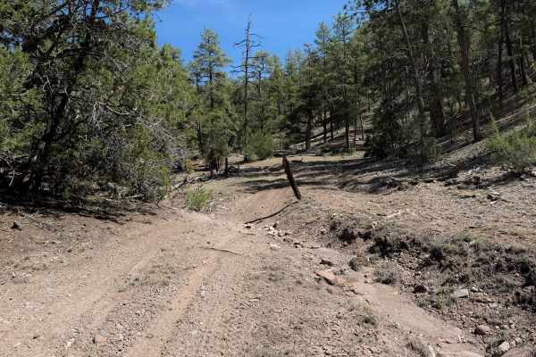
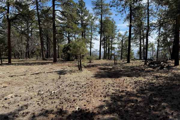
ATV trail 950 is a short and easy two-track through a high desert terrain in rolling hills in the Gila National Forest. The majority of the trail is wide, a mix of dirt and gravel, with shallow ruts, meandering between big juniper bushes. It narrows up at times and rides on the spine of the little r...
Learn more about 950
951
ATV Trail #951 is a short and primitive spur off of ATV Trail #950 that connects back to Bursum Road (159). The trail side-hills on the edge of a hill, on a narrow path, with a big water bar. It continues along a shelf traversing the side of the hill, on a surface covered in overgrown grass and smal...
Learn more about 951
Beyond Escudilla
This trail travels behind the Escudilla Mountain, providing beautiful scenery. This is not a difficult road as it appears to be well maintained. This is a good trail to spend a few hours with others who prefer a smoother ride and still wanting to see more in the area. This itinerary, although ent...
Learn more about Beyond Escudilla
Middle Mountain Road
This is a scenic easy road. In most places, it is well groomed. This is a great trail for a leisure day out in some beautiful country with the opportunity to see wildlife. This road although well maintained is not heavily used and can be traveled without 4WD except when snow is present.
Learn more about Middle Mountain Road
Homestead Loop
The Homestead Loop covers serene trails starting in Arizona and a brief pass through New Mexico before returning to State 48. Flanked by tall trees and grassy fields, the route is smooth with some sections that may require high clearance 4WD, depending on the season and road conditions. There are tw...
Learn more about Homestead Loop
Escudilla Mountain
This route takes you from US 180/191 up to Terry Flat on the Escudilla Mountains. It passes by Hulsey Lake, a quiet fishing spot, is also along the route. It is also the route to take to the Escudilla Lookout Trail. The loop continues and returns back down to US 180/191 to the point of beginning. Th...
Learn more about Escudilla Mountain
Noble Mountain
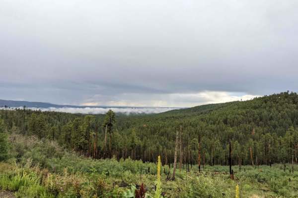
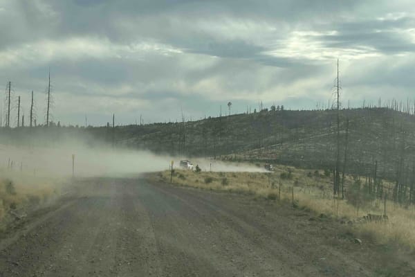
This trail travels above the Alpine Divide and along a head of the San Francisco River. Much of this area was burned out in the Bear Wallow fire of 2011. Although the scarred area itself is not visually appealing, the lack of trees in areas provides for stunning unobstructed views of the many mounta...
Learn more about Noble Mountain
Meadow Loop
This loop takes you from Arizona into New Mexico crossing the border line. The trail surface is smooth with occasional small potholes. This trail passes by many meadows surrounded by tall pine trees. You will find many cows grazing and some natural springs in the area as well.
Learn more about Meadow Loop
Gallo Peak Trail #6
Gallo Peak spurs off of Top Tank Trail and goes south for 1.4 miles. It is generally a wide path through a dry and sparse pine forest, often covered in scattered loose rocks. It goes through a fence and traverses up a hill towards a view overlooking the mountains at a flat spot that could be used as...
Learn more about Gallo Peak Trail #6
Top Tank Trail #5
This is a 3-mile-long ATV trail through the Gila National Forest. The west entrance is marked as Trail #5, but does not specify the width designation, so it looks like this trail gets inadvertently used by wider vehicles. The beginning is wide and graded, smooth and maintained. It narrows up from th...
Learn more about Top Tank Trail #5
Mushroom Loop
This loop starts and ends on Middle Mountain Road. This loop has been coined the Mushroom Loop because several mushrooms were on display at stops along this loop. Either direction can be traveled individually, with the northern side of the loop being a primitive road lightly used, the southern side ...
Learn more about Mushroom Loop
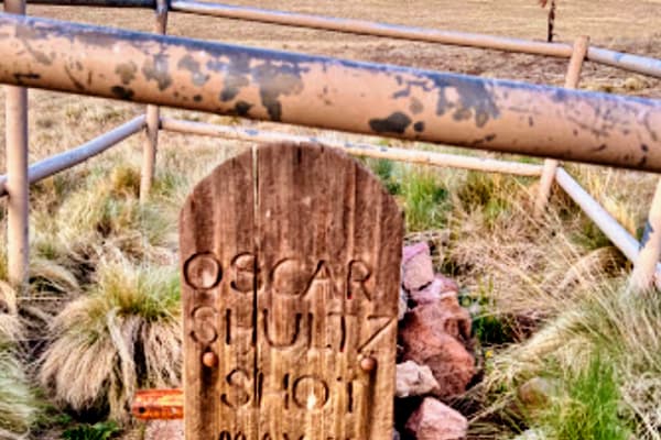
Oscar Schultz Loop
This is a short loop off of the North Fork East Fork Black River Canyon trail (276). The loop starts at the Oscar Shultz gravesite. The attraction to this short loop besides seeing the rustic grave of Oscar is that it encircles meadows where elk are often grazing. This loop is an easy sight worthy...
Learn more about Oscar Schultz Loop
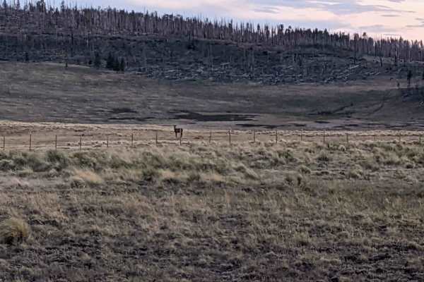
FS 25H
Forest Service Road 25 is an easy trail through a large open area, giving you plenty of opportunities to see wildlife like elk, deer, big horn sheep, and pronghorns. FS 25H is slightly more difficult with a narrower road and a couple of areas that were washed out by rain. There are amazing views on ...
Learn more about FS 25H
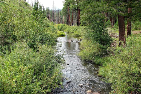
North Fork East Fork Black River Canyon
Beautiful Views of Round Valley, Nutrioso, Black River Canyon, North East Fork Black River and more as you climb up and over a couple mountain ranges and drop into the valleys below. Along this route, you will also find some history of the White Mountains when you come across the grave site of Oscar...
Learn more about North Fork East Fork Black River Canyon
Conklin Spring Road - Forest Road 68
Conklin Spring Road (Forest Road 68) is a scenic forest drive cutting across the Apache-Sitgreaves National Forest north of Big Lake. This well-maintained dirt road runs through diverse high-country landscapes, from open grasslands with burned stands of old timber to lush green pine and aspen groves...
Learn more about Conklin Spring Road - Forest Road 68
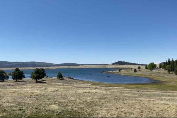
Log Landing
Log Landing is an easy, two-lane gravel road leading to Big Lake in the Apache-Sitgreaves National Forest in the beautiful Arizona White Mountains. Besides snow during the winter, there are no obstacles associated with this trail. The trail leads to Big Lake and offers camping and other recreation a...
Learn more about Log Landing
Beginner ATV trails near Lower Frisco, New Mexico
Explore ATV-friendly trails near you. These trails are accessible for vehicles up to 50 inches wide, perfect for ATVs and smaller off-road machines.
956
ATV Trail 956 goes through a scenic high desert terrain of rolling hills with juniper trees. The trail surface is a mix of dirt and loose rock, with several sections more heavily covered in scattered loose rock. The trail goes up and over the small hills, with small climbs and descents, but is overa...
Learn more about 956
954
ATV trail 954 is an interesting out-and-back spur off of #952 that goes through Pole Water Gap Canyon. Most of the trail is an easy two-track that curves through the dry and sparse ponderosa pine forest; however, it is pretty faint and a lightly trafficked route, requiring some good navigational ski...
Learn more about 954
952
952 is an easy ATV trail that goes through the Gila National Forest for over 4 miles near Apache Creek, New Mexico. It’s mostly a dirt two-track that is pretty wide, meandering through a dry and sparse ponderosa forest, through wide open grassy glades. The trail goes through several cattle gates and...
Learn more about 952
950
ATV trail 950 is a short and easy two-track through a high desert terrain in rolling hills in the Gila National Forest. The majority of the trail is wide, a mix of dirt and gravel, with shallow ruts, meandering between big juniper bushes. It narrows up at times and rides on the spine of the little r...
Learn more about 950
Beginner UTV/side-by-side trails near Lower Frisco, New Mexico
Find UTV and side-by-side trails near you. These trails accommodate vehicles up to 60 inches wide, ideal for UTVs, side-by-sides, and wider off-road rigs.
Beyond Escudilla
This trail travels behind the Escudilla Mountain, providing beautiful scenery. This is not a difficult road as it appears to be well maintained. This is a good trail to spend a few hours with others who prefer a smoother ride and still wanting to see more in the area. This itinerary, although ent...
Learn more about Beyond Escudilla
Middle Mountain Road
This is a scenic easy road. In most places, it is well groomed. This is a great trail for a leisure day out in some beautiful country with the opportunity to see wildlife. This road although well maintained is not heavily used and can be traveled without 4WD except when snow is present.
Learn more about Middle Mountain Road
Homestead Loop
The Homestead Loop covers serene trails starting in Arizona and a brief pass through New Mexico before returning to State 48. Flanked by tall trees and grassy fields, the route is smooth with some sections that may require high clearance 4WD, depending on the season and road conditions. There are tw...
Learn more about Homestead Loop
Escudilla Mountain
This route takes you from US 180/191 up to Terry Flat on the Escudilla Mountains. It passes by Hulsey Lake, a quiet fishing spot, is also along the route. It is also the route to take to the Escudilla Lookout Trail. The loop continues and returns back down to US 180/191 to the point of beginning. Th...
Learn more about Escudilla Mountain
The onX Offroad Difference
onX Offroad combines trail photos, descriptions, difficulty ratings, width restrictions, seasonality, and more in a user-friendly interface. Available on all devices, with offline access and full compatibility with CarPlay and Android Auto. Discover what you're missing today!
Open Trail Map