
Beginner Off-Road Trails
Near Iron City, Tennessee
Explore All Beginner Trails Near Iron City, Tennessee
Beginner Off-Road Trails Near Iron City, Tennessee
Discover the best beginner-friendly off-road trails near you. These easier, lower-rated trails are a great place to start — browse trail maps, check difficulty ratings, and find your next adventure.
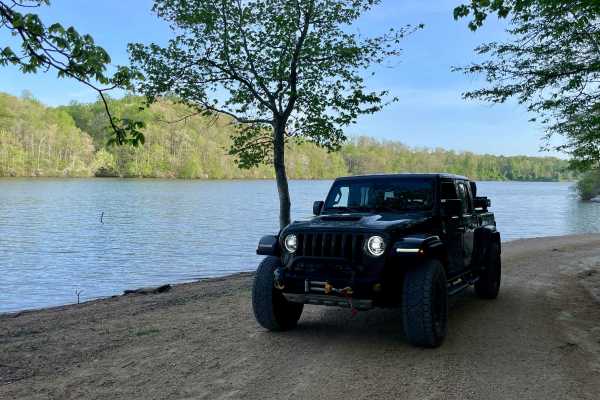
Peter Cave Road
Part of the Laurel Hill Wildlife Management Area Trail System. Drivers must possess a valid annual Hunt/Fish license, available online. Access is open year-round and restricted to daylight hours only (closed dusk to dawn). -- Peter Cave Rd. is a short access spur that provides direct entry to the we...
Learn more about Peter Cave Road
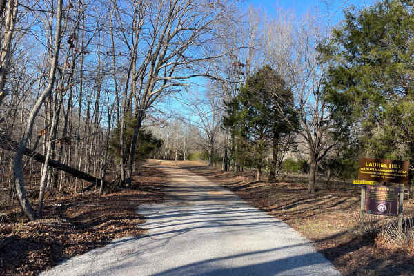
Artemis Lane
Artemis Lane is a primary interior access route within Laurel Hill Wildlife Management Area and one of the longest drivable tracks in the system at approximately six miles. Drivers must possess a valid annual Hunt/Fish license, available at GoOutdoorsTennessee.com. Tennessee resident licenses are $3...
Learn more about Artemis Lane
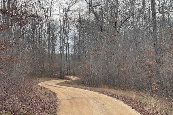
Burns Bottoms Road
Part of the Laurel Hill Wildlife Management Area Trail System. Drivers must possess a valid annual Hunt/Fish license, available online. Access is open year-round and restricted to daylight hours only (closed dusk to dawn). Burns Bottoms Road is a maintained gravel and dirt route winding through mixe...
Learn more about Burns Bottoms Road
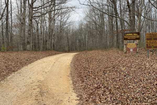
Finnie Road
Finnie Road is a gravel access route within Laurel Hill Wildlife Management Area, providing vehicle access through mixed hardwood forest and connecting interior management roads. Drivers must possess a valid annual Hunt/Fish license, available at GoOutdoorsTennessee.com. Tennessee resident licenses ...
Learn more about Finnie Road

VFW Road
Part of the Laurel Hill Wildlife Management Area trail system. A permit is not required to access this lake trail, only to fish. Access is open year-round and restricted to daylight hours only (closed dusk to dawn).
The VFW Lake Track is a short gravel access route that follows the shoreline of VFW...
Learn more about VFW Road
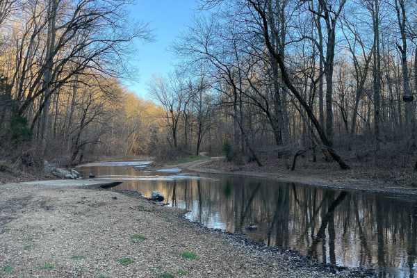
CC Road
CC Road is a short but important connector route within the Laurel Hill Wildlife Management Area, serving as one of the primary eastern access points into the WMA. The road links Laurel Hill Road on the east with Artemis Lane to the west, transitioning from pavement at the entrance to gravel once in...
Learn more about CC Road
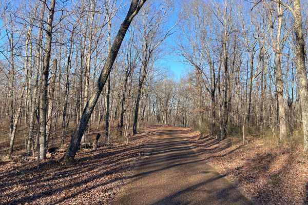
Laurel Hill Road
Laurel Hill Road is a scenic east–west traverse across the northern end of the Laurel Hill Wildlife Management Area, connecting Natchez Trace Parkway on the west to CC Road on the east. While both termini begin on pavement, the route quickly transitions to well-maintained gravel once inside the WMA,...
Learn more about Laurel Hill Road
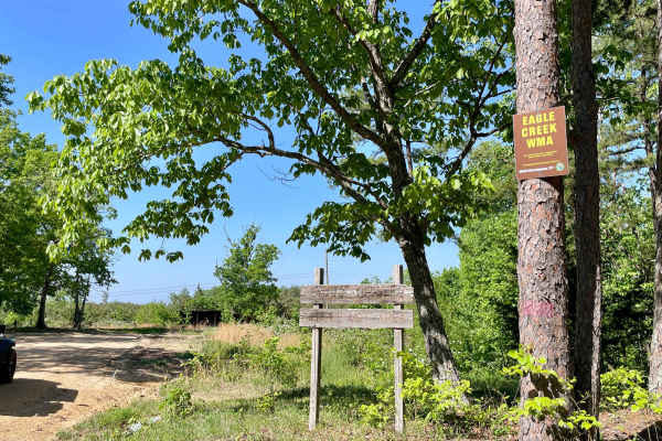
Copeland Ridge Road–Eagle Creek WMA
Access to Eagle Creek Wildlife Management Area requires a valid Tennessee hunting or fishing license and is limited to one-half hour before sunrise through one-half hour after sunset. Street-legal vehicles may use WMA roads with this license, while UTVs and other off-highway vehicles require a High ...
Learn more about Copeland Ridge Road–Eagle Creek WMA
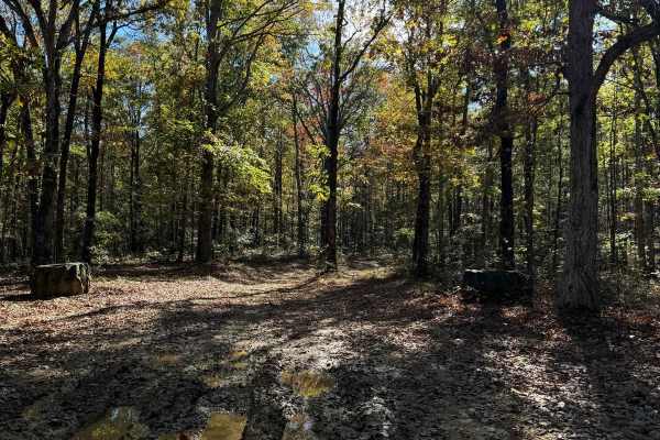
#81 Ridgeline Trail
This Trail is a connector trail that connects two parts of the outfitter trail. This trail follows the ridgeline of Hawkpride Mountain, so it is very flat and forested. The entrance is marked by two big tractor tires sitting on each side of the road. The trail is short and easy to follow since there...
Learn more about #81 Ridgeline Trail
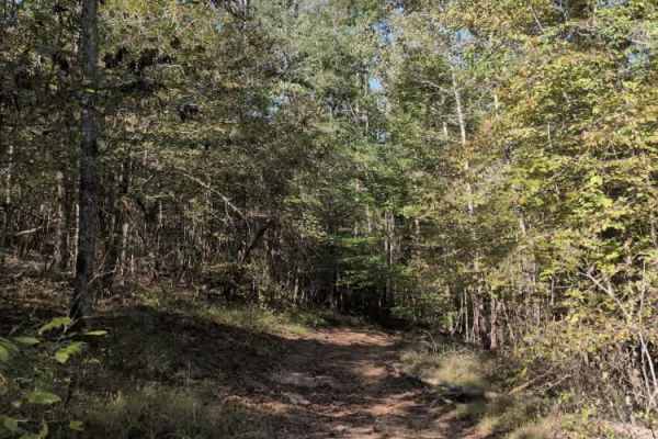
#101 Lower Ridge Line
Trail #111 – Lower Ridgeline is a steep access trail that leads to the start of Trail #100 (Whiskey Run) and several challenging hill climbs located at the north end of the park. While primarily used as a connector, it still offers a bit of character — with a few washouts, small rock obstacles, and ...
Learn more about #101 Lower Ridge Line
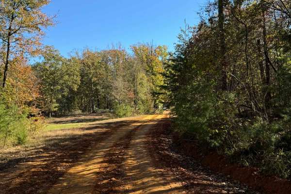
#80 Road to Primitive Camping
This road runs right in front of the cabins in the main parking area. Right past the cabin, you will see the area for primitive camping. This road also leads to the Polaris Outfitter Trail which is the longest and most popular trail in the park. This trail is very short and is really just used as a ...
Learn more about #80 Road to Primitive Camping
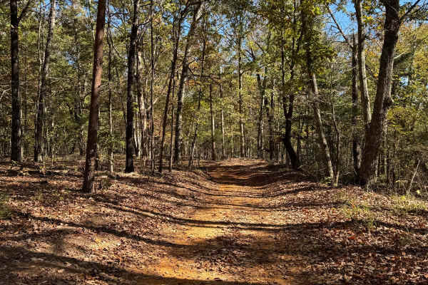
Blue Polaris Outfitter Trail
The Blue Polaris Outfitter Trail is one of the signature trails of Hawkpride Mountain Offroad Park. This trail is mainly a dirty road with the occasional mudhole here and there. You are riding in trees most of the trail, so there is always a chance a limb or two could have fallen. Along this trail, ...
Learn more about Blue Polaris Outfitter Trail
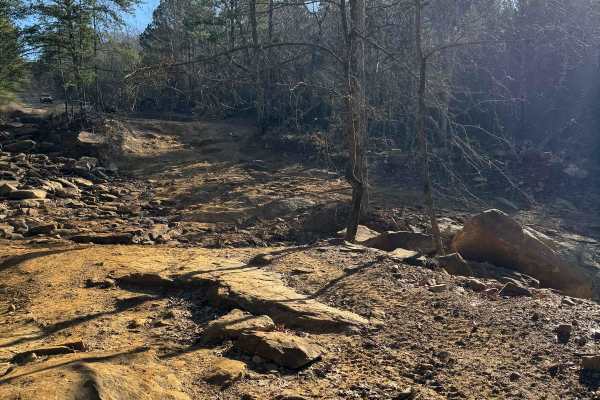
#1 Big Hill
The big hill is one of the main trails to get into the park. This trail starts from the parking lot and then goes down a Big hill that can get slick when wet. There is a great photo opportunity at the top of the big hill with a great view. This trail is plenty wide for two vehicles and due to all th...
Learn more about #1 Big Hill
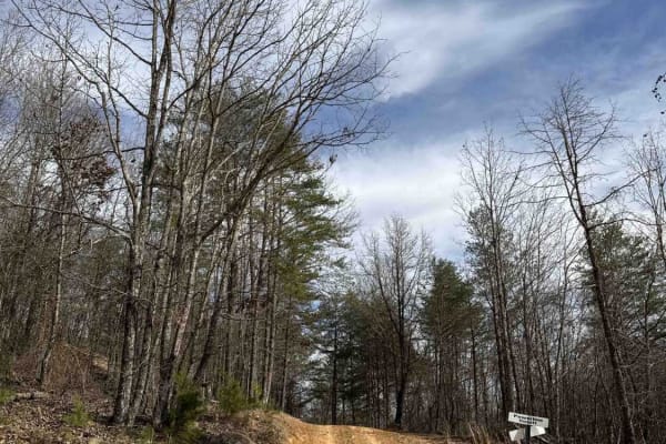
#2 Bluff Trail
#2 Bluff Trail crosses above Race Hills, then continues on as the lower access trail for trails 14, 16, 122, 123, 124, 133, & 135. Finishes on #6 Mountainside. The trail mostly consists of dirt and small rocks, could be pretty muddy after a rain. Several viewing areas are located along the trail to ...
Learn more about #2 Bluff Trail
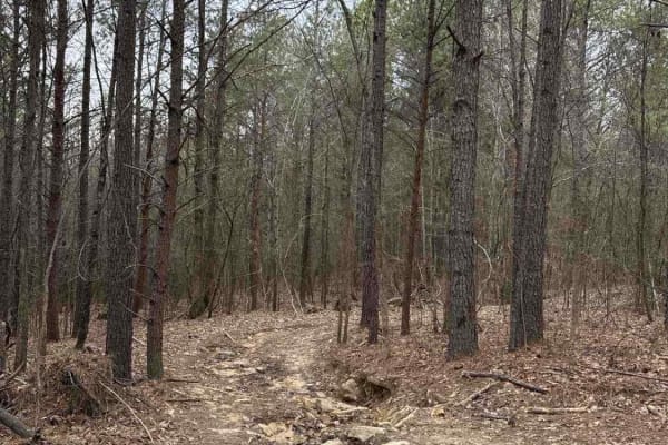
#86 Stinger
Trail #86 Stinger presents a rutted dirt trail heavily strewn with rocks, demanding careful tire placement and a steady hand. Expect frequent bumps and jostles as you navigate the uneven terrain. Occasional mud holes add to the challenge, requiring a bit of finesse. While challenging, Stinger is gen...
Learn more about #86 Stinger
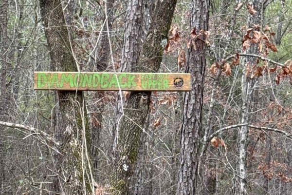
#7e Diamondback - easy out upper
Trail #7e Diamondback - Easy Out Upper, provides a gentle, accessible route through the wooded terrain. This slightly rutted dirt path meanders through the trees, offering an easygoing experience. Its key function is to connect to the upper reaches of #7 Diamondback trail, as well as the upper secti...
Learn more about #7e Diamondback - easy out upper
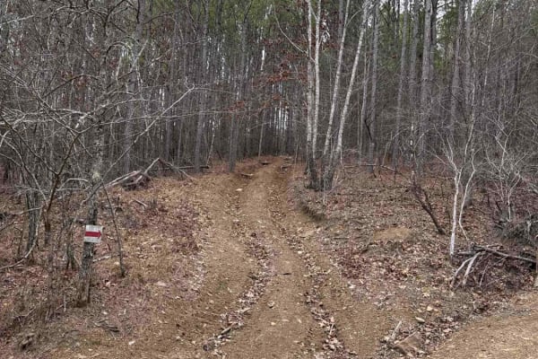
#85 Maze
Trail #85 Maze offers a narrow dirt path featuring mild ruts, providing a bumpy but manageable ride. Expect to encounter occasional mud holes that can add a touch of excitement, especially after rainfall. The trail winds its way through the landscape, offering a fun diversion. Starting from Trail #1...
Learn more about #85 Maze
#18 Gate Road
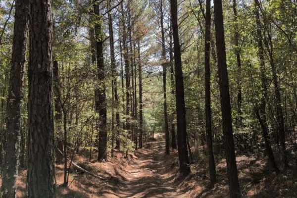
Trail #18 – Gate Road primarily serves as a return route for Trail #20 (Sidewinder) and Trail #19 (Viper). It’s a smooth, wooded dirt road that provides an easy connection back to the main Trail #1. Although it includes a few mild grades, the surface is generally well-packed and should pose no issue...
Learn more about #18 Gate Road
#6 Mountainside
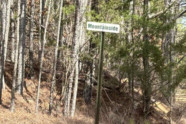
#6 Mountainside is located near the start of #1 Big Hill. This trail serves as access to trails 2, 7e, 8, 12, 68, and 86. Trail mostly consists of dirt and small rocks, could be pretty muddy after a rain. There is one small section with a short rock ledge.
Learn more about #6 Mountainside
#88 John's Way
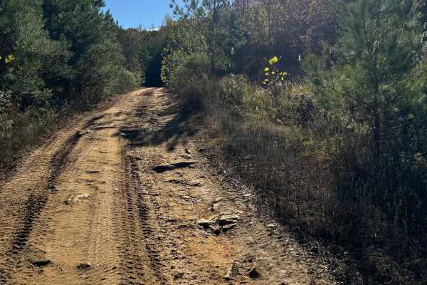
This trail starts at the red barn right off the main road. This trail is very popular since it is an easy way to go from one side of the park to another. The trail ends at trail #65 Bacon which is a pretty steep hill that is quite hard to do in the wet. If you do not want to attempt #65 there are ma...
Learn more about #88 John's Way
Beginner ATV trails near Iron City, Tennessee
Explore ATV-friendly trails near you. These trails are accessible for vehicles up to 50 inches wide, perfect for ATVs and smaller off-road machines.
Peter Cave Road
Part of the Laurel Hill Wildlife Management Area Trail System. Drivers must possess a valid annual Hunt/Fish license, available online. Access is open year-round and restricted to daylight hours only (closed dusk to dawn). -- Peter Cave Rd. is a short access spur that provides direct entry to the we...
Learn more about Peter Cave Road
Artemis Lane
Artemis Lane is a primary interior access route within Laurel Hill Wildlife Management Area and one of the longest drivable tracks in the system at approximately six miles. Drivers must possess a valid annual Hunt/Fish license, available at GoOutdoorsTennessee.com. Tennessee resident licenses are $3...
Learn more about Artemis Lane
Burns Bottoms Road
Part of the Laurel Hill Wildlife Management Area Trail System. Drivers must possess a valid annual Hunt/Fish license, available online. Access is open year-round and restricted to daylight hours only (closed dusk to dawn). Burns Bottoms Road is a maintained gravel and dirt route winding through mixe...
Learn more about Burns Bottoms Road
Finnie Road
Finnie Road is a gravel access route within Laurel Hill Wildlife Management Area, providing vehicle access through mixed hardwood forest and connecting interior management roads. Drivers must possess a valid annual Hunt/Fish license, available at GoOutdoorsTennessee.com. Tennessee resident licenses ...
Learn more about Finnie Road
Beginner UTV/side-by-side trails near Iron City, Tennessee
Find UTV and side-by-side trails near you. These trails accommodate vehicles up to 60 inches wide, ideal for UTVs, side-by-sides, and wider off-road rigs.
Peter Cave Road
Part of the Laurel Hill Wildlife Management Area Trail System. Drivers must possess a valid annual Hunt/Fish license, available online. Access is open year-round and restricted to daylight hours only (closed dusk to dawn). -- Peter Cave Rd. is a short access spur that provides direct entry to the we...
Learn more about Peter Cave Road
Artemis Lane
Artemis Lane is a primary interior access route within Laurel Hill Wildlife Management Area and one of the longest drivable tracks in the system at approximately six miles. Drivers must possess a valid annual Hunt/Fish license, available at GoOutdoorsTennessee.com. Tennessee resident licenses are $3...
Learn more about Artemis Lane
Burns Bottoms Road
Part of the Laurel Hill Wildlife Management Area Trail System. Drivers must possess a valid annual Hunt/Fish license, available online. Access is open year-round and restricted to daylight hours only (closed dusk to dawn). Burns Bottoms Road is a maintained gravel and dirt route winding through mixe...
Learn more about Burns Bottoms Road
Finnie Road
Finnie Road is a gravel access route within Laurel Hill Wildlife Management Area, providing vehicle access through mixed hardwood forest and connecting interior management roads. Drivers must possess a valid annual Hunt/Fish license, available at GoOutdoorsTennessee.com. Tennessee resident licenses ...
Learn more about Finnie Road
The onX Offroad Difference
onX Offroad combines trail photos, descriptions, difficulty ratings, width restrictions, seasonality, and more in a user-friendly interface. Available on all devices, with offline access and full compatibility with CarPlay and Android Auto. Discover what you're missing today!
Open Trail Map