
Beginner Off-Road Trails
Near Hopkins, South Carolina
Explore All Beginner Trails Near Hopkins, South Carolina
Beginner Off-Road Trails Near Hopkins, South Carolina
Discover the best beginner-friendly off-road trails near you. These easier, lower-rated trails are a great place to start — browse trail maps, check difficulty ratings, and find your next adventure.
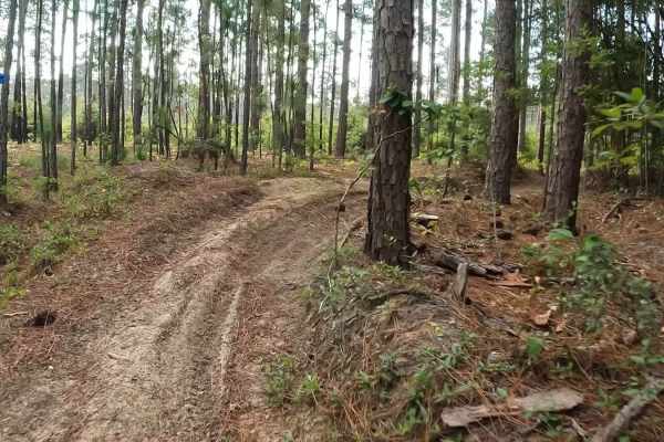
Outerloop
The Manchester State Forest Outer Loop trail is ridden in a counterclockwise direction. This flat trail offers both 50-inch and single-track routes, featuring half hard-packed surfaces mixed with pine needles and soft, loose flat sand. Riders can expect some sweeping turns and sandy whoops along the...
Learn more about Outerloop

Green Loop
The Manchester State Forest Green Loop is a clockwise single-track trail. It features hard-packed sand with pine needles, tight turns, and plenty of whoops. A $5 per day or $25 annual permit is required; you can pay using an envelope at the staging area or online. Also, be on the lookout for alliga...
Learn more about Green Loop
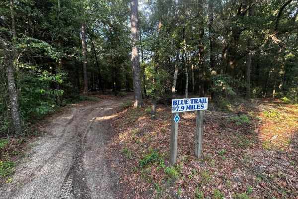
Inner Loop
The Manchester State Forest Inner Loop single track is ridden counterclockwise . It features mostly flat terrain with a hard-packed surface, mixed with pine needles and some sections of loose sand. Riders will encounter plenty of whoops, twists, and berms along the route. Please note that this trail...
Learn more about Inner Loop
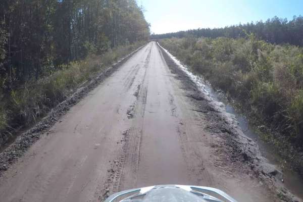
South Carolina Adventure Route Segment 5
Segment 5 is the longest section of the SCAR Loop, and stretches between the towns of Camden and St George. The north end of this segment briefly passes through what is known as the "Sandhills" region of the state. You will most likely encounter sand between Hwy 378 and I-95, in the general area of ...
Learn more about South Carolina Adventure Route Segment 5

Charles Town Road
This is an easy road to explore the rolling hills and deep cuts of the countryside. It is mostly sandy with some areas having a soft sand and red clay mix. The majority of the road is state-maintained and has limited washboards and potholes. It has a few roads that spur off the main route that one c...
Learn more about Charles Town Road
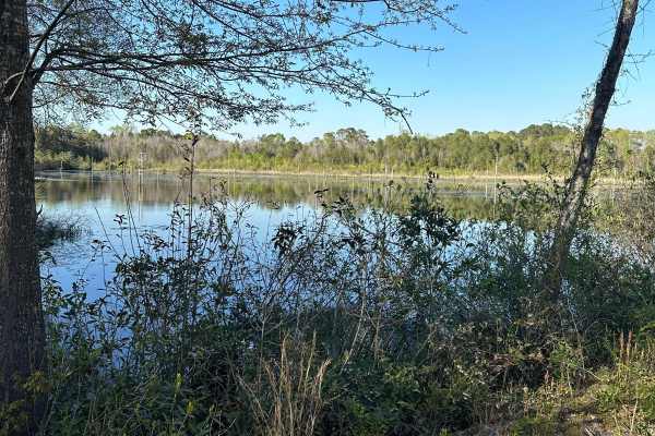
Elbert Taylor Road
This is a very easy sand and gravel trail to see some great scenery in the area. It's mostly sandy dirt with some gravel areas. This is well suited for anyone in a 4x4, stock or modified, looking to get out of the house and enjoy a nice trail. You will see some local farm fields, pastures, and a cou...
Learn more about Elbert Taylor Road
North Fork Road
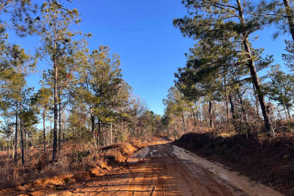
North Fork Road is a light to moderate challenging road that explores the countryside and large hardwood forest of the midlands. The road surface is mostly loose sand and a mixture of red clay. It also offers some graded inclines and blind curves. There are some rough sections that contain washouts ...
Learn more about North Fork Road
Gunter Pond Road
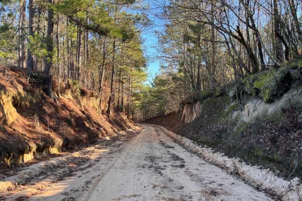
This is a mostly sand-covered road used for farming and local residencies. The surface includes some soft spots that are mild to deep, and red clay portions that are quite a joy to ride after a good rain. A good part of the road is actually below the contour of the land and would be a great spot for...
Learn more about Gunter Pond Road
Trail 17
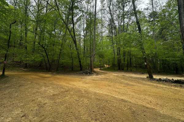
Trail 17 is smooth and groomed and provides access to Trail 15. It's a shortcut to avoid Mammoth Hill and the backside of Trail 4. The last section spits you out onto Trail 4. It's mainly a dirt road that runs beside a steep hill on the right. It's a 2-way trail.
Learn more about Trail 17
Moore Road
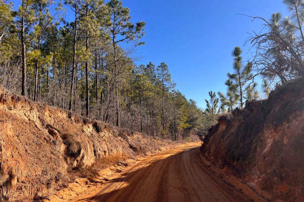
Ride out and enjoy the thick hardwood forest and abandoned farmhouses and barns of the past. This route is mostly loamy sand and a red clay mix. It has some graded hills and sharp curves that roll down the hills that twist and bend through the forest and farmlands. As you roll along, you will pass t...
Learn more about Moore Road

Red Shadow Road
This is an easy road to tackle for the beginner who wants to explore the countryside. Check out all that it offers including pine forests, large fields, and equestrian farms. It has all of the terrain features you want - loose sand, some small ruts, washboards, and areas with red clay that may be sl...
Learn more about Red Shadow Road
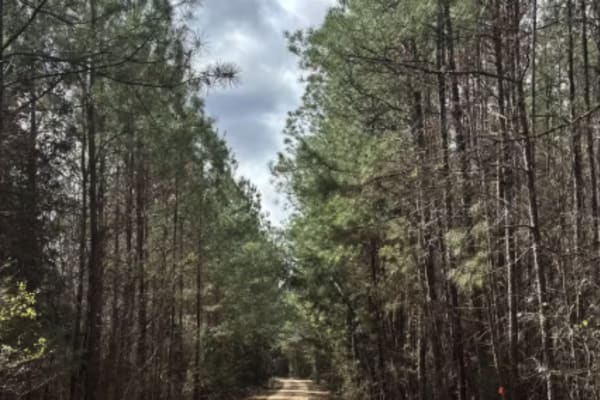
Cricket Tree Road
This scenic forest trail winds through tall pine trees and sandy terrain, offering a quiet off-road drive surrounded by nature. The surface is mostly sandy and graded, with occasional muddy puddles after rain and scattered pinecones along the path. Gentle curves and narrow sections between trees add...
Learn more about Cricket Tree Road
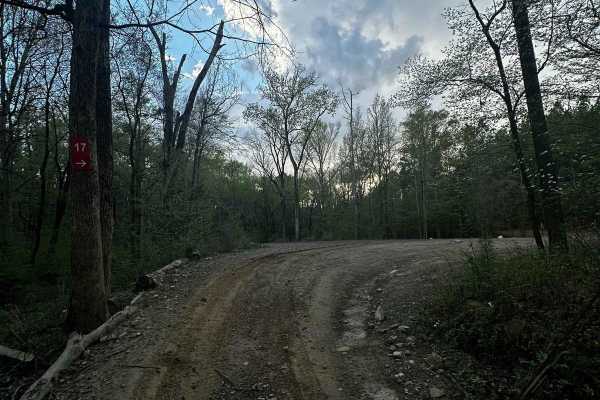
Service Road 17 (SR 17)
SR 17 is the road from the bridge crossing to SR 18. It's mainly a dirt road with some bedrock in one section. Trail 6, SR 18, the end of Trail 44, and a shortcut to SR 18 are accessed from this road. This service road is used for emergencies. It's a wide road that provides access to dirt bike Trail...
Learn more about Service Road 17 (SR 17)
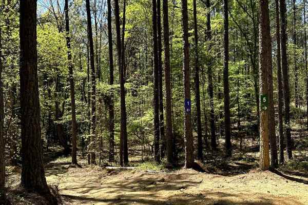
Trail 5
Trail 5 is a 2.5-mile easy-rated trail that begins off of Service Road 1. Trail 5 is a dirt trail with mild hills and some loose rock. The trail is very hard-packed, containing mild ruts that are all under 12 inches deep. Trail 5 crosses many other trails and service roads, making it an excellent pa...
Learn more about Trail 5

Trail 6
This is the longest trail in the trail system with a lot of mergers onto other trails. It goes through the whole park on a mostly dirt road with some bedrock in certain spots. When it rains, there will be some mud spots on the trail. Though the trail can be windy in some sections, it's the easiest t...
Learn more about Trail 6
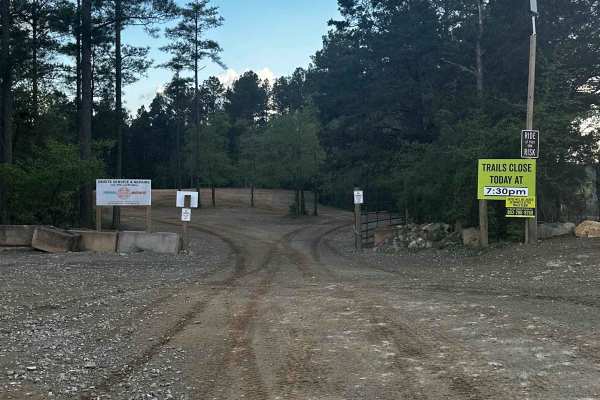
Service Road 4 (SR 4)
One of our main service roads that leads to trails, SR 4 is rocky in some areas. It's a very wide road that is very dusty if the ground is dry. The road is used by EMS/the Rescue Squad if needed. There are a couple of curves but it's mainly a straight road that leads to the bridge crossing. It's rea...
Learn more about Service Road 4 (SR 4)

SCAR Connector-Loop
This Connector Loop bisects the primary SCAR Loop, passing near the twin towns of Batesburg-Leesville, over the narrow end of Lake Murray, and through Newberry. It contains a mix of paved and unpaved roads. Off-pavement sections south of Batesburg-Leesville are sandy and can be loose when dry. North...
Learn more about SCAR Connector-Loop
SCAR Southeast Alternate
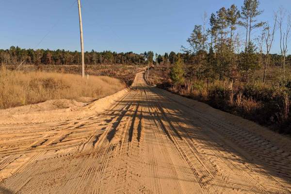
This route traverses the heart of the Sandhills region (which spans the state betwen Columbia and I-95), and it definitely delivers sand. It is approximately 80% off-pavement, and some of the sandy sections can be very loose and deep when conditions are dry. It also passes through some quaint towns ...
Learn more about SCAR Southeast Alternate

Richland Creek Road
Enjoy this easy route as you sit back and ride through large farmlands and admire the old forgotten houses and barns. This is an easy road that is maintained and has a mix of sand and gravel covering the roadway. You will pass over some single-lane bridges and see some marshland with a variety of wi...
Learn more about Richland Creek Road
Rugged Hill Drive
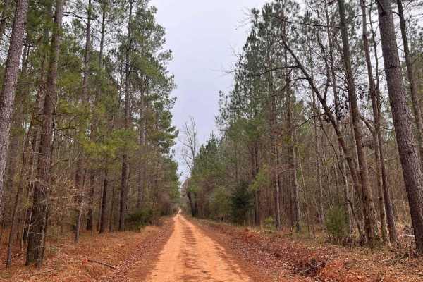
The name should not cause you any worry about this road. Although mild with its sandy and gravel coating, it does contain a few rough potholes and some washboards that will motivate your suspension. You will pass by the C.E Berry Jr. Forestry Center and admire the dam structure next to it that once ...
Learn more about Rugged Hill Drive
Beginner ATV trails near Hopkins, South Carolina
Explore ATV-friendly trails near you. These trails are accessible for vehicles up to 50 inches wide, perfect for ATVs and smaller off-road machines.
Outerloop
The Manchester State Forest Outer Loop trail is ridden in a counterclockwise direction. This flat trail offers both 50-inch and single-track routes, featuring half hard-packed surfaces mixed with pine needles and soft, loose flat sand. Riders can expect some sweeping turns and sandy whoops along the...
Learn more about Outerloop
Trail 17
Trail 17 is smooth and groomed and provides access to Trail 15. It's a shortcut to avoid Mammoth Hill and the backside of Trail 4. The last section spits you out onto Trail 4. It's mainly a dirt road that runs beside a steep hill on the right. It's a 2-way trail.
Learn more about Trail 17
Cricket Tree Road
This scenic forest trail winds through tall pine trees and sandy terrain, offering a quiet off-road drive surrounded by nature. The surface is mostly sandy and graded, with occasional muddy puddles after rain and scattered pinecones along the path. Gentle curves and narrow sections between trees add...
Learn more about Cricket Tree Road
Service Road 17 (SR 17)
SR 17 is the road from the bridge crossing to SR 18. It's mainly a dirt road with some bedrock in one section. Trail 6, SR 18, the end of Trail 44, and a shortcut to SR 18 are accessed from this road. This service road is used for emergencies. It's a wide road that provides access to dirt bike Trail...
Learn more about Service Road 17 (SR 17)
Beginner UTV/side-by-side trails near Hopkins, South Carolina
Find UTV and side-by-side trails near you. These trails accommodate vehicles up to 60 inches wide, ideal for UTVs, side-by-sides, and wider off-road rigs.
Trail 17
Trail 17 is smooth and groomed and provides access to Trail 15. It's a shortcut to avoid Mammoth Hill and the backside of Trail 4. The last section spits you out onto Trail 4. It's mainly a dirt road that runs beside a steep hill on the right. It's a 2-way trail.
Learn more about Trail 17
Cricket Tree Road
This scenic forest trail winds through tall pine trees and sandy terrain, offering a quiet off-road drive surrounded by nature. The surface is mostly sandy and graded, with occasional muddy puddles after rain and scattered pinecones along the path. Gentle curves and narrow sections between trees add...
Learn more about Cricket Tree Road
Service Road 17 (SR 17)
SR 17 is the road from the bridge crossing to SR 18. It's mainly a dirt road with some bedrock in one section. Trail 6, SR 18, the end of Trail 44, and a shortcut to SR 18 are accessed from this road. This service road is used for emergencies. It's a wide road that provides access to dirt bike Trail...
Learn more about Service Road 17 (SR 17)
Trail 5
Trail 5 is a 2.5-mile easy-rated trail that begins off of Service Road 1. Trail 5 is a dirt trail with mild hills and some loose rock. The trail is very hard-packed, containing mild ruts that are all under 12 inches deep. Trail 5 crosses many other trails and service roads, making it an excellent pa...
Learn more about Trail 5
The onX Offroad Difference
onX Offroad combines trail photos, descriptions, difficulty ratings, width restrictions, seasonality, and more in a user-friendly interface. Available on all devices, with offline access and full compatibility with CarPlay and Android Auto. Discover what you're missing today!
Open Trail Map