SCAR Connector-Loop

Total Miles 86.3
Technical Rating
2 Easy
Best Time Spring, Summer, Fall, Winter
Trail Type Full-Width Road
Accessible By
Open Trail Map

Trail Overview

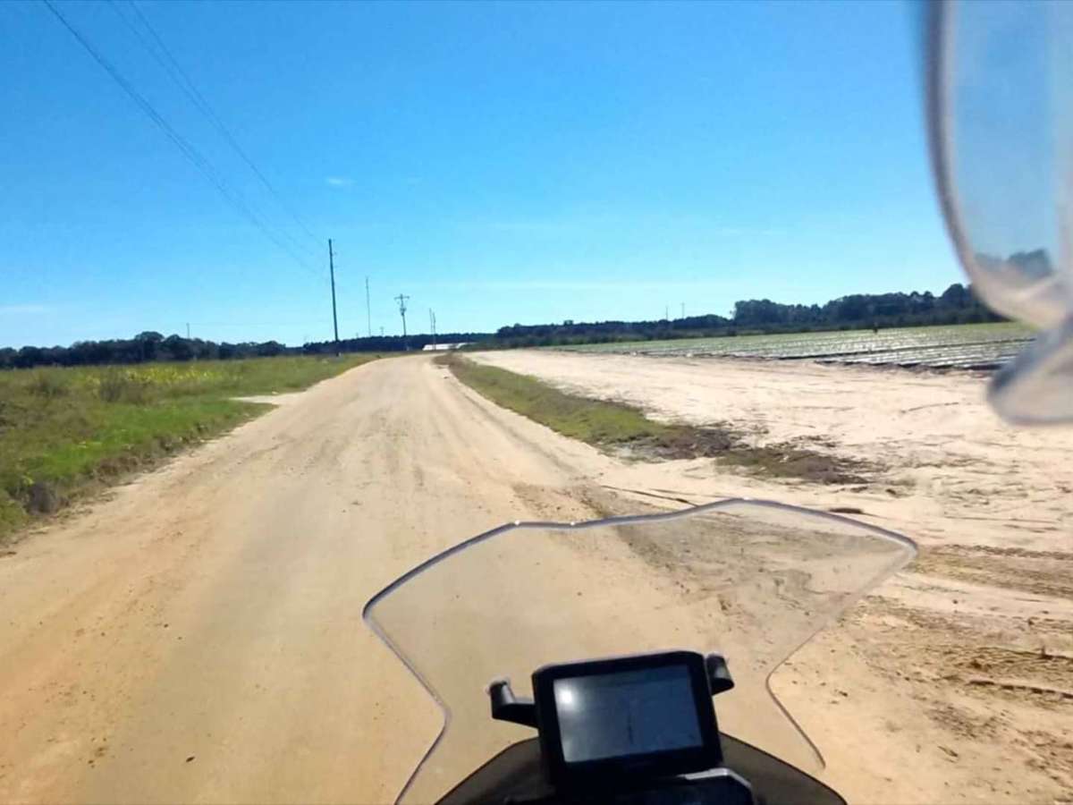
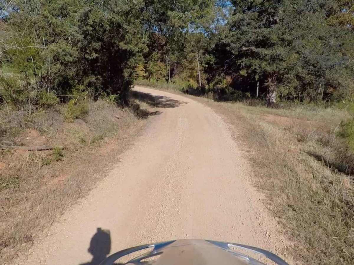
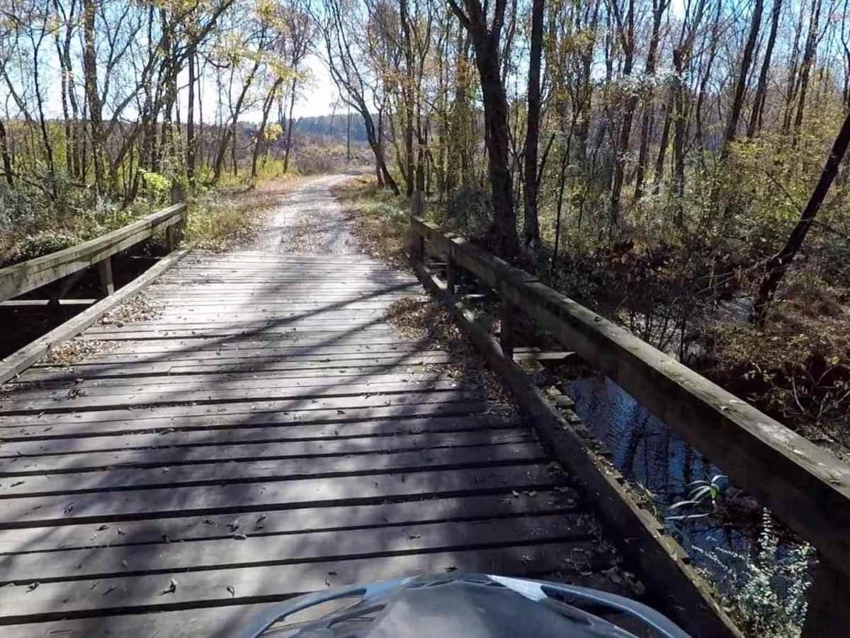
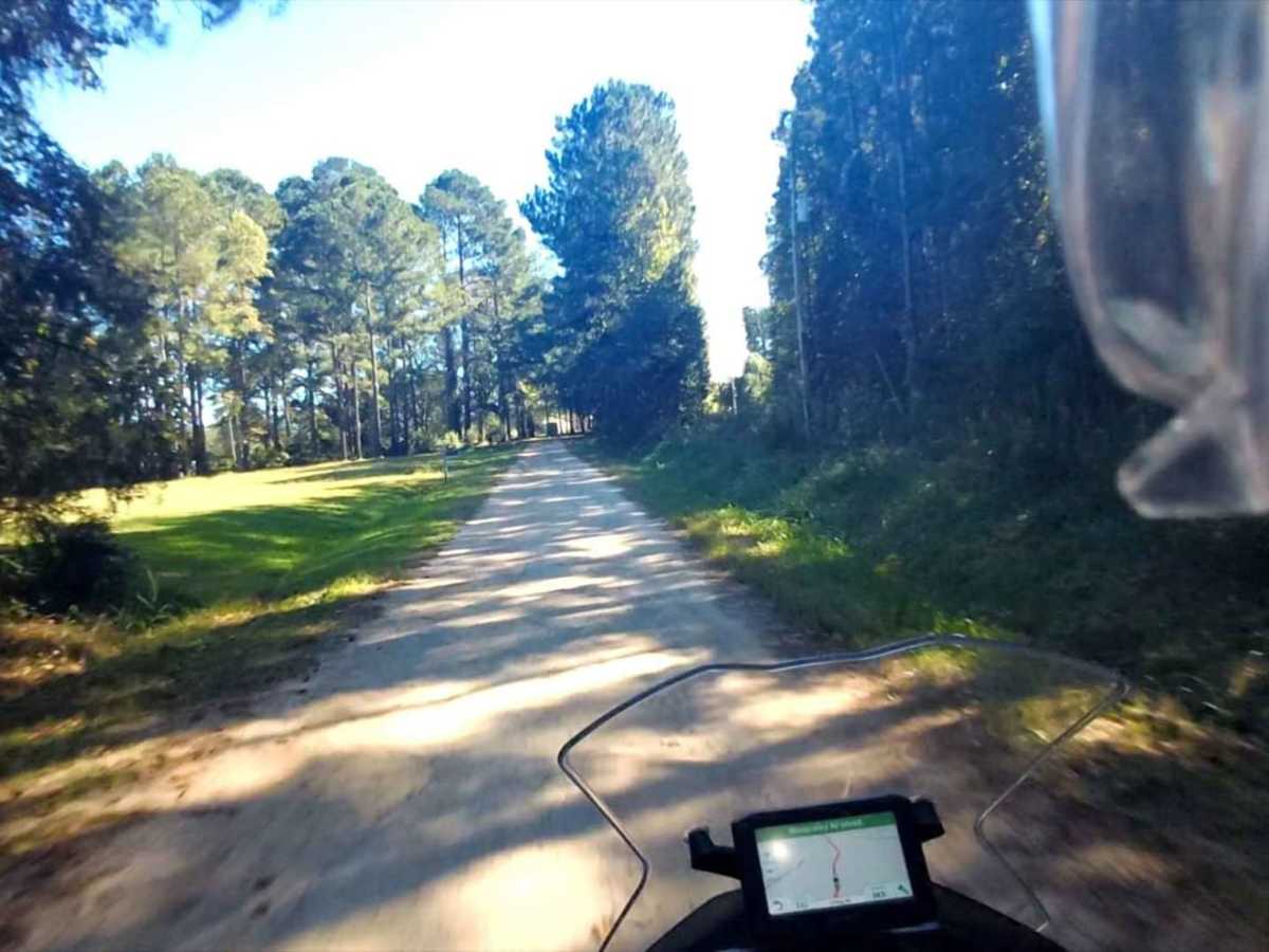
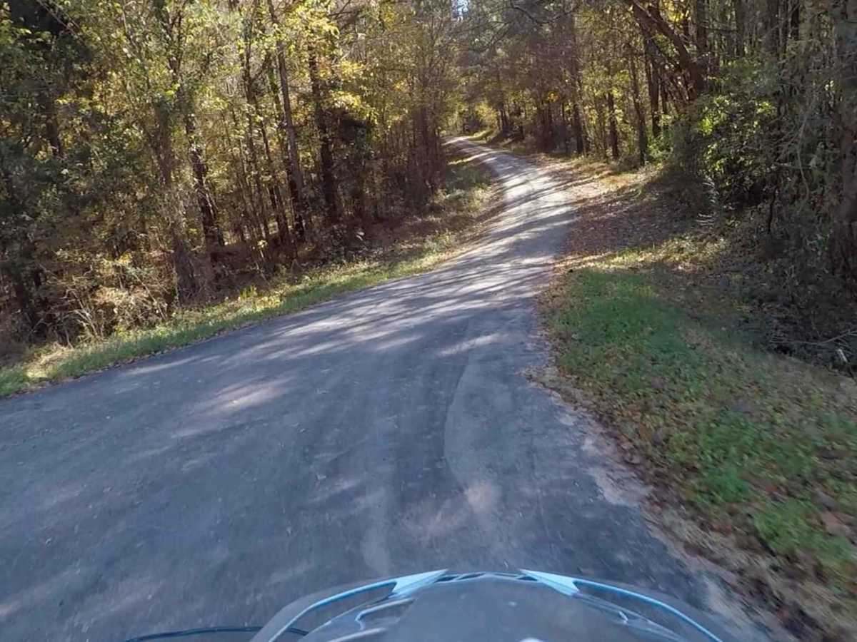
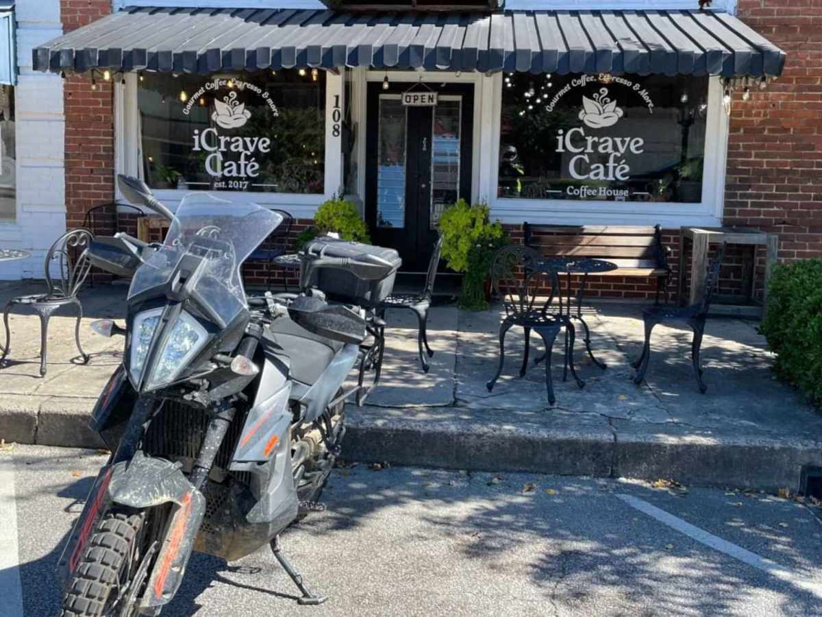
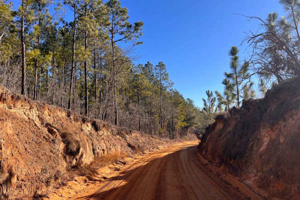
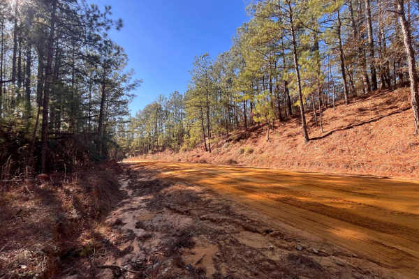
This Connector Loop bisects the primary SCAR Loop, passing near the twin towns of Batesburg-Leesville, over the narrow end of Lake Murray, and through Newberry. It contains a mix of paved and unpaved roads. Off-pavement sections south of Batesburg-Leesville are sandy and can be loose when dry. North of Batesburg-Leesville the off-pavement sections are gravel, and a small water crossing is usually present near the north end. In rainy conditions this water crossing can become deeper. About the SCAR: The South Carolina Adventure Route loops through approximately 1,000 miles of rural South Carolina. Along this route, you'll enjoy the Blue Ridge Mountains, the Atlantic Ocean, diverse forests, cotton fields, state parks, historical sites, and quaint towns. The SCAR also connects to the Smokey Mountains 500, the Georgia Traverse, and the Trans-America Trail (TAT), providing riders on those trails with a scenic route to the Atlantic coast at Edisto Beach. The roads along the SCAR are a mix of pavement and dirt, 60% and 40% respectively, with the surface alternating between gravel, dirt, clay, and sand. The route is not exceptionally technical, but dry conditions can leave the sandy roads loose, while wet conditions can leave the mud and clay roads slick and rutted. Travelers should expect to encounter deep sand and sizable mud holes in the worst conditions.

Photos of SCAR Connector-Loop

Difficulty

This is largely a graded route mixed with pavement

Technical Rating

2

Status Reports

Add Status Report
Harmon Baughman
May 17, 2026
Open
Bridge permanently closed
Marty Hinson
May 15, 2026
Open
Rawls road as part of SCAR is closed. Bridge out
joel Leland
Feb 14, 2026
Open
Bridge is out. Road is permanently closed.
David jennison
Nov 16, 2025
Open
This is on Rawls rd I had to turn around and choose alternate way.if coming from north turn right on saint Mathew’s then left on suber to bypass this talked to local person and he said that it may be permanently closed due to other locals trashing the area. I live close by so will update again in a couple months or so
Bob Beard
Jul 01, 2025
Open
Rawls Rd "pending road closure". Bridge out.
Corbin Fogle
Jun 29, 2025
Open
Carolina Overland Experience
Feb 28, 2025
Open
Ridge located at 34.34092, -81.41323 is damaged and closed. No way to cross creek.
Isaac Yoder
Feb 17, 2025
Open
David Erickson
Jan 28, 2025
Open
CONNECTOR-LOOP: Rawls Rd (East of Newberry) is still closed due to the bridge issue. Talked to a gentleman that lives along there, and they indicated that there is no current plan to fix it. We backtracked to Suber Rd went North to St Matthew Rd, then East to Broad River Rd and continued along the SCAR Route.
Gray O'Neil
Jun 07, 2024
Open
Thought I’d see if the bridge had been fixed. Still closed.
rob z
Apr 14, 2024
Open
Bridge barricaded at 34.34086, -81.41322 on Rawls Rd. From East, detour New Hope Rd to Griffin Rd to pick up SCAR -loop.
Xan Bogert
Mar 02, 2024
Open

SCAR Connector-Loop Trail can be accessed by the following ride types:

  • High Clearance
  • Full Width

SCAR Connector-Loop Map

The onX Offroad Difference

onX Offroad combines trail photos, descriptions, difficulty ratings, width restrictions, seasonality, and more in a user-friendly interface. Available on all devices, with offline access and full compatibility with CarPlay and Android Auto. Discover what you're missing today!

Open Trail Map