
Beginner Off-Road Trails
Near Hilham, Tennessee
Explore All Beginner Trails Near Hilham, Tennessee
Beginner Off-Road Trails Near Hilham, Tennessee
Discover the best beginner-friendly off-road trails near you. These easier, lower-rated trails are a great place to start — browse trail maps, check difficulty ratings, and find your next adventure.
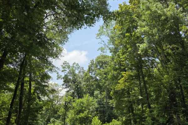
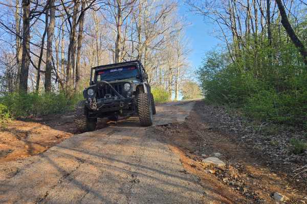
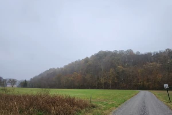
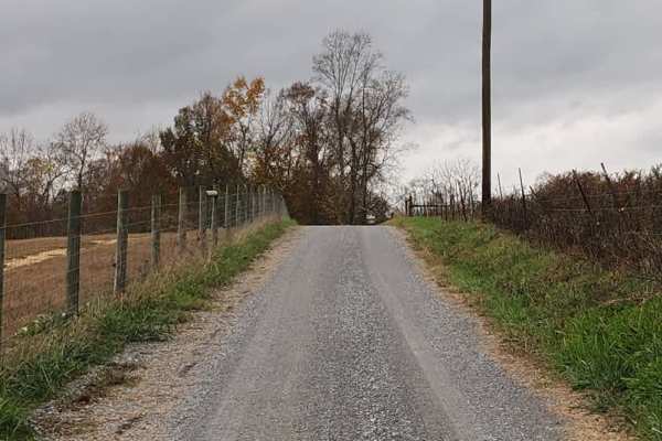
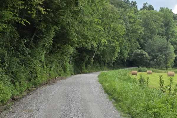
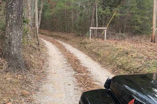
Sneed Hollow Road
Sneed Hollow Road is a short, scenic gravel spur that connects back into the broader Macon County Tour, making it an easy, but worthwhile, down-and-back addition for those looking to extend the drive. Though not officially part of the tour, it flows naturally off the main route and returns you right...
Learn more about Sneed Hollow Road
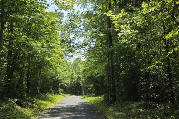
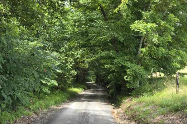
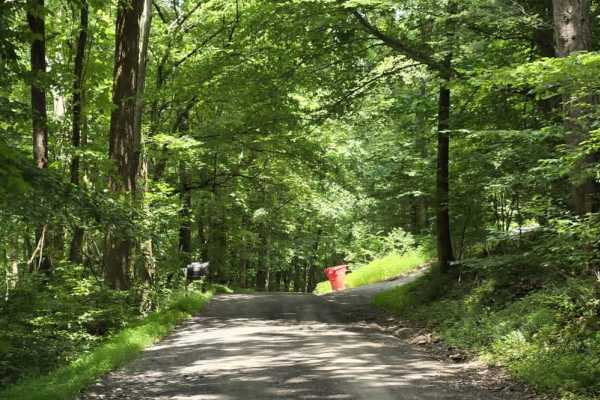
Goose Horn Road - Macon County Tour
Goose Horn Road is an easy gravel segment of the Macon County Tour, offering a relaxed drive beneath a dense canopy of hardwood trees. The route is relatively flat and county-maintained, making it accessible for most 4WD and high-clearance 2WD vehicles in normal conditions. The road is typically wid...
Learn more about Goose Horn Road - Macon County Tour
Trail 1
Trail 1 at Golden Mountain Offroad Park is divided into two sections and serves as the main road on the northern side of the park, with multiple trail entrances branching off both sides as you head toward the back. While generally an easy access route, there are a few areas with taller rocks that re...
Learn more about Trail 1
Trail 1B
Trail 1B at Golden Mountain Offroad Park is part of a loop with Trail 1 but offers a slightly more challenging route. While still generally manageable, this section includes a few areas that are more technical than the main Trail 1, especially in wet conditions where the trail becomes slick and more...
Learn more about Trail 1B
GMP Main Road
The main road at Golden Mountain Offroad Park runs from the ticket booth up to the top of the hill intersection and serves as the primary route through the park. The surface starts as loose dirt and transitions into a deteriorated, old road with multiple washed-out sections and frequent potholes, re...
Learn more about GMP Main Road
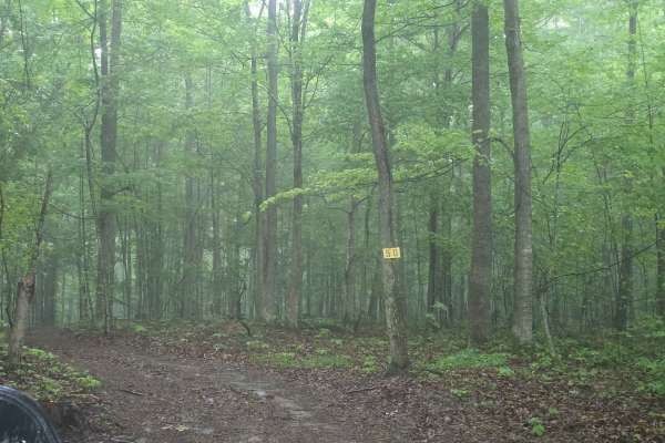
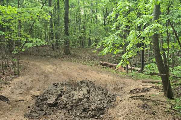
Trail 50
Trail 50 at Golden Mountain Offroad Park is just over a half mile long, and winds tightly through the woods with constant weaving turns that require careful navigation. The trail features several deeper mud holes, some with bypasses and others without, which can increase difficulty depending on cond...
Learn more about Trail 50
GMP Pavillion Road 2
Pavilion Road 2 at Golden Mountain Offroad Park runs from the main road to Pavilion Road 1 and is a mostly hard-packed dirt trail that winds through the camping area. While generally an easy drive, the trail is tree-tight in sections and requires attention for oncoming traffic, pedestrians, and park...
Learn more about GMP Pavillion Road 2
Trail 49
Trail 49 at Golden Mountain Offroad Park serves as a back entrance to the trail system and is commonly used by drivers heading toward spectator areas like the top of the Jungle or making their way over to Bounty Hill. This is a straightforward access route, but it can see increased traffic during ev...
Learn more about Trail 49
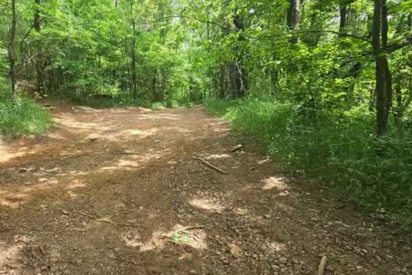
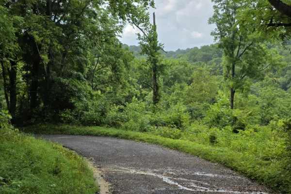
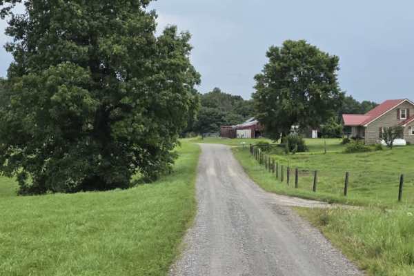
Wilmore Hollow Road - Macon County Tour
Wilmore Hollow Road is an easy gravel route that forms part of the well-known Macon County Tour in Tennessee, offering a relaxed drive through rolling countryside and wooded hillsides. The road is county-maintained and typically wide enough for two vehicles, making it suitable for most 4WD and high-...
Learn more about Wilmore Hollow Road - Macon County Tour
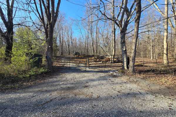
GMP Pavilion Road 1
The “Back Gate” entrance at Golden Mountain Offroad Park is a gravel access road that leads directly to the intersection of the main park road and Pavilion Road 2. This short, easy drive is primarily used by tow rigs and campers accessing the RV areas, making it well-maintained and suitable for all ...
Learn more about GMP Pavilion Road 1
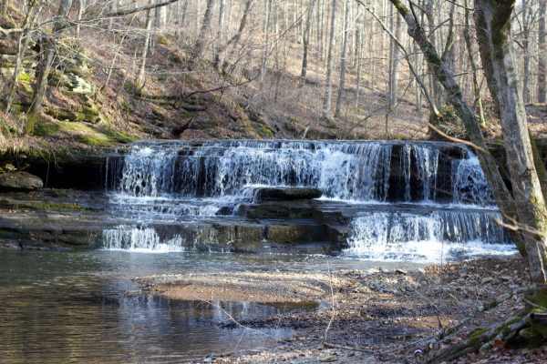
Long Fork Waterfall
Woodard Road is not a technical route;it is an easy gravel road leading down to a shallow creek crossing that includes a waterfall. The creek is shallow but the rock bottom can be slick. You can drive across it and continue further down the road or just turn around and head back out.
Learn more about Long Fork Waterfall
Highland Road - Macon County Tour
Highland Road is an easy, tightly packed gravel segment of the Macon County Tour that offers a straightforward rural drive. The surface is composed primarily of compacted rock and gravel, providing consistent traction under normal dry conditions. The road is generally one to one and a half lanes wid...
Learn more about Highland Road - Macon County Tour
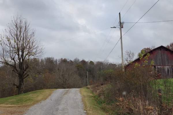
Holland Road - Macon County Tour
Holland Road is a short but scenic gravel segment of the Macon County Tour that offers a relaxed drive with a memorable water crossing at its end. The road is county-maintained and generally easy to navigate, though it can feel tight in places as it passes near farms and rural residences. Drivers sh...
Learn more about Holland Road - Macon County Tour
Spring Hollow Road - Macon County Tour
Spring Hollow Road is an easy gravel segment of the Macon County Tour that offers a relaxed drive with minor surface irregularities to keep drivers attentive. The road is typically about one and a half lanes wide, with periodic pull-offs that allow vehicles to pass when needed. While generally strai...
Learn more about Spring Hollow Road - Macon County Tour
Beech Grove Road - Macon County Tour
Beech Grove Road is a short gravel segment of the Macon County Tour that offers mild elevation changes and a quiet rural setting. The entrance can be easy to miss, so drivers should watch carefully for the turnoff when navigating the route. Once on the road, the surface consists of gravel that has e...
Learn more about Beech Grove Road - Macon County Tour
Dry Branch to Dixon Creek Road - Macon County Tour
This stretch of the iconic Macon County Tour offers a scenic drive through gently rolling hills and a patchwork of open farmland, blending rural charm with a few rugged elements. The road is primarily gravel, interrupted by a very brief paved connector that leads into a striking elevation change--co...
Learn more about Dry Branch to Dixon Creek Road - Macon County Tour
Knight Road - Macon County Tour
Knight Road is a slightly more engaging segment of the Macon County Tour that remains approachable while introducing a few mild features. The road follows a loose gravel surface and travels in close proximity to several rural homes and farms, so drivers should maintain slow speeds and remain alert f...
Learn more about Knight Road - Macon County Tour
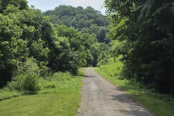
Puncheon Creek Road - Macon County Tour
Puncheon Creek Road is a scenic gravel segment of the Macon County Tour that follows and repeatedly crosses flowing water, creating a relaxed drive with 3 shallow creek features. The road surface consists primarily of loose gravel and travels in close proximity to rural homes and working farms, so m...
Learn more about Puncheon Creek Road - Macon County Tour
Myatt Creek Road
This well-maintained gravel road, mixed with sand, winds through the outskirts of the Catoosa Wildlife Management Area (WMA). Along this route, you'll pass through a site where a tornado struck in 2012. In the aftermath, the area was designated for a range of early plant succession management effort...
Learn more about Myatt Creek Road
Shockley Hill Road - Macon County Tour
Shockley Hill Road is a very brief connector within the Macon County Tour, serving as a short transition between longer segments of pavement along the route. The road surface is gravel and straightforward for easy navigation, for 4WD and high-clearance 2WD vehicles. While not a destination segment o...
Learn more about Shockley Hill Road - Macon County Tour
Beginner ATV trails near Hilham, Tennessee
Explore ATV-friendly trails near you. These trails are accessible for vehicles up to 50 inches wide, perfect for ATVs and smaller off-road machines.
GMP Pavilion Road 1
The “Back Gate” entrance at Golden Mountain Offroad Park is a gravel access road that leads directly to the intersection of the main park road and Pavilion Road 2. This short, easy drive is primarily used by tow rigs and campers accessing the RV areas, making it well-maintained and suitable for all ...
Learn more about GMP Pavilion Road 1
Long Fork Waterfall
Woodard Road is not a technical route;it is an easy gravel road leading down to a shallow creek crossing that includes a waterfall. The creek is shallow but the rock bottom can be slick. You can drive across it and continue further down the road or just turn around and head back out.
Learn more about Long Fork Waterfall
Dry Branch to Dixon Creek Road - Macon County Tour
This stretch of the iconic Macon County Tour offers a scenic drive through gently rolling hills and a patchwork of open farmland, blending rural charm with a few rugged elements. The road is primarily gravel, interrupted by a very brief paved connector that leads into a striking elevation change--co...
Learn more about Dry Branch to Dixon Creek Road - Macon County Tour
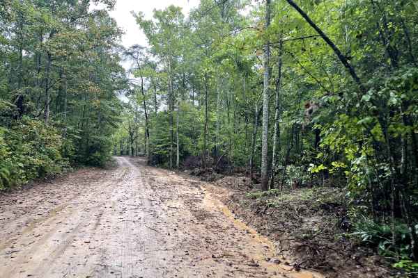
Bandy Creek Trek
This is a combination of dirt, gravel, and single-track in-the-woods roads. There really aren't a lot of difficult obstacles to make a note of other than a few areas that are washed out on Duncan Hollow Road. We had cell service off and on during this drive (Verizon). There weren't any great views a...
Learn more about Bandy Creek Trek
Beginner UTV/side-by-side trails near Hilham, Tennessee
Find UTV and side-by-side trails near you. These trails accommodate vehicles up to 60 inches wide, ideal for UTVs, side-by-sides, and wider off-road rigs.
Trail 1
Trail 1 at Golden Mountain Offroad Park is divided into two sections and serves as the main road on the northern side of the park, with multiple trail entrances branching off both sides as you head toward the back. While generally an easy access route, there are a few areas with taller rocks that re...
Learn more about Trail 1
Trail 1B
Trail 1B at Golden Mountain Offroad Park is part of a loop with Trail 1 but offers a slightly more challenging route. While still generally manageable, this section includes a few areas that are more technical than the main Trail 1, especially in wet conditions where the trail becomes slick and more...
Learn more about Trail 1B
GMP Main Road
The main road at Golden Mountain Offroad Park runs from the ticket booth up to the top of the hill intersection and serves as the primary route through the park. The surface starts as loose dirt and transitions into a deteriorated, old road with multiple washed-out sections and frequent potholes, re...
Learn more about GMP Main Road
Trail 50
Trail 50 at Golden Mountain Offroad Park is just over a half mile long, and winds tightly through the woods with constant weaving turns that require careful navigation. The trail features several deeper mud holes, some with bypasses and others without, which can increase difficulty depending on cond...
Learn more about Trail 50
The onX Offroad Difference
onX Offroad combines trail photos, descriptions, difficulty ratings, width restrictions, seasonality, and more in a user-friendly interface. Available on all devices, with offline access and full compatibility with CarPlay and Android Auto. Discover what you're missing today!
Open Trail Map