
Beginner Off-Road Trails
Near Granville, Pennsylvania
Explore All Beginner Trails Near Granville, Pennsylvania
Beginner Off-Road Trails Near Granville, Pennsylvania
Discover the best beginner-friendly off-road trails near you. These easier, lower-rated trails are a great place to start — browse trail maps, check difficulty ratings, and find your next adventure.
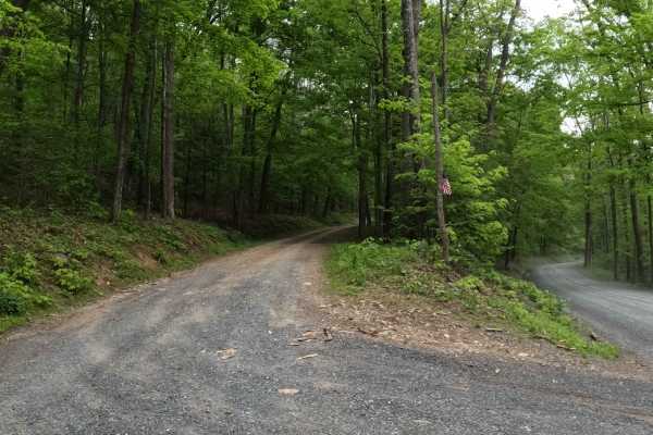
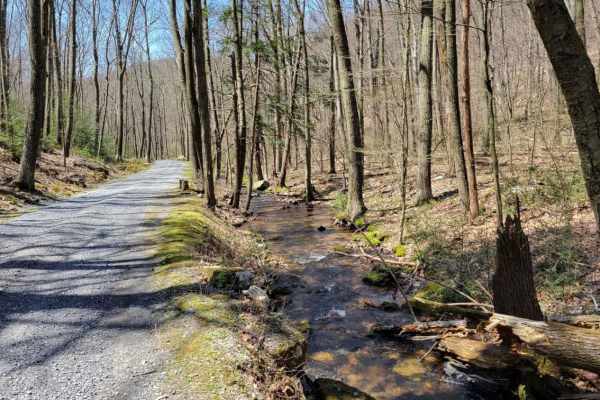
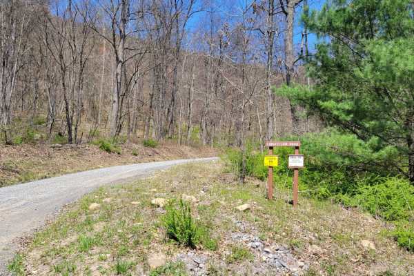
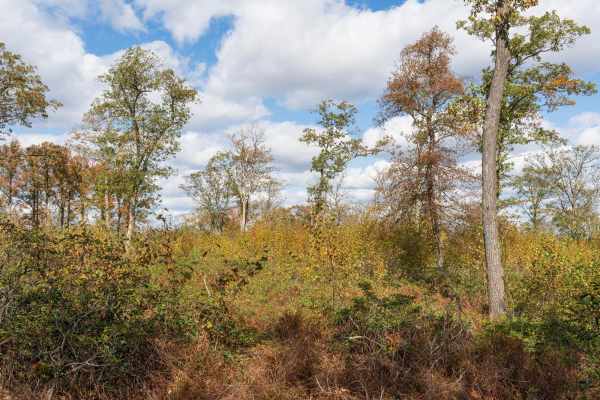
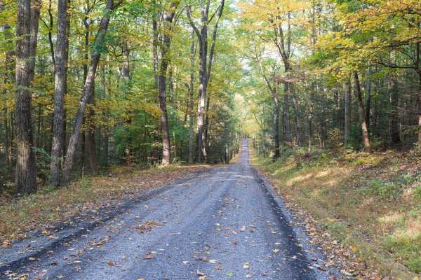
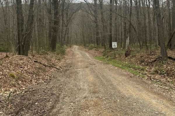
Vincent Tram Road
Vincent Tram Road is an up-and-back trail leading to a private property dead end. This trail is a typical state forest graded gravel/dirt road within Tuscarora State Forest. It comes off a main OnX Offroad mapped trail called Licking Creek Drive. This trail has an abundance of oak trees and pine tre...
Learn more about Vincent Tram Road
Flat Trail
The Flat Trail is an out and back Trail at Tuscarora State Forest in Pennsylvania. This road makes for a relaxing drive to get away from the gravel. The large and open camp site 008 can be reserved with a permit. There's minimal service at the Tuscarora State Forest so be sure to download offline ma...
Learn more about Flat Trail
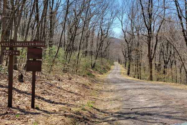
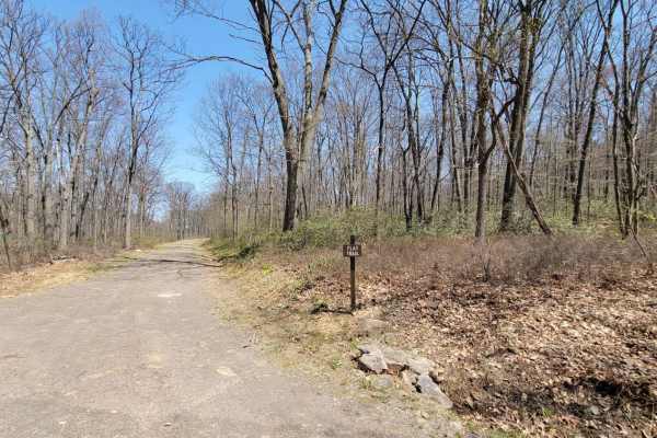
West Longfellow Trail
The West Longfellow Trail runs East West through Tuscarora State Forest in Pennsylvania. This road makes for a nice drive off the gravel. At the fork in the road, go left since the right side is private property. This trail does not have any camp sites. There's minimal service at the Tuscarora State...
Learn more about West Longfellow Trail
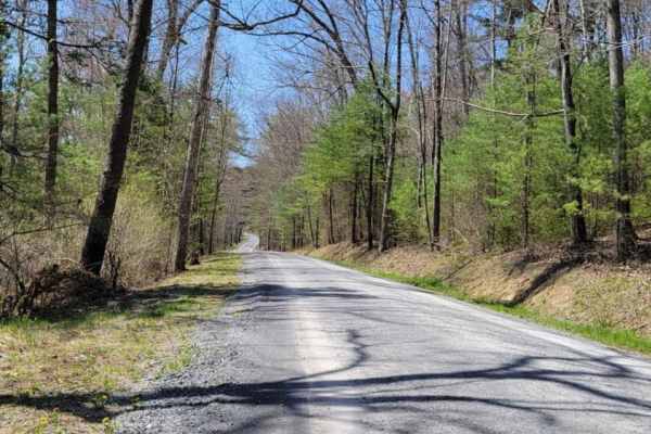
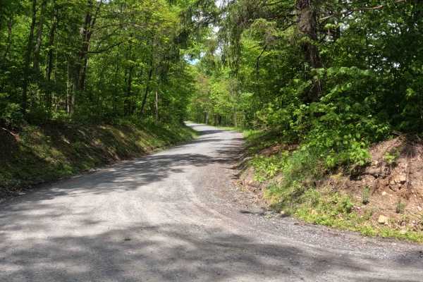
Licking Creek Dr
Licking Creek Drive is a standard PA State Forest road. It is graded gravel and is an easy, relaxing drive. This road offers access to several very nice dispersed motorized camp sites that, as with all camp sites and campgrounds in PA, must be reserved on the Reserve America app or site. It also fea...
Learn more about Licking Creek Dr
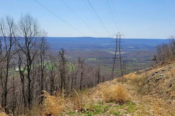
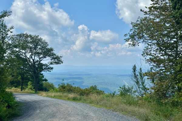
Spectacle Gap
The Spectacle Gap Trail is an out-and-back trail at Tuscarora State Forest in Pennsylvania. This road makes for a scenic drive up the mountain. Campsite 009, formerly known as Shade Mountain Fire Tower, can be reserved with a permit. There's minimal service at the Tuscarora State Forest, so be sure ...
Learn more about Spectacle Gap
Licking Creek
Licking Creek is a main forest road at Tuscarora State Forest in Pennsylvania. This road makes for a relaxing drive through the mountains. Several campsites at the Bell Furnace Camp Ground can be reserved with a permit. There's minimal service at the Tuscarora State Forest, so be sure to download of...
Learn more about Licking Creek
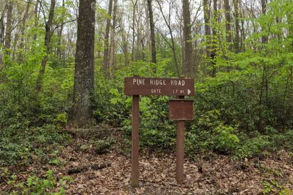
Pine Ridge Road
Pine Ridge Road is an up-and-back trail leading to a private property dead end. This trail is a typical state forest graded gravel road within Tuscarora State Forest. It comes off a main OnX Offroad mapped trail called Spectacle Gap Road. This trail has an abundance of oak trees and pine trees, prov...
Learn more about Pine Ridge Road
Odonnel Field Trail
The Odonnel Field Road runs North-South through Tuscarora State Forest in Pennsylvania. The high point of this dirt road has a beautiful unnamed overlook. This road does not have any campsites. There's minimal service at the Tuscarora State Forest, so be sure to download offline maps, although there...
Learn more about Odonnel Field Trail
Longfellow Road
The Longfellow Road runs East West through Tuscarora State Forest in Pennsylvania. This road makes for an easy and relaxing drive through the forest. This road passes right by the Short Mountain and Anderson Gap Vistas. This road does not have any camp sites. There's minimal service at the Tuscarora...
Learn more about Longfellow Road
McVeytown Road
McVeytown Road is an in-and-out trail leading to an exit on the pavement. This trail is a typical state forest graded gravel road within Tuscarora State Forest. It comes off a main OnX Offroad mapped trail called Licking Creek Road. This trail has an abundance of oak trees and pine trees, providing...
Learn more about McVeytown Road
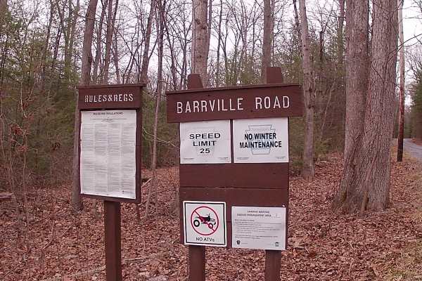
Barrville Road
Barrville Road is a typical graded gravel road within Rothrock State Forest. The trailhead is off a main paved road that is Route 305 (Greenwood Road). The Trail is gravel until the end portion turns to a paved road. It is an in-and-out trail. The trail is close to Greenwood Furnace Campground. The ...
Learn more about Barrville Road
Wynn Gap Rd
This is a normal PA state forest service road that connects the community of Blacklog to East Licking Creek Drive in Tuscarora State Forest. It's a scenic drive that features some private camps that are in restored CCC camp cabins near the midpoint of this track. The road passes between two private ...
Learn more about Wynn Gap Rd

Coopers Gap Road
This trail is an in-and-out trail leading to the 332 Highway. The trail is a typical Graded Gravel road within the Rothrock State Forest. This trail has some mild hills, with the last third of the trail having a shelf road. The trail is easily accessible in the warm months of the year, and the trail...
Learn more about Coopers Gap Road
Rag Hollow Road
Rag Hollow Road is a well-maintained gravel trail through Rothrock State Forest. The trail starts at the top of Broad Mountain, descending to Greenwood Furnace State Park. The trail starts in an open area at the top of the mountain before traversing a forest of deciduous trees, pine, mountain laurel...
Learn more about Rag Hollow Road
Spruce Mountain Road
This trail is a graded gravel road within Rothrock State Forest. The trail has some mild hills with winding roads. No Hiking trails off this road. It is a point-to-point type of trail. Easily accessible during warm months by car. Difficulty accessing the road in the winter months due to snow and ice...
Learn more about Spruce Mountain Road
Allensville Road
This forest road runs north-south over Stone Mountain through the southern part of Rothrock State Forest. It is most notable for having a hawk viewing platform on the east side of the mountain, not far from Allensville, at about 2000 feet above sea level. The platform is a short hike from the parkin...
Learn more about Allensville Road
Flat Road
Flat Road is a gravel road that serves as a connector between Allensville & Martins Gap Roads. It is a well-graded gravel road with wide shoulders on each side. There are numerous wildflowers and other natural sights along the sides. It can be easily completed with a 2-wheel drive vehicle.
Learn more about Flat Road
Turkey Hill Road
Turkey Hill Road is a gravel trail in Rothrock State Forest. The trail climbs to a ridge before descending into Greenwood Furnace State Park. The trail traverses a forest of deciduous trees and rhododendrons. The spring rhododendron bloom and fall foliage are especially scenic. There is a vista crea...
Learn more about Turkey Hill Road
Rock Spring Trail
Rock Spring Trail is a spur off Martin Gap Road that runs north into the forest. It has a few washouts and puddles, but is easily completed in a stock vehicle with good ground clearance. The north end of the trail terminates at a locked gate.
Learn more about Rock Spring Trail
Crowfield Road
Crowfield Road is a well-maintained gravel road in Rothrock State Forest. The trail traverses a forest of deciduous trees, pine, mountain laurel, and rhododendron and passes through Roosevelt State Park. There are a few spur roads to private cabins along the trail. Only highway-legal vehicles are al...
Learn more about Crowfield Road
Beginner ATV trails near Granville, Pennsylvania
Explore ATV-friendly trails near you. These trails are accessible for vehicles up to 50 inches wide, perfect for ATVs and smaller off-road machines.
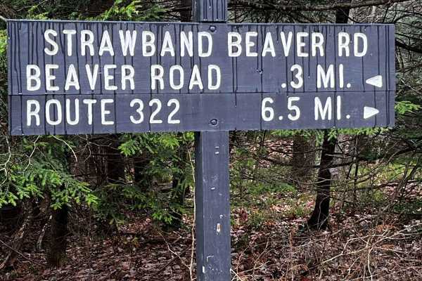
Strawband Beaver Road
This is a very well-maintained gravel, mostly one-car-width road through Moshannon State Forest. Along the route, you will find many different types of trees and wildlife. There are plenty of spots along the road to pull over. There is a lot of traffic during the hunting season.
Learn more about Strawband Beaver Road
Bald Eagle Pike
This is a rocky dirt road up the mountainside. There are some small washed-out areas, but it can be easily navigated with a factory-height SUV. You'll get some great views down into the valley along with wildlife such as turkey and deer crossing the trail. It's single-lane with a few pull-off areas ...
Learn more about Bald Eagle Pike
Hall Road
Hall Road is primarily a graded gravel road. It is an easy ride in the summer months; however, there is no winter maintenance. During times of rain, snow, and ice, the road can become rutted and harder to travel on. Hall Road is within Sproul State Forest. There are numerous spots to stop along this...
Learn more about Hall Road
Huckleberry Road
This is a maintained gravel road taking you for an easy drive through Moshannon State Forest. Entering from the Casanova Road side will take you through the forest, passing a few pull-off areas and the Benner Run Vista overlook, eventually coming to a three-way intersection. From this intersection,...
Learn more about Huckleberry Road
Beginner UTV/side-by-side trails near Granville, Pennsylvania
Find UTV and side-by-side trails near you. These trails accommodate vehicles up to 60 inches wide, ideal for UTVs, side-by-sides, and wider off-road rigs.
Strawband Beaver Road
This is a very well-maintained gravel, mostly one-car-width road through Moshannon State Forest. Along the route, you will find many different types of trees and wildlife. There are plenty of spots along the road to pull over. There is a lot of traffic during the hunting season.
Learn more about Strawband Beaver Road
Bald Eagle Pike
This is a rocky dirt road up the mountainside. There are some small washed-out areas, but it can be easily navigated with a factory-height SUV. You'll get some great views down into the valley along with wildlife such as turkey and deer crossing the trail. It's single-lane with a few pull-off areas ...
Learn more about Bald Eagle Pike
Hall Road
Hall Road is primarily a graded gravel road. It is an easy ride in the summer months; however, there is no winter maintenance. During times of rain, snow, and ice, the road can become rutted and harder to travel on. Hall Road is within Sproul State Forest. There are numerous spots to stop along this...
Learn more about Hall Road
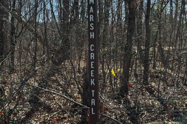
Marsh Creek Trail
Marsh Creek Trail is primarily a graded gravel road, with the southern end being dirt. It is an easy ride in the summer months; however, there is no winter maintenance. During times of rain, snow, and ice, the road can become rutted and harder to travel on. Marsh Creek Trail is within Sproul State F...
Learn more about Marsh Creek Trail
The onX Offroad Difference
onX Offroad combines trail photos, descriptions, difficulty ratings, width restrictions, seasonality, and more in a user-friendly interface. Available on all devices, with offline access and full compatibility with CarPlay and Android Auto. Discover what you're missing today!
Open Trail Map