
Beginner Off-Road Trails
Near Grady, Arkansas
Explore All Beginner Trails Near Grady, Arkansas
Beginner Off-Road Trails Near Grady, Arkansas
Discover the best beginner-friendly off-road trails near you. These easier, lower-rated trails are a great place to start — browse trail maps, check difficulty ratings, and find your next adventure.
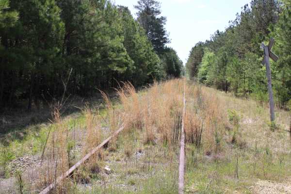
The Arkansas Overland Route - TrailHawk Loop - Section 15
Gravel and dirt roads that can be muddy and slick with possible ruts when wet. This is Section 15 of the Arkansas Overland Route. This section makes up the Hawks' beak when looking at this loop on the map. There are some nice straight sections on this trail. Watch for wildlife. This road goes to the...
Learn more about The Arkansas Overland Route - TrailHawk Loop - Section 15
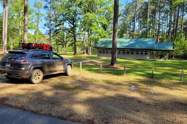
The Arkansas Overland Route - Section 13 - Moro State Park
Gravel road that can be nasty when wet. This section has some pavement that takes you into Moro State Park. This is the beginning of The Trailhawk Loop. The Trail Hawk Loop is part of The Arkansas Overland Route. This is a good area to camp and refresh before starting the TrailHawk Loop.
Learn more about The Arkansas Overland Route - Section 13 - Moro State Park
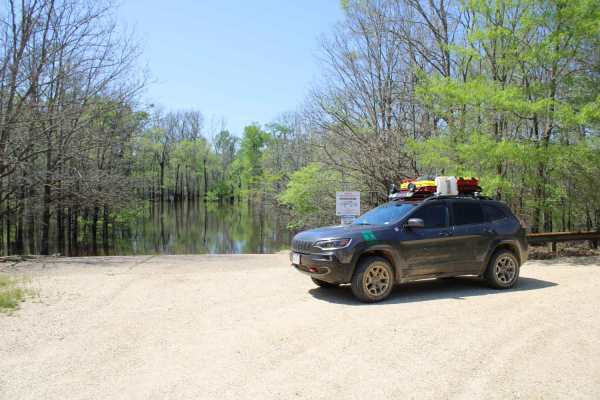
The Arkansas Overland Route - TrailHawk Loop - Section 16
Gravel and pavement roads that go to Eagle Landing Lake and boat ramp. Portions of roads can be muddy and slick when wet. These roads are well maintained but can be a bit rough in areas. There is dispersed camping and picnicking at the Eagle Landing Lake area.
Learn more about The Arkansas Overland Route - TrailHawk Loop - Section 16
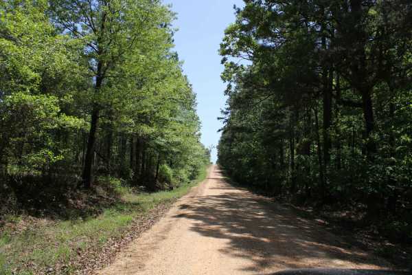
The Arkansas Overland Route - TrailHawk Loop - Section 19
This is a mix of gravel and pavement. The gravel can be messy when wet. This goes to Crosset Harbor RV Park. There is camping, a boat ramp, and restrooms. This section ends at the Ouachita River on the edge of this park. Great views and play equipment for the kiddos to take a break before beginning ...
Learn more about The Arkansas Overland Route - TrailHawk Loop - Section 19
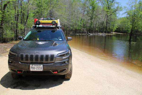
The Arkansas Overland Route - TrailHawk Loop - Section 17
Gravel roads that can be muddy and slick when wet. Roads can become flooded and not passable during and after rains. This goes to a lake and camping area. There is a section known to hold water -depths can vary. Travel with caution in the flooded areas. Watch for wildlife as you travel the route.
Learn more about The Arkansas Overland Route - TrailHawk Loop - Section 17
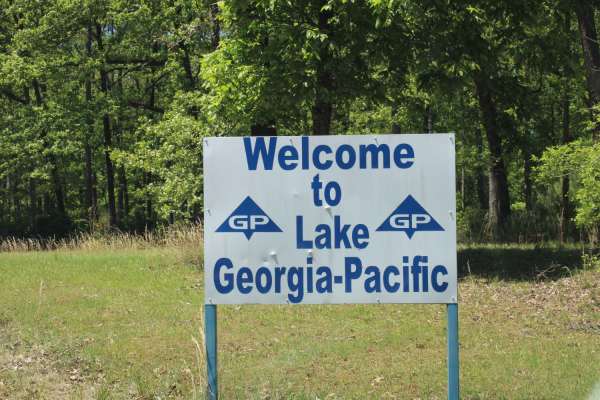
The Arkansas Overland Route - TrailHawk Loop - Section 18
Gravel and dirt roads that can be dusty when dry. Some pavement is in this section. These roads can be muddy and slick with possible ruts when wet. Some areas can be flooded. This section forms the hawk's wing when looking at this loop on the map. This takes you to Georgia Pacific Park. There is fis...
Learn more about The Arkansas Overland Route - TrailHawk Loop - Section 18
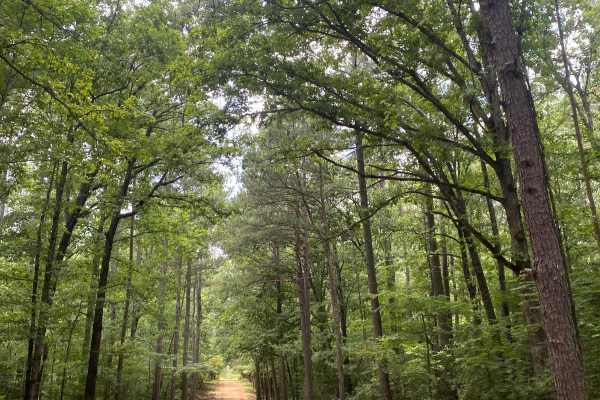
Potlach Road
This is a well-maintained dirt road with a few campsites along the way. This road leads through the Moro Big Pine WMA and there are several horseshoe lakes in the surrounding areas. It is very common to see wildlife such as hogs, turkeys, deer, and occasionally bears. This road can be very dusty dur...
Learn more about Potlach Road
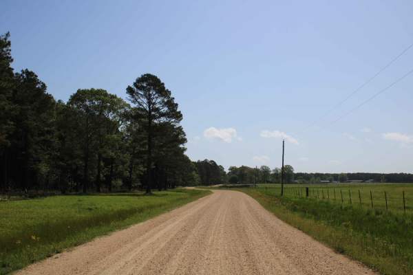
The Arkansas Overland Route - TrailHawk Loop - Section 14 - The Beginning
These are gravel roads that are dusty when dry and can be nasty when wet. They seem well maintained, and there is awesome scenery. Watch for farm equipment on the roads and cattle. This is the first section of The TrailHawk Loop, Section 14 of The Arkansas Overland Route. This section starts the hea...
Learn more about The Arkansas Overland Route - TrailHawk Loop - Section 14 - The Beginning
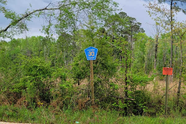
The Arkansas Overland Route - Section 11 - County Road 30 and 32
This is Section 11 of The Arkansas Overland Route. This section is gravel and dirt roads and ends at a deer camp. The road continues on, but after rain, it is all mud and a narrow track. After and during rains, these roads can be messy and have water across them. Some washed-out holes can be deep, s...
Learn more about The Arkansas Overland Route - Section 11 - County Road 30 and 32
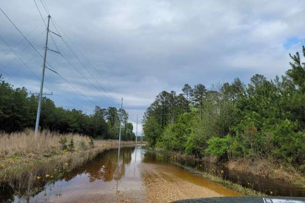
The Arkansas Overland Route - Section 12 - Dead End but Fresh Beginning
This is Section 12 of The Arkansas Overland Route. Deep graveled roads with potholes and water crossing after rain. Ending at HWY 160, a right turn will take you towards Moro State Park. There are dispersed camping areas along this trail, some big enough for group camping.
Learn more about The Arkansas Overland Route - Section 12 - Dead End but Fresh Beginning
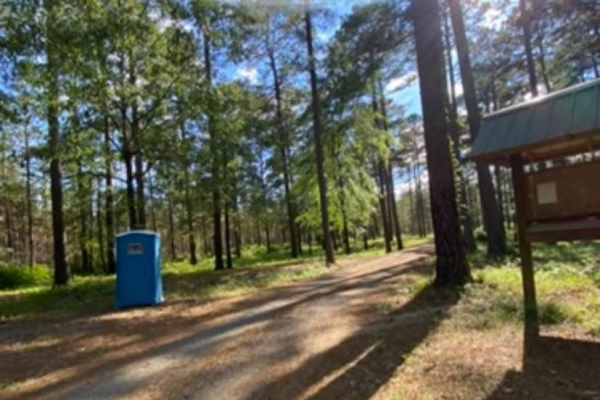
Champagnolle Creek Loop
The Champagnolle Creek Loop is a well-maintained dirt road with some uneven and rutted sections. While the road is easily passable during normal weather, the high river level makes the road impassable at times. Along this route, expect mild traffic, especially during prime fishing and hunting season...
Learn more about Champagnolle Creek Loop
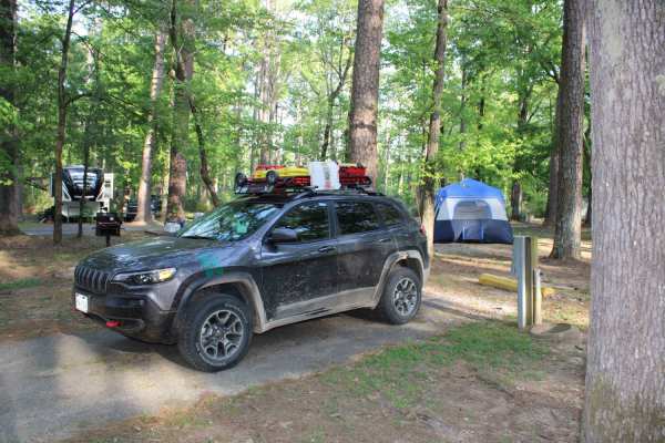
The Arkansas Overland Route - TrailHawk Loop - Section 21 - Haus SP
This is a mix of pavement and gravel. Some sections can be messy when wet. This route takes you to Haus State Park. There are full hookup sites, tent sites, and cabin rentals. This is an excellent place to stay the night before continuing the route. There are kayak rentals here to kayak out and see ...
Learn more about The Arkansas Overland Route - TrailHawk Loop - Section 21 - Haus SP
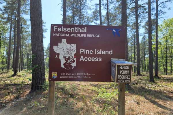
The Arkansas Overland Route - TrailHawk Loop - Section 20
These are gravel and dirt roads that can be muddy and have ruts when wet. This route goes to the Pine Island Boat Ramp and Recreation Area. Some areas of the road could flood, so travel with caution. Some mud holes can be deep enough to cause front-end damage if hit too fast. There is water access t...
Learn more about The Arkansas Overland Route - TrailHawk Loop - Section 20
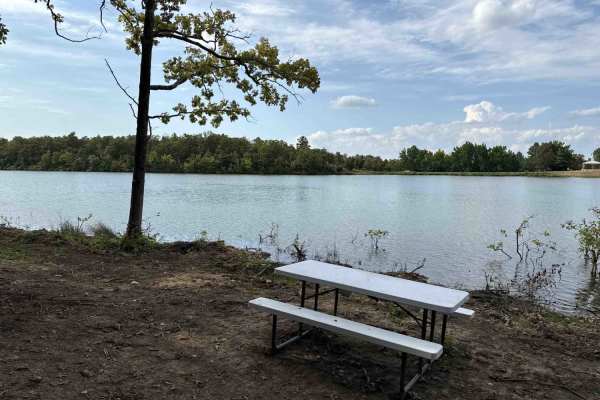
Plumeria Picnic
This smooth two track trail is used to access a scenic and secluded lakefront picnic area.
Learn more about Plumeria Picnic
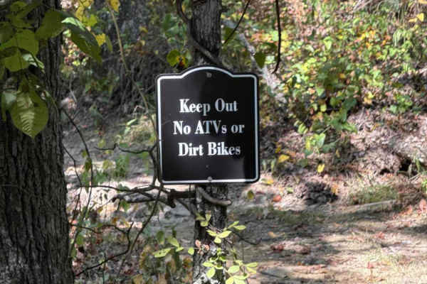
Kauai Lane
This connector from Mana Ridge to Ohana Trail offers access to several singletrack trails. This trail has some mild hills with ruts and loose rocks. It's a great spot to kick up the speed and knock the dirt off. At the east end, there is a closed trail heading to a part of the park that is under con...
Learn more about Kauai Lane
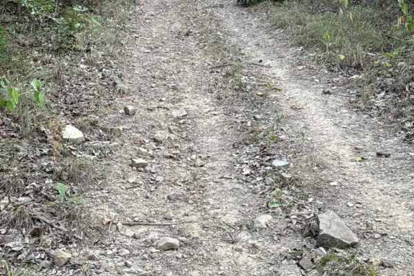
Palm's Way
This is a fun uphill connector with some loose rocks. Connects you from Kauai Lane to Mana Ridge on a gradual incline. The slope is mild and should not challenge any off-road vehicle. Be aware of dirt bikes, as there is a singletrack crossing on the trail about halfway to the top.
Learn more about Palm's Way
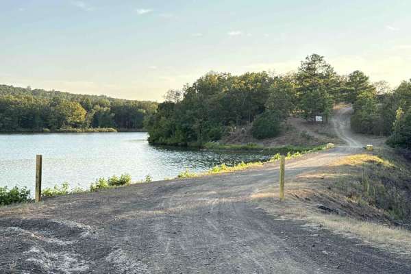
Ohana Trail
This two-track trail leads you from the park to the OHV trails area. Please go slowly near the lake until you are in the woods. At the top, there are some loose softball and football-sized rocks to watch for, but after you get down the hil,l it smooths out. One or two mud holes that are not deep. Th...
Learn more about Ohana Trail
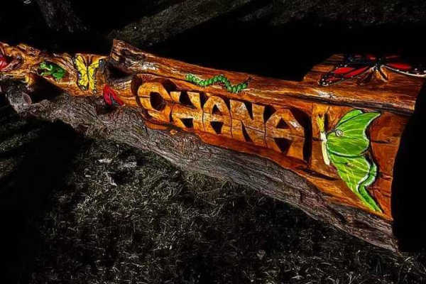
Waterway Trail
Check in at the office before riding. Currently, this trail holds a lot of water when the lake rises after rain. It will remain closed except in case of emergency or in the summer when lake levels are lower and the mudholes dry up. 5ST does intersect with this trail multiple times and crossing at th...
Learn more about Waterway Trail
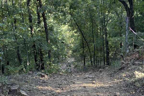
Iwa Ridge
This two-track ridge road starts near the lake and flows across the highest points of the park and ending at the west boundary. Rock gardens are common, as are steep hills with loose rocks. High point views are common when the leaves are down. Several connector trails branch off if you need to loop ...
Learn more about Iwa Ridge
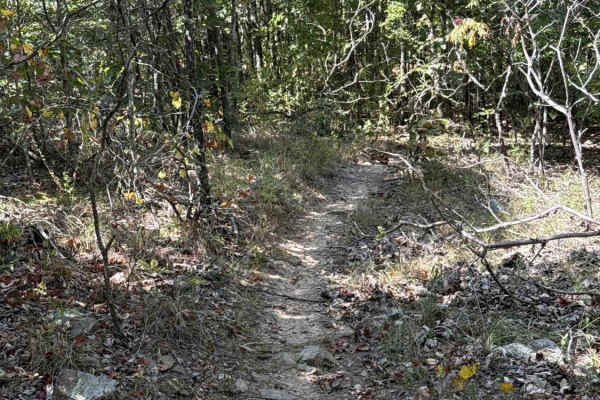
Pineapple Express
This fun, flowy singletrack connects Ohana Trail up to Mana Ridge. It maintains a smooth and gradual flow across mild slopes and shallow, seasonal water crossings. The eastern terminus of the trail is near a closed section of the park. Continue on Mana Ridge to other trails.
Learn more about Pineapple Express
Beginner ATV trails near Grady, Arkansas
Explore ATV-friendly trails near you. These trails are accessible for vehicles up to 50 inches wide, perfect for ATVs and smaller off-road machines.
Potlach Road
This is a well-maintained dirt road with a few campsites along the way. This road leads through the Moro Big Pine WMA and there are several horseshoe lakes in the surrounding areas. It is very common to see wildlife such as hogs, turkeys, deer, and occasionally bears. This road can be very dusty dur...
Learn more about Potlach Road
Champagnolle Creek Loop
The Champagnolle Creek Loop is a well-maintained dirt road with some uneven and rutted sections. While the road is easily passable during normal weather, the high river level makes the road impassable at times. Along this route, expect mild traffic, especially during prime fishing and hunting season...
Learn more about Champagnolle Creek Loop
Plumeria Picnic
This smooth two track trail is used to access a scenic and secluded lakefront picnic area.
Learn more about Plumeria Picnic
Kauai Lane
This connector from Mana Ridge to Ohana Trail offers access to several singletrack trails. This trail has some mild hills with ruts and loose rocks. It's a great spot to kick up the speed and knock the dirt off. At the east end, there is a closed trail heading to a part of the park that is under con...
Learn more about Kauai Lane
Beginner UTV/side-by-side trails near Grady, Arkansas
Find UTV and side-by-side trails near you. These trails accommodate vehicles up to 60 inches wide, ideal for UTVs, side-by-sides, and wider off-road rigs.
Potlach Road
This is a well-maintained dirt road with a few campsites along the way. This road leads through the Moro Big Pine WMA and there are several horseshoe lakes in the surrounding areas. It is very common to see wildlife such as hogs, turkeys, deer, and occasionally bears. This road can be very dusty dur...
Learn more about Potlach Road
Champagnolle Creek Loop
The Champagnolle Creek Loop is a well-maintained dirt road with some uneven and rutted sections. While the road is easily passable during normal weather, the high river level makes the road impassable at times. Along this route, expect mild traffic, especially during prime fishing and hunting season...
Learn more about Champagnolle Creek Loop
Plumeria Picnic
This smooth two track trail is used to access a scenic and secluded lakefront picnic area.
Learn more about Plumeria Picnic
Kauai Lane
This connector from Mana Ridge to Ohana Trail offers access to several singletrack trails. This trail has some mild hills with ruts and loose rocks. It's a great spot to kick up the speed and knock the dirt off. At the east end, there is a closed trail heading to a part of the park that is under con...
Learn more about Kauai Lane
The onX Offroad Difference
onX Offroad combines trail photos, descriptions, difficulty ratings, width restrictions, seasonality, and more in a user-friendly interface. Available on all devices, with offline access and full compatibility with CarPlay and Android Auto. Discover what you're missing today!
Open Trail Map