
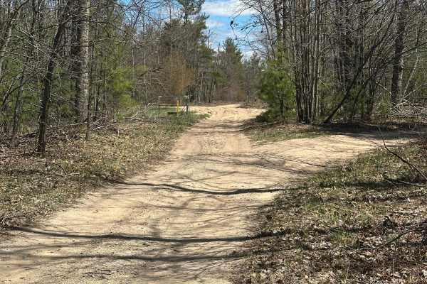
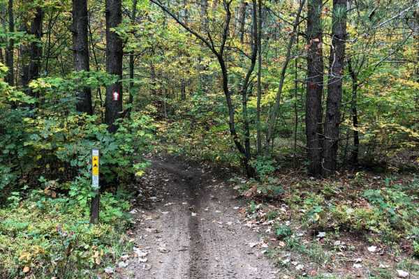
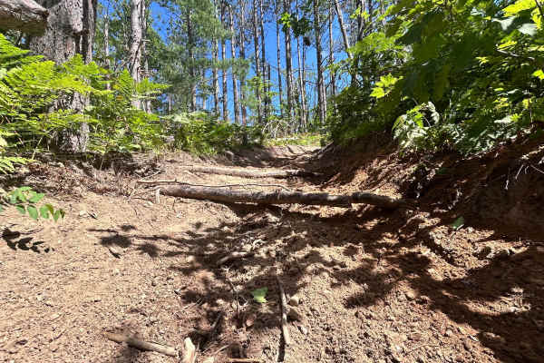
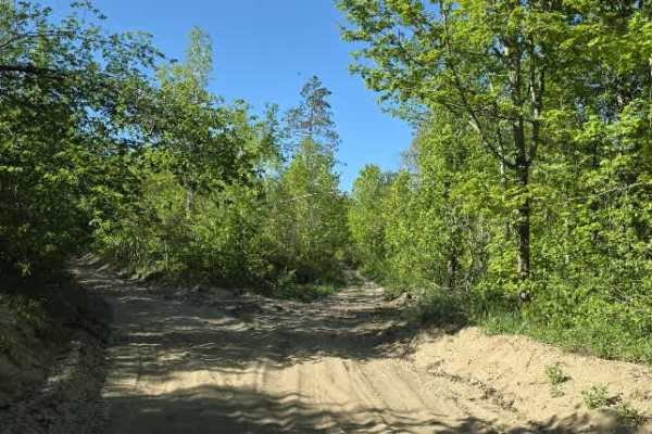
Beginner Off-Road Trails
Near Gaylord, Michigan
Explore All Beginner Trails Near Gaylord, Michigan
Beginner Off-Road Trails Near Gaylord, Michigan
Discover the best beginner-friendly off-road trails near you. These easier, lower-rated trails are a great place to start — browse trail maps, check difficulty ratings, and find your next adventure.
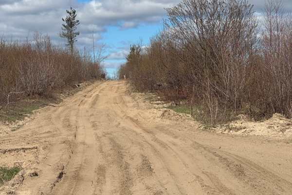
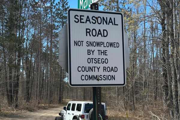
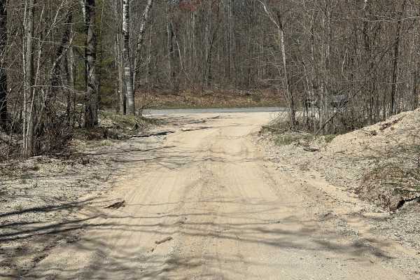
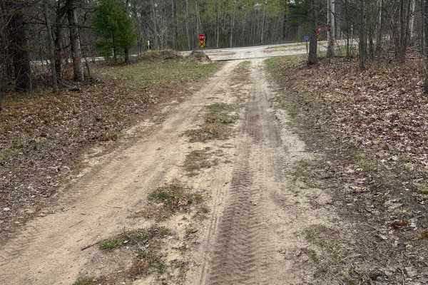
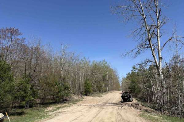
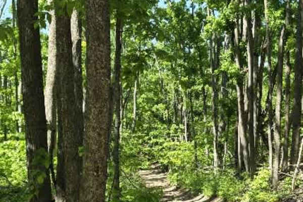
Milbocker Road
Milbocker Road is a seasonal single-lane gravel/dirt/sand road. The trail is part of the Gaylord Forest Management Unit and gives you the opportunity to see wildlife and explore the trail system in Northern Michigan. Some sections are wide enough for another vehicle to pass. This trail is a nice rid...
Learn more about Milbocker Road
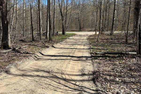
Gump Lake Trail
Gump Lake Road is a single lane two track gravel/dirt/sand road. The trail is part of the Gaylord Forest Management Unit and gives you the opportunity to see wildlife and explore the trail system in Northern Michigan. Some sections are wide enough for another vehicle to pass. This trail is a nice ri...
Learn more about Gump Lake Trail
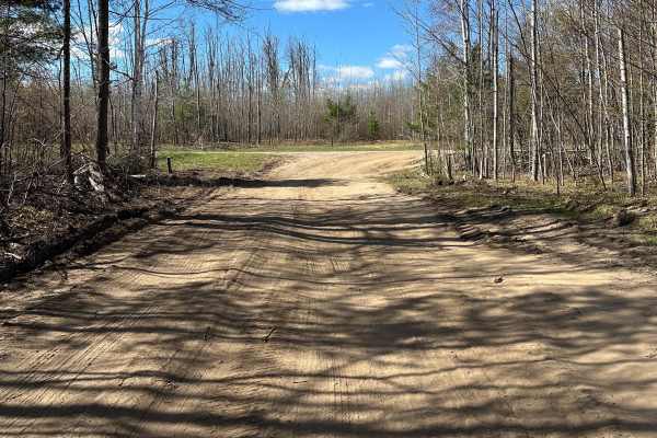
Manuka Trail
Manuka Trail is a seasonal single lane gravel/dirt/sand road. The trail is part of the Gaylord Forest Management Unit and gives you the opportunity to see wildlife and explore the trail system in Northern Michigan. Some sections are wide enough for another vehicle to pass. This trail is a nice ride ...
Learn more about Manuka Trail
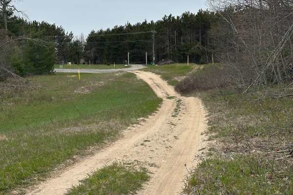
Fowler Lake Cutover
Fowler Lake Cutover is a single-lane, two-track gravel/dirt/sand trail. The trail is part of the Gaylord Forest Management Unit and gives you the opportunity to see wildlife and explore the trail system in Northern Michigan. This trail is a nice ride with some soft sand in spots, so be careful. The ...
Learn more about Fowler Lake Cutover
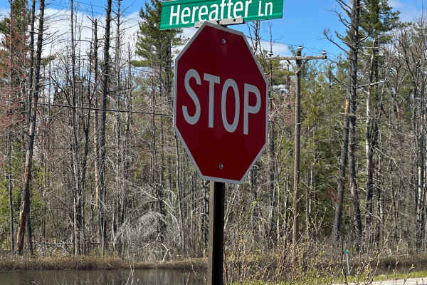
Hereafter Lane
Hereafter Lane is a short single-lane gravel/dirt/mud road. The trail is part of the Gaylord Forest Management Unit and gives you the opportunity to see wildlife and explore the trail system in Northern Michigan. This trail is a nice ride, but it can be flooded and muddy in spots, so be careful. The...
Learn more about Hereafter Lane
Wequas Lake Road
Wequas Lake Road is a short single lane gravel/dirt/sand road. The trail is part of the Gaylord Forest Management Unit and gives you the opportunity to see wildlife and explore the trail system in Northern Michigan. Some sections are wide enough for another vehicle to pass. This trail is a nice ride...
Learn more about Wequas Lake Road
Old Alba Cutover
Old Alba Cutover is a single-lane, two-track gravel/dirt/sand road. The trail is part of the Gaylord Forest Management Unit and gives you the opportunity to see wildlife and explore the trail system in Northern Michigan. You could encounter some mud holes depending on the time of year. This trail is...
Learn more about Old Alba Cutover
Hays Tower Loop
Hays Tower Loop is a single lane gravel/dirt/sand two track. The trail is part of the Gaylord Forest Management Unit and gives you the opportunity to see wildlife and explore the trail system in Northern Michigan. This track is a nice ride with some areas with very soft sand. The trail can be ran in...
Learn more about Hays Tower Loop
West Otsego Lake Loop
West Otsego Lake Loop starts as a double-lane gravel/dirt/sand road, then goes to a single lane. The trail is part of the Gaylord Forest Management Unit and gives you the opportunity to see wildlife and explore the trail system in Northern Michigan. Some sections are wide enough for another vehicle ...
Learn more about West Otsego Lake Loop
Manuka Lake Loop
Manuka Lake Loop is a seasonal single-lane two-track gravel/dirt/sand road. The trail is part of the Gaylord Forest Management Unit and gives you the opportunity to see wildlife and explore the trail system in Northern Michigan. This trail is a nice ride with some soft sand in spots, so be careful. ...
Learn more about Manuka Lake Loop
West Otsego Lake Cutover
West Otsego Lake Cutover is a single lane dirt/gravel/sand two-track. The trail is part of the Gaylord Forest Management Unit and gives you the opportunity to see wildlife and explore the trail system in Northern Michigan. Some sections are wide enough for another vehicle to pass. This trail is a ni...
Learn more about West Otsego Lake Cutover
Pipeline Track
Pipeline Track is a short single-lane dirt and soft sand track. The trail is part of the Gaylord Forest Management Unit and gives you the opportunity to see wildlife and explore the trail system in Northern Michigan. Some sections are wide enough for another vehicle to pass. This trail is a nice rid...
Learn more about Pipeline Track
9996052
9996052 is a single-lane dirt/gravel/sand two-track. The trail is part of the Gaylord Forest Management Unit, providing the opportunity to see wildlife and explore the trail system in Northern Michigan. Some sections are wide enough for another vehicle to pass. This trail is a nice ride with some so...
Learn more about 9996052
Hayesego Trail
Hayesego Trail is a single-lane dirt and sand track. The trail has it all and is part of the Gaylord Forest Management Unit, and gives you the opportunity to see wildlife and explore the trail system in Northern Michigan. Some sections are wide enough for another vehicle to pass. This trail is a nic...
Learn more about Hayesego Trail
Hayesego Loop Around
Hayesego Loop Around is a single-lane dirt and sand track that has some washboarding, hills, and dips. The trail has it all and is part of the Gaylord Forest Management Unit, and gives you the opportunity to see wildlife and explore the trail system in Northern Michigan. Some sections are wide enoug...
Learn more about Hayesego Loop Around
AuSable Cutover
AuSable Cutover is a single-lane dirt and sand track. The trail is part of the Gaylord Forest Management Unit and gives you the opportunity to see wildlife and explore the trail system in Northern Michigan. The trail starts out narrow with some washboarding throughout the trail. Some sections are wi...
Learn more about AuSable Cutover
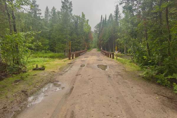
Jordan River Road
This trail winds along the Jordan River and is one vehicle wide, with places to pass along this route. There are two large well well-kept bridges that cross over the Jordan River. This route has some of the best views in the area, providing ample places to see the surrounding wildlife and forest tha...
Learn more about Jordan River Road
Mason Pit
This trail is sandy with a few large mud puddles. There are remnants of an old sand pit and chute that sits next to the trail on the south end, but it is located on private property. There is a bridge along the route that crosses over a little creek or river.
Learn more about Mason Pit
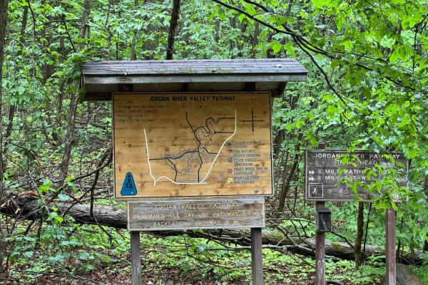
Deadman Hill Road
This is a quick and easy two-lane dirt and gravel road that can be traveled by any rig. This trail leads to great views and some amazing hiking trails. At the end of this route, there are signs about the surrounding area with details about the nearby hiking trails. It also provides information about...
Learn more about Deadman Hill Road
AuSable Loop
AuSable Loop is a single-lane dirt/sand track. The trail is part of the Gaylord Forest Management Unit and gives you the opportunity to see wildlife and explore the trail system in Northern Michigan. The trail starts out narrow with some bumps throughout the trail. Some sections are wide enough for ...
Learn more about AuSable Loop
Beginner ATV trails near Gaylord, Michigan
Explore ATV-friendly trails near you. These trails are accessible for vehicles up to 50 inches wide, perfect for ATVs and smaller off-road machines.
Mason Pit
This trail is sandy with a few large mud puddles. There are remnants of an old sand pit and chute that sits next to the trail on the south end, but it is located on private property. There is a bridge along the route that crosses over a little creek or river.
Learn more about Mason Pit
Calker
Calker is a versatile route accessible to all vehicle sizes, from robust 4x4s to nimble dirt bikes. The terrain is predominantly composed of sand and dirt, bordered by dense forests interspersed with open areas. However, larger vehicles may encounter challenges navigating through low-hanging brush a...
Learn more about Calker
Crapo Creek Trail
Crapo Creek Trail (Pronounced Crap-oh) is a fifty-inch trail designed to be ridded by dirt bikes and quads. The general make up of this trail is black dirt with some sandy spots in fresh timber cut areas where the sun has had a chance to bake the ground. This is a relatively obstacle free trail. Som...
Learn more about Crapo Creek Trail
Big Bear Connector
Big Bear Connector is a fifty-inch trail designed to be ridden by 50-inch ATVs, dirtbikes, and quads. The general makeup of this trail is hard-packed sand with some soft sandy spots under a canopy of trees that connects Crapo Trail to Big Bear. There is only one section of the trail with a few expo...
Learn more about Big Bear Connector
Beginner UTV/side-by-side trails near Gaylord, Michigan
Find UTV and side-by-side trails near you. These trails accommodate vehicles up to 60 inches wide, ideal for UTVs, side-by-sides, and wider off-road rigs.
Mason Pit
This trail is sandy with a few large mud puddles. There are remnants of an old sand pit and chute that sits next to the trail on the south end, but it is located on private property. There is a bridge along the route that crosses over a little creek or river.
Learn more about Mason Pit
Calker
Calker is a versatile route accessible to all vehicle sizes, from robust 4x4s to nimble dirt bikes. The terrain is predominantly composed of sand and dirt, bordered by dense forests interspersed with open areas. However, larger vehicles may encounter challenges navigating through low-hanging brush a...
Learn more about Calker
Wolf Run
This route begins off Charlevoix/Booth Lake Rd and runs toward Marl Creek Rd with an intersection tying into Wilderness Rd. It’s a mixed-use forest connector that shifts between sandy two-track, narrow wooded corridors, and more technical off-camber sections.
The trail starts sandy with light rock ...
Learn more about Wolf Run
Dunham Rd
Dunham Road branches off the side of the Tomahawk C Loop and begins as a relatively easy hard-packed dirt trail before quickly narrowing into a more rugged two-track. The trail winds through dense forest, where low-hanging and fallen branches form a natural tunnel in several sections, creating a sec...
Learn more about Dunham Rd
The onX Offroad Difference
onX Offroad combines trail photos, descriptions, difficulty ratings, width restrictions, seasonality, and more in a user-friendly interface. Available on all devices, with offline access and full compatibility with CarPlay and Android Auto. Discover what you're missing today!
Open Trail Map