
Beginner Off-Road Trails
Near Del Rio, California
Explore All Beginner Trails Near Del Rio, California
Beginner Off-Road Trails Near Del Rio, California
Discover the best beginner-friendly off-road trails near you. These easier, lower-rated trails are a great place to start — browse trail maps, check difficulty ratings, and find your next adventure.
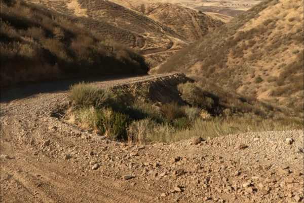
Kiln Trail
Kiln Trail is one of the primary entrances to the park. The route begins as a mellow hardpack dirt road leading to the park boundary, where signs outline park regulations and warn visitors about mountain lions. Shortly after entering, riders encounter the first notable obstacle: a steep climb with l...
Learn more about Kiln Trail
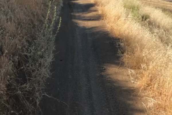
Sri Loop
SRI Loop begins with a steep, winding descent on hardpack dirt. The trail follows a narrow, mostly groomed path with rolling terrain, featuring several steep climbs and descents along the way. Expect light rutting in places, but few significant obstacles. After the loop, you can enter the Golden Eag...
Learn more about Sri Loop
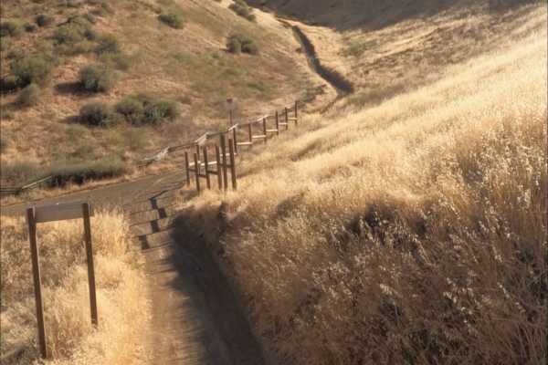
Golden Eagle
Golden Eagle Trail is a mellow hardpack dirt route that serves as a connector to SRI Loop and several other trails within the network. The trail is generally smooth and easy to follow, with a mix of steep climbs and descents along the way.
Riders traveling toward SRI Loop will need to cross a paved ...
Learn more about Golden Eagle
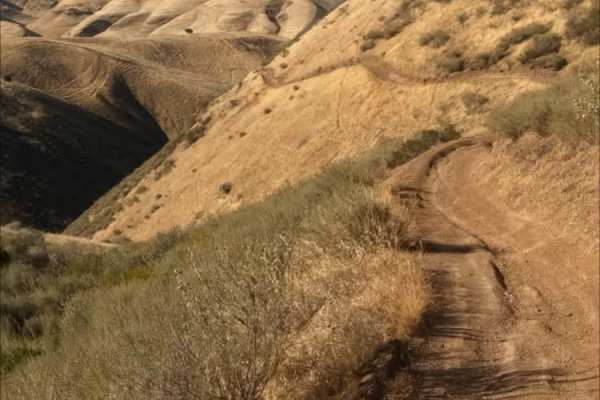
Red Trail
Juniper Trail is one of the park's primary connector routes, linking riders to the broader trail network. The trail features mostly smooth hardpack dirt with a mix of winding turns, climbs, and descents that make for an enjoyable ride.
As the route progresses, riders gain access to several steeper h...
Learn more about Red Trail
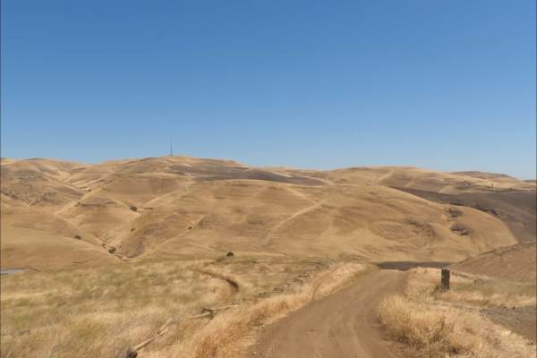
Los Osos Trail
The Los Osos Trail is one of the park's main connector routes, providing access to many of the surrounding trails and trail networks. The trail consists mostly of smooth, well-groomed hardpack dirt and offers an easy, enjoyable ride through the park.
Expect a mix of winding turns, gradual climbs, an...
Learn more about Los Osos Trail
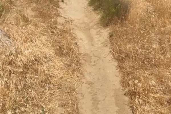
Badger
Badger Trail runs parallel to Ridge Trail, following the same hillside at a lower elevation. The route consists of firm hardpack dirt and a series of winding turns that contour along the slope. Technical obstacles are minimal, with few rocks or ruts to navigate. However, the steep hillside and narro...
Learn more about Badger
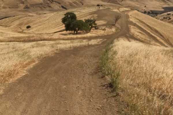
Juniper Trail
Juniper Trail is one of the park's primary connector routes, linking riders to the broader trail network. The trail features mostly smooth hardpack dirt with a mix of winding turns, climbs, and descents that make for an enjoyable ride.
As the route progresses, riders gain access to several steeper h...
Learn more about Juniper Trail
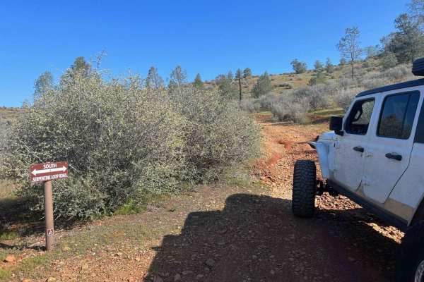
Red Hills Road/Serpentine loop
Red Hills Recreation (BLM) area is a scenic day use only location. There are tons of hiking trails in the area, as well as the Serpentine Loop Trail which is a mild to moderate trail with tons of seasonal water crossings and picnic areas near the water. Accessible to most 4x4 and AWD vehicles, small...
Learn more about Red Hills Road/Serpentine loop
American Camp Lookout
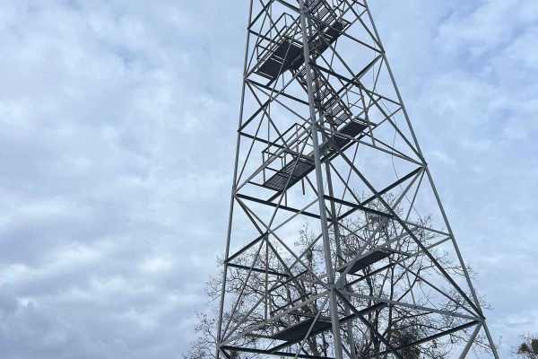
This is a super pretty drive as it descends into the canyons and back up to the mountaintops. On your way to the lookout, you will drive through the Italian Bar/Lost Dutchman Mining Camp, which is a cool place to either pay to camp or you can pay and go gold panning in the river. After leaving there...
Learn more about American Camp Lookout
Lug Nut Ledge
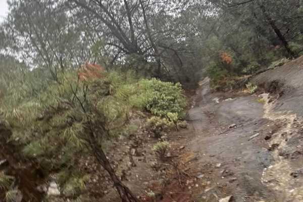
Lug Nut Ledge is a short but fun trail with moderate obstacles, including rocky sections, rutted sections, and water crossings. The namesake Lug Nut Ledge features a mild rock step that requires good tire placement but is manageable for most high-clearance vehicles. Water crossings can reach up to a...
Learn more about Lug Nut Ledge

Forebay to American Camp
This trail is a connector between the American Camp Lookout and the Forebay trail. Connect all these 3 trails for a fun weekend or day trip full of adventure and fishing/exploring! There is a creek crossing as well as a bridge crossing with some swimming holes. Be prepared for some mud and ruts, es...
Learn more about Forebay to American Camp

Stanislaus Forebay
This a very easy trail and is mostly forest roads that zig-zag up the hill to the Forebay. This can be accessed from many ways whether it be from Columbia, Twain Harte, or Camp 9. The Camp 9 entrance is the fastest way in and is a pretty drive looking over the Stanislaus River. Fishing? Try the Fore...
Learn more about Stanislaus Forebay
Boneyard Road - FS 1S07
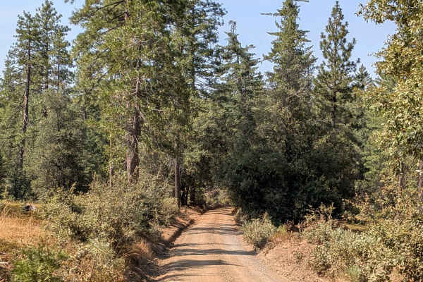
This trail starts just off Highway 120, located 2.7 miles east of the Groveland District Ranger Office, and begins as a 1.5-vehicle-wide gravel trail with some sand sections. Lined with Ponderosa pine trees and bushes, the route provides a pleasant forest driving experience within the Stanislaus Nat...
Learn more about Boneyard Road - FS 1S07
Keltz Mine
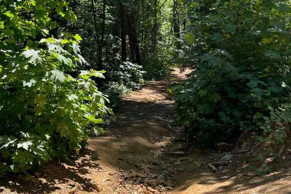
This trail is steep, overgrown, and narrow. Typically home to lots of poison oak and fallen trees but the reward at the end is totally worth it! Keltz Mine road takes you down to the South Fork Stanislaus River and ends at a camping area. There are fish and swimming holes and slippery rocks so bewar...
Learn more about Keltz Mine
Wagner Ridge Road - FS 2S08
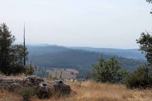
This trail climbs over 600 feet and drops almost 1,200 feet across just over 5 miles of diverse terrain that spans BLM land and Stanislaus National Forest, though it begins on private land requiring respectful passage. Starting at Smith Station Road and ending on Wild Rose Road, the route begins as ...
Learn more about Wagner Ridge Road - FS 2S08
Candy Rock Road
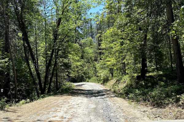
As of May 26, 2023. This road is accessible by vehicles of higher clearance than sedans. This is due to the fire road are not as flat and maintained as Google Maps makes it out to be. When driving on the road, there will be moderately size ruts, and bumps running across the width of the road due to ...
Learn more about Candy Rock Road

Candy Rock Road P.2
As of May 26, 2023. This road is accessible by vehicles of higher clearance than sedans. This is because the fire roads are not as flat and maintained as Google Maps makes them out to be. When driving on the road, there will be moderately size ruts, and bumps running across the width of the road due...
Learn more about Candy Rock Road P.2

FS 2S37
This trail is a 3.5-mile out-and-back trail that drops almost 700 feet and climbs over 100 feet in just under 2 miles. The trail sometimes runs along shelf roads lined with trees and brush, providing natural corridors and periodic exposure as it descends toward the valley floor. Pleasant views of fa...
Learn more about FS 2S37

Jordan Creek Road - FS 2S17
This trail drops over 800 feet in just over 4.5 miles, starting on Smith Station Road (FS J132). The route begins in a neighborhood area requiring respectful behavior, initially following a crushed granite gravel road surface. After the first mile, private land ends and the trail continues through t...
Learn more about Jordan Creek Road - FS 2S17

Tolumne Road/120 Bypass
This 5-mile point-to-point trail runs along HWY 120. The trail runs along the ridge of the Tolumne River Valley and gives excellent views of the valley below. The trail is mostly one vehicle with shallow mud holes less than 12" in depth. There is a short section of HWY 120 which must be traveled. Th...
Learn more about Tolumne Road/120 Bypass
Beginner ATV trails near Del Rio, California
Explore ATV-friendly trails near you. These trails are accessible for vehicles up to 50 inches wide, perfect for ATVs and smaller off-road machines.
Kiln Trail
Kiln Trail is one of the primary entrances to the park. The route begins as a mellow hardpack dirt road leading to the park boundary, where signs outline park regulations and warn visitors about mountain lions. Shortly after entering, riders encounter the first notable obstacle: a steep climb with l...
Learn more about Kiln Trail
Sri Loop
SRI Loop begins with a steep, winding descent on hardpack dirt. The trail follows a narrow, mostly groomed path with rolling terrain, featuring several steep climbs and descents along the way. Expect light rutting in places, but few significant obstacles. After the loop, you can enter the Golden Eag...
Learn more about Sri Loop
Golden Eagle
Golden Eagle Trail is a mellow hardpack dirt route that serves as a connector to SRI Loop and several other trails within the network. The trail is generally smooth and easy to follow, with a mix of steep climbs and descents along the way.
Riders traveling toward SRI Loop will need to cross a paved ...
Learn more about Golden Eagle
Red Trail
Juniper Trail is one of the park's primary connector routes, linking riders to the broader trail network. The trail features mostly smooth hardpack dirt with a mix of winding turns, climbs, and descents that make for an enjoyable ride.
As the route progresses, riders gain access to several steeper h...
Learn more about Red Trail
Beginner UTV/side-by-side trails near Del Rio, California
Find UTV and side-by-side trails near you. These trails accommodate vehicles up to 60 inches wide, ideal for UTVs, side-by-sides, and wider off-road rigs.
Kiln Trail
Kiln Trail is one of the primary entrances to the park. The route begins as a mellow hardpack dirt road leading to the park boundary, where signs outline park regulations and warn visitors about mountain lions. Shortly after entering, riders encounter the first notable obstacle: a steep climb with l...
Learn more about Kiln Trail
Los Osos Trail
The Los Osos Trail is one of the park's main connector routes, providing access to many of the surrounding trails and trail networks. The trail consists mostly of smooth, well-groomed hardpack dirt and offers an easy, enjoyable ride through the park.
Expect a mix of winding turns, gradual climbs, an...
Learn more about Los Osos Trail
Juniper Trail
Juniper Trail is one of the park's primary connector routes, linking riders to the broader trail network. The trail features mostly smooth hardpack dirt with a mix of winding turns, climbs, and descents that make for an enjoyable ride.
As the route progresses, riders gain access to several steeper h...
Learn more about Juniper Trail
American Camp Lookout
This is a super pretty drive as it descends into the canyons and back up to the mountaintops. On your way to the lookout, you will drive through the Italian Bar/Lost Dutchman Mining Camp, which is a cool place to either pay to camp or you can pay and go gold panning in the river. After leaving there...
Learn more about American Camp Lookout
The onX Offroad Difference
onX Offroad combines trail photos, descriptions, difficulty ratings, width restrictions, seasonality, and more in a user-friendly interface. Available on all devices, with offline access and full compatibility with CarPlay and Android Auto. Discover what you're missing today!
Open Trail Map