
Beginner Off-Road Trails
Near Crawfordville, Georgia
Explore All Beginner Trails Near Crawfordville, Georgia
Beginner Off-Road Trails Near Crawfordville, Georgia
Discover the best beginner-friendly off-road trails near you. These easier, lower-rated trails are a great place to start — browse trail maps, check difficulty ratings, and find your next adventure.
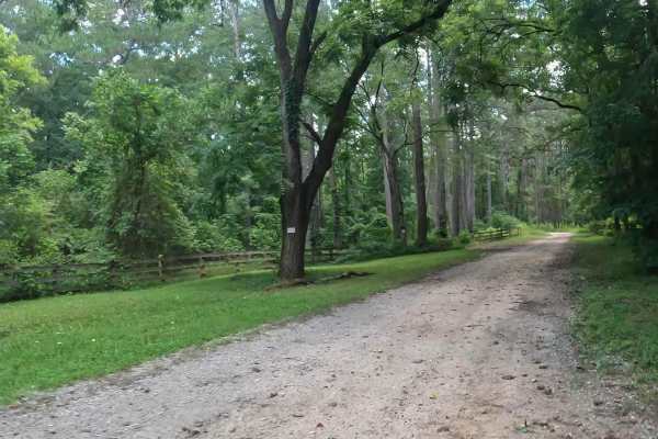
Penfield Hunt Camp Road
Penfield Hunt Camp Road is located in the Oconee National Forest. This road is mostly flat, with a few pothole exceptions. If you are traveling with a long trailer, drive slowly; the road is passable. At the end of the road, you'll find three fire rings, a large turnaround loop, a pit toilet, handic...
Learn more about Penfield Hunt Camp Road
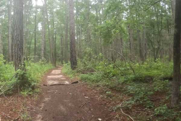
B Loop
Town Creek ORV is located in Onocee National Forest. The B Loop trail is fairly flat and made up of hard pack and red clay dirt with plenty of roots. The trail is ridden clockwise . The last two miles of the trail, are the most challenging due downhill trail erosion. There are many bridges on the t...
Learn more about B Loop
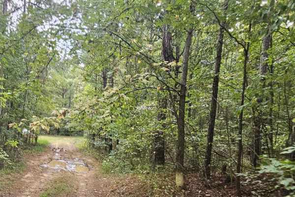
Cold Springs Road - FS 1245
This route is easily traveled and is well-maintained. Initially passing private property, Cold Springs Road leads to Redlands Wildlife Management Area and Billups Road (1245). Throughout this drive, some mud holes may be encountered however, they can be navigated with ease. Additionally, there are a...
Learn more about Cold Springs Road - FS 1245

Billups - FS 1245
Billups Road is an out-and-back trail that winds through the Redlands Wildlife Management Area of the Oconee National Forest. It leads to a primitive camp and a primitive boat launch on the Oconee River just north of Oconee Lake. The trail surface is a generous one lane wide and is well maintained w...
Learn more about Billups - FS 1245

Redlands WMA
The Redlands WMA Trail is an easy 1.5-mile dirt track south of Watkinsville, Georgia, perfect for hunters, anglers, and beginner offroaders seeking a quick, scenic excursion through the Redlands Wildlife Management Area. The route starts right off Athens Highway (US-129) and winds westward toward th...
Learn more about Redlands WMA
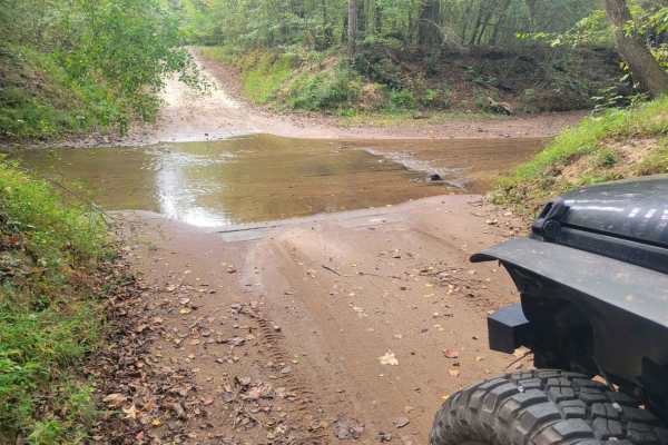
Skull Shoal Pass
This route passes through Oconee National Forest. It is well maintained and passable with most vehicles any time of the year. Muddy conditions can be encountered from time to time however, it should not limit the ability to travel the route. Several camping locations exist throughout the trail as we...
Learn more about Skull Shoal Pass
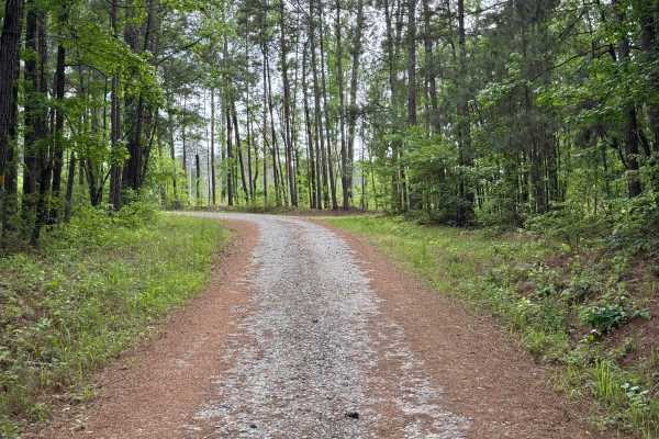
Watson Spring - FS 1202
Watson Spring (FS 1202) is a winding out-and-back trail leading from Highway 15 downhill towards the Oconee River. The trail does not actually reach all the way to the river, but it's a short hike to the shoreline. The roadbed is packed dirt with plenty of gravel, making it easily drivable in a pass...
Learn more about Watson Spring - FS 1202
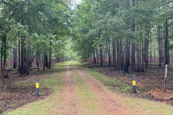
Vinning - FS 1092
Vinning (FS 1092) is a short, gentle, and beautiful ride through the far northeast section of the Oconee National Forest close to the Oconee Ranger Station. Its eastern end is along the well-manicured Rock Eagle Road and the entrance to the Rock Eagle 4-H Center. The trail winds through large stands...
Learn more about Vinning - FS 1092

Reids Road
Reids Road is a packed Georgia clay point-to-point road with some sections of crushed gravel for stability. It is a generous one vehicle wide on the northwestern end, narrowing to a typical one lane wide on the southeast end, where it transitions to a two lane paved surface. The trail passes through...
Learn more about Reids Road
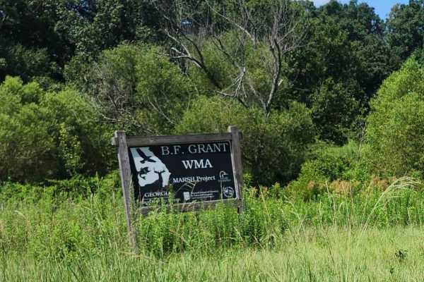
Hearnville Pond Trail
This 2.8-mile trail through B.F Grant Wildlife Management Area near Madison, Georgia, it winds through rolling farmland, open fields, ponds, creeks, and wetlands, ending at a fishing pond. The terrain includes a mixture of maintained gravel, packed clay, ruts, washouts, rock gardens, and sand. Weath...
Learn more about Hearnville Pond Trail
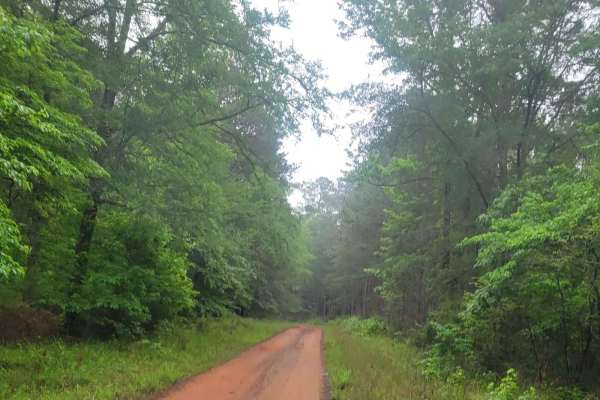
Oconee Southern Traverse (Segment 1)
This route begins at the northern end of Burgess Road (1120), a well-maintained gravel service road that leads to Martins Mill Road. At this split, travelers should turn right as taking a left will lead you to a dead end. Martins Mill Road is well maintained however some washed out road conditions m...
Learn more about Oconee Southern Traverse (Segment 1)
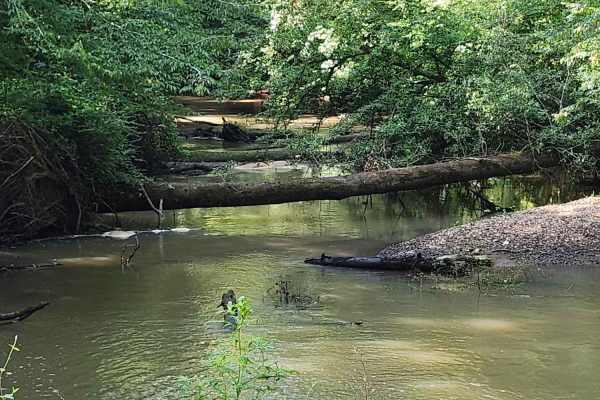
Indian Creek Trail
A 4.8-mile scenic passing trail through farmland, ponds, open fields, thick forest, and canopied wetlands. The route features a mixture of gravel, sand, and red clay with minor ruts, potholes, and washouts. Wetland sections can become thick and mucky even during dry weather; check ahead and use caut...
Learn more about Indian Creek Trail
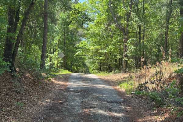
Rock House Falls Road - FS 1108
Rock House Falls Road is a short drive in the Cedar Creek Wildlife Management Area of the Oconee National Forest. It leads down to the banks of Murder Creek at Rock House Falls, where there is a small parking area and overlook for the falls. Foot trails lead from the parking area down to Murder Cree...
Learn more about Rock House Falls Road - FS 1108
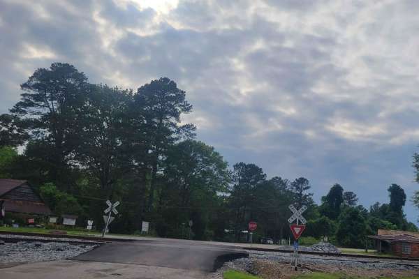
Oconee Southern Traverse - 1068 (Segment 2)
This portion of the Oconee forest has well maintained service roads throughout with minimal-to-no obstacles to encounter. Wildlife such as deer and turkey are often seen so situational awareness should be maintained while driving to ensure safe travel. While the majority of the route is gravel/dirt,...
Learn more about Oconee Southern Traverse - 1068 (Segment 2)

Glenwood Springs Road
Glenwood Springs Road is a two-lane wide, packed red Georgia clay and crushed rock point-to-point trail through the central section of the Oconee National Forest. The forest on each side of the trail is fairly open on the western end and begins to thicken as you travel westward, with dense underbrus...
Learn more about Glenwood Springs Road
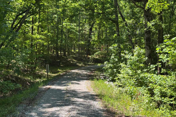
Stanford FR1059
Stanford FR1059 is an interesting stretch of a two-track point-to-point trail through the Oconee National Forest. It provides a scenic alternate route from Greenwood Spring Road's midpoint back to Highway 212. It has a well-maintained gravel base with plenty of turns and elevation changes to make th...
Learn more about Stanford FR1059

Peter Williams FR1052
Peter Williams Forest Road 1052 is a winding out-and-back trail that sees little traffic, likely because it begins on private property off the beaten path. The road leading to Peter Williams is paved, but don't worry, as the trail starts where the pavement ends. The road is single-lane wide with a g...
Learn more about Peter Williams FR1052

Hosannah Road (643-643A)
This short route travels through a portion of the Sumter National Forest. The road is a well-maintained service road that provides beautiful scenery and is accessible with minimal vehicle clearance. Logging may be encountered throughout the route as it is normal practice in the area of the National ...
Learn more about Hosannah Road (643-643A)
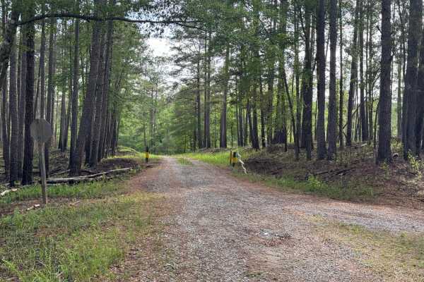
Williamson Cemetery A - FS 1048A
Williamson Cemetery A (FS 1048A) branches off of FS 1048 about three miles south of County Road 212. Most of the road is single-lane, improved gravel up to the closed gate where it enters private land. Turning left at the private gate to continue, the road loses some of its gravel base and picks up ...
Learn more about Williamson Cemetery A - FS 1048A
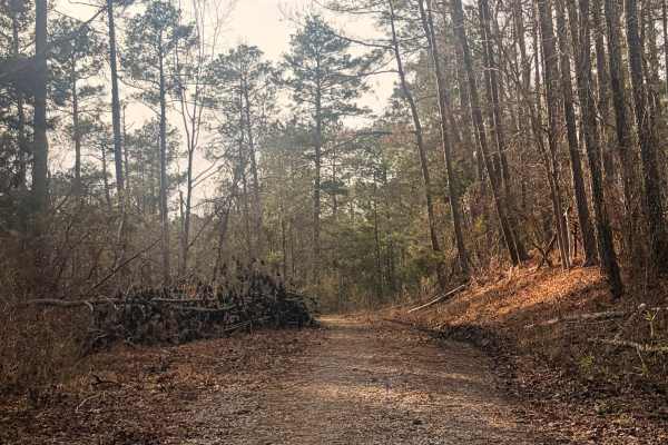
FS 570A
This is an out-and-back 2-track road inside the Sumter National Forest that leads to a roundabout next to a large clearing. The surface is gravel and hard dirt. There are no obstacles on this trail besides uncleared brush after storms. No vehicles should have a problem trying to complete this trail....
Learn more about FS 570A
Beginner ATV trails near Crawfordville, Georgia
Explore ATV-friendly trails near you. These trails are accessible for vehicles up to 50 inches wide, perfect for ATVs and smaller off-road machines.
Penfield Hunt Camp Road
Penfield Hunt Camp Road is located in the Oconee National Forest. This road is mostly flat, with a few pothole exceptions. If you are traveling with a long trailer, drive slowly; the road is passable. At the end of the road, you'll find three fire rings, a large turnaround loop, a pit toilet, handic...
Learn more about Penfield Hunt Camp Road
B Loop
Town Creek ORV is located in Onocee National Forest. The B Loop trail is fairly flat and made up of hard pack and red clay dirt with plenty of roots. The trail is ridden clockwise . The last two miles of the trail, are the most challenging due downhill trail erosion. There are many bridges on the t...
Learn more about B Loop
Hearnville Pond Trail
This 2.8-mile trail through B.F Grant Wildlife Management Area near Madison, Georgia, it winds through rolling farmland, open fields, ponds, creeks, and wetlands, ending at a fishing pond. The terrain includes a mixture of maintained gravel, packed clay, ruts, washouts, rock gardens, and sand. Weath...
Learn more about Hearnville Pond Trail
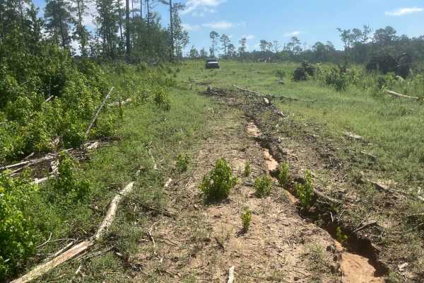
Mason Wildlife Trail North
Most of this trail is a single lane with several muddy patches and occasional ruts that require careful navigation. A four-wheel-drive vehicle is essential unless it hasn’t rained for weeks. Expect multiple mud holes, the deepest around eight inches, with some areas prone to sticky, deep mud—exercis...
Learn more about Mason Wildlife Trail North
Beginner UTV/side-by-side trails near Crawfordville, Georgia
Find UTV and side-by-side trails near you. These trails accommodate vehicles up to 60 inches wide, ideal for UTVs, side-by-sides, and wider off-road rigs.
Penfield Hunt Camp Road
Penfield Hunt Camp Road is located in the Oconee National Forest. This road is mostly flat, with a few pothole exceptions. If you are traveling with a long trailer, drive slowly; the road is passable. At the end of the road, you'll find three fire rings, a large turnaround loop, a pit toilet, handic...
Learn more about Penfield Hunt Camp Road
Hearnville Pond Trail
This 2.8-mile trail through B.F Grant Wildlife Management Area near Madison, Georgia, it winds through rolling farmland, open fields, ponds, creeks, and wetlands, ending at a fishing pond. The terrain includes a mixture of maintained gravel, packed clay, ruts, washouts, rock gardens, and sand. Weath...
Learn more about Hearnville Pond Trail
Indian Creek Trail
A 4.8-mile scenic passing trail through farmland, ponds, open fields, thick forest, and canopied wetlands. The route features a mixture of gravel, sand, and red clay with minor ruts, potholes, and washouts. Wetland sections can become thick and mucky even during dry weather; check ahead and use caut...
Learn more about Indian Creek Trail
Mason Wildlife Trail North
Most of this trail is a single lane with several muddy patches and occasional ruts that require careful navigation. A four-wheel-drive vehicle is essential unless it hasn’t rained for weeks. Expect multiple mud holes, the deepest around eight inches, with some areas prone to sticky, deep mud—exercis...
Learn more about Mason Wildlife Trail North
The onX Offroad Difference
onX Offroad combines trail photos, descriptions, difficulty ratings, width restrictions, seasonality, and more in a user-friendly interface. Available on all devices, with offline access and full compatibility with CarPlay and Android Auto. Discover what you're missing today!
Open Trail Map