
Beginner Off-Road Trails
Near Conway, Iowa
Explore All Beginner Trails Near Conway, Iowa
Beginner Off-Road Trails Near Conway, Iowa
Discover the best beginner-friendly off-road trails near you. These easier, lower-rated trails are a great place to start — browse trail maps, check difficulty ratings, and find your next adventure.
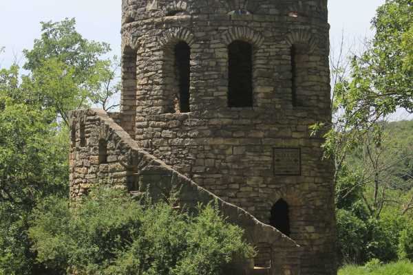
Clark Tower Trail
Nestled within Winterset City Park, Clark Tower Trail offers visitors a surprising escape into nature that feels far removed from city life. As the journey begins, travelers are greeted by the historic Cutler-Donahoe Bridge, one of the area's oldest covered bridges. Originally constructed in 1871 by...
Learn more about Clark Tower Trail
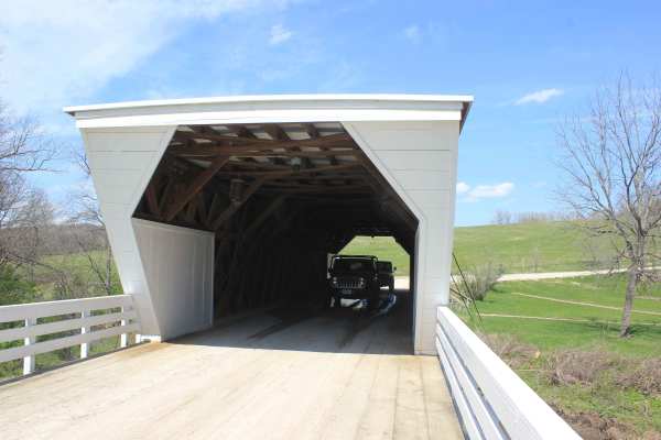
Covered Bridge Trail
This is one of the most iconic and well-known routes in Iowa- a true must-do for anyone interested in scenic backroads, history, and classic Midwest landscapes. The trail can be completed in any street-legal vehicle under normal conditions, but be aware that water crossings and Class B roads can mak...
Learn more about Covered Bridge Trail
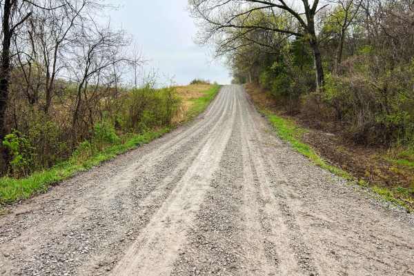
Monkey Mountain
Monkey Mountain follows along the edge of Honey Creek Conservation area before crossing the Nodaway River. Crossing into Holt County Holt 325 road climbs quickly along the Monkey Mountain Conservation area ending at MO U. This is an easy-going gravel road that can become soft and loose after heavy r...
Learn more about Monkey Mountain
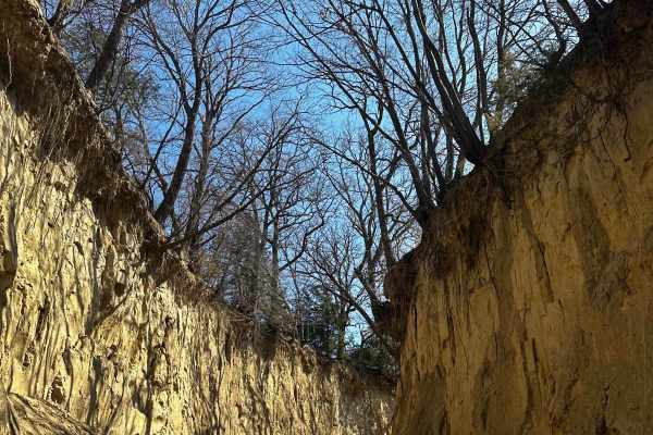
Waubonsie Creek Trail - Pathfield Road
This trail has beautiful side walls that go up to 20 feet on some parts. There is a bridge at the halfway mark that crosses Waubonsie Creek. On the other side of the bridge, the trail goes to an incline at a steep angle that, if muddy, you will need 4WD.
Learn more about Waubonsie Creek Trail - Pathfield Road
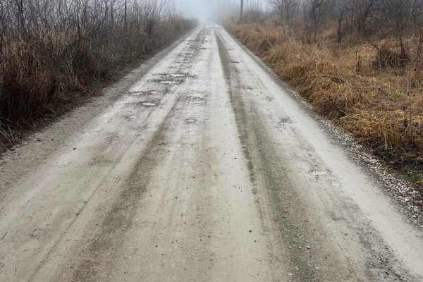
Nodaway River Drive
Nodaway River drive follows along the Nodaway River to the confluence of the Missouri River. It connects the Missouri conservation areas of Honey Creek and Monkey Mountain. It's an easy-going gravel road passing through mostly private property with occasional potholes to look out for. The road may r...
Learn more about Nodaway River Drive
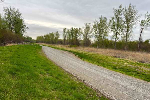
Bob Brown
Bob Brown Conservation area is located west of Forest City Missouri in the Missouri River bottoms and is a wide well maintained gravel road. This is a great area for migratory bird watching, hunting and catfishing along the Missouri River. There are many river access points geared for fishing with a...
Learn more about Bob Brown
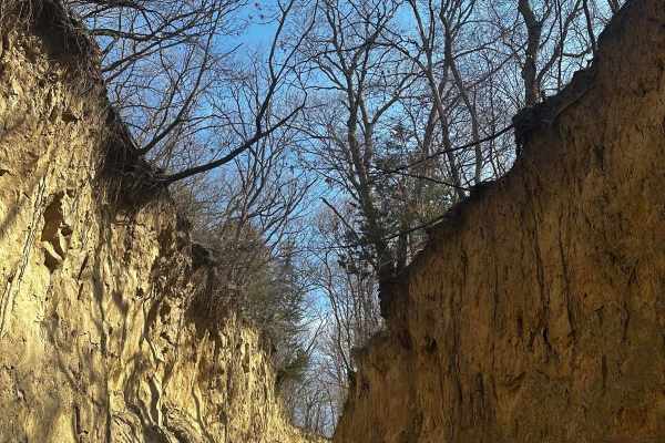
Mud Slinging Trail - Raleigh Road
At the beginning of the trail, there is a small bridge. Halfway into the trail, there is a small stream that makes a small drop down that can catch you off guard. After the small stream, there is a 35-degree incline that can be very difficult when the ground is muddy. This trail also has beautiful s...
Learn more about Mud Slinging Trail - Raleigh Road
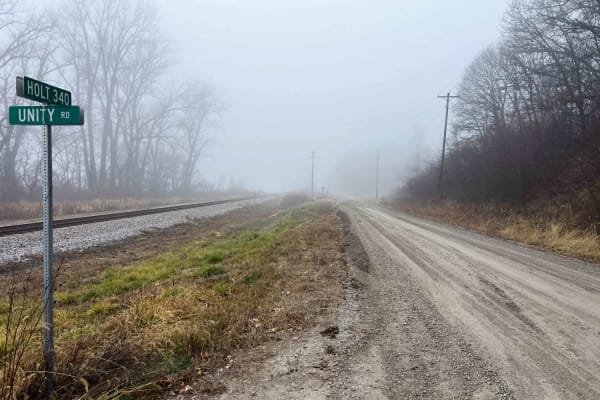
Parkstone Drive
Parkstone Drive weaves along the Missouri river bottoms following the Corps of Engineers levee system. It's a well-maintained gravel drive with private property on each side. This route ends and begins at Missouri Conservation areas Riverbreaks and Monkey Mountain. Many upland and migratory birds ca...
Learn more about Parkstone Drive
Country Road 392/396
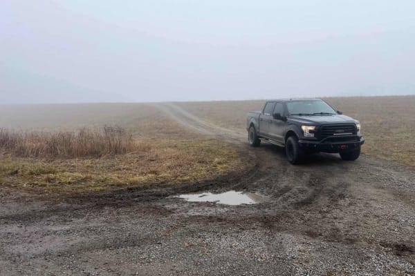
This trail in Worthwine Island California is an easy gravel road that leads from MO K turning off to Road 392 to Missouri Conservation area Worthwine Island along the Missouri River. Worthwine Island provides good hunting and fishing opportunities along the Missouri River bottoms with mixed timber a...
Learn more about Country Road 392/396
Riverbreaks
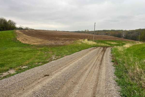
Riverbreaks is a gravel road that climbs from the Missouri River bottoms turning onto Quebec Road. It is well-maintained gravel but can become soft and muddy after heavy rains. 4WD is recommended when visiting this area during bad weather or snow in order to climb out of the bluffs. There are many d...
Learn more about Riverbreaks
Brown State Fishing Lake Road
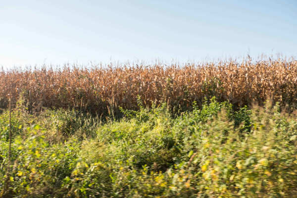
Easy gravel road around Brown State Fishing Lake with small spurs around the lake to camp and fish. Camping and fishing are free. A couple of pit toilets around the lake and campfire rings at campsites. The lake is surrounded by cornfields. The grade is gentle and can be driven in a 2-wheel drive ve...
Learn more about Brown State Fishing Lake Road
O Road
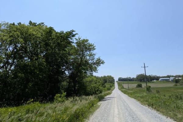
The route begins as a single-lane strip of gravel, tight enough that you feel the grass brush the mirrors, but it soon broadens into a well-graded road where only the odd patch of deep stone unsettles the tires. Partway along, the gravel skirts a small country church and its quiet hillside cemetery-...
Learn more about O Road
Beginner ATV trails near Conway, Iowa
Explore ATV-friendly trails near you. These trails are accessible for vehicles up to 50 inches wide, perfect for ATVs and smaller off-road machines.
Waubonsie Creek Trail - Pathfield Road
This trail has beautiful side walls that go up to 20 feet on some parts. There is a bridge at the halfway mark that crosses Waubonsie Creek. On the other side of the bridge, the trail goes to an incline at a steep angle that, if muddy, you will need 4WD.
Learn more about Waubonsie Creek Trail - Pathfield Road
Mud Slinging Trail - Raleigh Road
At the beginning of the trail, there is a small bridge. Halfway into the trail, there is a small stream that makes a small drop down that can catch you off guard. After the small stream, there is a 35-degree incline that can be very difficult when the ground is muddy. This trail also has beautiful s...
Learn more about Mud Slinging Trail - Raleigh Road
Brown State Fishing Lake Road
Easy gravel road around Brown State Fishing Lake with small spurs around the lake to camp and fish. Camping and fishing are free. A couple of pit toilets around the lake and campfire rings at campsites. The lake is surrounded by cornfields. The grade is gentle and can be driven in a 2-wheel drive ve...
Learn more about Brown State Fishing Lake Road
Beginner UTV/side-by-side trails near Conway, Iowa
Find UTV and side-by-side trails near you. These trails accommodate vehicles up to 60 inches wide, ideal for UTVs, side-by-sides, and wider off-road rigs.
Clark Tower Trail
Nestled within Winterset City Park, Clark Tower Trail offers visitors a surprising escape into nature that feels far removed from city life. As the journey begins, travelers are greeted by the historic Cutler-Donahoe Bridge, one of the area's oldest covered bridges. Originally constructed in 1871 by...
Learn more about Clark Tower Trail
Waubonsie Creek Trail - Pathfield Road
This trail has beautiful side walls that go up to 20 feet on some parts. There is a bridge at the halfway mark that crosses Waubonsie Creek. On the other side of the bridge, the trail goes to an incline at a steep angle that, if muddy, you will need 4WD.
Learn more about Waubonsie Creek Trail - Pathfield Road
Mud Slinging Trail - Raleigh Road
At the beginning of the trail, there is a small bridge. Halfway into the trail, there is a small stream that makes a small drop down that can catch you off guard. After the small stream, there is a 35-degree incline that can be very difficult when the ground is muddy. This trail also has beautiful s...
Learn more about Mud Slinging Trail - Raleigh Road
Brown State Fishing Lake Road
Easy gravel road around Brown State Fishing Lake with small spurs around the lake to camp and fish. Camping and fishing are free. A couple of pit toilets around the lake and campfire rings at campsites. The lake is surrounded by cornfields. The grade is gentle and can be driven in a 2-wheel drive ve...
Learn more about Brown State Fishing Lake Road
The onX Offroad Difference
onX Offroad combines trail photos, descriptions, difficulty ratings, width restrictions, seasonality, and more in a user-friendly interface. Available on all devices, with offline access and full compatibility with CarPlay and Android Auto. Discover what you're missing today!
Open Trail Map