
Beginner Off-Road Trails
Near Centropolis, Kansas
Explore All Beginner Trails Near Centropolis, Kansas
Beginner Off-Road Trails Near Centropolis, Kansas
Discover the best beginner-friendly off-road trails near you. These easier, lower-rated trails are a great place to start — browse trail maps, check difficulty ratings, and find your next adventure.
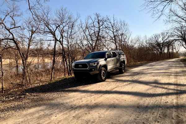
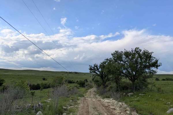
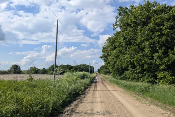
Scenic River Road
The Scenic River Road, County Road N. 2000 Road to N. 2050 Road, travels along the Kansas River Northwest of Lawrence, Kansas, heading west toward historic Lecompton, Kansas, the first state capital. The trail is hard-packed dirt and gravel suitable for any vehicle except in winter conditions with h...
Learn more about Scenic River Road
Lake Road West Fork
Lake Rd (west fork) is a graded rock road that forks off to the west for lake access. This was another a great spot for fishing or a picnic. There is a lot of native tallgrass prairie, and is on a flight path for migratory ducks and geese. There is no camping or fires allowed in this area, however t...
Learn more about Lake Road West Fork
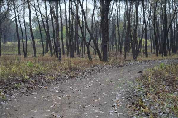
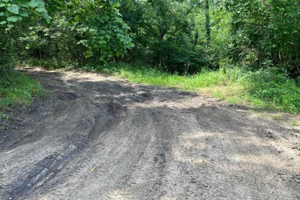
Otter Creek Inner Trail
The Inner trail connects with the main trail throughout the area. This trail is dirt with relatively shallow mud holes, rutted out tracks. This trail gets extremely muddy and slick with the rain. Most of the mud holes are near trees. Take caution with the ones that are not, as you may not have a way...
Learn more about Otter Creek Inner Trail
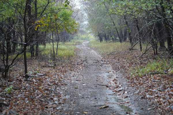
Otter Creek Main Trail
This 2 1/2 mile Trail takes you through the Otter Creek ORV area. The trail is mostly flat, with a few slight elevation changes, and some mud holes that can get deep; however, they are relatively easy to either split or go around entirely. Everything from a small ATV up should have no problem. If th...
Learn more about Otter Creek Main Trail
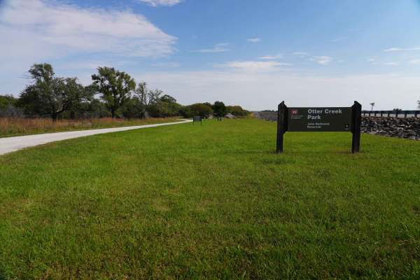
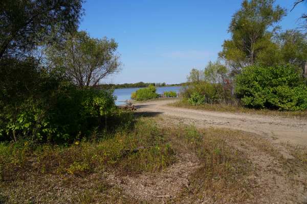
Lake Road
Lake Road is a graded rock road that is a quiet and peaceful drive to the lake at John Redmond Reservoir. This looked like a great spot for fishing or a picnic. There is no camping or fires allowed in this area; however, there is plenty of primitive or RV camping, with 110 hookups just on the other ...
Learn more about Lake Road
Hessdale Road
This trail is as sublime as the trail before it and unfolds over well-maintained gravel, showing few potholes or bumps as it winds through green rolling hills with gentle ascents and descents. Scattered farms and shallow creek crossings add a quiet, rural rhythm to the drive. There are no formal or ...
Learn more about Hessdale Road
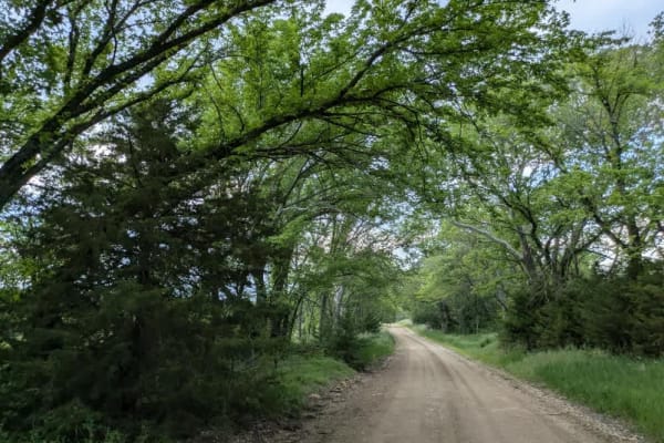
Neahring Ranch
This trail follows a narrow ribbon of smooth gravel that occasionally gives way to rocky patches, winding through a dense forest flanked by a sea of open fields. You'll likely spot deer browsing along the roadside as you drive, so stay alert. There are no formal or dispersed campsites, and you won't...
Learn more about Neahring Ranch
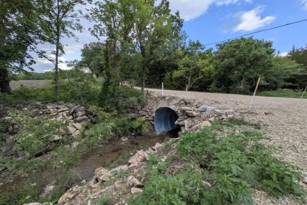
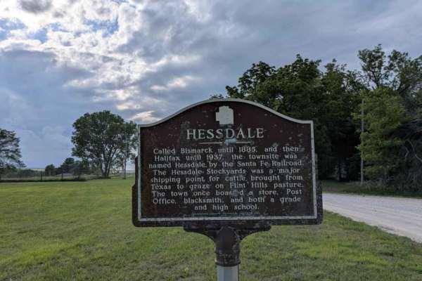
Halifax Road
This trail is fairly narrow, with smooth, well-maintained sections giving way to rocky, muddy stretches. It winds through rolling hills, rising and falling over gentle ascents and descents before crossing a small stream. Alongside the path stands a modest graveyard, its peaceful setting quietly memo...
Learn more about Halifax Road
Christy Road
This section represents the trail's most technical challenges, though you can bypass it by remaining on the main artery route. Despite its short length, this narrow path sees little use and receives no maintenance. You'll face rocky, off-camber stretches, steep ascents and descents, and plenty of mu...
Learn more about Christy Road
Agnes City Road
This trail winds through a heavily treed landscape where the gravel surface stays buttery smooth for the most part, punctuated by a few gentle climbs and descents. Along the way, you'll cross several shallow rivers and pass fields tended by local farmers. Be mindful of deer and the occasional vehicl...
Learn more about Agnes City Road
Chalk Road
This trail is sublime, unfolding over well-maintained gravel that shows few potholes or bumps as it winds through green rolling hills with gentle ascents and descents. Scattered farms dot the landscape, and the route crosses several creeks beneath a canopy of trees. There are no designated or disper...
Learn more about Chalk Road
Prairie View
This trail follows a well-maintained gravel road that remains arrow-straight primarily, with a few gentle climbs and drops along its length. If you approach from the south, you'll encounter a steep descent demanding careful steering. As you progress, the vista reveals sweeping views of lush green fi...
Learn more about Prairie View
Kuenzli Creek
This trail follows a very well-maintained gravel road that remains mostly smooth as it winds through a hilly landscape. Drivers will navigate numerous ascents and descents, with occasional rocky or bumpy sections demanding attention. There are no formal or dispersed campsites along the route, and yo...
Learn more about Kuenzli Creek
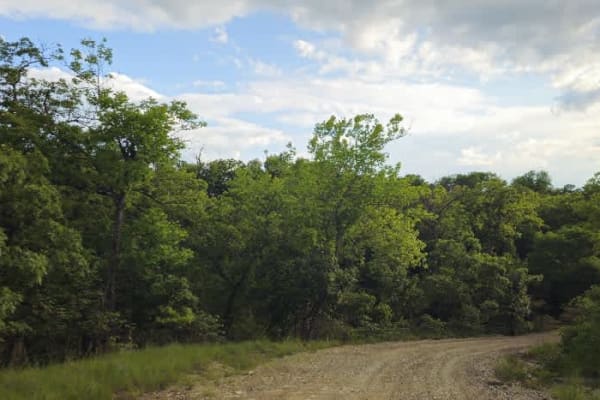
Clapboard Ravine
Approaching from the south, this trail ranks among the most scenic routes in Eastern Kansas. It follows mostly well-maintained gravel that can become thick in spots, presenting a challenge for cyclists or bikers. The sublime trail descends into a gorge and enters a forest of mature trees, then runs ...
Learn more about Clapboard Ravine
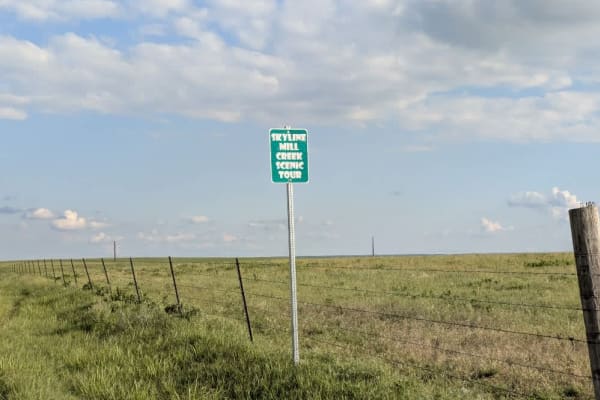
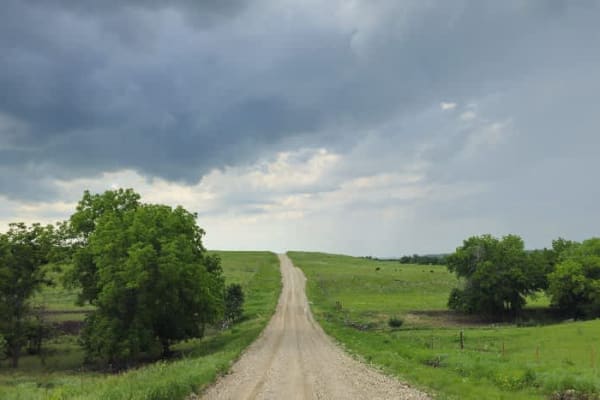
Skyline Road
The trail follows a well-maintained gravel road running along a ridgeline, providing expansive views of the surrounding hills. Scattered farming infrastructure and a few cattle are visible, but most of the route passes through an unbroken expanse of green landscape, especially vibrant in May. There ...
Learn more about Skyline Road
Kickapoo Trail
The Kickapoo Trail offers a relaxing and scenic off-road experience in northeast Kansas, perfect for riders looking to enjoy a leisurely ride through nature without too much difficulty. Located near Kickapoo in Brown County, this trail primarily follows a well-maintained gravel road, making it acces...
Learn more about Kickapoo Trail
Road D
This trail begins on a narrow, well-maintained track that climbs steadily into the hills and intersects a section of the Flint Trail where motor vehicles are prohibited. In that stretch, free-range bison roam, and the area is popular with hikers and mountain bikers. From there, the route descends pa...
Learn more about Road D
Road 310
This trail begins with an arrow-straight, smooth stretch peppered by a few gentle ascents and descents. As it starts to wind, you'll pass a scene reminiscent of a painting: black cows grazing on vibrant grass beside cream-colored concrete slabs supporting black oil tanks, all set against rolling gre...
Learn more about Road 310
South 150 Road
This trail runs over predominantly smooth gravel, featuring gentle climbs and descents and a few shallow dips. When the surface is wet, sections can become slippery, so caution is advised. The route crosses a small bridge and winds past farms and sublime countryside. There are no formal or dispersed...
Learn more about South 150 Road
Unpaved Road
Unpaved Road is a very short non-directional trail located within the Takanoah's Hill area of the park, maintained by the Flint Hills Jeep Club. This trail meets Takanoah's Hill at the bottom and also runs right into Ft. Scott Ave. There are no signs for this trail.
Learn more about Unpaved Road
Beginner ATV trails near Centropolis, Kansas
Explore ATV-friendly trails near you. These trails are accessible for vehicles up to 50 inches wide, perfect for ATVs and smaller off-road machines.
Scenic River Road
The Scenic River Road, County Road N. 2000 Road to N. 2050 Road, travels along the Kansas River Northwest of Lawrence, Kansas, heading west toward historic Lecompton, Kansas, the first state capital. The trail is hard-packed dirt and gravel suitable for any vehicle except in winter conditions with h...
Learn more about Scenic River Road
Lake Road West Fork
Lake Rd (west fork) is a graded rock road that forks off to the west for lake access. This was another a great spot for fishing or a picnic. There is a lot of native tallgrass prairie, and is on a flight path for migratory ducks and geese. There is no camping or fires allowed in this area, however t...
Learn more about Lake Road West Fork
Otter Creek Inner Trail
The Inner trail connects with the main trail throughout the area. This trail is dirt with relatively shallow mud holes, rutted out tracks. This trail gets extremely muddy and slick with the rain. Most of the mud holes are near trees. Take caution with the ones that are not, as you may not have a way...
Learn more about Otter Creek Inner Trail
Otter Creek Main Trail
This 2 1/2 mile Trail takes you through the Otter Creek ORV area. The trail is mostly flat, with a few slight elevation changes, and some mud holes that can get deep; however, they are relatively easy to either split or go around entirely. Everything from a small ATV up should have no problem. If th...
Learn more about Otter Creek Main Trail
Beginner UTV/side-by-side trails near Centropolis, Kansas
Find UTV and side-by-side trails near you. These trails accommodate vehicles up to 60 inches wide, ideal for UTVs, side-by-sides, and wider off-road rigs.
Scenic River Road
The Scenic River Road, County Road N. 2000 Road to N. 2050 Road, travels along the Kansas River Northwest of Lawrence, Kansas, heading west toward historic Lecompton, Kansas, the first state capital. The trail is hard-packed dirt and gravel suitable for any vehicle except in winter conditions with h...
Learn more about Scenic River Road
Lake Road West Fork
Lake Rd (west fork) is a graded rock road that forks off to the west for lake access. This was another a great spot for fishing or a picnic. There is a lot of native tallgrass prairie, and is on a flight path for migratory ducks and geese. There is no camping or fires allowed in this area, however t...
Learn more about Lake Road West Fork
Otter Creek Inner Trail
The Inner trail connects with the main trail throughout the area. This trail is dirt with relatively shallow mud holes, rutted out tracks. This trail gets extremely muddy and slick with the rain. Most of the mud holes are near trees. Take caution with the ones that are not, as you may not have a way...
Learn more about Otter Creek Inner Trail
Otter Creek Main Trail
This 2 1/2 mile Trail takes you through the Otter Creek ORV area. The trail is mostly flat, with a few slight elevation changes, and some mud holes that can get deep; however, they are relatively easy to either split or go around entirely. Everything from a small ATV up should have no problem. If th...
Learn more about Otter Creek Main Trail
The onX Offroad Difference
onX Offroad combines trail photos, descriptions, difficulty ratings, width restrictions, seasonality, and more in a user-friendly interface. Available on all devices, with offline access and full compatibility with CarPlay and Android Auto. Discover what you're missing today!
Open Trail Map