
Beginner Off-Road Trails
Near Cedar Hill, Tennessee
Explore All Beginner Trails Near Cedar Hill, Tennessee
Beginner Off-Road Trails Near Cedar Hill, Tennessee
Discover the best beginner-friendly off-road trails near you. These easier, lower-rated trails are a great place to start — browse trail maps, check difficulty ratings, and find your next adventure.
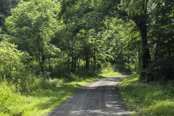
Gravley Hill Road - Macon County Tour
Winding through the gentle terrain of northern Tennessee, this graded gravel trail marks the starting point of the iconic Macon County Tour (MCT), a 100+ mile off-road journey that explores the rolling hills and hardwood forests of Tennessee and Kentucky. While generally easy and well-maintained, th...
Learn more about Gravley Hill Road - Macon County Tour
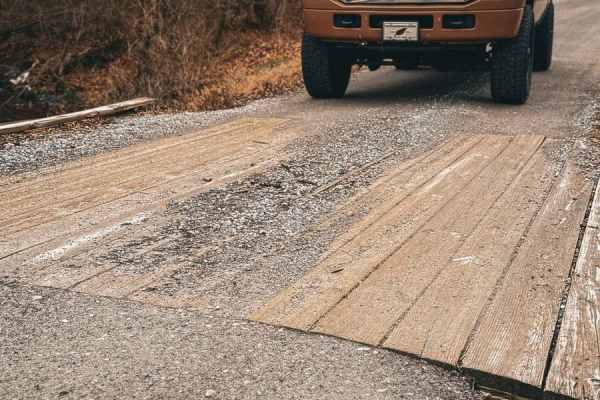
Tooley Branch Road
This trail starts off as an easy gravel track with several creek crossings. About halfway through the track, the gravel stops, and the track turns into a mixture of dirt and rock that will lead you through another creek crossing. The entrance and exit of this creek crossing is slick shale that could...
Learn more about Tooley Branch Road
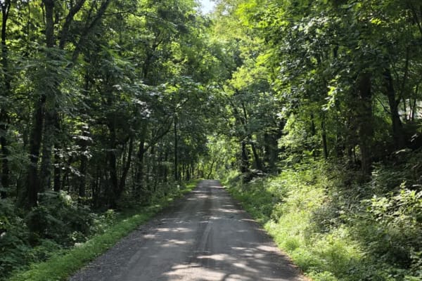
Sullivan Hollow Road - Macon County Tour
This scenic off-road trail, part of the Macon County Tour (MCT), offers an easy yet engaging drive through Tennessee's rolling backcountry. While the route follows a graded path, multiple washouts and narrow stretches without shoulders--some with steep drop-offs--add a layer of caution to the otherw...
Learn more about Sullivan Hollow Road - Macon County Tour
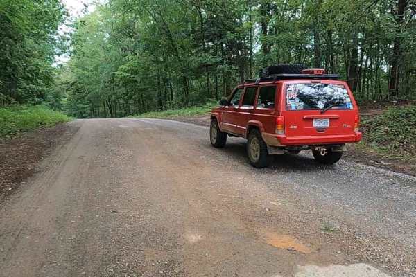
Gatlin Point South FSR 227
Gatlin Point South FSR 227 is a gravel forestry road through the southeast corner of the southern Tennessee section, Lake Barkley side, of the Land Between the Lake National Recreation Area. This road features small rolling hills and beautiful treelines, with minimal water collection spots on the ro...
Learn more about Gatlin Point South FSR 227
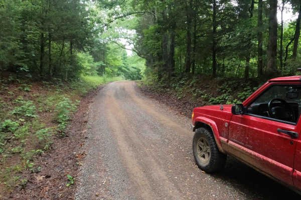
Bear Creek Road FSR 229
Bear Creek Road FSR 229 is a gravel forestry road through the southeast corner of the southern Tennessee section, Lake Barkley side, of the Land Between the Lake National Recreation Area. This road is made up of small hills leading to the generally flat bottoms near Bards Lake and crosses over the B...
Learn more about Bear Creek Road FSR 229
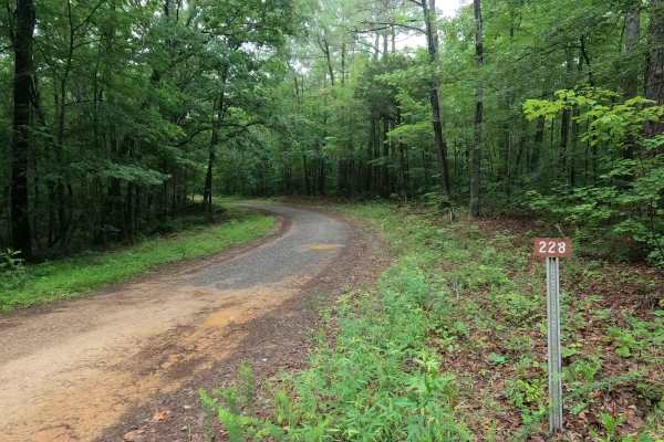
Gatlin Point North FSR 228
Gatlin Point North FSR 228 is a gravel forestry road through the southeast corner of the southern Tennessee section, Lake Barkley side, of the Land Between the Lake National Recreation Area. This road features small rolling hills cutting through the treelines leading down mild rutted grades into the...
Learn more about Gatlin Point North FSR 228
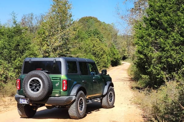
South Lick Creek Road
This is a public access dirt road that makes up a portion of the famed, Tennessee Dirt Devil. While not particularly challenging, trail riders will enjoy beautiful views of sprawling farmland and wildlife. One water crossing has a paved bridge which is eroding heavily at a corner and can be treacher...
Learn more about South Lick Creek Road
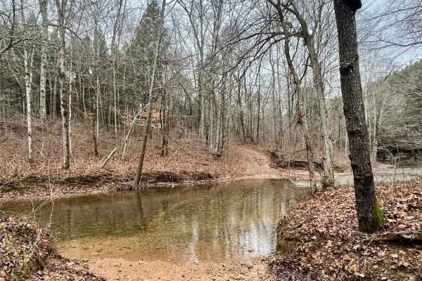
Old Mill Creek Road
Old Mill Creek Road is great for someone just getting into off-roading. Most, if not all, of this route is safe and easy enough for high-clearance 2WD. However, there are one to two muddy/rocky areas that could benefit from 4WD depending on the amount of rain the area has received and how muddy it i...
Learn more about Old Mill Creek Road
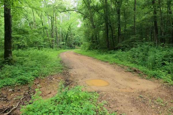
Crutcher Hollow Road FS 213
Crutcher Hollow Road FS 213 is a gravel forestry road through the southern Tennessee section, centrally located off the Woodlands Trace National Scenic Byway headed east to Lake Barkley, of Land Between the Lake National Recreation Area. The road starts just south of the Great Western Furnace, headi...
Learn more about Crutcher Hollow Road FS 213

Porter Branch Road
This is a public access dirt road that has a few simple water crossings. It's 2WD-friendly and easy to complete. The surrounding property off the road is private property, so be sure to stay on the road and do not drive up the creek to adhere to Tread Lightly standards as well as local laws.
Learn more about Porter Branch Road
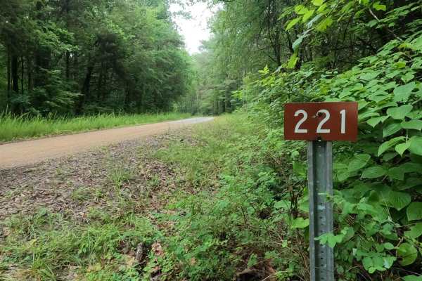
Tharpe Road FSR 221
Tharpe Road FSR 221 is a gravel forestry road through southern Tennessee, the center section of the peninsula, within the Land Between the Lakes National Recreation Area. It features a gently and well maintained gravel road going over rolling hills, from the Woodland Trace on the east side to the FS...
Learn more about Tharpe Road FSR 221
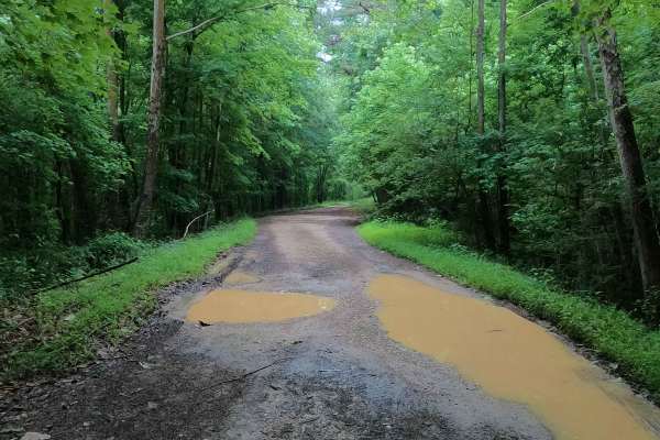
Tharpe Hollow - FS 384
The Tharpe Hollow / Whitford Cemetery Road FS 384, is a gravel and natural dirt forest service road through the southern Tennessee section, Lake Barkley side of Land Between the Lakes National Recreation Area. The road leads east off the Woodland Trace, at first giving the feeling it is a basic grav...
Learn more about Tharpe Hollow - FS 384

George Watson Road
George Watson Road takes you to to a primitive Boat Ramp on Lake Barkley. The trail is a gravel forestry road with some soft sand spots that can turn into mud holes after heavy rain. This trail is ususally a very easy road. The Land between the Lakes is an 170,000-acre inland peninsula. Approximatel...
Learn more about George Watson Road
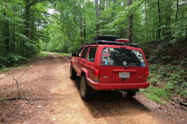
Fox Hollow Hill FSR 218
The Fox Hollow Hill FSR 218 is a gravel forestry road through the southern Tennessee section, Lake Barkley side, of Land Between the Lake National Recreation Area. This road features rolling hills and beautiful tree lines, with minimal water collection spots on the road surface and occasional mild s...
Learn more about Fox Hollow Hill FSR 218

Fox Hollow Bottoms FSR 219
The Fox Hollow Bottoms FSR 219 is a gravel forestry road through the southern Tennessee section, Lake Barkley side, of Land Between the Lake National Recreation Area. To differ from the other half of Fox Hollow, the Bottoms traverses alongside the feeder creeks that lead to the Fox Hollow bay area o...
Learn more about Fox Hollow Bottoms FSR 219
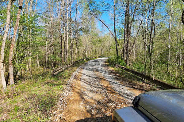
Neville Bay Road 214
This trail is part of the Land Between the Lakes Forestry Road System. It starts its southern leg at Woodlands Trace National Scenic Byway (also known as The Trace), heads east along the northern shore of Neville Bay, and turns north to eventually connect with Linton Ferry Road. At the time of this ...
Learn more about Neville Bay Road 214
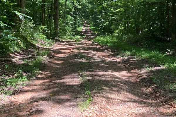
Bear Creek Road
Starts off easy going, small washouts and puddle crossings. The bottoms of the crossings are not muddy and pretty solid. About halfway through, you encounter a 30-degree downward incline. Massive washouts and slippery, loose rock. Spotter advised. Nice little trail through the woods that ends at a p...
Learn more about Bear Creek Road
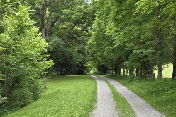
Wix Hollow Road - Macon County Tour
Wix Hollow Road is a scenic and slightly more dynamic segment of the Macon County Tour that briefly crosses into the state of Kentucky. The route features a mixed surface of dirt and gravel, offering a relaxed drive with a bit more character than a standard, maintained county road. The surrounding l...
Learn more about Wix Hollow Road - Macon County Tour
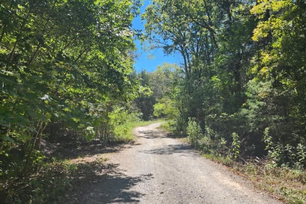
Cedar Forest Road
This trail is only open to vehicles that are registered and street legal. If your vehicle is not registered or street legal, do not attempt this trail. If you're up for some light trail riding under a canopy provided by beautiful, mature trees, Cedar Forest Road in the Cedars of Lebanon State Forest...
Learn more about Cedar Forest Road
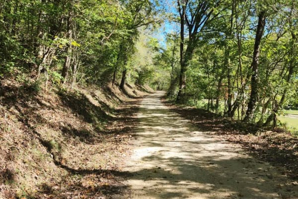
Dutch Potts Hollow Road
This is a public access dirt road that makes up a portion of the famed, Tennessee Dirt Devil. While not particularly challenging, trail riders will enjoy beautiful views graced with rockwork and a very nice waterfall. The surrounding property off the roadway is private property so be sure to stay on...
Learn more about Dutch Potts Hollow Road
Beginner ATV trails near Cedar Hill, Tennessee
Explore ATV-friendly trails near you. These trails are accessible for vehicles up to 50 inches wide, perfect for ATVs and smaller off-road machines.
Gravley Hill Road - Macon County Tour
Winding through the gentle terrain of northern Tennessee, this graded gravel trail marks the starting point of the iconic Macon County Tour (MCT), a 100+ mile off-road journey that explores the rolling hills and hardwood forests of Tennessee and Kentucky. While generally easy and well-maintained, th...
Learn more about Gravley Hill Road - Macon County Tour
Sullivan Hollow Road - Macon County Tour
This scenic off-road trail, part of the Macon County Tour (MCT), offers an easy yet engaging drive through Tennessee's rolling backcountry. While the route follows a graded path, multiple washouts and narrow stretches without shoulders--some with steep drop-offs--add a layer of caution to the otherw...
Learn more about Sullivan Hollow Road - Macon County Tour
South Lick Creek Road
This is a public access dirt road that makes up a portion of the famed, Tennessee Dirt Devil. While not particularly challenging, trail riders will enjoy beautiful views of sprawling farmland and wildlife. One water crossing has a paved bridge which is eroding heavily at a corner and can be treacher...
Learn more about South Lick Creek Road
Old Mill Creek Road
Old Mill Creek Road is great for someone just getting into off-roading. Most, if not all, of this route is safe and easy enough for high-clearance 2WD. However, there are one to two muddy/rocky areas that could benefit from 4WD depending on the amount of rain the area has received and how muddy it i...
Learn more about Old Mill Creek Road
Beginner UTV/side-by-side trails near Cedar Hill, Tennessee
Find UTV and side-by-side trails near you. These trails accommodate vehicles up to 60 inches wide, ideal for UTVs, side-by-sides, and wider off-road rigs.
Gravley Hill Road - Macon County Tour
Winding through the gentle terrain of northern Tennessee, this graded gravel trail marks the starting point of the iconic Macon County Tour (MCT), a 100+ mile off-road journey that explores the rolling hills and hardwood forests of Tennessee and Kentucky. While generally easy and well-maintained, th...
Learn more about Gravley Hill Road - Macon County Tour
Sullivan Hollow Road - Macon County Tour
This scenic off-road trail, part of the Macon County Tour (MCT), offers an easy yet engaging drive through Tennessee's rolling backcountry. While the route follows a graded path, multiple washouts and narrow stretches without shoulders--some with steep drop-offs--add a layer of caution to the otherw...
Learn more about Sullivan Hollow Road - Macon County Tour
South Lick Creek Road
This is a public access dirt road that makes up a portion of the famed, Tennessee Dirt Devil. While not particularly challenging, trail riders will enjoy beautiful views of sprawling farmland and wildlife. One water crossing has a paved bridge which is eroding heavily at a corner and can be treacher...
Learn more about South Lick Creek Road
Old Mill Creek Road
Old Mill Creek Road is great for someone just getting into off-roading. Most, if not all, of this route is safe and easy enough for high-clearance 2WD. However, there are one to two muddy/rocky areas that could benefit from 4WD depending on the amount of rain the area has received and how muddy it i...
Learn more about Old Mill Creek Road
The onX Offroad Difference
onX Offroad combines trail photos, descriptions, difficulty ratings, width restrictions, seasonality, and more in a user-friendly interface. Available on all devices, with offline access and full compatibility with CarPlay and Android Auto. Discover what you're missing today!
Open Trail Map